
The Front Range is a mountain range of the Southern Rocky Mountains of North America located in the central portion of the U.S. State of Colorado, and southeastern portion of the U.S. State of Wyoming. It is the first mountain range encountered as one goes westbound along the 40th parallel north across the Great Plains of North America.

The Colorado Plateau, also known as the Colorado Plateau Province, is a physiographic and desert region of the Intermontane Plateaus, roughly centered on the Four Corners region of the southwestern United States. This province covers an area of 336,700 km2 (130,000 mi2) within western Colorado, northwestern New Mexico, southern and eastern Utah, northern Arizona, and a tiny fraction in the extreme southeast of Nevada. About 90% of the area is drained by the Colorado River and its main tributaries: the Green, San Juan, and Little Colorado. Most of the remainder of the plateau is drained by the Rio Grande and its tributaries.

The Uinta Mountains are an east-west trending chain of mountains in northeastern Utah extending a short distance into northwest Colorado and slightly into southwestern Wyoming in the United States. As a subrange of the Rocky Mountains, they are unusual for being the highest range in the contiguous United States running east to west, and lie approximately 100 miles (160 km) east of Salt Lake City. The range has peaks ranging from 11,000 to 13,528 feet, with the highest point being Kings Peak, also the highest point in Utah. The Mirror Lake Highway crosses the western half of the Uintas on its way to Wyoming. Utah State Route 44 crosses the east end of the Uintas between Vernal and Manila.

The Sangre de Cristo Mountains are the southernmost subrange of the Rocky Mountains. They are located in southern Colorado and northern New Mexico in the United States. The mountains run from Poncha Pass in South-Central Colorado, trending southeast and south, ending at Glorieta Pass, southeast of Santa Fe, New Mexico. The mountains contain a number of fourteen thousand foot peaks in the Colorado portion, as well as several peaks in New Mexico which are over thirteen thousand feet.

The Medicine Bow Mountains are a mountain range in the Rocky Mountains that extend 100 miles (160 km) from northern Colorado into southern Wyoming. The northern extent of this range is the sub-range the Snowy Range. From the northern end of Colorado's Never Summer Mountains, the Medicine Bow mountains extend north from Cameron Pass along the border between Larimer and Jackson counties in Colorado and northward into south central Wyoming. In Wyoming, the range sits west of Laramie, in Albany and Carbon counties to the route of the Union Pacific Railroad and U.S. Interstate 80. The mountains often serve as a symbol for the city of Laramie. The range is home to Snowy Range Ski Area.
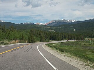
Kenosha Pass, elevation 10,000 ft (3,000 m), is a high mountain pass located in the Rocky Mountains of central Colorado in the United States.

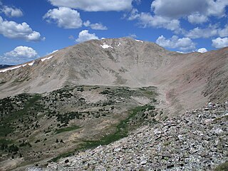
The Mosquito Range is a high mountain range in the Rocky Mountains of central Colorado in the United States. The peaks of the range form a ridge running north–south for roughly 40 mi (64 km) from southern Summit County on the north end, then along the boundary between Lake and Park Counties. The ranges forms a high barrier separating the headwaters of the Arkansas River near Leadville from South Park and the headwaters of the South Platte River near Fairplay. The highest peak in the range is Mount Lincoln at an elevation of 14,286 ft. Other fourteeners in the range are Quandary Peak (14,272 ft), Mount Bross (14,172 ft), Mount Democrat (14,148 ft), and Mount Sherman (14,036 ft).

Trout Creek Pass, elevation 9,346 ft (2,849 m), is a mountain pass located in the Rocky Mountains of south-central Colorado in the United States. The pass sits atop the southern end of the Mosquito Range on the Park-Chaffee county line, between South Park and the headwaters of the Arkansas River to the west. It is traversed jointly by U.S. Highway 24 (US 24) and US 285. Most motorised vehicles can travel on it, and it is only ever closed during really bad winter storms. While the south side has a moderate 5% gradient, the approach from the north is gentle.

The geography of the U.S. State of Colorado is diverse, encompassing both rugged mountainous terrain, vast plains, desert lands, desert canyons, and mesas. Colorado is a landlocked U.S. state. In 1861, the United States Congress defined the boundaries of the new Territory of Colorado exclusively by lines of latitude and longitude, stretching from 37°N to 41°N latitude, and from 102°02'48"W to 109°02'48"W longitude. Starting in 1868, official surveys demarcated the boundaries, deviating from the parallels and meridians in several places. Later surveys attempted to correct some of these mistakes but in 1925 the U.S. Supreme Court affirmed that the earlier demarcation was the official boundary. The borders of Colorado are now officially defined by 697 boundary markers connected by straight boundary lines. Colorado, Wyoming, and Utah are the only states that have their borders defined solely by straight boundary lines with no natural features. The southwest corner of Colorado is the Four Corners Monument at 36°59'56"N, 109°2'43"W. This is the only place in the United States where four states meet: Colorado, New Mexico, Arizona, and Utah.
The Wet Mountains are a small mountain range in southern Colorado, named for the amount of snow they receive in the winter as compared to the dry Great Plains to the east. They are a sub-range of the Sangre de Cristo Mountains, in the southern Rocky Mountains System. There are three variant names of mountain range: Cuerno Verde, Greenhorn Mountains, and Sierra Mojada.

Devil's Head Lookout is a U.S. Forest Service fire lookout tower at the summit of Devils Head in Douglas County, Colorado. Located on a large pinnacle of Pikes Peak granite, the fire lookout point lies within the Pike National Forest and is accessed by hiking the Devils Head National Recreation Trail.

The La Garita Mountains are a high mountain range in the San Juan Mountains, a sub-range of the Southern Rocky Mountains. The mountains are located in Saguache and Mineral counties in southwestern Colorado and are almost entirely managed as public land within the Rio Grande National Forest.

Devils Head is a mountain summit in the Rampart Range of the Rocky Mountains of Colorado. The 9,749-foot (2,971 m) peak is located in Pike National Forest, 14.2 miles (22.9 km) southwest by south of the community of Sedalia in Douglas County, Colorado, United States.

Pikes Peak is the highest summit of the southern Front Range of the Rocky Mountains in North America. The ultra-prominent 14,115-foot (4,302.31 m) fourteener is located in Pike National Forest, 12 miles (19 km) west of downtown Colorado Springs, Colorado. The town of Manitou Springs lies at its base.

Blodgett Peak is a mountain summit in El Paso County, Colorado. Blodgett Peak is located in Pike National Forest. and at its base is Blodgett Peak Open Space of Colorado Springs.

Long Scraggy Peak is a mountain in Jefferson County, Colorado. A prominent peak, it is characterized by its elongated, craggy ridge, for which it is named. The mountain is located within the Pike National Forest near the confluence of the North Fork South Platte River and the South Platte River.

The bedrock under the U.S. State of Colorado was assembled from island arcs accreted onto the edge of the ancient Wyoming Craton. The Sonoma orogeny uplifted the ancestral Rocky Mountains in parallel with the diversification of multicellular life. Shallow seas covered the regions, followed by the uplift current Rocky Mountains and intense volcanic activity. Colorado has thick sedimentary sequences with oil, gas and coal deposits, as well as base metals and other minerals.
Fairview Peak is mountain summit in the Sawatch Range of the Rocky Mountains of North America. The 13,214 feet (4,028 m) mountain is located in Gunnison County, Colorado, and in the Gunnison National Forest.

Chipeta Mountain is a mountain summit in the Sawatch Range of the Rocky Mountains of North America. The 13,472-foot (4,106 m) mountain is located in Chaffee County, Colorado, and in the San Isabel National Forest.
