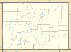
Mount Columbia is a high mountain summit of the Collegiate Peaks in the Sawatch Range of the Rocky Mountains of North America. The 14,077-foot (4,291 m) fourteener is located in the Collegiate Peaks Wilderness of San Isabel National Forest, 9.9 miles (16.0 km) northwest by west of the Town of Buena Vista in Chaffee County, Colorado, United States. The mountain was named in honor of Columbia University in the City of New York and in commemoration of its rowing victory at the renowned Henley Royal Regatta in 1878.

The Sawatch Range is a high and extensive mountain range in central Colorado which includes eight of the twenty highest peaks in the Rocky Mountains, including Mount Elbert, at 14,440 feet (4,401 m) elevation, the highest peak in the Rockies.

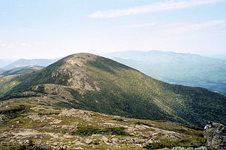
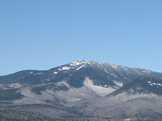
Mount Adams, elevation 5,793 feet (1,766 m) above sea level, is a mountain in New Hampshire, the second highest peak in the Northeast United States after its nearby neighbor, Mt. Washington. Located in the northern Presidential Range, Mount Adams was named after John Adams, the second President of the United States. It was given this name on July 31, 1820. To the northeast is Mount Madison and to the southwest is Mount Jefferson. From the summit, Mount Washington can be seen directly to the south.

Mount Jefferson is located in Coos County, New Hampshire, and is the third highest mountain in the state. The mountain is named after Thomas Jefferson, the third president of the United States, and is part of the Presidential Range of the White Mountains. Mount Jefferson is flanked by Mount Adams and Mount Clay.
Mount Eisenhower is a mountain in the Presidential Range in the White Mountains of New Hampshire approximately 4,760 ft (1,450 m) high. Named after President Dwight D. Eisenhower, its summit offers a 360° view of New Hampshire's mountains. It is inaccessible by road.

Mount Bierstadt is a high mountain summit of the Chicago Peaks in the Front Range of the Rocky Mountains of North America. The 14,065-foot (4,287 m) fourteener is located in the Mount Evans Wilderness of Pike National Forest, 9.4 miles (15.1 km) south by east of the Town of Georgetown in Clear Creek County, Colorado, United States. It was named in honor of Albert Bierstadt, the American landscape painter who made the first recorded summit of the mountain in 1863.

Torreys Peak is a mountain in the Front Range region of the Rocky Mountains in Colorado. It is one of 53 fourteeners in Colorado. Its nearest major city is Denver. Torreys Peak is located along the Continental Divide, as well as the division between Clear Creek County and Summit County.

Mount Lincoln is the eighth-highest summit of the Rocky Mountains of North America and the U.S. state of Colorado. The prominent 14,293-foot (4356.5 m) fourteener is the highest summit of the Mosquito Range and the eleventh-highest summit in the contiguous United States. Mount Lincoln is located in Pike National Forest, 5.2 miles (8.3 km) north-northwest of the Town of Alma in Park County, Colorado, United States. The summit of Mount Lincoln is the highest point in Park County and the entire drainage basin of the Missouri River. The mountain was named in honor of Abraham Lincoln, 16th President of the United States.
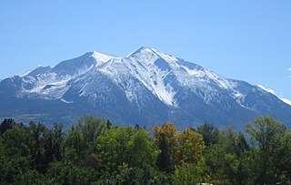
Mount Sopris is a twin-summit mountain in the northwestern Elk Mountains range of the Rocky Mountains of North America. The 12,965-foot (3,952 m) mountain is located in the Maroon Bells-Snowmass Wilderness of White River National Forest, 6.6 miles (10.7 km) north by northeast of the community of Redstone in Pitkin County, Colorado, United States.

Mount Moosilauke is a 4,802-foot-high (1,464 m) mountain at the southwestern end of the White Mountains in the town of Benton, New Hampshire, United States. It is the tenth highest and most southwesterly of the 4,000 foot summits in the White Mountains.

Mount Tom is a large and prominent peak near the city of Bishop in Inyo County of eastern California. It is in the Sierra Nevada and east of the Sierra Crest. The mountain is also in the John Muir Wilderness.

Humboldt Peak is a high mountain summit of the Crestones in the Sangre de Cristo Range of the Rocky Mountains of North America. The 14,070-foot (4,289 m) fourteener is located in the Sangre de Cristo Wilderness of San Isabel National Forest, 11.9 miles (19.2 km) south-southwest of the Town of Westcliffe in Custer County, Colorado, United States. The Crestones are a cluster of high summits in the Sangre de Cristo Range, comprising Crestone Peak, Crestone Needle, Kit Carson Peak, Challenger Point, Humboldt Peak, and Columbia Point.

San Luis Peak is the highest summit of the La Garita Mountains range in the Rocky Mountains of North America. The prominent 14,022-foot (4273.8 m) fourteener is located in the Gunnison National Forest portion of the La Garita Wilderness in Saguache County approximately 10 miles (16 km) north of Creede. It is situated rather far to the east of the other fourteeners in the San Juans, and has more of a wilderness setting than many of the others.
Mount Pierce is a mountain in the Presidential Range in the White Mountains of New Hampshire that is approximately 4,310 feet (1,314 m) high. Formerly called Mount Clinton for 19th-century governor DeWitt Clinton of New York, in 1913 it was renamed after President Franklin Pierce (1804–69), the only president born in New Hampshire, although the newer name is not universally accepted. Its summit offers a wide view of New Hampshire's mountains.

Mount Sherman is a high mountain summit in the Mosquito Range of the Rocky Mountains of North America. The 14,043-foot (4,280 m) fourteener is located 6.8 miles (11.0 km) east by south of the City of Leadville, Colorado, United States, on the drainage divide separating San Isabel National Forest and Lake County from Pike National Forest and Park County. The mountain was named in honor of General William Tecumseh Sherman.
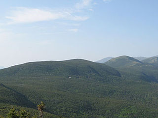
Mount Whiteface is a mountain located in Grafton County, New Hampshire. The mountain is part of the Sandwich Range of the White Mountains. Whiteface is flanked to the northwest by Mount Tripyramid, and to the northeast by Mount Passaconaway. Whiteface is on the eastern border of the Sandwich Range Wilderness. To the east, between Whiteface, Passaconaway, and Mt. Wonalancet, lies The Bowl natural area, an unlogged cirque.

Mount Abraham is a mountain located in Franklin County, Maine. Mount Abraham is flanked to the north by Spaulding Mountain.

Tumbledown Mountain is a mountain in Franklin County, Maine. The mountain is a popular hiking spot in western Maine, with trailheads located on Byron Road in unincorporated Township 6, north of Weld. It is distinguished by an alpine pond just below the summit. Tumbledown Mountain is also located near Coos Canyon, a mountain stream. Tumbledown offers trails of varying difficulty for different hikers.

Mount Parnassus is a high mountain summit in the Front Range of the Rocky Mountains of North America. The 13,580-foot (4,139 m) thirteener is located in Arapaho National Forest, 5.4 miles (8.7 km) west-northwest of the Town of Silver Plume in Clear Creek County, Colorado, United States.

Blodgett Peak is a mountain summit in El Paso County, Colorado. Blodgett Peak is located in Pike National Forest. and at its base is Blodgett Peak Open Space of Colorado Springs.