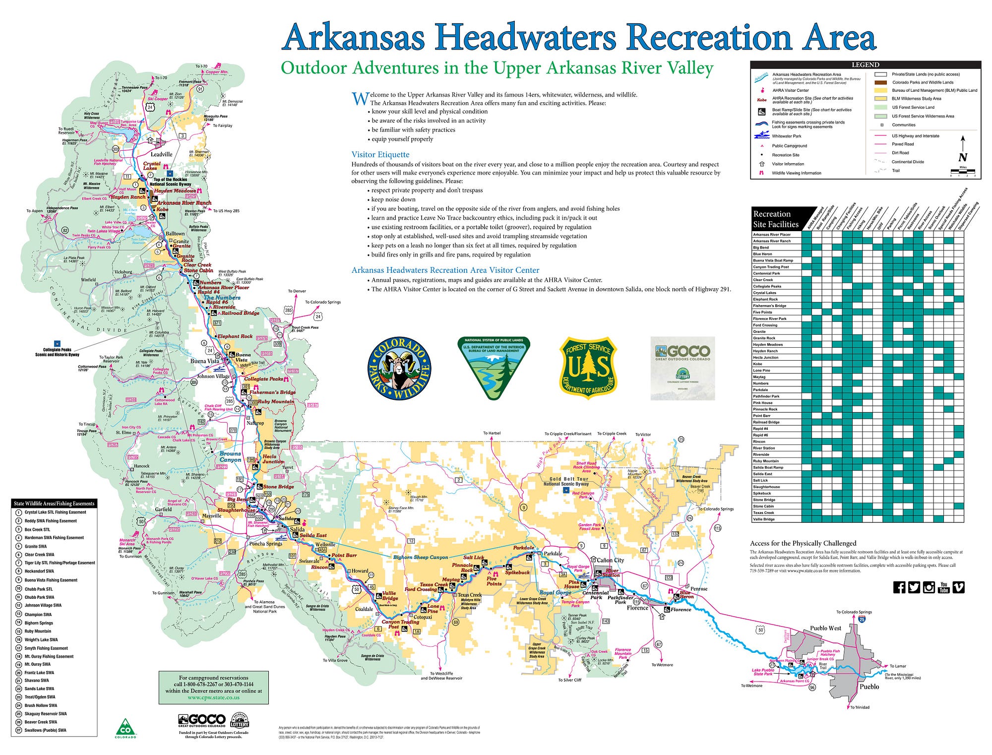
| Arkansas Headwaters Recreation Area | |
|---|---|
 Recreation Area office sign in Salida | |
 | |
| Location | Chaffee / Fremont / Lake / Pueblo counties, Colorado, USA |
| Nearest city | Salida, Colorado |
| Coordinates | 38°32′16″N105°59′33″W / 38.53778°N 105.99250°W |
| Area | 6,193 acres (25.06 km2) |
| Established | 1998 |
| Visitors | 1.2 million(in 2023 [1] ) |
| Governing body | Colorado Parks and Wildlife Bureau of Land Management United States Forest Service |
The Arkansas Headwaters Recreation Area (AHRA) is a state park in Colorado, U.S. The park is jointly administered by Colorado Parks and Wildlife, the Bureau of Land Management, and the United States Forest Service. The park's joint headquarters and visitor center is in Salida, Colorado.