List of Colorado natural areas

Last updated
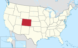
The location of the State of Colorado in the United States of America. Colorado in United States.svg
The location of the State of Colorado in the United States of America .

The U.S. State of Colorado has designated 95 natural areas of the state for special protection. [1] The Colorado Natural Areas Program was established in 1977 to preserve and protect special areas of the state with distinctive flora, fauna, ecological, geological, and paleontologic features. It is a program of Colorado Parks and Wildlife that identifies and protects public, and in some cases private, areas with at least one unique or high-quality natural feature of statewide significance. Land management agreements are made with landowners concerning private property. [2]

Contents

Natural areas

The Colorado Natural Areas are: [1]

See also

Related Research Articles

<span class="mw-page-title-main">Jefferson County, Colorado</span> County in Colorado, United States

Jefferson County is a county located in the U.S. state of Colorado. As of the 2020 census, the population was 582,910, making it the fourth-most populous county in Colorado. The county seat is Golden, and the most populous city is Lakewood.

<span class="mw-page-title-main">Great Sand Dunes National Park and Preserve</span> American national park in Colorado

Great Sand Dunes National Park and Preserve is an American national park that conserves an area of large sand dunes up to 750 feet (230 m) tall on the eastern edge of the San Luis Valley, and an adjacent national preserve in the Sangre de Cristo Range, in south-central Colorado, United States. The park was originally designated Great Sand Dunes National Monument on March 17, 1932, by President Herbert Hoover. The original boundaries protected an area of 35,528 acres. A boundary change and redesignation as a national park and preserve was authorized on November 22, 2000, and then established on September 24, 2004. The park encompasses 107,342 acres while the preserve protects an additional 41,686 acres for a total of 149,028 acres. The recreational visitor total was 527,546 in 2019.

<span class="mw-page-title-main">Colorado Plateau</span> Plateau in the Four Corners region of the Southwest United States

The Colorado Plateau, also known as the Colorado Plateau Province, is a physiographic and desert region of the Intermontane Plateaus, roughly centered on the Four Corners region of the southwestern United States. This province covers an area of 336,700 km2 (130,000 mi2) within western Colorado, northwestern New Mexico, southern and eastern Utah, northern Arizona, and a tiny fraction in the extreme southeast of Nevada. About 90% of the area is drained by the Colorado River and its main tributaries: the Green, San Juan, and Little Colorado. Most of the remainder of the plateau is drained by the Rio Grande and its tributaries.

<span class="mw-page-title-main">American Discovery Trail</span> Long-distance hiking trail across the United States

The American Discovery Trail is a system of recreational trails and roads that collectively form a coast-to-coast hiking and biking trail across the mid-tier of the United States. Horses can also be ridden on most of this trail. The coastal trailheads are the Delmarva Peninsula on the Atlantic Ocean and the northern California coast on the Pacific Ocean. The trail has northern and southern alternates for part of its distance, passing through Chicago and St. Louis respectively. The total length of the trail, including both the north and south routes, is 6,800 miles (10,900 km). The northern route covers 4,834 miles (7,780 km) with the southern route covering 5,057 miles (8,138 km). It is the only non-motorized coast-to-coast trail.

<span class="mw-page-title-main">Roxborough State Park</span> State park in Colorado, United States

Roxborough State Park is a state park of Colorado, United States, known for dramatic red sandstone formations. Located in Douglas County 20 miles (32 km) south of Denver, Colorado, the 3,339-acre (13.51 km2) park was established in 1975. In 1980 it was recognized as a National Natural Landmark.

<span class="mw-page-title-main">Curecanti National Recreation Area</span>

Curecanti National Recreation Area is a National Park Service unit located on the Gunnison River in western Colorado. Established in 1965, Curecanti National Recreation Area is responsible for developing and managing recreational facilities on three reservoirs, Blue Mesa Reservoir, Morrow Point Reservoir and Crystal Reservoir, constructed on the upper Gunnison River in the 1960s by the U.S. Bureau of Reclamation to better utilize the vital waters of the Colorado River and its major tributaries. A popular destination for boating and fishing, Curecanti offers visitors two marinas, traditional and group campgrounds, hiking trails, boat launches, and boat-in campsites. The state's premiere lake trout and Kokanee salmon fisheries, Curecanti is a popular destination for boating and fishing, and is also a popular area for ice-fishing in the winter months.

<span class="mw-page-title-main">Comanche National Grassland</span> Protected area in southeast Colorado

Comanche National Grassland is a National Grassland located in southeastern Colorado, United States. It is the sister grassland of Cimarron National Grassland and contains both prairie grasslands and canyons. It is separated into two sections, each operated by a local ranger district, one of which is in Springfield and the other of which is in La Junta. The grassland is administered by the Forest Service together with the Pike and San Isabel National Forests, and the Cimarron National Grassland, from common headquarters located in Pueblo, Colorado.

<span class="mw-page-title-main">National Register of Historic Places listings in Colorado</span>

There are more than 1,500 properties and historic districts in Colorado listed on the National Register of Historic Places. They are distributed over 63 of Colorado's 64 counties; only the City and County of Broomfield has none.

<span class="mw-page-title-main">San Isabel National Forest</span> Forest in Colorado, US

San Isabel National Forest is located in central Colorado. The forest contains 19 of the state's 53 fourteeners, peaks over 14,000 feet (4,267 m) high, including Mount Elbert, the highest point in Colorado.

<span class="mw-page-title-main">Castlewood Canyon State Park</span> State park in Colorado, United States

Castlewood Canyon State Park is a Colorado state park near Franktown, Colorado. The park retains a unique part of Colorado's history, the remains of Castlewood Canyon Dam. Visitors can still see the remnants and damage from that dam which burst in 1933. The event sent a 15-foot (5 m) wave of water all the way to downtown Denver resulting in a flood. Also contained within the park is the historic Cherry Creek Bridge.

Audubon Canyon Ranch U.S. nonprofit organization

Audubon Canyon Ranch (ACR) is a 501(c)(3) not-for-profit environmental conservation and education organization headquartered in Stinson Beach, Marin County, California, on the eastern shore of Bolinas Lagoon. The lands upon which ACR operates are within the ancestral territories of the Coast Miwok, Southern Pomo and Wappo peoples. ACR recognizes that Indigenous communities are very much alive today and striving to protect and maintain relationships with cultural and natural resources on ACR lands; they acknowledge that Indigenous lands are occupied by them and others.

<span class="mw-page-title-main">Geography of Colorado Springs, Colorado</span>

Colorado Springs geography describes geographical topics regarding the city of Colorado Springs, Colorado in El Paso County, Colorado. With 194.87 sq mi (504.7 km2) of land, it is the state's largest-sized city. Denver is the most populated city.

<span class="mw-page-title-main">Index of Colorado-related articles</span> Article index for the U.S. State of Colorado

This is an alphabetical list of articles related to the U.S. State of Colorado.

<span class="mw-page-title-main">Area of Critical Environmental Concern</span>

Areas of Critical Environmental Concern (ACEC) is a conservation ecology program in the Western United States, managed by the Bureau of Land Management (BLM). The ACEC program was conceived in the 1976 Federal Lands Policy and Management Act (FLPMA), which established the first conservation ecology mandate for the BLM. The FLPMA mandate directs the BLM to protect important riparian corridors, threatened and endangered species habitats, cultural and archeological resources, as well as unique scenic landscapes that the agency assesses as in need of special management attention.

Prehistory of Colorado provides an overview of the activities that occurred prior to Colorado's recorded history. Colorado experienced cataclysmic geological events over billions of years, which shaped the land and resulted in diverse ecosystems. The ecosystems included several ice ages, tropical oceans, and a massive volcanic eruption. Then, ancient layers of earth rose to become the Rocky Mountains.

<span class="mw-page-title-main">Bear Creek (Colorado)</span> River

Bear Creek is a tributary of the South Platte River in central Colorado in the United States. It begins as a small creek up in the Mount Evans Wilderness in Summit Lake and makes its way through Evergreen, CO, Kittredge, CO, Idledale, CO and Morrison, CO before entering into Bear Ponds. The stream flows to a confluence with the South Platte River in Sheridan, Colorado, just south of Denver, and then into the South Platte River near Englewood. As it moves downstream, Kerr Gulch, Cold Spring Gulch and Saw Mill Gulch all add to its flow making it a sustainable river to fish from spring to fall, with close access to the Denver area.

<span class="mw-page-title-main">Parks in Colorado Springs, Colorado</span>

There are a wide range of recreational areas and facilities in Colorado Springs, Colorado.

References

  1. 1 2 "Colorado Natural Areas Program, 2018-2020 review, triennal report to Governor Polis" (PDF). Colorado Parks & Wildlife. State of Colorado. n.d. Retrieved 2022-07-25.
  2. "Colorado Natural Areas Program". Colorado Parks & Wildlife. Retrieved 2022-07-25.

Coordinates: 38°59′50″N105°32′52″W / 38.9972°N 105.5478°W / 38.9972; -105.5478 (State of Colorado)