Platte River Wilderness | |
---|---|
Location | Carbon / Albany counties, Wyoming / Jackson County, Colorado, USA |
Nearest city | Rawlins, WY |
Coordinates | 41°05′N106°21′W / 41.083°N 106.350°W [1] |
Area | 23,492 acres (95.07 km2) |
Established | 1984 |
Governing body | U.S. Forest Service |
The Platte River Wilderness is primarily located in south central Wyoming, with a small section extending into Colorado in the United States. Located entirely within Medicine Bow - Routt National Forest, the wilderness was created in 1984 to protect the forestlands adjacent to the North Platte River. These forestlands were almost entirely consumed by the Mullen Fire in 2020. [2]
The Wyoming section lies within the original Medicine Bow National Forest, whereas the Colorado section is in the original Routt National Forest; since 1995 these have been administratively combined. [3] [4] [5] [6]
U.S. Wilderness Areas do not allow motorized or mechanized vehicles, including bicycles. Although camping and fishing are allowed with proper permit, no roads or buildings are constructed and there is also no logging or mining, in compliance with the 1964 Wilderness Act. Wilderness areas within National Forests and Bureau of Land Management areas also allow hunting in season. [7]
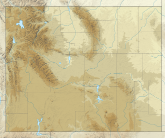
Jackson County is a county located in the U.S. state of Colorado. As of the 2020 census, the population was 1,379, and it was the fourth least populated in the state. The county is named after the United States President Andrew Jackson. The county seat and only municipality in the county is Walden.
The North Platte River is a major tributary of the Platte River and is approximately 716 miles (1,152 km) long, counting its many curves. In a straight line, it travels about 550 miles (890 km), along its course through the U.S. states of Colorado, Wyoming, and Nebraska.
The Laramie Mountains are a range of moderately high peaks on the eastern edge of the Rocky Mountains in the U.S states of Wyoming and Colorado. The range is the northernmost extension of the line of the ranges along the eastern side of the Rockies, and in particular of the higher peaks of the Front Range directly to the south. North of the range, the gap between the Laramie range and the Bighorn Mountains provided the route for historical trails, such as the Oregon Trail, the Mormon Trail, and the Pony Express.
The Little Snake River is a tributary of the Yampa River, approximately 155 miles (249 km) long, in southwestern Wyoming and northwestern Colorado in the United States.
The Laramie River is a tributary of the North Platte River, approximately 280 miles (450 km) long, in the U.S. states of Colorado and Wyoming. The river was named for Jacques La Ramie, a fur trapper who visited the area in the early 19th century. Laramie County, Wyoming, the city of Laramie, and other geographical entities in the region have "Laramie" in their names.
The Medicine Bow Mountains are a mountain range in the Rocky Mountains that extend 100 miles (160 km) from northern Colorado into southern Wyoming. The northern extent of this range is the sub-range the Snowy Range. From the northern end of Colorado's Never Summer Mountains, the Medicine Bow mountains extend north from Cameron Pass along the border between Larimer and Jackson counties in Colorado and northward into south central Wyoming. In Wyoming, the range sits west of Laramie, in Albany and Carbon counties to the route of the Union Pacific Railroad and U.S. Interstate 80. The mountains often serve as a symbol for the city of Laramie. The range is home to Snowy Range Ski Area.
The Park Range, elevation approximately 3,712 metres (12,178 ft), is a mountain range in the Rocky Mountains of northwestern Colorado in the United States. The range forms a relatively isolated part of the Continental Divide, extending north-to-south for approximately 170 kilometres (110 mi) along the boundary between Jackson (east) and Routt counties. It separates North Park in the upper basin of the North Platte River on the east from the Elk River basin in the watershed of the Yampa River the west. It rises steeply out of the Yampa River basin, forming a climatic barrier that receives much snowfall in winter. The northern end of the range lies in Wyoming and is known as the Sierra Madre Range.
The Roosevelt National Forest is a National Forest located in north central Colorado. It is contiguous with the Colorado State Forest as well as the Arapaho National Forest and the Routt National Forest. The forest is administered jointly with the Arapaho National Forest and the Pawnee National Grassland from offices in Fort Collins, and is denoted by the United States Forest Service as ARP.
The Lost Creek Wilderness is a 119,790-acre (485 km2) wilderness area located in central Colorado in Jefferson and Park counties, south of the town of Bailey. The area is situated entirely within the boundaries of the Pike National Forest.
Flat Tops Wilderness Area is the second largest U.S. Wilderness Area in Colorado. It is 235,214 acres (951.88 km2), with 38,870 acres (157.3 km2) in Routt National Forest and 196,344 acres (794.58 km2) in White River National Forest. It was designated a wilderness area in 1975. Trappers Lake, located in the north of the area, was the lake that inspired Arthur Carhart, a United States Forest Service official, to plead for wilderness preservation.
Medicine Bow–Routt National Forest is the official title to a U.S. Forest Service managed area extending over 2,222,313 acres (8,993.38 km2) in the states of Wyoming and Colorado, United States. What were once three separate areas, Medicine Bow National Forest, Routt National Forest, and Thunder Basin National Grassland were administratively combined in 1995 due to similarity of the resources, proximity to each other and for administrative purposes.
Popo Agie Wilderness is located within Shoshone National Forest, Wyoming, United States. The wilderness consists of 101,870 acres on the east side of the continental divide in the Wind River Range. Originally set aside as a primitive area in 1932, in 1984 the Wyoming Wilderness Act was passed securing a more permanent protection status for the wilderness. The wilderness is a part of the 20,000,000 acres Greater Yellowstone Ecosystem.
The Cloud Peak Wilderness is located in north central Wyoming in the United States. Entirely within Bighorn National Forest, the wilderness was established in 1984 in an effort to preserve the wildest section of the Bighorn Mountains. The wilderness has the highest peaks in the Bighorn Mountains including Cloud Peak and Black Tooth Mountain, as well as Cloud Peak Glacier, the only remaining active glacier in the Bighorn Mountains. The Cloud Peak Wilderness is 189,039 acres (765.01 km2).
The Encampment River Wilderness is a designated wilderness area located in south central Wyoming in the United States. Entirely within Medicine Bow National Forest, the wilderness was designated to increase protection of the Encampment River and the canyon through which it flows.
The Huston Park Wilderness is located in south central Wyoming in the United States. Entirely within Medicine Bow National Forest, the wilderness was designated in 1984 to preserve the northernmost section of the central Rocky Mountains, an area of high mountain peaks and coniferous forest.
The Savage Run Wilderness is located in south central Wyoming in the United States. Entirely within Medicine Bow National Forest, the wilderness was designated in 1978 in an effort to protect vital rangeland for a large elk population.
The Rawah Wilderness is administered by the USDA Forest Service. It is located on the Canyon Lakes Ranger District of the Roosevelt National Forest in Colorado, near the Wyoming border, and also in the Routt National Forest to its south. It encompasses 76,394 acres (309.16 km2) and includes 25 named lakes ranging in size from five to 39 acres. There are 85 miles (137 km) of trails in the area and elevation ranges from 8,400 feet (2,600 m) to 13,000 feet (4,000 m). Much of the area is traversed by the Medicine Bow Mountains and the Rawah Range for which it is named. The temperature in the Rawah Wilderness ranges from a low of 5 °F (−15 °C) during the winter and a high of 77 °F (25 °C) during the summer.
Clark Peak is the highest summit of the Medicine Bow Mountains range of the Rocky Mountains of North America. The prominent 12,960-foot (3,950 m) peak is located in the Rawah Wilderness of Routt National Forest, 6.3 miles (10.1 km) north-northwest of Cameron Pass, Colorado, United States, on the drainage divide between Jackson and Larimer counties. Clark Peak is the highest point of Jackson County and the entire drainage basin of the North Platte River.
The Ptarmigan Peak Wilderness is a U.S. Wilderness Area located north of Dillion, Colorado in the Williams Fork Mountains. The 12,760-acre (51.6 km2) wilderness was established in 1993 in the White River and Routt National Forests.
The Sierra Madre Range is a mountain range in the western United States, located in south-central Wyoming and north-central Colorado. Geologically, it may be considered an extension of the Park Range of Colorado. South of the Great Divide Basin, the US Continental Divide runs along the Sierre Madre high points. Its western basins drain into the Colorado River and its eastern into the North Platte River. Buck Mountain is the highest peak in the range and lies within Colorado. Bridger Peak is its highest elevation on the Wyoming side of the range.