Guernsey State Park

Last updated

Guernsey State Park
Guernsey Lake Park.JPG
Guernsey Reservoir
USA Wyoming location map.svg
Red pog.svg
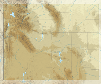
Location in Wyoming
Location Platte County, Wyoming, United States
Nearest town Guernsey, Wyoming
Coordinates 42°17′24″N104°45′50″W / 42.29000°N 104.76389°W / 42.29000; -104.76389 [2]
Area8,631 acres (34.93 km2) [3]
Elevation4,416 ft (1,346 m) [2]
Designation Wyoming state park
Established1934
Administrator Wyoming State Parks, Historic Sites & Trails
Website Guernsey State Park
Lake Guernsey State Park
Guernsey State Park Museum, Highway 317, Guernsey (Platte County, Wyoming).jpg
Guernsey State Park Museum
Area3,760 acres (original)
8,602 acres (increase) [4]
Built1934-39
Architect Roland Pray (original)
S. R. Deboer; Richard G. Redell (expanded)
Architectural style National Park Service Rustic, Bungalow/Craftsman
NRHP reference No. 80004051 (original)
97001260 (increase) [4]
Significant dates
Added to NRHPAugust 26, 1980 (original)
September 25, 1997 (increase)
Designated NHLDSeptember 25, 1997 [5]

Guernsey State Park is a public recreation area surrounding the Guernsey Reservoir, an impoundment of the North Platte River, one mile northwest of the town of Guernsey in Platte County, Wyoming, USA. The state park has campgrounds, boat ramps and hiking trails as well as exceptional examples of structures created by the Civilian Conservation Corps in the 1930s. [6] Facilities are managed for the Bureau of Reclamation by the Wyoming Division of State Parks and Historic Sites. [7]

Contents

History

Guernsey State Park Power Plant GuernseyStatePark PowerPlant.jpg
Guernsey State Park Power Plant

The park began with the construction of the Guernsey Dam, started in 1925 and completed in 1927. [8] [9] Between 1934 and 1939, workers with the Civilian Conservation Corps created recreational facilities on the land surrounding the dam's reservoir. Park management fell to the state of Wyoming in 1957. [4]

Lake Guernsey State Park (also known as Guernsey State Park Historic District, Lake Guernsey Park, Guernsey Lake Park, or Guernsey State Park) was declared a National Historic Landmark District in 1997 for its design history and construction. The park's design was the result of the first collaboration between the National Park Service and the Bureau of Reclamation, and its infrastructure was built by Civilian Conservation Corps crews. The historic district contains 60 contributing resources: 14 buildings, three sites and 43 structures, as well as 46 non-contributing resources. [4] [10]

Features

The Guernsey State Park Museum offers information about the CCC and the natural and cultural history of the area. [11] [12] The park contains a separate National Historic Landmark, the Oregon Trail Ruts. Register Cliff, another feature of the Oregon Trail listed on the National Register of Historic Places, is located two miles southeast of the park. [6]

Activities and amenities

The park has seven campgrounds and three boat ramps. Fish species include walleye, yellow perch and channel catfish. Fish populations are affected by the reservoir's twice-yearly draw-downs. [7]

Related Research Articles

<span class="mw-page-title-main">Bighorn Canyon National Recreation Area</span> National recreation area in the United States

Bighorn Canyon National Recreation Area is a national recreation area established by an act of Congress on October 15, 1966, following the construction of the Yellowtail Dam by the Bureau of Reclamation. It is one of over 420 sites managed by the U.S. National Park Service. The recreation area spans 120,296.22 acres, straddling the border between Wyoming and Montana. It is divided into two distinct areas, the North District accessed via Fort Smith, Montana and the South District accessed through Lovell, Wyoming. There is no thru road inside the recreation area connecting the two districts. The Yellowtail Dam is located in the North District. It is named after the famous Crow leader Robert Yellowtail, harnesses the waters of the Bighorn River by turning that variable watercourse into Bighorn Lake. The lake extends 71 miles (114 km) through Wyoming and Montana, 55 miles (89 km) of which lie within the national recreation area. The lake provides recreational boating, fishing, water skiing, kayaking, and birding opportunities to visitors. About one third of the park unit is located on the Crow Indian Reservation. Nearly one-quarter of the Pryor Mountains Wild Horse Range lies within the Bighorn Canyon National Recreation Area.

<span class="mw-page-title-main">North Platte River</span> River in the Western United States

The North Platte River is a major tributary of the Platte River and is approximately 716 miles (1,152 km) long, counting its many curves. In a straight line, it travels about 550 miles (890 km), along its course through the U.S. states of Colorado, Wyoming, and Nebraska.

<span class="mw-page-title-main">Lake Mead National Recreation Area</span> U.S. protected area in Nevada and Arizona

Lake Mead National Recreation Area is a U.S. national recreation area in southeastern Nevada and northwestern Arizona. Operated by the National Park Service, Lake Mead NRA follows the Colorado River corridor from the westernmost boundary of Grand Canyon National Park to just north of the cities of Laughlin, Nevada and Bullhead City, Arizona. It includes all of the eponymous Lake Mead as well as the smaller Lake Mohave – reservoirs on the river created by Hoover Dam and Davis Dam, respectively – and the surrounding desert terrain and wilderness.

<span class="mw-page-title-main">Folsom Lake State Recreation Area</span> Park on the American River in the Sacramento metropolitan area

The Folsom Lake State Recreation Area surrounds Folsom Lake in the foothills of the Sierra Nevada, and is managed by the California Department of Parks and Recreation. It is located near the city of Folsom, California, about 25 miles (40 km) east of Sacramento.

<span class="mw-page-title-main">Curecanti National Recreation Area</span>

Curecanti National Recreation Area is a National Park Service unit located on the Gunnison River in western Colorado. Established in 1965, Curecanti National Recreation Area is responsible for developing and managing recreational facilities on three reservoirs, Blue Mesa Reservoir, Morrow Point Reservoir and Crystal Reservoir, constructed on the upper Gunnison River in the 1960s by the U.S. Bureau of Reclamation to better utilize the vital waters of the Colorado River and its major tributaries. A popular destination for boating and fishing, Curecanti offers visitors two marinas, traditional and group campgrounds, hiking trails, boat launches, and boat-in campsites. The state's premiere lake trout and Kokanee salmon fisheries, Curecanti is a popular destination for boating and fishing, and is also a popular area for ice-fishing in the winter months.

<span class="mw-page-title-main">Keyhole State Park</span> State park in Wyoming, United States

Keyhole State Park is a public recreation area surrounding Keyhole Reservoir, ten miles (16 km) northeast of Moorcroft in Crook County, Wyoming. The state park is managed by the Wyoming Division of State Parks and Historic Sites.

<span class="mw-page-title-main">Pathfinder Dam</span> Dam in Wyoming, USA

Pathfinder Dam is a masonry dam, located on the North Platte River, approximately 47 miles (76 km) southwest of Casper, Wyoming. It was originally constructed from 1905 to 1909 as part of the North Platte Project and has been modified several times since then. It is included on the National Register of Historic Places. Construction of the dam created Pathfinder Reservoir which provides water storage for 226,000 acres (910 km2) of irrigation in Wyoming and Nebraska. The dam is named for General John Charles Fremont, who had explored the area in 1842 and was nicknamed the "Pathfinder of the West."

<span class="mw-page-title-main">Blue Mesa Reservoir</span> Lake on the Gunnison River in Colorado, United States

Blue Mesa Reservoir is an artificial reservoir located on the upper reaches of the Gunnison River in Gunnison County, Colorado. The largest lake located entirely within the state, Blue Mesa Reservoir was created by the construction of Blue Mesa Dam, a 390-foot tall earthen fill dam constructed on the Gunnison by the U.S. Bureau of Reclamation in 1966 for the generation of hydroelectric power. Managed as part of the Curecanti National Recreation Area, a unit of the National Park Service, Blue Mesa Reservoir is the largest lake trout and Kokanee salmon fishery in Colorado.

<span class="mw-page-title-main">Buffalo Bill State Park</span> State Park in Park County, Wyoming

Buffalo Bill State Park is a public recreation area surrounding the reservoir formed by the Buffalo Bill Dam, an impoundment of the Shoshone River, in Park County, Wyoming. The state park, reservoir and dam were named after William "Buffalo Bill" Cody, who founded the nearby town of Cody and who owned much of the land now occupied by the reservoir and park. The park offers camping, hiking, boating, fishing, and picnicking and is managed by Wyoming Division of State Parks and Historic Sites.

<span class="mw-page-title-main">Douthat State Park</span> Park in the Appalachians, United States

Douthat State Park is a state park located in the Allegheny Mountains in Virginia. It is in Bath County and Alleghany County. The park is 4,545 acres (18 km2) total with a 50-acre (20 ha) lake, the second-largest Virginia state park after Pocahontas State Park. It is one of the original Virginia state parks built in the 1930s by the Civilian Conservation Corps.

The Central Utah Project is a US federal water project that was authorized for construction under the Colorado River Storage Project Act of April 11, 1956, as a participating project. In general, the Central Utah Project develops a portion of Utah's share of the yield of the Colorado River, as set out in the Colorado River Compact of 1922.

<span class="mw-page-title-main">Buffalo Bill Dam</span> Dam in Wyoming

Buffalo Bill Dam is a concrete arch-gravity dam on the Shoshone River in the U.S. state of Wyoming. It is named after the famous Wild West figure William "Buffalo Bill" Cody, who founded the nearby town of Cody and owned much of the land now covered by the reservoir formed by its construction. The dam is part of the Shoshone Project, successor to several visionary schemes promoted by Cody to irrigate the Bighorn Basin and turn it from a semi-arid sagebrush-covered plain to productive agricultural land. Known at the time of its construction as Shoshone Dam, it was renamed in 1946 to honor Cody.

<span class="mw-page-title-main">Oregon Trail Ruts</span> United States historic place

Oregon Trail Ruts State Historic Site is a preserved site of wagon ruts of the Oregon Trail on the North Platte River, about 0.5 miles south of Guernsey, Wyoming. The Oregon Trail here was winding up towards South Pass. Here, wagon wheels, draft animals, and people wore down the trail into a sandstone ridge about two to six feet, during its heavy usage from 1841–1869. The half-mile stretch is "unsurpassed" and is the best-preserved set of Oregon Trail ruts anywhere along its former length.

<span class="mw-page-title-main">Register Cliff</span> United States historic place

Register Cliff is a sandstone cliff and featured key navigational landmark prominently listed in the 19th century guidebooks about the Oregon Trail, and a place where many emigrants chiseled the names of their families on the soft stones of the cliff — it was one of the key checkpoint landmarks for parties heading west along the Platte River valley west of Fort John, Wyoming which allowed travelers to verify they were on the correct path up to South Pass and not moving into impassable mountain terrains—geographically, it is on the eastern ascent of the Continental Divide leading upward out of the Great Plains in the east of the U.S. state of Wyoming. It is notable as a historic landmark for 'registering' hundreds of emigrants on the Oregon Trail who came to follow custom and inscribed their names on its rocks during the western migrations of the 19th century. An estimated 500,000 emigrants used these trails from 1843 to 1869, with up to one-tenth dying along the way, usually due to disease.

<span class="mw-page-title-main">Mammoth Hot Springs Historic District</span> United States historic place in Yellowstone National Park

The Mammoth Hot Springs Historic District is a 158-acre (64 ha) historic district in Yellowstone National Park comprising the administrative center for the park. It is composed of two major parts: Fort Yellowstone, the military administrative center between 1886 and 1918, and now a National Historic Landmark, and a concessions district which provides food, shopping, services, and lodging for park visitors and employees. It was added to the National Register of Historic Places on March 20, 2002, for its significance in architecture, conservation, entertainment/recreation, and military. The district includes 189 contributing buildings.

<span class="mw-page-title-main">Glendo State Park</span> State Park in Converse and Platte counties, Wyoming

Glendo State Park is a public recreation area surrounding Glendo Reservoir on the North Platte River in Platte and Converse counties in Wyoming in the United States. The state park is located near the town of Glendo, about 20 miles (32 km) southeast of the city of Douglas. The park offers 45 miles (72 km) of mountain bike trails, multiple camping areas totaling more than 500 campsites, plus fishing and other water activities with the reservoir producing several state record-size fish. The park is managed by the Wyoming Division of State Parks and Historic Sites.

<span class="mw-page-title-main">Guernsey Dam</span> Dam in Wyoming, USA

Guernsey Dam is an earthfill dam on the North Platte River in Platte County in the U.S. State of Wyoming. The dam creates Guernsey Reservoir, the last of the 5 major reservoirs on the North Platte River in Wyoming. The dam contains a hydroelectric plant capable of 6.4 megawatts of electricity. The total capacity of the reservoir is 71,040 acre-feet (87,630,000 m3) of water which is used mainly for irrigation. Morrison-Knudsen and Utah Construction Company constructed Guernsey Dam and the hydroelectric plant as part of the North Platte Project to provide irrigation to eastern Wyoming and western Nebraska. Guernsey helps control the river flow and stores water released from the project's primary storage upstream at Pathfinder Reservoir. About 8 miles (13 km) downstream of the dam the Whalen Diversion Dam diverts water into the Fort Laramie and Interstate Canals that service farms in Wyoming and Nebraska.

<span class="mw-page-title-main">Wickiup Reservoir</span> Lake in Oregon, United States

Wickiup Reservoir is the second-largest reservoir in the U.S. state of Oregon. It is located 60 miles (97 km) southwest of Bend, and is the largest of the Cascade Lakes. Wickiup Reservoir is close to the Twin Lakes, Davis Lake, Crane Prairie Reservoir, Cultus Lake, and Little Cultus Lake. The reservoir is located within the Deschutes National Forest and the Fort Rock Ranger District, near the Cascade Lakes Scenic Byway.

<span class="mw-page-title-main">Lake Ahquabi State Park</span> State park in Warren County, Iowa

Lake Ahquabi State Park is a state park of Iowa, US, featuring a 115-acre (47 ha) reservoir. Ahquabi means "resting place" in the Fox language. The park is 6 miles (9.7 km) south of Indianola and 22 miles (35 km) south of Des Moines. Three sections of the park were listed on the National Register of Historic Places in 1991.

<span class="mw-page-title-main">DUX Bessemer Bend Bridge</span> United States historic place

The DUX Bessemer Bend Bridge was a Warren through truss bridge in Bessemer Bend, Wyoming, which carried Natrona County Road CN1-58 across the North Platte River. The bridge was built from 1921 to 1922. When nominated to the National Register of Historic Places in 1982, it was one of only three Warren through truss bridges remaining on Wyoming county highways. In addition, the bridge was located at the site of a historic river crossing on the Oregon Trail.

References

  1. "Guernsey State Park". Protected Planet. IUCN. Retrieved May 1, 2018.
  2. 1 2 "Guernsey Dam". Geographic Names Information System . United States Geological Survey, United States Department of the Interior.
  3. "Table 1. Facilities managed by Wyoming State Parks, Historic Sites and Trails" (PDF). SOAR 2021. Wyoming Department of State Parks and Cultural Resources. p. 12. Retrieved August 28, 2017.
  4. 1 2 3 4 Begley, Susan; Carr, Ethan (January 6, 1997). "Lake Guernsey State Park". National Historic Landmark Nomination. National Park Service. Retrieved December 1, 2015.
  5. "Listing of National Historic Landmarks by State". National Park Service. Retrieved March 11, 2020.
  6. 1 2 "Guernsey State Park". Wyoming State Parks, Historic Sites & Trails. State of Wyoming. Retrieved August 28, 2017.
  7. 1 2 "Guernsey Reservoir Facilities". Bureau of Reclamation. Retrieved June 24, 2016.
  8. "Guernsey Dam and Reservoir". Wyoming Places. Wyoming State Library. Retrieved March 11, 2020.
  9. "Wyoming: Guernsey Dam". National Park Service. Retrieved March 11, 2020.
  10. "Lake Guernsey State Park: Accompanying 20 images (photos and plans), from 1977, 1994, and c. 1935". NRHP database. National Park Service. Retrieved December 1, 2015.
  11. "Guernsey State Park". Sangres.com. Retrieved December 1, 2015.
  12. "Guernsey Museum Digitization Project". Wyoming State Parks & Historic Sites. Retrieved December 1, 2015.