List of National Natural Landmarks in Wyoming

Last updated

Map all coordinates using: OpenStreetMap  
Download coordinates as: KML

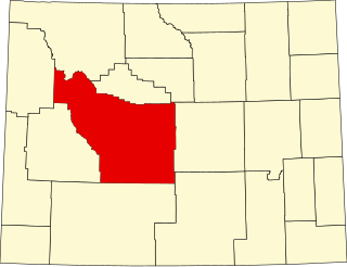
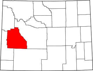
From List of National Natural Landmarks, these are the National Natural Landmarks in Wyoming. There are 6 in total: 3 are canyons, one is a depression, one is a cliff, and the last is a stream that divides and flows into two oceans.

Wyoming National Natural Landmarks (clickable map)
NameImageDateLocationCountyOwnershipDescription
1 The Big Hollow November 1980 Laramie
41°18′48″N105°43′17″W / 41.313209°N 105.721307°W / 41.313209; -105.721307
Albany federal, privateA large wind eroded deflection basin.
2 Como Bluff Como Bluff.jpg May 1966, November 1973 Rock River
41°52′53″N106°04′34″W / 41.881384°N 106.076217°W / 41.881384; -106.076217
Albany federal, state, privateA ridge noted for multiple significant fossil discoveries from the late Jurassic of the Mesozoic Era.
3 Crooked Creek Natural Area 1966 Big Horn federal (Bighorn National Forest)A rich source of fossils of Early Cretaceous land vertebrates.
4 Red Canyon Red Canyon Road and Rim.jpg November 1980 Lander
42°40′20″N108°39′29″W / 42.672087°N 108.658175°W / 42.672087; -108.658175
Fremont federal, state, privateA canyon exposing a number of sedimentary formations as well as 10,000 years of human habitation.
5 Sand Creek Sand Creek NNL.jpg December 1984 40°59′49″N105°46′14″W / 40.99694°N 105.77056°W / 40.99694; -105.77056 (Sand Creek) Albany federal, state, privateThe most spectacular examples of cross-bedded sandstone and "topple blocks" in North America. NNL area extends across Colorado border.
6 Two Ocean Pass October 1965 Teton Wilderness
44°02′35″N110°10′30″W / 44.04293°N 110.17495°W / 44.04293; -110.17495
Teton federal (Bridger-Teton National Forest)A pass located on the continental divide. Here, at a place called Parting of the Waters, North Two Ocean Creek splits into its two distributaries which form the headwaters of Pacific Creek and Atlantic Creek. Waters from these two creeks ultimately flow the Pacific and Atlantic ocean drainages, respectively.

Related Research Articles

National monument (United States) Monuments assigned protected status by Presidents of the US

In the United States, a national monument is a protected area that can be created from any land owned or controlled by the federal government by proclamation of the President of the United States or an act of Congress. National monuments protect a wide variety of natural and historic resources, including sites of geologic, marine, archaeological, and cultural importance.

Santa Ana Mountains Mountain range in California, United States

The Santa Ana Mountains are a short peninsular mountain range along the coast of Southern California in the United States. They extend for approximately 61 miles (98 km) southeast of the Los Angeles Basin largely along the border between Orange and Riverside counties.

Hermits Rest NRHP site in Coconino County, Arizona

Hermits Rest is a structure built in 1914 at the western end of Hermit Road at the south rim of the Grand Canyon in Arizona, United States. The Hermit Trail, a hiking trail that extends to the Colorado River, begins about ¼ mile beyond the shuttle bus stop at Hermits Rest. Hermits Rest also represents the western terminus of the Rim Trail. The location was named for Louis Boucher. Around 1891, Boucher – a Canadian-born prospector – staked claims below present-day Hermits Rest. With help, Boucher carved the aforementioned trail into the canyon, and for years lived alone at nearby Dripping Springs. The main structure currently standing at Hermits Rest was designed by architect Mary Colter. Hermits Rest is the westernmost point on the canyon's south rim that is accessible by paved road. It was built as a rest area for tourists on coaches operated by the Fred Harvey Company on the way to the now-vanished Hermit Camp. The building was designed to appear to be a natural stone formation, closely tied to the land. Colter selected furnishings that are included in the National Historic Landmark designation.

Salt River Bay National Historical Park and Ecological Preserve National Park Service unit in the U.S. Virgin Islands

Salt River Bay National Historic Park and Ecological Preserve is a unit of the National Park Service on the island of St. Croix in the U.S. Virgin Islands. It preserves upland watersheds, mangrove forests, and estuarine and marine environments that support threatened and endangered species. It also contains the Columbus Landing Site, a National Historic Landmark that is the only known site where members of a Columbus expedition set foot on what is now United States territory. The site is marked by Fort Salé, a remaining earthworks fortification from the French period of occupation, about 1617. The park also preserves prehistoric and colonial-era archeological sites including the only existing example of a ball court in the US Virgin Islands.

Osceola National Forest National forest located Florida

Osceola National Forest is a National Forest located in northeast Florida.

The Gold Belt Tour Scenic and Historic Byway is a National Scenic Byway, a Back Country Byway, and a Colorado Scenic and Historic Byway located in Fremont and Teller counties, Colorado, USA. The byway is named for the Gold Belt mining region. The Cripple Creek Historic District is a National Historic Landmark. The byway forms a three-legged loop with the Phantom Canyon Road, the Shelf Road, and the High Park Road (paved).

Lake Billy Chinook Body of water

Lake Billy Chinook is a reservoir in Jefferson County in the U.S. state of Oregon. Created by the Round Butte Dam in 1964, Lake Billy Chinook lies in a canyon at the confluence of the Crooked, Deschutes, and Metolius rivers near Culver and Madras. It was named for Billy Chinook, a Native American of the Wasco tribe who traveled alongside American explorers John C. Frémont and Kit Carson in their expeditions of 1843 and 1844.

Lowry Pueblo United States historic place

The Lowry Pueblo is an Ancestral Puebloan archaeological site located in Canyons of the Ancients National Monument near Pleasant View, Colorado, United States. The pueblo was constructed around 1060 AD atop abandoned pithouses from an earlier period of occupation. It was occupied by 40 to 100 people at a time for 165 years. The site is one of the northernmost to be associated with the Puebloan cultures. The site was declared a National Historic Landmark in 1964.

Grand Canyon Park Operations Building United States historic place

The Grand Canyon Park Operations Building was built in 1929 on the South Rim of the Grand Canyon in Grand Canyon National Park. It is significant as an example of a National Park Service building designed to blend harmoniously with the natural surroundings, in the National Park Service Rustic style. The Operations Building was designed to replace the Superintendent's Residence as the park headquarters. It was in turn replaced by a newer building in 1967, and presently functions as the headquarters for park law enforcement. The building was designed by the National Park Service Landscape Division under the direction of Thomas Chalmers Vint, and has been designated a National Historic Landmark for its design significance.

Landmark Recognizable feature used for navigation

A landmark is a recognizable natural or artificial feature used for navigation, a feature that stands out from its near environment and is often visible from long distances.

The West Branch Pleasant River is a 36.1-mile-long (58.1 km) tributary of the Piscataquis River in Piscataquis County, Maine. From a location north of Fourth West Branch Pond in Shawtown, the river runs about 18 miles (29 km) counterclockwise around the White Cap Mountain massif, then about 18 miles (29 km) southeast to its confluence with the East Branch of the Pleasant River in Brownville.

Buffalo Lake National Wildlife Refuge National Wildlife Refuge near Canyon, Texas

Buffalo Lake National Wildlife Refuge is a protected area in Randall County in the Texas Panhandle. Its shortgrass prairies spill into marshes, woodlands, riparian habitat, croplands, and water-carved canyon walls that together form 7,664 acres (31.02 km2) of homes for migratory and year-round wildlife. The area forms a habitat for black-tailed prairie dogs and burrowing owls, among many other species. Some 175 acres (0.71 km2) of the refuge carries the designation of National Natural Landmark.

Thousand Springs State Park

Thousand Springs State Park is a public recreation and nature preservation area consisting of multiple units — Billingsley Creek, Earl M. Hardy Box Canyon Springs Nature Preserve, Malad Gorge, Niagara Springs, and Ritter Island — in Gooding County, Idaho.

Laguna Coast Wilderness Park

Laguna Coast Wilderness Park is a 7,000-acre (2,800 ha) wilderness area in the San Joaquin Hills surrounding Laguna Beach, California. This park features coastal canyons, ridgeline views and the only natural lakes in Orange County, California. Trails are maintained for hiking and mountain biking with a wide range of difficulty, from beginner to expert. Most trails gain in height, reaching a maximum of 1,000 feet (300 m) in elevation. Several trails lead to downtown Laguna Beach.

San Felipe Creek is a stream in Imperial and San Diego Counties of California. It arises in the Volcan Mountains of San Diego County 33°11′57″N116°37′35″W, and runs eastward, gathering the waters of most of the eastern slope of the mountains and desert of the county before it empties into the Salton Sea. It is probably the last remaining perennial natural desert stream in the Colorado Desert region. In 1974, the San Felipe Creek Area was designated as a National Natural Landmark by the National Park Service.

Fishers Peak State Park

Fishers Peak State Park is a Colorado state park in Las Animas County, Colorado, just south of Trinidad. Trinidad Lake State Park is nearby. The park opened on October 30, 2020 and is still being developed.