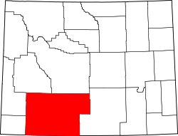
Sweetwater County, Wyoming

Last updated

Sweetwater County
DowntownRS.jpg
Flag of Sweetwater County, Wyoming.svg
Map of Wyoming highlighting Sweetwater County.svg
Location within the U.S. state of Wyoming
Wyoming in United States.svg
Wyoming's location within the U.S.
Coordinates: 41°40′N108°53′W / 41.66°N 108.89°W / 41.66; -108.89
CountryFlag of the United States.svg United States
StateFlag of Wyoming.svg  Wyoming
FoundedDecember 17, 1867
Named for Sweetwater River
Seat Green River
Largest city Rock Springs
Area
  Total10,491 sq mi (27,170 km2)
  Land10,427 sq mi (27,010 km2)
  Water64 sq mi (170 km2)  0.6%
Population
 (2020)
  Total42,272
  Density4.0/sq mi (1.6/km2)
Time zone UTC−7 (Mountain)
  Summer (DST) UTC−6 (MDT)
Area code 307
Congressional district At-large
Website www.sweetwatercountywy.gov

Sweetwater County is a county in southwestern Wyoming, United States. [1] As of the 2020 United States Census, the population was 42,272, making it the fourth-most populous county in Wyoming. [2] Its county seat is Green River. [3] By area, it is the largest county in Wyoming. Its southern boundary line abuts the north lines of the states of Colorado and Utah.

Contents

Sweetwater County comprises the Rock Springs, Green River, Wyoming Micropolitan Statistical Area.

History

Sweetwater County was created on December 17, 1867, as a county within the Dakota Territory. [4] The county was formed of territory partitioned from Laramie County. The county was originally named Carter County for Judge W.A. Carter of Fort Bridger [5] In 1869, the newly established legislature of the Wyoming Territory renamed the county for the Sweetwater River.

Also in 1869, Uinta County was organized with land ceded by Sweetwater County. Johnson County, originally named Pease County, was formed from parts of Sweetwater and Carbon counties in 1875. In 1884, Sweetwater County lost territory when Fremont County was created. Sweetwater County also lost territory when its boundary with Carbon County was adjusted in 1886. County boundaries were also adjusted in 1909, 1911, and 1951.

South Pass City was the county seat from 1867 until 1873, when the county seat was moved to Green River.

Geography

According to the U.S. Census Bureau, the county has a total area of 10,491 square miles (27,170 km2), of which 10,427 square miles (27,010 km2) is land and 64 square miles (170 km2) (0.6%) is water. [6] The largest county in Wyoming, Sweetwater County is larger than six states and is the eighth-largest county in the United States (not including boroughs and census areas in Alaska). Most of the Great Divide Basin lies within the county, comprising the county's northeast quadrant. The Continental Divide runs through the county.

Adjacent counties

Major highways

National protected areas

Demographics

Historical population
CensusPop.Note
1870 1,916
1880 2,56133.7%
1890 4,94192.9%
1900 8,45571.1%
1910 11,57536.9%
1920 13,64017.8%
1930 18,16533.2%
1940 19,4076.8%
1950 22,01713.4%
1960 17,920−18.6%
1970 18,3912.6%
1980 41,723126.9%
1990 38,823−7.0%
2000 37,613−3.1%
2010 43,80616.5%
2020 42,272−3.5%
2023 (est.)41,249 [7] −2.4%
US Decennial Census [8]
1870–2000 [9] 2010–2020 [2]

2000 census

As of the 2000 United States Census, [10] of 2000, there were 37,613 people, 14,105 households, and 10,099 families in the county. The population density was 4 people per square mile (1.5 people/km2). There were 15,921 housing units at an average density of 2 units per square mile (0.77 units/km2). The racial makeup of the county was 91.62% White, 0.73% Black or African American, 1.01% Native American, 0.64% Asian, 0.04% Pacific Islander, 3.59% from other races, and 2.37% from two or more races. 9.42% of the population were Hispanic or Latino of any race. 16.4% are of English, 16.2% German, 9% Irish and 5% Italian ancestry. [11]

There were 14,105 households, out of which 38.20% had children under the age of 18 living with them, 57.80% were married couples living together, 9.20% had a female householder with no husband present, and 28.40% were non-families. 23.60% of all households were made up of individuals, and 6.90% had someone living alone who was 65 years of age or older. The average household size was 2.62 and the average family size was 3.11.

The county population contained 28.90% under the age of 18, 10.10% from 18 to 24, 29.30% from 25 to 44, 23.70% from 45 to 64, and 8.00% who were 65 years of age or older. The median age was 34 years. For every 100 females there were 102.40 males. For every 100 females age 18 and over, there were 101.10 males.

The median income for a household in the county was $46,537, and the median income for a family was $54,173. Males had a median income of $45,678 versus $22,440 for females. The per capita income for the county was $19,575. About 5.40% of families and 7.80% of the population were below the poverty line, including 9.20% of those under age 18 and 7.00% of those age 65 or over.

2010 census

As of the 2010 United States Census, there were 43,806 people, 16,475 ;households, and 11,405 families in the county. [12] The population density was 4.2 people per square mile (1.6 people/km2). There were 18,735 housing units at an average density of 1.8 units per square mile (0.69 units/km2). [13] The racial makeup of the county was 88.5% white, 1.0% American Indian, 1.0% black or African American, 0.8% Asian, 0.1% Pacific islander, 6.4% from other races, and 2.3% from two or more races. Those of Hispanic or Latino origin made up 15.3% of the population. [12] In terms of ancestry, 22.4% were German, 19.0% were English, 13.0% were Irish, 7.4% were Italian, and 4.4% were American. [14]

Of the 16,475 households, 36.7% had children under the age of 18 living with them, 53.5% were married couples living together, 9.0% had a female householder with no husband present, 30.8% were non-families, and 24.0% of all households were made up of individuals. The average household size was 2.62 and the average family size was 3.09. The median age was 32.8 years. [12]

The median income for a household in the county was $69,828 and the median income for a family was $79,527. Males had a median income of $65,174 versus $31,738 for females. The per capita income for the county was $30,961. About 6.1% of families and 8.2% of the population were below the poverty line, including 12.0% of those under age 18 and 5.0% of those age 65 or over. [15]

Religion

Religion in Sweetwater County,according to ARDA (2020)

  • "Nones" is an unclear category. [16] [17] It is a heterogenous group of the not religious and intermittently religious. [18] Researchers argue that most of the "Nones" should be considered "unchurched", rather than objectively nonreligious; [17] [19] [20] [21] [22] especially since most "Nones" do hold some religious-spiritual beliefs and a notable amount participate in behaviors. [17] [19] [23] [24] For example, 72% of American "Nones" believe in God or a Higher Power. [25]

Education

Sweetwater County is home to Sweetwater County School District Number 1 and Sweetwater County School District Number 2. Sweetwater is also home to Western Wyoming Community College which is located in Rock Springs.

Politics and government

Sweetwater County was a Democratic stronghold in Wyoming until recent years, voting Democratic in eleven consecutive presidential elections between 1928 and 1968, after supporting Progressive Robert La Follette Sr. in 1924. In 1928, 1952, 1956 and 1976 it was the only Wyoming county to support the Democratic presidential nominee.

Nonetheless, no Democratic presidential candidate has won Sweetwater County since Bill Clinton in 1996. In 2016, Hillary Clinton won just 18.9 percent of the vote in the county. [26] At the state level, Sweetwater County is represented by one Democrat, four Republicans and one Libertarian in the Wyoming House of Representatives, and three Republicans in the Wyoming Senate.

United States presidential election results for Sweetwater County, Wyoming [26]
Year Republican Democratic Third party
No.%No.%No.%
2020 12,22973.66%3,82323.03%5513.32%
2016 12,15470.95%3,23118.86%1,74510.19%
2012 11,42867.64%4,77428.26%6934.10%
2008 10,36062.02%5,76234.50%5813.48%
2004 10,65365.47%5,20832.01%4112.53%
2000 9,42560.07%5,52135.19%7454.75%
1996 5,59135.76%7,08845.34%2,95518.90%
1992 4,47630.02%6,41743.04%4,01726.94%
1988 6,78049.47%6,72049.03%2051.50%
1984 8,30860.59%5,23038.14%1741.27%
1980 6,26551.92%4,72839.18%1,0748.90%
1976 4,93746.69%5,57552.72%620.59%
1972 5,17558.05%3,71341.65%270.30%
1968 2,72636.60%4,08654.85%6378.55%
1964 1,94424.57%5,96975.43%00.00%
1960 2,54532.04%5,39867.96%00.00%
1956 3,35541.41%4,74758.59%00.00%
1952 3,56738.05%5,80761.95%00.00%
1948 2,53831.39%5,14663.65%4014.96%
1944 2,62331.90%5,59968.10%00.00%
1940 2,43926.82%6,63772.98%180.20%
1936 1,79722.19%6,23276.97%680.84%
1932 2,04329.26%4,63766.40%3034.34%
1928 2,52845.15%2,97453.12%971.73%
1924 2,11942.16%68813.69%2,21944.15%
1920 1,74454.14%1,21637.75%2618.10%
1916 1,28743.79%1,49650.90%1565.31%
1912 88835.76%91636.89%67927.35%
1908 1,29958.49%63728.68%28512.83%
1904 1,47371.37%46422.48%1276.15%
1900 1,10159.80%74040.20%00.00%
1896 75442.19%99655.74%372.07%
1892 67447.03%00.00%75952.97%

County commissioners

NamePartyTerm
Randal "Doc" Wendling Republican 2015-
Wally Johnson Republican 2005-
Jeffrey Smith (chair) Republican 2019-
Roy Lloyd Republican 2019-
Lauren Schoenfeld Republican 2019-

Communities

Cities

Towns

Census-designated places

Other unincorporated communities

Ghost towns

Media

Print

Sweetwater County is served by two print publications: Rock Springs Daily Rocket-Miner and The Green River Star (a weekly newspaper published in Green River).

Hyperlocal websites

Sweetwater County is served by a hyperlocal news websites, SweetwaterNOW.com and wyo4news.com.

See also

Related Research Articles

<span class="mw-page-title-main">Johnson County, Wyoming</span> County in Wyoming, United States

Johnson County is a county in the north central part of the U.S. state of Wyoming. At the 2020 United States Census, the population was 8,447. The county seat is Buffalo. Kaycee is the only other incorporated town in the county.

<span class="mw-page-title-main">Uinta County, Wyoming</span> County in Wyoming, United States

Uinta County is a county in the U.S. state of Wyoming. As of the 2020 United States Census, the population was 20,450. Its county seat is Evanston. Its south and west boundary lines abut the Utah state line.

<span class="mw-page-title-main">Sheridan County, Wyoming</span> County in Wyoming, United States

Sheridan County is a county in the U.S. state of Wyoming. As of the 2020 United States Census, the population was 30,921. The county seat is Sheridan. Its northern boundary abuts the Montana state border.

<span class="mw-page-title-main">Platte County, Wyoming</span> County in Wyoming, United States

Platte County is a county located in the U.S. state of Wyoming. As of the 2020 United States Census, the population was 8,605. Its county seat is Wheatland.

<span class="mw-page-title-main">Park County, Wyoming</span> County in Wyoming, United States

Park County is a county in the U.S. state of Wyoming. As of the 2020 United States Census, the population was 29,624. The county seat is Cody.

<span class="mw-page-title-main">Natrona County, Wyoming</span> County in Wyoming, United States

Natrona County is a county in the U.S. state of Wyoming. As of the 2020 United States Census, the population was 79,955, making it the second-most populous county in Wyoming. Its county seat is Casper.

<span class="mw-page-title-main">Lincoln County, Wyoming</span> County in Wyoming, United States

Lincoln County is a county in the U.S. state of Wyoming. As of the 2020 United States Census, the population was 19,581. Its county seat is Kemmerer. Its western border abuts the eastern borders of the states of Idaho and Utah.

<span class="mw-page-title-main">Laramie County, Wyoming</span> County in Wyoming, United States

Laramie County is a county located at the southeast corner of the state of Wyoming. As of the 2020 United States Census, the population was 100,512 or 17.4% of the state's total 2020 population, making it the most populous county in Wyoming, but the least populous county in the United States to be the most populous in its state.

<span class="mw-page-title-main">Fremont County, Wyoming</span> County in Wyoming, United States

Fremont County is a county in the U.S. state of Wyoming. As of the 2020 United States census, the population was 39,234, making it the fifth-most populous county in Wyoming. Its county seat is Lander. The county was founded in 1884 and is named for John C. Frémont, a general, explorer, and politician. It is roughly the size of the state of Vermont.

<span class="mw-page-title-main">Converse County, Wyoming</span> County in Wyoming, United States

Converse County is a county located in the U.S. state of Wyoming. As of the 2020 United States Census, the population was 13,751. Its county seat is Douglas.

<span class="mw-page-title-main">Carbon County, Wyoming</span> County in Wyoming, United States

Carbon County is a county in the U.S. state of Wyoming. As of the 2020 United States Census, the population was 14,537. Its county seat is Rawlins. Its south border abuts the north line of Colorado.

<span class="mw-page-title-main">Big Horn County, Wyoming</span> County in Wyoming, United States

Big Horn County is a county in the U.S. state of Wyoming. As of the 2020 United States Census, the population was 11,521. The county seat is Basin. Its north boundary abuts the south boundary of Montana.

<span class="mw-page-title-main">Albany County, Wyoming</span> County in Wyoming, United States

Albany County is a county in the U.S. state of Wyoming. As of the 2020 United States Census, the population was 37,066. Its county seat is Laramie, the site of the University of Wyoming. Its south border lies on the northern Colorado state line.

<span class="mw-page-title-main">Jeffrey City, Wyoming</span> Census-designated place in Wyoming, United States

Jeffrey City is a former uranium mining boomtown located in Fremont County, in the central part of the U.S. state of Wyoming. The town is known in Wyoming and the American West as symbol of a boomtown that went "bust" very quickly, as the mine was shut down in 1982 and over 95% of the inhabitants left the town within three years. The population was 58 at the 2010 census, far lower than its onetime population of several thousand people. For statistical purposes, the United States Census Bureau has defined Jeffrey City as a census-designated place (CDP).

<span class="mw-page-title-main">Farson, Wyoming</span> CDP in Wyoming, United States

Farson is a census-designated place (CDP) in Sweetwater County, Wyoming, United States. The population was 313 at the 2010 census.

<span class="mw-page-title-main">Little America, Wyoming</span> CDP in Wyoming, United States

Little America is a census-designated place (CDP) in Sweetwater County, Wyoming, United States. The population was 68 at the 2010 census. The community got its name from the Little America motel, which was purposefully located in a remote location as a haven, not unlike the Little America base camp the polar explorer Richard E. Byrd set up in the Antarctic in 1928. However, being situated on a coast-to-coast highway and offering travel services, it thrived, launching a chain of travel facilities by the same name. Its developer, Robert Earl Holding, died on April 19, 2013, with a personal net worth of over $3 billion.

North Rock Springs is a census-designated place (CDP) in Sweetwater County, Wyoming, United States. The population was 2,439 at the 2020 census.

<span class="mw-page-title-main">Reliance, Wyoming</span> CDP in Wyoming, United States

Reliance is a census-designated place (CDP) in Sweetwater County, Wyoming, United States. The population was 714 at the 2010 census.

Sweeney Ranch is an unincorporated community in Sweetwater County, Wyoming, United States. The population was 17 at the 2000 census, when it was a census-designated place (CDP).

Washam is a census-designated place (CDP) in Sweetwater County, Wyoming, United States. The population was 51 at the 2010 census.

References

  1. U.S. Geological Survey Geographic Names Information System: Sweetwater County
  2. 1 2 "State & County QuickFacts".
  3. "Find a County". National Association of Counties. Retrieved June 7, 2011.
  4. Long, John H. (2006). "Wyoming: Individual County Chronologies". Wyoming Atlas of Historical County Boundaries. The Newberry Library. Archived from the original on July 18, 2011. Retrieved September 1, 2011.
  5. Urbanek, Mae (1988). Wyoming Place Names. Missoula MT: Mountain Press Publ. Co. ISBN   0-87842-204-8.
  6. "2010 Census Gazetteer Files". US Census Bureau. August 22, 2012. Retrieved August 18, 2015.
  7. "Annual Estimates of the Resident Population for Counties: April 1, 2020 to July 1, 2023". United States Census Bureau. Retrieved March 24, 2024.
  8. "US Decennial Census". US Census Bureau. Retrieved August 18, 2015.
  9. "Historical Decennial Census Population for Wyoming Counties, Cities, and Towns". Wyoming Department of Administration & Information, Division of Economic Analysis. Retrieved January 25, 2014.
  10. "U.S. Census website". US Census Bureau. Retrieved May 14, 2011.
  11. "Sweetwater County, Wyoming - Ancestry & family history". Epodunk.com. Retrieved January 9, 2018.
  12. 1 2 3 "Profile of General Population and Housing Characteristics: 2010 Demographic Profile Data". US Census Bureau. Archived from the original on February 13, 2020. Retrieved January 12, 2016.
  13. "Population, Housing Units, Area, and Density: 2010 - County". US Census Bureau. Archived from the original on February 13, 2020. Retrieved January 12, 2016.
  14. "Selected Social Characteristics in the US – 2006-2010 American Community Survey 5-Year Estimates". US Census Bureau. Archived from the original on February 13, 2020. Retrieved January 12, 2016.
  15. "Selected Economic Characteristics – 2006-2010 American Community Survey 5-Year Estimates". US Census Bureau. Archived from the original on February 13, 2020. Retrieved January 12, 2016.
  16. Wuthnow, Robert (2015). Inventing American Religion : Polls, Surveys, and the Tenuous Quest for a Nation's Faith. Oxford University Press. pp. 151–155. ISBN   9780190258900.
  17. 1 2 3 Johnson, Byron; Stark, Rodney; Bradshaw, Matt; Levin, Jeff (2022). "Are Religious "Nones" Really Not Religious?: Revisiting Glenn, Three Decades Later". Interdisciplinary Journal of Research on Religion. 18 (7).
  18. Blankholm, Joseph (2022). The Secular Paradox : On the Religiosity of the Not Religious. New York: New York University Press. p. 7. ISBN   9781479809509.
  19. 1 2 Johnson, Todd; Zurlo, Gina (2016). "Unaffiliated, Yet Religious: A Methodological and Demographic Analysis". In Cipriani, Roberto; Garelli, Franco (eds.). Annual Review of the Sociology of Religion: Volume 7: Sociology of Atheism. Leiden: Brill. pp. 58–60. ISBN   9789004317536.
  20. Hout, Michael; Fischer, Claude S. (October 13, 2014). "Explaining Why More Americans Have No Religious Preference: Political Backlash and Generational Succession, 1987-2012". Sociological Science. 1: 423–447. doi: 10.15195/v1.a24 .
  21. Hout, Michael (November 2017). "American Religion, All or Nothing at All". Contexts. 16 (4): 78–80. doi: 10.1177/1536504217742401 . S2CID   67327797.
  22. Robert Fuller, Spiritual, but not Religious: Understanding Unchurched America, Oxford University Press (2001). pp. 1-4.
  23. Drescher, Elizabeth (2016). Choosing our Religion: The Spiritual Lives of America's Nones. New York. pp. 21–26. ISBN   9780199341221.{{cite book}}: CS1 maint: location missing publisher (link)
  24. Cox, Kiana (March 17, 2021). "Nine-in-ten Black 'nones' believe in God, but fewer pray or attend services". Pew Research Center.
  25. "Key findings about Americans' belief in God". Pew Research Center. April 25, 2018.
  26. 1 2 Leip, Dave. US Election Atlas; 2016 Presidential General Election Results – Sweetwater County, WY (and earlier years)
  27. Creston WY Google Maps (accessed January 13, 2019)
  28. Quealy WY Google Maps (accessed January 13, 2019)
  29. Red Desert WY Google Maps (accessed January 13, 2019)
  30. Riner WY Google Maps (accessed January 13, 2019)

Further reading