Park County, Wyoming

Last updated

Park County
Park county wyoming courthouse.jpg
Park County Courthouse in Cody
Flag of Park County, Wyoming.gif
Map of Wyoming highlighting Park County.svg
Location within the U.S. state of Wyoming
Wyoming in United States.svg
Wyoming's location within the U.S.
Coordinates: 44°29′N109°34′W / 44.49°N 109.56°W / 44.49; -109.56
CountryFlag of the United States.svg United States
StateFlag of Wyoming.svg  Wyoming
FoundedFebruary 15, 1909 (established)
1911 (organized)
Named for Yellowstone National Park
Seat Cody
Largest cityCody
Area
  Total6,967 sq mi (18,040 km2)
  Land6,942 sq mi (17,980 km2)
  Water25 sq mi (60 km2)  0.4%
Population
 (2020)
  Total29,624
  Density4.3/sq mi (1.6/km2)
Time zone UTC−7 (Mountain)
  Summer (DST) UTC−6 (MDT)
Congressional district At-large
Website parkcounty-wy.gov

Park County is a county in the U.S. state of Wyoming. As of the 2020 United States Census, the population was 29,624. [1] The county seat is Cody. [2]

Contents

Park County is a major tourism destination. The county has over 53 percent of Yellowstone National Park's land area. [3] Many attractions abound, including the Buffalo Bill Historical Center, the Cody Stampede Rodeo, the Ghost Town of Kirwin, and the western museum Old Trail Town.

History

Wyoming gained separate territorial status in 1868. Before that, most of the state's area was included in either Laramie County (part of the Dakota Territory) or as unorganized territory within the Dakota Territory. Wyoming Territory was established on July 25, 1868, at which time Laramie County was assigned to this jurisdiction. The area now known as Park County was established as Carter County, then Sweetwater County. In 1884 it was assigned to Fremont County; this continued until 1896, when it was assigned to Big Horn County.

Wyoming achieved statehood in 1890. The area of present-day Park Continued as part of Big Horn County until 1909, when Park County was authorized. The county governing structure was put in place during 1911; [4] a courthouse was constructed 1911–1912. An addition to the building was completed in 1983, and the complete building was restored in 1985. [5] The county was named for Yellowstone National Park which is mostly within the limits of Park County. [6]

Immigrants from Ireland and Germany settled in what would become Park County in the 1870s. [7] Immigrants from England were the largest immigrant group in Park County in the late 1800s and early 1900s. [8] In 1911 when the county was organized the largest population group in the county were first generation English immigrants and their Wyoming-born children. Many English immigrants who had settled in Wyoming and become American citizens remained connected to England, many of the children of these English immigrants who had been born and raised in Wyoming joined the Canadian military in order to fight alongside Britain during World War I, and subsequently, when America joined the war many volunteered to join the United States military before the U.S. officially instituted a draft. [9]

In 1913, Hot Springs County was created from portions of Park County, Big Horn County, and Fremont County. Park County also had minor boundary adjustments in 1929 and 1931, but otherwise its boundaries have remained unchanged.

Geography

Much of Park County is held under state or federal control. Most of the Shoshone National Forest, the first national forest, and a portion of Yellowstone National Park, the first national park, fall within Park County boundaries. Three rivers flow through Park County: the Greybull and Shoshone Rivers which are tributaries to the Big Horn River, and the Clark's Fork River which flows into the Yellowstone River. [5]

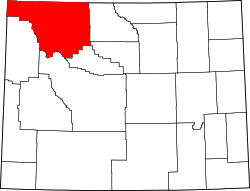
According to the US Census Bureau, the county has a total area of 6,967 square miles (18,040 km2), of which 6,942 square miles (17,980 km2) is land and 25 square miles (65 km2) (0.4%) is water. [10]

Adjacent counties

National protected areas

Major highways

Transit

Demographics

Historical population
CensusPop.Note
1910 4,909
1920 7,29848.7%
1930 8,20712.5%
1940 10,97633.7%
1950 15,18238.3%
1960 16,87411.1%
1970 17,7525.2%
1980 21,63921.9%
1990 23,1787.1%
2000 25,78611.3%
2010 28,2059.4%
2020 29,6245.0%
2023 (est.)30,735 [11] 3.8%
US Decennial Census [12]
1870–2000 [13] 2010–2016 [1]

2000 census

As of the 2000 United States Census, [14] there were 25,786 people, 10,312 households, and 7,094 families in the county. The population density was 4 people per square mile (1.5 people/km2). There were 11,869 housing units at an average density of 2 units per square mile (0.77 units/km2). The racial makeup of the county was 96.46% White, 0.09% Black or African American, 0.47% Native American, 0.44% Asian, 0.05% Pacific Islander, 1.41% from other races, and 1.08% from two or more races. 3.72% of the population were Hispanic or Latino of any race. 26.3% were of German and 13.3% English ancestry.

There were 10,312 households, out of which 30.10% had children under the age of 18 living with them, 58.90% were married couples living together, 7.10% had a female householder with no husband present, and 31.20% were non-families. 26.20% of all households were made up of individuals, and 10.00% had someone living alone who was 65 years of age or older. The average household size was 2.42 and the average family size was 2.92.

The county population contained 24.40% under the age of 18, 9.10% from 18 to 24, 25.20% from 25 to 44, 26.70% from 45 to 64, and 14.50% who were 65 years of age or older. The median age was 40 years. For every 100 females there were 95.00 males. For every 100 females age 18 and over, there were 93.10 males.

The median income for a household in the county was $35,829, and the median income for a family was $41,406. Males had a median income of $33,452 versus $20,500 for females. The per capita income for the county was $18,020. About 8.40% of families and 12.70% of the population were below the poverty line, including 16.60% of those under age 18 and 8.30% of those age 65 or over.

2010 census

As of the 2010 United States Census, there were 28,205 people, 11,885 households, and 7,777 families in the county. [15] The population density was 4.1 people per square mile (1.6 people/km2). There were 13,562 housing units at an average density of 2.0 units per square mile (0.77 units/km2). [16] The racial makeup of the county was 95.6% white, 0.6% Asian, 0.6% American Indian, 0.2% black or African American, 0.1% Pacific islander, 1.4% from other races, and 1.6% from two or more races. Those of Hispanic or Latino origin made up 4.8% of the population. [15] In terms of ancestry, 31.7% were German, 16.3% were English, 15.4% were Irish, and 6.3% were American. [17]

Of the 11,885 households, 26.1% had children under the age of 18 living with them, 54.9% were married couples living together, 7.2% had a female householder with no husband present, 34.6% were non-families, and 28.5% of all households were made up of individuals. The average household size was 2.29 and the average family size was 2.81. The median age was 43.6 years. [15]

The median income for a household in the county was $46,637 and the median income for a family was $58,297. Males had a median income of $40,036 versus $27,450 for females. The per capita income for the county was $26,203. About 5.5% of families and 9.0% of the population were below the poverty line, including 14.2% of those under age 18 and 6.4% of those age 65 or over. [18]

Communities

Cities

Towns

Census-designated places

Unincorporated communities

Politics

Like almost all of Wyoming, Park County is overwhelmingly Republican.

United States presidential election results for Park County, Wyoming [29]
Year Republican Democratic Third party
No.%No.%No.%
2020 12,81376.65%3,41020.40%4942.96%
2016 11,11573.63%2,53516.79%1,4459.57%
2012 11,23476.90%2,92720.04%4473.06%
2008 10,83972.33%3,75725.07%3892.60%
2004 10,91776.71%3,00721.13%3072.16%
2000 9,88477.00%2,42418.88%5284.11%
1996 7,43061.42%3,24026.78%1,42811.80%
1992 5,21846.55%2,77124.72%3,22028.73%
1988 6,88470.95%2,64627.27%1721.77%
1984 7,99479.19%1,96519.47%1361.35%
1980 6,43573.03%1,71819.50%6587.47%
1976 5,87868.33%2,65630.88%680.79%
1972 5,89074.79%1,95024.76%350.44%
1968 4,67765.56%1,85225.96%6058.48%
1964 3,69849.68%3,74550.32%00.00%
1960 4,51064.37%2,49635.63%00.00%
1956 4,39769.17%1,96030.83%00.00%
1952 5,06770.62%2,08429.05%240.33%
1948 2,65551.60%2,46147.83%290.56%
1944 2,57153.25%2,25746.75%00.00%
1940 2,51247.56%2,74752.01%230.44%
1936 1,61837.50%2,59460.12%1032.39%
1932 1,60042.59%2,04354.38%1143.03%
1928 2,17566.72%1,06232.58%230.71%
1924 1,60755.47%53018.29%76026.23%
1920 1,63070.53%66628.82%150.65%
1916 1,09246.89%1,14649.21%913.91%
1912 53429.80%67237.50%58632.70%

Education

School districts include: [30]

The portion of Park County in Yellowstone National Park is not in any school district. [30]

See also

Related Research Articles

<span class="mw-page-title-main">Johnson County, Wyoming</span> County in Wyoming, United States

Johnson County is a county in the north central part of the U.S. state of Wyoming. At the 2020 United States Census, the population was 8,447. The county seat is Buffalo. Kaycee is the only other incorporated town in the county.

<span class="mw-page-title-main">Teton County, Wyoming</span> County in Wyoming, United States

Teton County is a county in the U.S. state of Wyoming. As of the 2020 United States Census, the population was 23,331. Its county seat is Jackson. Its west boundary line is also the Wyoming state boundary shared with Idaho and the southern tip of Montana. Teton County is part of the Jackson, WY-ID Micropolitan Statistical Area.

<span class="mw-page-title-main">Sweetwater County, Wyoming</span> County in Wyoming, United States

Sweetwater County is a county in southwestern Wyoming, United States. As of the 2020 United States Census, the population was 42,272, making it the fourth-most populous county in Wyoming. Its county seat is Green River. By area, it is the largest county in Wyoming. Its southern boundary line abuts the north lines of the states of Colorado and Utah.

<span class="mw-page-title-main">Sheridan County, Wyoming</span> County in Wyoming, United States

Sheridan County is a county in the U.S. state of Wyoming. As of the 2020 United States Census, the population was 30,921. The county seat is Sheridan. Its northern boundary abuts the Montana state border.

<span class="mw-page-title-main">Platte County, Wyoming</span> County in Wyoming, United States

Platte County is a county located in the U.S. state of Wyoming. As of the 2020 United States Census, the population was 8,605. Its county seat is Wheatland.

<span class="mw-page-title-main">Laramie County, Wyoming</span> County in Wyoming, United States

Laramie County is a county located at the southeast corner of the state of Wyoming. As of the 2020 United States Census, the population was 100,512 or 17.4% of the state's total 2020 population, making it the most populous county in Wyoming, but the least populous county in the United States to be the most populous in its state.

<span class="mw-page-title-main">Fremont County, Wyoming</span> County in Wyoming, United States

Fremont County is a county in the U.S. state of Wyoming. As of the 2020 United States census, the population was 39,234, making it the fifth-most populous county in Wyoming. Its county seat is Lander. The county was founded in 1884 and is named for John C. Frémont, a general, explorer, and politician. It is roughly the size of the state of Vermont.

<span class="mw-page-title-main">Converse County, Wyoming</span> County in Wyoming, United States

Converse County is a county located in the U.S. state of Wyoming. As of the 2020 United States Census, the population was 13,751. Its county seat is Douglas.

<span class="mw-page-title-main">Carbon County, Wyoming</span> County in Wyoming, United States

Carbon County is a county in the U.S. state of Wyoming. As of the 2020 United States Census, the population was 14,537. Its county seat is Rawlins. Its south border abuts the north line of Colorado.

<span class="mw-page-title-main">Big Horn County, Wyoming</span> County in Wyoming, United States

Big Horn County is a county in the U.S. state of Wyoming. As of the 2020 United States Census, the population was 11,521. The county seat is Basin. Its north boundary abuts the south boundary of Montana.

<span class="mw-page-title-main">Albany County, Wyoming</span> County in Wyoming, United States

Albany County is a county in the U.S. state of Wyoming. As of the 2020 United States Census, the population was 37,066. Its county seat is Laramie, the site of the University of Wyoming. Its south border lies on the northern Colorado state line.

<span class="mw-page-title-main">Yellowstone County, Montana</span> County in Montana, United States

Yellowstone County is the most populous county in the U.S. state of Montana. As of the 2020 census, the population was 164,731. Its county seat is Billings, the state's most populous city. Like the nearby park, Yellowstone County is named after the Yellowstone River which roughly bisects the county, flowing southwest to northeast. The river, in turn, was named for the yellow sandstone cliffs in what is now Yellowstone County.

<span class="mw-page-title-main">Park County, Montana</span> County in Montana, United States

Park County is a county in the U.S. state of Montana. At the 2020 census, the population was 17,191. Its county seat is Livingston. A small part of Yellowstone National Park is in the southern part of the county.

<span class="mw-page-title-main">Gallatin County, Montana</span> County in Montana, United States

Gallatin County is located in the U.S. state of Montana. With its county seat in Bozeman, it is the second-most populous county in Montana, with a population of 118,960 in the 2020 Census.

<span class="mw-page-title-main">Carbon County, Montana</span> County in Montana, United States

Carbon County is a county located in the U.S. state of Montana. As of the 2020 census, the population was 10,473. Its county seat is Red Lodge.

<span class="mw-page-title-main">Big Horn County, Montana</span> County in Montana, United States

Big Horn County is a county located in the U.S. state of Montana. As of the 2020 census, the population was 13,124. The county seat is Hardin. The county, like the river and the mountain range, is named after the bighorn sheep in the Rocky Mountains. The county was founded in 1913. It is located on the south line of the state.

<span class="mw-page-title-main">Huntley, Montana</span> CDP in Montana, United States

Huntley is a census-designated place (CDP) in Yellowstone County, Montana, United States. The population was 411 at the 2000 census. Huntley lent its name to the Huntley Project, a federal irrigation project that began delivering water to the arid district in 1907. Today, Huntley is an eastern suburb of Billings and is located east of Shepherd and west of Worden.

<span class="mw-page-title-main">Manderson, Wyoming</span> Town in Wyoming, United States

Manderson is a town in Big Horn County, Wyoming, United States. The population was 88 at the 2020 census. The town was originally called Alamo, but it was renamed in 1889 in honor of Charles F. Manderson, chief counsel for Burlington Railroad. The town is widely regarded as a speed trap for tourists heading to Yellowstone National Park.

<span class="mw-page-title-main">Cody, Wyoming</span> City in Wyoming, United States

Cody is a city in and the county seat of Park County, Wyoming, United States. It is named after Buffalo Bill Cody for his part in the founding of Cody in 1896.

<span class="mw-page-title-main">Worland, Wyoming</span> City in Wyoming, United States

Worland is a city in Washakie County, Wyoming, United States. The population was 5,487 at the 2010 census. It is the county seat of Washakie County. It is located within the Big Horn Basin and along the Big Horn River in northwestern Wyoming.

References

  1. 1 2 "State & County QuickFacts". US Census Bureau. Archived from the original on June 6, 2011. Retrieved January 25, 2014.
  2. "Find a County". National Association of Counties. Archived from the original on May 31, 2011. Retrieved June 7, 2011.
  3. "Census 2000 Summary File 1 (SF 1) 100-Percent Data ." US Census Bureau.
  4. Long, John H., ed. (2004). "Wyoming: Individual County Chronologies". Wyoming Atlas of Historical County Boundaries. The Newberry Library. Retrieved January 11, 2019.
  5. 1 2 "History of Park County (accessed 11 January 2019)".
  6. Urbanek, Mae (1988). Wyoming Place Names. Missoula MT: Mountain Press Pub. Co. ISBN   0-87842-204-8.
  7. Wyoming: A Source Book by Roy Allen Jordan and Brett DeBoer; University Press of Colorado, 1996 - pg. 56
  8. Peopling the High Plains: Wyoming's European Heritage by Gordon Olaf Hendrickson, pg. 2
  9. Peopling the High Plains: Wyoming's European Heritage by Gordon Olaf Hendrickson, pg. 27
  10. "2010 Census Gazetteer Files". US Census Bureau. August 22, 2012. Retrieved August 18, 2015.
  11. "Annual Estimates of the Resident Population for Counties: April 1, 2020 to July 1, 2023". United States Census Bureau. Retrieved March 24, 2024.
  12. "US Decennial Census". US Census Bureau. Retrieved August 18, 2015.
  13. "Historical Decennial Census Population for Wyoming Counties, Cities, and Towns". Wyoming Department of Administration & Information, Division of Economic Analysis. Retrieved January 25, 2014.
  14. "U.S. Census website". US Census Bureau. Retrieved May 14, 2011.
  15. 1 2 3 "Profile of General Population and Housing Characteristics: 2010 Demographic Profile Data". US Census Bureau. Archived from the original on February 13, 2020. Retrieved January 12, 2016.
  16. "Population, Housing Units, Area, and Density: 2010 - County". US Census Bureau. Archived from the original on February 13, 2020. Retrieved January 12, 2016.
  17. "Selected Social Characteristics in the US – 2006-2010 American Community Survey 5-Year Estimates". US Census Bureau. Archived from the original on February 13, 2020. Retrieved January 12, 2016.
  18. "Selected Economic Characteristics – 2006-2010 American Community Survey 5-Year Estimates". US Census Bureau. Archived from the original on February 13, 2020. Retrieved January 12, 2016.
  19. 1 2 "Google Maps". Google Maps.
  20. "Google Maps". Google Maps.
  21. "Google Maps". Google Maps.
  22. "Google Maps". Google Maps.
  23. "Google Maps". Google Maps.
  24. "Google Maps". Google Maps.
  25. "Kirwin · Wyoming 82433". Kirwin · Wyoming 82433.
  26. "Pahaska Tepee · Wyoming 82414". Pahaska Tepee · Wyoming 82414.
  27. "Google Maps". Google Maps.
  28. "Google Maps". Google Maps.
  29. Leip, David. "Atlas of US Presidential Elections". uselectionatlas.org. Retrieved April 5, 2018.
  30. 1 2 "2020 CENSUS - SCHOOL DISTRICT REFERENCE MAP: Teton County, WY" (PDF). U.S. Census Bureau. p. 1 (PDF p. 2/3). Retrieved March 13, 2024. - 2020 text list, page 1 shows underfined district area; 2010 map, 2010 text list (which has "School District Not Defined" for the Yellowstone Area)

44°29′N109°34′W / 44.49°N 109.56°W / 44.49; -109.56