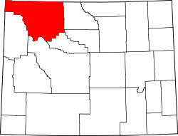
Kirwin, Wyoming

Last updated

Kirwin
Kirwin, Wyoming (1905).jpg
Kirwin, 1905
USA Wyoming location map.svg
Red pog.svg
Kirwin
Location within the state of Wyoming
Usa edcp location map.svg
Red pog.svg
Kirwin
Kirwin (the United States)
Coordinates: 43°52′35″N109°17′53″W / 43.87639°N 109.29806°W / 43.87639; -109.29806
Country United States
State Wyoming
County Park
Time zone UTC-7 (Mountain (MST))
  Summer (DST) UTC-6 (MDT)
GNIS feature ID1600733 [1]

Kirwin is a ghost town [2] in Park County, in the U.S. state of Wyoming. Its post office has been closed. [3]

Contents

The former mining town is a historic site. Amelia Earhart was having a cabin built there before her disappearance. [4]

History

Kirwin is located at the headwaters of Wood River and is surrounded by several 12,000-foot peaks. [2]

The area's first prospectors, a group of 130 men, arrived in 1870 led by William Kuykendall. [5] The prospectors were made to leave by soldiers from Fort Bowman [6] or possibly Camp Brown [7] due to the area being a part of a treaty with the Shoshone tribe. [5] [6] [7] One of the prospectors, John Henry, was killed after splitting off from the group to hunt buffalo. [5] [6]

It's origins as a town trace back to 1885 when Harry Adams, and the town's namesake, William Kirwin found gold and silver while hunting deer in the area. [2] [6] [7]

The town quickly attracted attention after Adams shared news of the find, sparking a rush of prospectors. [2] In 1891, the Wood River Mining District was formed leading to several claims being made in the surrounding area. [2] [6]

At its peak between 1904 and 1906, the town was home to about 200 people, all miners and their families. [2] [6] [7] "The town was home to a hotel, a boarding house, two general stores, a sawmill, an assay shop, a headquarters building, a post office, and a number of cabins, stables, and meat storage sheds." [2] Many of which buildings are still standing. [2] [4] [6] [7]

On February 5, 1907, the precarious positioning of Kirwin came to a head when a massive avalanche from Bald Mountain struck the town, destroying several buildings and killing three people, causing a large portion of the town to leave the area, with the rest vacating the area in the following years. [2] [7]

There were several attempts at reviving the area, through both the Double D Dude Ranch, as well as various attempts at establishing mining operations in the 40s and 60s, all of which eventually fell through. [6] [7]

In 1992 the land, including Kirwin and the Double D ranch, was purchased by a conservation fund who donated the it to the public, at which point, in 1999 restoration and stabilization of the historic buildings and area began. [2] [6]

Climate

Kirwin has a subarctic climate (Köppen Dfc).

Climate data for Kirwin, Wyoming, 1991–2020 normals: 9550ft (2911m)
MonthJanFebMarAprMayJunJulAugSepOctNovDecYear
Mean daily maximum °F (°C)26.0
(−3.3)
27.6
(−2.4)
36.6
(2.6)
43.0
(6.1)
50.7
(10.4)
59.7
(15.4)
68.4
(20.2)
66.7
(19.3)
56.9
(13.8)
42.5
(5.8)
30.8
(−0.7)
25.0
(−3.9)
44.5
(6.9)
Daily mean °F (°C)17.7
(−7.9)
17.9
(−7.8)
24.9
(−3.9)
30.6
(−0.8)
39.2
(4.0)
47.3
(8.5)
54.6
(12.6)
53.4
(11.9)
45.3
(7.4)
33.3
(0.7)
22.7
(−5.2)
17.0
(−8.3)
33.7
(0.9)
Mean daily minimum °F (°C)9.3
(−12.6)
7.9
(−13.4)
12.9
(−10.6)
18.1
(−7.7)
27.6
(−2.4)
34.8
(1.6)
40.8
(4.9)
40.0
(4.4)
33.8
(1.0)
23.9
(−4.5)
14.6
(−9.7)
8.9
(−12.8)
22.7
(−5.1)
Average precipitation inches (mm)1.63
(41)
1.88
(48)
2.41
(61)
2.97
(75)
3.62
(92)
2.45
(62)
1.81
(46)
1.69
(43)
2.17
(55)
2.22
(56)
1.93
(49)
2.01
(51)
26.79
(679)
Source 1: XMACIS2 [8]
Source 2: NOAA (Precipitation) [9]

Mount Crosby (Wyoming) is a mountain that rises to the north of Kirwin. There is no weather station at the summit, but this climate table contains interpolated data for an area around the summit. Mount Crosby has an Alpine climate (ET).

Climate data for Mount Crosby 43.8749 N, 109.3331 W, Elevation: 11,991 ft (3,655 m) (1991–2020 normals)
MonthJanFebMarAprMayJunJulAugSepOctNovDecYear
Mean daily maximum °F (°C)18.8
(−7.3)
18.7
(−7.4)
24.8
(−4.0)
31.0
(−0.6)
39.7
(4.3)
49.9
(9.9)
59.5
(15.3)
58.4
(14.7)
49.2
(9.6)
36.0
(2.2)
24.4
(−4.2)
17.9
(−7.8)
35.7
(2.1)
Daily mean °F (°C)10.2
(−12.1)
9.2
(−12.7)
14.3
(−9.8)
19.4
(−7.0)
28.0
(−2.2)
37.4
(3.0)
46.0
(7.8)
45.2
(7.3)
37.1
(2.8)
25.7
(−3.5)
15.8
(−9.0)
9.6
(−12.4)
24.8
(−4.0)
Mean daily minimum °F (°C)1.7
(−16.8)
−0.3
(−17.9)
3.7
(−15.7)
7.9
(−13.4)
16.4
(−8.7)
24.8
(−4.0)
32.6
(0.3)
32.0
(0.0)
24.9
(−3.9)
15.4
(−9.2)
7.2
(−13.8)
1.3
(−17.1)
14.0
(−10.0)
Average precipitation inches (mm)1.80
(46)
2.03
(52)
2.49
(63)
3.13
(80)
3.84
(98)
2.52
(64)
2.01
(51)
1.89
(48)
2.33
(59)
2.28
(58)
2.07
(53)
2.21
(56)
28.6
(728)
Source: PRISM Climate Group [10]

Related Research Articles

<span class="mw-page-title-main">Sheridan, Wyoming</span> City in Wyoming, United States

Sheridan is a city in the U.S. state of Wyoming and the county seat of Sheridan County. The city is located halfway between Yellowstone Park and Mount Rushmore by U.S. Route 14 and 16. It is the principal town of the Sheridan, Wyoming, Micropolitan Statistical Area which encompasses all of Sheridan County. The 2020 census put the city's population at 18,737, making it the 6th most populous city in Wyoming.

<span class="mw-page-title-main">Wyoming Department of Corrections</span>

The Wyoming Department of Corrections (WDOC) is a state agency of Wyoming that operates adult correctional facilities. It is headquartered in Suite 100 of the 1934 Wyott Drive building in Cheyenne.

The Washakie Wilderness is located in Shoshone National Forest in the U.S. state of Wyoming.

<span class="mw-page-title-main">Wind River Peak</span> Mountain in Wyoming, United States

Wind River Peak is the highest point in the southern end of the Wind River Range that is located in the U.S. state of Wyoming. The peak straddles the Continental Divide and is surrounded by National Forest lands. The west slopes are in the Bridger Wilderness of Bridger-Teton National Forest, while the east side is in the Popo Agie Wilderness of Shoshone National Forest. In a cirque on the northeast slopes of the peak lies Wind River Glacier.

Doane Peak is in the northern Teton Range, Grand Teton National Park, Wyoming. The peak is located west of and across Jackson Lake from Colter Bay Village. The scenic Waterfalls Canyon is immediately northeast of the peak, but there are no maintained trails in the area. Access to the summit involves off trail hiking and scrambling as the top of the mountain is more than 4,500 feet (1,400 m) above Jackson Lake. The peak is named for Lt. Gustavus Cheyney Doane.

<span class="mw-page-title-main">Wyoming Peak</span>

Wyoming Peak is the tallest mountain in the Wyoming Range in the U.S. state of Wyoming. Situated in Bridger-Teton National Forest, a now collapsed fire lookout is located on the summit. Wyoming Peak is .75 miles (1.21 km) south-southeast of Coffin Peak, the second highest peak in the Wyoming Range.

Mount Febbas is located in the Wind River Range in the U.S. state of Wyoming. Mount Febbas is at the western end of the high-altitude plateau known as Horse Ridge, which extends for more than 10 mi (16 km) to the northeast at elevations greater than 10,000 ft (3,000 m).

<span class="mw-page-title-main">Sierra Madre Range (Wyoming)</span>

The Sierra Madre Range is a mountain range in the western United States, located in south-central Wyoming and north-central Colorado. Geologically, it may be considered an extension of the Park Range of Colorado. South of the Great Divide Basin, the US Continental Divide runs along the Sierre Madre high points. Its western basins drain into the Colorado River and its eastern into the North Platte River. Buck Mountain is the highest peak in the range and lies within Colorado. Bridger Peak is its highest elevation on the Wyoming side of the range.

<span class="mw-page-title-main">Sunrise Historic District</span> Historic district in Washington, United States

The Sunrise Historic District, also known as the community of Sunrise, Washington, is located at approximately 6,400 feet (2,000 m) on a ridge overlooking the northeast side of Mount Rainier in Mount Rainier National Park. The district comprises seven individual structures designed in accordance with the principles of the National Park Service Rustic style. The area is inhabited and open to the public only during a brief period in the summer season.

<span class="mw-page-title-main">Flagstone Peak (Fremont County, Wyoming)</span>

Flagstone Peak is located in the Wind River Range in the U.S. state of Wyoming. The peak is the 12th highest peak in Wyoming. The summit is located on the Continental Divide and is in both Shoshone and Bridger-Teton National Forests. The Flagstone Peak-Southeast Peak lies .25 mi (0.40 km) to the southeast.

Downs Mountain is located in the Wind River Range in the U.S. state of Wyoming. Downs Mountain is the 15th highest peak in Wyoming. The summit is on the Continental Divide in both Shoshone and Bridger-Teton National Forests. The East Torrey Glacier is on the northern slopes of Downs Mountain, while Continental Glacier lies to the west and north and the Downs Glacier is 1 mi (1.6 km) to the south.

Fortress Mountain is located in the Absaroka Range in the U.S. state of Wyoming. Fortress Mountain is 1 mi (1.6 km) south of Sheep Mesa, a subpeak along the mesa that is 500 ft (150 m) lower in altitude. The headwaters of Cabin Creek are on the east slopes of Fortress Mountain, while those for Sheep Creek are on the northwest.

Muddy Mountain is a peak in the Laramie Mountains approximately 12 miles (19 km) south-south-east of Casper, Wyoming. There is a two-mile (3.2 km) "interpretive nature trail" maintained by the Bureau of Land Management, as well as a series of trails popular with mountain bikers, horseback riders, and ATVs in the summer, and snowmobiles in the winter.

Shale Mountain is located in the northern Wind River Range in the U.S. state of Wyoming. Shale Mountain straddles the Continental Divide and is in both Bridger-Teton and Shoshone National Forests. Shale Mountain is 5 mi (8.0 km) north of Downs Mountain.

<span class="mw-page-title-main">Torrey Peak (Wyoming)</span> Mountain in the American state of Wyoming

Torrey Peak is located in the northern Wind River Range in the U.S. state of Wyoming. Torrey Peak is in Shoshone National Forest near the southern end of Upper Ross Lake.

Brown Cliffs North is located in the northern Wind River Range in the U.S. state of Wyoming. Brown Cliffs North is the 18th tallest peak in Wyoming. The summit is at the northwestern end of a ridge known as Brown Cliffs which are in the Fitzpatrick Wilderness of Shoshone National Forest.

<span class="mw-page-title-main">Twin Peaks (Wyoming)</span>

Twin Peaks is located in the Wind River Range in the U.S. state of Wyoming. Twin Peaks is the 20th highest peak in Wyoming. Twin Peaks is in the Bridger Wilderness of Bridger-Teton National Forest and is .58 mi (0.93 km) southwest of Mount Woodrow Wilson and about the same distance southeast of Split Mountain. Mammoth Glacier flows from the north slopes of the peak while the smaller Twins Glacier flows to the southeast.

<span class="mw-page-title-main">Atlantic Peak</span>

Atlantic Peak is located in the southern Wind River Range in the U.S. state of Wyoming. Atlantic Peak sits along the Continental Divide, less than 1 mi (1.6 km) southeast of West Atlantic Peak.

Big Sandy Mountain is located in the southern Wind River Range in the U.S. state of Wyoming. Big Sandy Mountain sits along the Continental Divide, less than 1 mi (1.6 km) southeast of Dog Tooth Peak.

Mather Peaks is located in the Bighorn Mountains in the U.S. state of Wyoming. The peak is the sixth highest in the range and it is in the Cloud Peak Wilderness of Bighorn National Forest. Mather Peaks is 4.5 miles (7.2 km) northwest of Darton Peak and 3.2 mi (5.1 km) south of Bomber Mountain.

References

  1. U.S. Geological Survey Geographic Names Information System: Kirwin, Wyoming
  2. 1 2 3 4 5 6 7 8 9 10 "The History of Kirwin". United States Forest Service . March 7, 2024. Archived from the original on March 7, 2024. Retrieved March 7, 2024.
  3. U.S. Geological Survey Geographic Names Information System: Kirwin WY post office
  4. 1 2 Freedman, Lew (July 19, 2017). "Vandalism at Kirwin site investigated". Cody Enterprise. Archived from the original on March 7, 2024. Retrieved August 25, 2017.
  5. 1 2 3 Van Pelt, Lori; Van Pelt, Lori (1999). Profiles from Carbon County, Wyoming's past. Dreamers & schemers. Glendo, Wyo: High Plains Press. pp. 164–165. ISBN   978-0-931271-50-2.{{cite book}}: CS1 maint: date and year (link)
  6. 1 2 3 4 5 6 7 8 9 "Kirwin: Key Dates in History" (PDF). United States Forest Service . Archived (PDF) from the original on March 7, 2024. Retrieved March 7, 2024.
  7. 1 2 3 4 5 6 7 Pelt, Lori Van (May 18, 2016). "Kirwin Inspired Dreams of Prosperity, Solitude | WyoHistory.org". www.wyohistory.org. Archived from the original on March 7, 2024. Retrieved March 7, 2024.
  8. "xmACIS2". National Oceanic and Atmospheric Administration. Retrieved October 12, 2023.
  9. "Kirwin, Wyoming 1991-2020 Monthly Normals" . Retrieved October 12, 2023.
  10. "PRISM Climate Group, Oregon State University". PRISM Climate Group, Oregon State University. Retrieved October 12, 2023. To find the table data on the PRISM website, start by clicking Coordinates (under Location); copy Latitude and Longitude figures from top of table; click Zoom to location; click Precipitation, Minimum temp, Mean temp, Maximum temp; click 30-year normals, 1991-2020; click 800m; click Retrieve Time Series button.