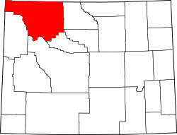
Mammoth, Wyoming

Last updated
Mammoth, Wyoming
Mammoth Hot Springs at dawn, Mammoth, WY.jpg
Mammoth at dawn
USA Wyoming location map.svg
Red pog.svg
Mammoth
Location within the state of Wyoming
Coordinates: 44°58′36″N110°42′06″W / 44.97667°N 110.70167°W / 44.97667; -110.70167 Coordinates: 44°58′36″N110°42′06″W / 44.97667°N 110.70167°W / 44.97667; -110.70167
Country United States
State Wyoming
County Park
Area
[1]
  Total0.788 sq mi (2.04 km2)
  Land0.788 sq mi (2.04 km2)
  Water0 sq mi (0 km2)
Population
 (2010) [2]
  Total263
  Density330/sq mi (130/km2)
Time zone UTC-7 (Mountain (MST))
  Summer (DST) UTC-6 (MDT)
ZIP codes
82190
GNIS feature ID1591192 [3]

Mammoth is a census-designated place in Park County, Wyoming, United States, comprising Fort Yellowstone and Mammoth Hot Springs in Yellowstone National Park. As of the 2010 census, its population was 263. [2]

Contents

Some students from Mammoth attend Gardiner Public Schools in Gardiner, Montana. [4]

Climate

Climate data for Mammoth
MonthJanFebMarAprMayJunJulAugSepOctNovDecYear
Average high °F (°C)30
(−1)
34
(1)
41
(5)
50
(10)
60
(16)
70
(21)
81
(27)
79
(26)
68
(20)
55
(13)
39
(4)
30
(−1)
53
(12)
Average low °F (°C)11
(−12)
13
(−11)
19
(−7)
27
(−3)
35
(2)
42
(6)
49
(9)
47
(8)
39
(4)
30
(−1)
20
(−7)
12
(−11)
29
(−2)
Average snowfall inches (cm)11.6
(29)
9.2
(23)
10.7
(27)
6.5
(17)
2
(5.1)
0.2
(0.51)
0
(0)
0
(0)
0.3
(0.76)
3.4
(8.6)
10.7
(27)
11.7
(30)
66.3
(167.97)
[ citation needed ]


See also

Related Research Articles

Wyoming U.S. state

Wyoming is a state in the Mountain West subregion of the Western United States. The 10th largest state by area, it is also the least populous and least densely populated state in the contiguous United States.

Yellowstone National Park Natural park located in the western United States

Yellowstone National Park is an American national park located in the western United States, largely in the northwest corner of Wyoming and extending into Montana and Idaho. It was established by the 42nd U.S. Congress with the Yellowstone National Park Protection Act and signed into law by President Ulysses S. Grant on March 1, 1872. Yellowstone was the first national park in the U.S. and is also widely held to be the first national park in the world. The park is known for its wildlife and its many geothermal features, especially the Old Faithful geyser, one of its most popular. While it represents many types of biomes, the subalpine forest is the most abundant. It is part of the South Central Rockies forests ecoregion.

Park County, Wyoming County in Wyoming, United States

Park County is a county in the U.S. state of Wyoming. As of the 2020 United States Census, the population was 29,624. The county seat is Cody.

Park County, Montana County in Montana, United States

Park County is a county in the U.S. state of Montana. At the 2020 census, the population was 17,191. Its county seat is Livingston. A small part of Yellowstone National Park is in the southern part of the county.

Gardiner, Montana Census designated place in Montana, United States

Gardiner is a unincorporated community in Park County, Montana, along the 45th parallel. The population was 833 at the time of the 2020 census. For statistical purposes, the United States Census Bureau has defined Gardiner as a census-designated place (CDP).

Thermopolis, Wyoming Town in Wyoming, United States

Thermopolis is the county seat and largest town in Hot Springs County, Wyoming, United States. As of the 2020 U.S. Census, the town population was 2,725.

Cody, Wyoming City in Wyoming, United States

Cody is a city in Northwest Wyoming and the county seat of Park County, Wyoming, United States. It is named after Colonel William Frederick "Buffalo Bill" Cody for his part in the founding of Cody in 1896.

Jackson, Wyoming Town in Wyoming, United States

Jackson is a town in the Jackson Hole valley of Teton County, Wyoming, United States. The population was 10,760 at the 2020 census, up from 9,577 in 2010. It is the largest town in Teton County and its county seat. Jackson is the principal town of the Jackson, WY-ID Micropolitan Statistical Area, which includes Teton County in Wyoming and Teton County in Idaho. The town, often mistakenly called Jackson Hole, derives its name from the valley in which it is located. Jackson is a popular tourist destination due to its proximity to the ski resorts Jackson Hole Mountain, Snow King Mountain, and Grand Targhee, as well as Grand Teton National Park and Yellowstone National Park.

Robert Reamer American architect

Robert C. Reamer (1873–1938) was an American architect, most noted for the Old Faithful Inn in Yellowstone National Park.

Obsidian Cliff United States historic place

Obsidian Cliff, also known as 48YE433, was an important source of lithic materials for prehistoric peoples in Yellowstone National Park near Mammoth Hot Springs, Wyoming, United States. The cliff was named by Philetus Norris, the second park superintendent in 1878. It was declared a National Historic Landmark in 1996.

Index of Wyoming-related articles Wikipedia index

The following is an alphabetical list of articles related to the U.S. state of Wyoming.

Mammoth Hot Springs Historic District United States historic place in Yellowstone National Park

The Mammoth Hot Springs Historic District is a 158-acre (64 ha) historic district in Yellowstone National Park comprising the administrative center for the park. It is composed of two major parts: Fort Yellowstone, the military administrative center between 1886 and 1918, and now a National Historic Landmark, and a concessions district which provides food, shopping, services, and lodging for park visitors and employees. It was added to the National Register of Historic Places on March 20, 2002, for its significance in architecture, conservation, entertainment/recreation, and military. The district includes 189 contributing buildings.

North Entrance Road Historic District Historic district in Montana, United States

The North Entrance Road Historic District comprises Yellowstone National Park's North Entrance Road from Gardiner, Montana to the park headquarters at Mammoth Hot Springs, Wyoming, a distance of a little over five miles (8 km). The North Entrance Road was the first major road in the park, necessary to join the U.S. Army station at Fort Yellowstone to the Northern Pacific Railroad station at Gardiner. The road includes the Roosevelt Arch at the northern boundary of the park and winds through rolling terrain before crossing the Gardner River and joining the Grand Loop Road. The road was planned in 1883 by Lieutenant Dan Kingman of the U.S. Army Corps of Engineers and later on improved by Captain Hiram M. Chittenden of the Corps.,. It replaced the old Gardiner High Road which went from behind the Mammoth Hotel north over the ridges west of the river to the town of Gardiner. The first permanent entrance station to house rangers checking vehicle entering the park was constructed in 1921. It replaced temporary tents used by rangers at the Roosevelt Arch.

United States Post Office (Yellowstone National Park) United States historic place

The Yellowstone Main Post Office in Yellowstone National Park was built in Mammoth Hot Springs as part of a facilities improvement program by the United States Post Office Department. The post office in Yellowstone was nominated to the National Register of Historic Places as part of a thematic study comprising twelve Wyoming post offices built to standardized USPO plans in the early twentieth century. The Yellowstone facility is an understated classical structure with a low hipped roof and rounded dormers that uses a plan and a basic design vocabulary similar to that used in other post offices in the program. It is somewhat at odds with the prevailing design theme expressed in other buildings in the former Fort Yellowstone district.

Gardner River River in the United States of America

The Gardner River is a tributary of the Yellowstone River, approximately 25 miles (40 km) long, in northwestern Wyoming and south central Montana in the United States. The entire river is located within Yellowstone National Park. It rises on the slope of Joseph Peak, Gallatin Range in the northwestern part of the park, and winds southeast through Gardner's Hole, a broad subalpine basin which is a popular trout fishing location. The Gardner falls within the Native Trout Conservation Area and anglers are allowed to take an unlimited number of brown and rainbow trout. Mountain whitefish and Yellowstone cutthroat trout must be released. Angling on the Gardner is governed by Yellowstone National Park fishing regulations. After merging with Panther Creek, Indian Creek and Obsidian Creek, it then turns north and flows through a steep canyon where it cuts through a basaltic flow from approximately 500,000 years ago known as Sheepeater Cliffs. Below Sheepeater, Glen Creek out of Golden Gate Canyon and Lava Creek out of Lava Creek Canyon join the Gardner near Mammoth Hot Springs. The river crosses the 45th parallel in Gardner Canyon and is also home to a popular hot spring known as The Boiling River. The river continues north through Gardner Canyon and empties into the Yellowstone near Gardiner, Montana.

Mount Everts Mountain in Montana, United States

Mount Everts, elevation 7,846 feet (2,391 m), is a prominent mountain peak in Yellowstone National Park, Wyoming, near Mammoth Hot Springs. The peak was named for Truman C. Everts, a member of the Washburn–Langford–Doane Expedition of 1870. Mount Everts is located immediately due south of Gardiner, Montana and due east of Mammoth Hot Springs.

Sepulcher Mountain Mountain in Wyoming, United States

Sepulcher Mountain, elevation 9,642 feet (2,939 m), is a moderate mountain peak in northwest Yellowstone National Park halfway between the summit of Electric Peak and Mammoth Hot Springs. The peak was named Sepulcher by U.S. Army Captain John W. Barlow in 1871 because of its resemblance to a crypt when viewed from Gardiner, Montana.

Bunsen Peak

Bunsen Peak el. 8,564 feet (2,610 m) is a prominent peak due south of Mammoth Hot Springs in Yellowstone National Park, Wyoming. The peak lies on the east flank of Kingman Pass on the Mammoth to Norris section of the Grand Loop Road. The peak was first ascended by Ferdinand V. Hayden and Captain John W. Barlow in 1871, Bunsen Peak was not named until 1872 during the second Hayden Geologic Survey. E. S. Topping named the peak Observation Mountain in 1872 as well, but that name did not stick. The Bunsen Peak Trail with its trailhead just south of Mammoth is a steep 2.1 miles (3.4 km) to the summit. Bunsen Peak was named for the German chemist Robert Bunsen, the inventor of the Bunsen Burner and responsible for early work on volcanic geyser theories.

Clagett Butte Mountain in Wyoming, United States

Clagett Butte el. 8,041 feet (2,451 m) is a mountain peak butte in the Gallatin Range in Yellowstone National Park. Clagett Butte is an isolated summit 1.9 miles (3.1 km) west of Mammoth Hot Springs between Clematis Creek and Snow Pass. The Snow Pass trail passes approximately .33 miles (0.53 km) south of the butte.

Terrace Mountain (Park County, Wyoming)

Terrace Mountain is a mountain peak in the Gallatin Range in Yellowstone National Park in Park County, Wyoming, United States. The mountain is located 2.2 miles (3.5 km) southwest of Mammoth Hot Springs. Terrace Mountain was named by the 1878 Hayden Geological Survey because of its proximity to the travertine terraces at Mammoth and because it too is an ancient travertine terrace. The mountain has also been known as "Soda Mountain" and "White Mountain".

References

  1. "US Gazetteer files: 2010, 2000, and 1990". United States Census Bureau. 2011-02-12. Retrieved 2011-04-23.
  2. 1 2 "U.S. Census website". United States Census Bureau . Retrieved 2011-05-14.
  3. "Mammoth, Wyoming". Geographic Names Information System . United States Geological Survey . Retrieved 2012-10-17.
  4. "About". Gardiner Public Schools. Retrieved 2020-01-19.