Cody, Wyoming

Last updated

Cody, Wyoming
Cody, Wyoming.jpg
Flag of Cody, Wyoming.svg
Park County Wyoming Incorporated and Unincorporated areas Cody Highlighted 5615760.svg
Location of Cody in Park County, Wyoming.
Coordinates: 44°31′24″N109°3′26″W / 44.52333°N 109.05722°W / 44.52333; -109.05722
CountryUnited States
State Wyoming
County Park
Named for Buffalo Bill Cody
Government
  Type Mayor–council
  MayorMatt Hall
  City AdministratorBarry A. Cook
Area
[1]
  Total10.46 sq mi (27.08 km2)
  Land10.22 sq mi (26.47 km2)
  Water0.24 sq mi (0.61 km2)
Elevation
5,016 ft (1,529 m)
Population
 (2010) [2]
  Total9,520
  Estimate 
(2021) [3]
10,174
  Density957.73/sq mi (369.79/km2)
Time zone UTC−7 (Mountain (MST))
  Summer (DST) UTC−6 (MDT)
ZIP code
82414
Area code 307
FIPS code 56-15760 [4]
GNIS feature ID1586861 [5]
Website codywy.gov

Cody is a city in and the county seat of Park County, Wyoming, United States. [6] It is named after Buffalo Bill Cody for his part in the founding of Cody in 1896. [7]

Contents

The population was 10,066 at the 2020 census. Cody is served by Yellowstone Regional Airport.

Buffalo Bill Cody, 1903 Buffalo bill cody.jpg
Buffalo Bill Cody, 1903

Geography

According to the United States Census Bureau, the city has a total area of 10.43 square miles (27.01 km2), of which 10.20 square miles (26.42 km2) is land and 0.23 square miles (0.60 km2) is water. [8]

Cody's elevation is approximately 4,997 feet (1,523 m) above sea level. The main part of the city is split across three levels, separated by about 60 feet (18 m).

Near Cody, Wyoming Cody.jpg
Near Cody, Wyoming

The Shoshone River flows through Cody in a canyon. There are four bridges over this river in the Cody vicinity, one at the north edge of town that allows travel to the north, and one about 5 miles (8.0 km) east of Cody that allows passage to Powell and the areas to the north and east. The other two are west of town; one allows access to the East Gate of Yellowstone National Park, and the other is used by fishermen in Shoshone Canyon and as access to the Buffalo Bill Dam.

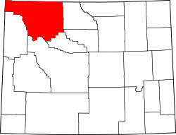
Cody is located at the western edge of the Bighorn Basin, a depression surrounded by the Big Horn, Owl Creek, Bridger, and Absaroka ranges. At the western edge of Cody, a deep canyon formed by the Shoshone River provides the only passage to Yellowstone's Eastern Entrance. At its mouth and rising above Cody are Rattlesnake Mountain on the north side and Cedar Mountain on the south side. Much of Cody has views of Heart Mountain, whose 8,123 ft (2,500 m) peak is 9 miles (14 km) directly north of Cody, and the Carter Mountain massif, which forms a line with peaks above 12,000 ft (3,700 m), some 15 miles (24 km) to the south.

Climate

Cody experiences a semi-arid climate (Köppen BSk), with highly variable conditions. Summers are warm, with some heat spells pushing temperatures above 90 °F (32.2 °C). Winters are cold, with frigid periods alternating with sometimes milder temperatures. Relative humidity is usually a fairly dry 30% or less. Precipitation averages 11.5 inches or 292.1 millimetres annually, including 45.0 inches or 1.14 metres of snow per season. Due to the aridity, snow cover is highly unreliable, with 29.4 days per season with 1 inch or 0.025 metres or more on the ground. Cody enjoys about 300 days of sunshine per year.

Wind is an almost constant presence in the Cody area. Air flow in Cody area is turbulent, but during the winter most storms move in from the north-northwest. During the summer, it is not unusual to see storms move in from the southwest. Throughout a normal day, winds can be experienced as coming from almost any direction, mostly from the north and west, but sometimes from the south and east. The Canyon at the west end of Cody funnels rain and wind across the city from the west. The winds can be quite strong at 30 to 40 miles per hour (48 to 64 km/h) and last for several days.

Because of the dry climate, the entire area is laced with irrigation canals, holding ponds, laterals, and drops. 
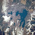
The Buffalo Bill Dam between Rattlesnake and Cedar mountains forms a large reservoir about 10 miles (16 km) to the west of Cody. This reservoir (among others) feeds the Shoshone Project, a large irrigation water distribution system.

The monthly daily average temperature ranges from 27.3 °F or −2.6 °C in December to 70.6 °F or 21.4 °C in July. An average of 16.2 days have highs of 90 °F (32 °C) or higher and an average of 12.3 days have lows of 0 °F (−18 °C) or lower; the average window for freezing temperatures is September 30 thru May 10 and for measurable (≥0.1 inches or 0.25 centimetres snow, October 21 thru April 21. The record high temperature was 105 °F or 40.6 °C on July 14, 1925 and July 15, 1951, and the record low temperature was −46 °F or −43.3 °C on February 8, 1936.

The wettest calendar year has been 2014 with 16.59 inches (421.4 mm) and the driest 1956 with 3.58 inches (90.9 mm). The most rainfall in one month was 5.76 in (146 mm) in June 1992. The most rainfall in 24 hours was 2.51 inches or 64 millimetres on July 22, 1973. There are an average of 72.3 days with measurable precipitation. The most snow in one year was 73.4 inches (1.86 m) between July 1916 and June 1917. The most snow in one month was 29.0 inches (0.74 m) in February 2014. [9]

Climate data for Cody, Wyoming, 1991–2020 normals, extremes 1915–present
MonthJanFebMarAprMayJunJulAugSepOctNovDecYear
Record high °F (°C)68
(20)
75
(24)
79
(26)
87
(31)
94
(34)
103
(39)
105
(41)
103
(39)
97
(36)
87
(31)
74
(23)
67
(19)
105
(41)
Mean maximum °F (°C)56.2
(13.4)
56.5
(13.6)
66.4
(19.1)
75.3
(24.1)
81.6
(27.6)
89.8
(32.1)
94.9
(34.9)
93.2
(34.0)
88.4
(31.3)
78.0
(25.6)
64.3
(17.9)
55.4
(13.0)
95.6
(35.3)
Mean daily maximum °F (°C)37.5
(3.1)
38.7
(3.7)
48.7
(9.3)
55.3
(12.9)
64.4
(18.0)
74.8
(23.8)
84.0
(28.9)
82.2
(27.9)
72.3
(22.4)
58.0
(14.4)
44.8
(7.1)
36.5
(2.5)
58.1
(14.5)
Daily mean °F (°C)27.5
(−2.5)
28.6
(−1.9)
37.7
(3.2)
44.2
(6.8)
53.1
(11.7)
62.4
(16.9)
70.6
(21.4)
68.9
(20.5)
59.7
(15.4)
46.9
(8.3)
35.2
(1.8)
27.3
(−2.6)
46.8
(8.3)
Mean daily minimum °F (°C)17.5
(−8.1)
18.5
(−7.5)
26.8
(−2.9)
33.0
(0.6)
41.9
(5.5)
50.0
(10.0)
57.3
(14.1)
55.6
(13.1)
47.2
(8.4)
35.9
(2.2)
25.5
(−3.6)
18.0
(−7.8)
35.6
(2.0)
Mean minimum °F (°C)−8.6
(−22.6)
−3.2
(−19.6)
5.6
(−14.7)
17.6
(−8.0)
28.0
(−2.2)
38.1
(3.4)
47.5
(8.6)
43.3
(6.3)
31.8
(−0.1)
16.5
(−8.6)
2.1
(−16.6)
−5.7
(−20.9)
−16.0
(−26.7)
Record low °F (°C)−40
(−40)
−46
(−43)
−23
(−31)
−18
(−28)
15
(−9)
25
(−4)
33
(1)
29
(−2)
9
(−13)
−11
(−24)
−24
(−31)
−35
(−37)
−46
(−43)
Average precipitation inches (mm)0.37
(9.4)
0.46
(12)
0.55
(14)
1.35
(34)
2.18
(55)
1.62
(41)
0.89
(23)
0.90
(23)
1.15
(29)
0.99
(25)
0.59
(15)
0.46
(12)
11.51
(292.4)
Average snowfall inches (cm)7.3
(19)
7.5
(19)
5.8
(15)
5.9
(15)
0.8
(2.0)
0.0
(0.0)
0.0
(0.0)
0.0
(0.0)
0.4
(1.0)
3.4
(8.6)
6.4
(16)
7.5
(19)
45.0
(114)
Average precipitation days (≥ 0.01 in)3.24.04.87.710.49.16.87.15.85.74.03.772.3
Average snowy days (≥ 0.1 in)2.73.32.72.30.20.00.00.00.21.32.63.218.5
Source 1: NOAA [10]
Source 2: National Weather Service [9]

Culture

Buffalo Bill - The Scout statue by Gertrude Vanderbilt Whitney commemorates Buffalo Bill The Scout by Gertrude Vanderbilt Whitney.jpg
Buffalo Bill - The Scout statue by Gertrude Vanderbilt Whitney commemorates Buffalo Bill
The flag waves at the start of the Cody Nite Rodeo, August 6, 2006 Cody rodeo IMG 0324.JPG
The flag waves at the start of the Cody Nite Rodeo, August 6, 2006

Themes surrounding Cody's pioneer and Cowboy and Western history are common in the cultural events and activities in the area.

The Buffalo Bill Center of the West is a large and modern facility located near the center of the city. It contains five museums in one, including the Draper Natural History Museum, the Plains Indian Museum, the Cody Firearms Museum, the Whitney Western Art Museum and the Buffalo Bill Museum which chronicles the life of William F. Cody, for whom the historical center is named. [11] The historical center maintains large collections. It is a favorite stopping point for tourists passing through the town, on their way to or from Yellowstone.

Old Trail Town, a restoration of more than 25 historic Western buildings and artifacts, is located in Cody just off the Yellowstone Highway. [12]

Rodeo is important in the culture in Cody, which calls itself the "Rodeo Capital of the World". [13] The Cody Nite Rodeo is an amateur rodeo every night from June 1 through August 31. [14]

Cody is also host to the Cody Stampede Rodeo. The Stampede is a Professional Rodeo Cowboys Association rodeo and is one of the largest rodeos in the nation that is held over the Independence Day Holiday. Many of the top cowboys in the country attend. The stampede has been held from July 1–4 every year since 1919. Cody hosts the Cody Stampede, a weeklong series of events around the 4th of July, featuring several parades where the main street is blocked off, [15] rodeos, fireworks and more. In 2019 Cody Stampede celebrated its 100th year. [16]

The Heart Mountain Relocation Center, was a War Relocation Camp where 14,000 Japanese Americans were interned during World War II (Internment of Japanese Americans). The Interpretive Center is approximately 17 miles east of town and includes surviving buildings from the camp, a war memorial, a walking trail, and a world-class museum. [17]

Arts

Cody is also a bustling arts town.

Visual Arts are celebrated and displayed within the Buffalo Bill Center of the West, Whitney Western Arts Museum as well as many other collective local/regional galleries around town such as the Cody Country Art League, [18] By Western Hands [19] and more. Many photographers, painters, sculptors, designers, and artists love to capture the surrounding natural wonder and western aesthetics.

For nearly twenty years Cody has also been the home to the Rendezvous Royale art festival. [20] The week-long festival includes the Buffalo Bill Art Show and Sale, [21] a nationally renowned art show that features a wide range of interpretations of western art from emerging artists and contemporary masters. Rendezvous Royale features the art show sale, lectures, workshops, and a patrons ball.

The live music scene in Cody is especially vibrant in the summer when the City of Cody hosts an annual Concert in the Park series, [22] The Cody Cattle Company does a nightly show, [23] Dan Miller's Cowboy Music Revue is up and running, and several bars in town host touring artists.

Cody is also the home to several theatre and dance companies that promote community theatre and dance education from pre-k through high school. These companies produce many seasonal projects as well as annual productions. Throughout the year various dance recitals from the companies, as well as musical theatre and theatre productions from community members are produced and performed. The annual performing arts events in Cody are produced from The Rocky Mountain Dance Theatre. They have been doing The Nutcracker annually in December for 25 years, [24] and The Wild West Spectacular Musical for seven seasons. [25]

Education

Public education in the city of Cody is provided by Park County School District #6. [26] Three elementary schools – Eastside, Glenn Livingston, and Sunset - serve students in grades kindergarten through five. The district's two secondary campuses are Cody Middle School (grades 6-8) and Cody High School (grades 9-12).

Cody has a public library, a branch of the Park County Library System. [27]

Industry

Sheridan Avenue in downtown Cody Sheridan Avenue in Cody, Wyoming.jpg
Sheridan Avenue in downtown Cody

The primary industry in Cody is tourism. Hotels, restaurants and shops cater to travelers coming to visit the West and Yellowstone Park. Cody has several art galleries, with some notable local painters and artists living in the area.

Cody is fast becoming a hub for outdoor recreation. The Shoshone River runs through town offering class I-V kayaking and whitewater rafting. Shoshone Canyon offers over 300 rock climbing routes, while Cedar Mountain boasts nearly 600 boulder problems. Cody hosts nearly 50 miles of single track, with a large amount of it accessible by bike from town. A bike park was recently completed with jump and drop lines as well as a pump track. Skiing, both downhill and cross-country are very popular sports in Cody, with the local High School boasting competitive cross-country and downhill ski teams. [28] Sleeping Giant Ski Area & Zipline, about an hour west of Cody, is a popular local downhill ski mountain, in close proximity Yellowstone East Entrance. [29]

Another industry is western style furniture, with several small furniture makers producing custom pieces.

The oil industry seems to wax and wane over the years in the Cody area. Husky Energy was founded in Cody in 1938 (as Husky Refining Company), when Glenn Nielson purchased the assets of Park Refining Company, started four years earlier by area oil developer Valentine M. Kirk. Husky operated as refinery until 1980s, the facility being demolished in the 1990s.

Just to the south of Cody are large deposits of gypsum.

Park County School District #6 is another large employer in the area.

Demographics

Historical population
CensusPop.Note
1910 1,132
1920 1,2429.7%
1930 1,80044.9%
1940 2,53640.9%
1950 3,87252.7%
1960 4,83824.9%
1970 5,1616.7%
1980 6,59927.9%
1990 7,89719.7%
2000 8,83511.9%
2010 9,5207.8%
2020 10,0665.7%
2021 (est.)10,1741.1%
[30]

2020 census

As of the census of 2020, there were 10,066 people, and 4,401 households in the city. [2] The population density was 981.7 people per square mile. The racial makeup of the city was 93.8% White, 0.6% African American, 0.6% Native American, 0.0% Asian, 0.0% Pacific Islander, and 3.8% from two or more races. Those of Hispanic or Latino origin made up 7% of the population. [2]

21.4% of the population were under 18, and 6.6% were under 5. People over 65 made up 19.4% of the population. The gender makeup was 49.9% female and 50.1% male. [2]

The median household income was $59,682, and the per capita income was $34,127. People under the poverty line made up 8.9% of the population. [2]

2010 census

As of the census [2] of 2010, there were 9,520 people, 4,278 households, and 2,502 families living in the city. The population density was 933.3 inhabitants per square mile (360.3/km2). There were 4,650 housing units at an average density of 455.9 per square mile (176.0/km2). The racial makeup of the city was 95.9% White, 0.2% African American, 0.7% Native American, 0.4% Asian, 0.1% Pacific Islander, 1.0% from other races, and 1.8% from two or more races. Hispanic or Latino residents of any race were 3.1% of the population.

There were 4,278 households, of which 26.5% had children under the age of 18 living with them, 45.0% were married couples living together, 9.5% had a female householder with no husband present, 4.0% had a male householder with no wife present, and 41.5% were non-families. 34.8% of all households were made up of individuals, and 13.2% had someone living alone who was 65 years of age or older. The average household size was 2.19 and the average family size was 2.82.

The median age in the city was 42.4 years. 21.8% of residents were under the age of 18; 7.1% were between the ages of 18 and 24; 24.1% were from 25 to 44; 28.9% were from 45 to 64; and 18.2% were 65 years of age or older. The gender makeup of the city was 48.2% male and 51.8% female.

2000 census

As of the census [4] of 2000, there were 8,835 people, 3,791 households, and 2,403 families living in the city. The population density was 952.3 people per square mile (367.6/km2). There were 4,113 housing units at an average density of 443.3 per square mile (171.1/km2). The racial makeup of the city was 96.90% White, 0.10% African American, 0.42% Native American, 0.58% Asian, 0.05% Pacific Islander, 0.85% from other races, and 1.11% from two or more races. Hispanic or Latino of any race were 2.22% of the population.

There were 3,791 households, out of which 29.0% had children under the age of 18 living with them, 50.7% were married couples living together, 9.5% had a female householder with no husband present, and 36.6% were non-families. 32.2% of all households were made up of individuals, and 12.4% had someone living alone who was 65 years of age or older. The average household size was 2.27 and the average family size was 2.86.

In the city, the population was spread out, with 24.8% under the age of 18, 7.2% from 18 to 24, 26.4% from 25 to 44, 24.9% from 45 to 64, and 16.6% who were 65 years of age or older. The median age was 40 years. For every 100 females, there were 90.9 males. For every 100 females age 18 and over, there were 88.1 males.

The median income for a household in the city was $34,450, and the median income for a family was $40,554. Males had a median income of $31,395 versus $19,947 for females. The per capita income for the city was $17,813. About 9.4% of families and 13.9% of the population were below the poverty line, including 19.3% of those under age 18 and 11.0% of those age 65 or over.

Government

Cody is governed by a city council and a mayor. The mayor is elected in a citywide vote. The city council consists of six members who are elected from one of three wards. Each ward elects two members.

Media

AM Radio
FM Radio
Television
Newspaper

Twice-weekly Cody Enterprise. Founded by "Buffalo Bill" Cody and Col. John Peake in August 1899. The paper has a paid circulation of 7,050, and is owned by SAGE Publishing of Cody.

Transportation

Highways

Airport

The Yellowstone Regional Airport offers full passenger service. Flights are available through SkyWest (United Airlines), connecting through Denver, Colorado. Air cargo services are provided by FedEx and UPS.

Ground transit

Cody has four local transportation companies: Cody Over Land Transit, Phidippides Shuttle Service, Cody Town Taxi, and the Cody Shuttle. Cody Over Land operates routes within the city of Cody, from June through September. Phidippides is a full service transportation company with service to Cody, Yellowstone National Park, and airports in Cody, Jackson, and Billings. They also have courier and package service available. Cody Town Taxi and Cody Shuttle operate primarily in Cody.

Intercity bus service to the city is provided by Express Arrow. [31]

Railroad

Cody is served by the Cody Branch of the BNSF Railway, which runs south-west from Frannie for about 46 miles (74 km). The branch terminates in Cody near where WY-120 crosses the Shoshone River.

Notable people

Persons born in Cody or with notable connections.


Sister cities

See also

Related Research Articles

<span class="mw-page-title-main">Wyoming</span> U.S. state

Wyoming is a landlocked state in the Mountain West subregion of the Western United States. It borders Montana to the north and northwest, South Dakota and Nebraska to the east, Idaho to the west, Utah to the southwest, and Colorado to the south. With a population of 576,851 in 2020, Wyoming is the least populous state despite being the 10th largest by area, with the second-lowest population density after Alaska. The state capital and most populous city is Cheyenne, which had an estimated population of 63,957 in 2018.

<span class="mw-page-title-main">North Platte, Nebraska</span> City in Nebraska, United States

North Platte is a city in and the county seat of Lincoln County, Nebraska, United States. It is located in the west-central part of the state, along Interstate 80, at the confluence of the North and South Platte Rivers forming the Platte River. The population was 23,390 at the 2020 census, making it the 11th most populous city in Nebraska.

<span class="mw-page-title-main">Teton County, Wyoming</span> County in Wyoming, United States

Teton County is a county in the U.S. state of Wyoming. As of the 2020 United States Census, the population was 23,331. Its county seat is Jackson. Its west boundary line is also the Wyoming state boundary shared with Idaho and the southern tip of Montana. Teton County is part of the Jackson, WY-ID Micropolitan Statistical Area.

<span class="mw-page-title-main">Park County, Wyoming</span> County in Wyoming, United States

Park County is a county in the U.S. state of Wyoming. As of the 2020 United States Census, the population was 29,624. The county seat is Cody.

<span class="mw-page-title-main">Hot Springs County, Wyoming</span> County in Wyoming, United States

Hot Springs County is a county in the U.S. state of Wyoming. As of the 2020 United States Census, the population was 4,696, making it the second-least populous county in Wyoming. Its county seat is Thermopolis. The county is named for the hot springs located in Hot Springs State Park.

<span class="mw-page-title-main">Fremont County, Wyoming</span> County in Wyoming, United States

Fremont County is a county in the U.S. state of Wyoming. As of the 2020 United States census, the population was 39,234, making it the fifth-most populous county in Wyoming. Its county seat is Lander. The county was founded in 1884 and is named for John C. Frémont, a general, explorer, and politician. It is roughly the size of the state of Vermont.

<span class="mw-page-title-main">Ashton, Idaho</span> City in Idaho, United States

Ashton is a city in Fremont County, Idaho, United States. The population was 1,127 at the 2010 census, and it is part of the Rexburg Micropolitan Statistical Area. The district is noted for seed potato production and bills itself as the world's largest seed potato growing area.

<span class="mw-page-title-main">Island Park, Idaho</span> City in Idaho, United States

Island Park is a city in Fremont County, Idaho, United States. The city's population was 286 at the 2010 census, up from 215 in 2000. The city was incorporated by owners of the many lodges and resorts along U.S. Route 20 in 1947, primarily to circumvent Idaho's liquor laws that prohibited the sale of liquor outside of city limits. It is only 500 feet (150 m) wide in most locations yet, at 33 miles (53 km), claims to have the longest "Main Street" in the world.

<span class="mw-page-title-main">Dubois, Wyoming</span> Town in Wyoming, United States

Dubois is a town in Fremont County, Wyoming, United States. The population was 971 at the 2010 census, but dropped to 911 in the 2020 census. The population nearly doubles in the summer with many part-time residents.

<span class="mw-page-title-main">Lander, Wyoming</span> City in Wyoming, United States

Lander is a city in Wyoming, United States, and the county seat of Fremont County. It is in central Wyoming, along the Middle Fork of the Popo Agie River, just south of the Wind River Indian Reservation. It is a tourism center with several nearby guest ranches. Its population was 7,546 at the 2020 census.

<span class="mw-page-title-main">Sheridan, Wyoming</span> City in Wyoming, United States

Sheridan is a city in the U.S. state of Wyoming and the county seat of Sheridan County. The city is located halfway between Yellowstone Park and Mount Rushmore by U.S. Route 14 and 16. It is the principal town of the Sheridan, Wyoming, Micropolitan Statistical Area which encompasses all of Sheridan County. The 2020 census put the city's population at 18,737, making it the 6th most populous city in Wyoming.

<span class="mw-page-title-main">Rock Springs, Wyoming</span> City in Wyoming, United States

Rock Springs is a city in Sweetwater County, Wyoming, United States. The population was 23,526 at the 2020 census, making it the fifth most populous city in the state of Wyoming, and the most populous city in Sweetwater County. Rock Springs is the principal city of the Rock Springs micropolitan statistical area, which has a population of 37,975. Rock Springs is known as the Home of 56 Nationalities because of the influx of immigrants from all over the world who came to work in the coal mines that supplied the fuel to power the steam engines of the Union Pacific Railroad. The city's rich cultural heritage is celebrated each summer on International Day, a festival where the foods, costumes, and traditions of residents' ancestors are recreated and enjoyed at Bunning Park in downtown Rock Springs.

<span class="mw-page-title-main">Jackson, Wyoming</span> Town in Wyoming, United States

Jackson is a town in Teton County, Wyoming, United States. The population was 10,760 at the 2020 census, up from 9,577 in 2010. It is the largest town in Teton County and its county seat. Jackson is the principal town of the Jackson, WY-ID Micropolitan Statistical Area, which includes Teton County in Wyoming and Teton County in Idaho. The town, often familiarly or mistakenly called Jackson Hole, derives its name from the valley in which it is located. Jackson is a popular tourist destination due to its proximity to the ski resorts Jackson Hole Mountain, Snow King Mountain, and Grand Targhee, as well as Grand Teton National Park and Yellowstone National Park.

<span class="mw-page-title-main">Buffalo Bill</span> American frontiersman and showman (1846–1917)

William Frederick Cody, known as Buffalo Bill, was an American soldier, bison hunter, and showman.

<span class="mw-page-title-main">Shoshone National Forest</span> National Forest in Wyoming, US

Shoshone National Forest is the first federally protected National Forest in the United States and covers nearly 2,500,000 acres (1,000,000 ha) in the state of Wyoming. Originally a part of the Yellowstone Timberland Reserve, the forest is managed by the United States Forest Service and was created by an act of Congress and signed into law by U.S. President Benjamin Harrison in 1891. Shoshone National Forest is one of the first nationally protected land areas anywhere. Native Americans have lived in the region for at least 10,000 years, and when the region was first explored by European adventurers, forestlands were occupied by several different tribes. Never heavily settled or exploited, the forest has retained most of its wildness. Shoshone National Forest is a part of the Greater Yellowstone Ecosystem, a nearly unbroken expanse of federally protected lands encompassing an estimated 20,000,000 acres (8,100,000 ha).

<span class="mw-page-title-main">Buffalo Bill Cody Scenic Byway</span>

Buffalo Bill Cody Scenic Byway is in the U.S. state of Wyoming and spans most of the distance from Cody, Wyoming to Yellowstone National Park. The 27.5-mile (44.3 km) scenic highway follows the north fork of the Shoshone River through the Wapiti Valley to Sylvan Pass and the eastern entrance to Yellowstone. Most of the scenic byway is contained within Shoshone National Forest and is also known as US Highway 14 (US 14), US 16 and US 20.

<span class="mw-page-title-main">Buffalo Bill State Park</span> State Park in Park County, Wyoming

Buffalo Bill State Park is a public recreation area surrounding the reservoir formed by the Buffalo Bill Dam, an impoundment of the Shoshone River, in Park County, Wyoming. The state park, reservoir and dam were named after William "Buffalo Bill" Cody, who founded the nearby town of Cody and who owned much of the land now occupied by the reservoir and park. The park offers camping, hiking, boating, fishing, and picnicking and is managed by Wyoming Division of State Parks and Historic Sites.

<span class="mw-page-title-main">Shoshone River</span> River in Wyoming, United States

The Shoshone River is a 100-mile (160 km) long river in northern Wyoming in the United States. Its headwaters are in the Absaroka Range in Shoshone National Forest. It ends when it runs into the Big Horn River near Lovell, Wyoming. Cities it runs near or through are Cody, Powell, Byron, and Lovell. Near Cody, it runs through a volcanically active region of fumaroles known as Colter's Hell. This contributed to the river being named on old maps of Wyoming as the Stinking Water River.

<span class="mw-page-title-main">Buffalo Bill Dam</span> Dam in Wyoming

Buffalo Bill Dam is a concrete arch-gravity dam on the Shoshone River in the U.S. state of Wyoming. It is named after the famous Wild West figure William "Buffalo Bill" Cody, who founded the nearby town of Cody and owned much of the land now covered by the reservoir formed by its construction. The dam is part of the Shoshone Project, successor to several visionary schemes promoted by Cody to irrigate the Bighorn Basin and turn it from a semi-arid sagebrush-covered plain to productive agricultural land. Known at the time of its construction as Shoshone Dam, it was renamed in 1946 to honor Cody.

<span class="mw-page-title-main">Pahaska Tepee</span> United States historic place

Pahaska Tepee is William "Buffalo Bill" Cody's old hunting lodge and hotel in the U.S. state of Wyoming. It is located 50 miles (80 km) west of the town of Cody and two miles from the east entrance to Yellowstone National Park.

References

  1. "2019 U.S. Gazetteer Files". United States Census Bureau. Retrieved August 7, 2020.
  2. 1 2 3 4 5 6 "U.S. Census website". United States Census Bureau . Retrieved December 14, 2012.
  3. "Population and Housing Unit Estimates". United States Census Bureau. May 24, 2020. Retrieved May 27, 2020.
  4. 1 2 "U.S. Census website". United States Census Bureau . Retrieved January 31, 2008.
  5. "US Board on Geographic Names". United States Geological Survey. October 25, 2007. Retrieved January 31, 2008.
  6. "Find a County". National Association of Counties. Archived from the original on May 31, 2011. Retrieved June 7, 2011.
  7. Robert E. Bonner (October 25, 2015). "Town Founder and Irrigation Tycoon: The Buffalo Bill Nobody Knows". WyoHistory.org. Archived from the original on December 7, 2018. Retrieved December 8, 2018.
  8. "US Gazetteer files 2010". United States Census Bureau. Archived from the original on July 2, 2012. Retrieved December 14, 2012.
  9. 1 2 "NOAA Online Weather Data". National Weather Service. Retrieved August 15, 2022.
  10. "U.S. Climate Normals Quick Access". National Oceanic and Atmospheric Administration. Retrieved August 15, 2022.
  11. Buffalo Bill Center of the West https://centerofthewest.org/ . Retrieved July 25, 2022.{{cite web}}: Missing or empty |title= (help)
  12. "Old Trail Town" . Retrieved July 25, 2022.
  13. "History of Cody and Rodeo". Cody Stampede Rodeo. Retrieved July 25, 2022.
  14. "Cody Nite Rodeo". Cody Stampede Rodeo. Retrieved July 25, 2022.
  15. "Parades". Cody Stampede Rodeo. Retrieved July 25, 2022.
  16. KUSEK 406mtsports.com, J. O. E. (June 29, 2019). "Cody Stampede celebrating 100 years of rodeo". The Billings Gazette. Retrieved January 24, 2020.{{cite web}}: CS1 maint: numeric names: authors list (link)
  17. "About". Heart Mountain Interpretative Center. Retrieved July 25, 2022.
  18. "Cody Country Art League". Cody Country Art League. Retrieved July 25, 2022.
  19. "By Western Hands". By Western Hands. Retrieved July 25, 2022.
  20. "Rendezvous Royale". Rendezvous Royale. Retrieved July 25, 2022.
  21. "Buffalo Bill Art Show and Sale". Rendezvous Royale. Retrieved July 25, 2022.
  22. "Concerts in the Park". City of Cody.
  23. "Cody Cattle Company". Cody Cattle Company. Retrieved July 25, 2022.
  24. "The Nutcracker". Rocky Mountain Dance Theatre. Retrieved July 25, 2022.
  25. "The Wild West Spectacular". Wild West Show.
  26. "2020 CENSUS - SCHOOL DISTRICT REFERENCE MAP: Park County, WY" (PDF). U.S. Census Bureau. p. 2 (PDF p. 3/3). Retrieved March 11, 2024. - Text list
  27. "Wyoming Public Libraries". PublicLibraries.com. Retrieved June 14, 2019.
  28. Miller, Max (January 20, 2018). "Pahaska pop-up ski city: Cody hosts weekend Nordic meet". Cody Enterprise. Retrieved January 17, 2023.
  29. "Ski Sleeping Giant". AllTrips. Retrieved January 17, 2023.
  30. "Historical Decennial Census Population for Wyoming Counties, Cities, and Towns". Wyoming Department of State / U.S. Census Bureau. Retrieved June 30, 2008.
  31. "Express Arrow Locations" . Retrieved July 20, 2023.
  32. "Archived copy". legacy.sistercities.org. Archived from the original on August 6, 2019. Retrieved August 6, 2019.{{cite web}}: CS1 maint: archived copy as title (link)

^20 "Kanye, Out West: What is the Superstar doing out in Wyoming?" New York Times, Style section, 23 Feb 2020. Retrieved October 26, 2020. https://www.nytimes.com/2020/02/23/style/kanye-west-cody-wyoming.html