The Absaroka Range is a sub-range of the Rocky Mountains in the United States. The range stretches about 150 mi (240 km) across the Montana-Wyoming border, and 75 miles at its widest, forming the eastern boundary of Yellowstone National Park along Paradise Valley (Montana), and the western side of the Bighorn Basin. The range borders the Beartooth Mountains to the north and the Wind River Range to the south. The northern edge of the range rests along I-90 and Livingston, Montana. The highest peak in the range is Francs Peak, located in Wyoming at 13,153 ft (4,009 m). There are 46 other peaks over 12,000 ft (3,700 m).

Eagle Peak is a mountain in the Absaroka Range in the U.S. state of Wyoming and at 11,372 feet (3,466 m) is the highest point in Yellowstone National Park. It is located about 6 miles (9.7 km) east of the southeast arm of Yellowstone Lake.

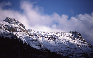
The following articles relate to the history, geography, geology, flora, fauna, structures and recreation in Yellowstone National Park.

Mount Haynes el. 8,218 feet (2,505 m) is a prominent peak adjacent to the Madison River in Yellowstone National Park. The peak was named by then Yellowstone superintendent Horace Albright to honor Frank Jay Haynes (1853–1921), the first official photographer of the park. Prior to being named Mount Haynes, the peak was unofficially called Mount Burley for D. E. Burley of the Union Pacific Railroad. Today there is an interpretive overlook along the Madison River just opposite the peak.
Sepulcher Mountain el. 9,642 feet (2,939 m) is a moderate mountain peak in northwest Yellowstone National Park halfway between the summit of Electric Peak and Mammoth Hot Springs. The peak was named Sepulcher by Captain John W. Barlow, U.S. Army in 1871 because of its resemblance to a crypt when viewed from Gardiner, Montana.
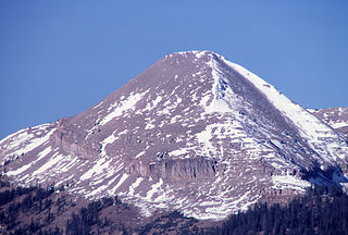
Bunsen Peak el. 8,564 feet (2,610 m) is a prominent peak due south of Mammoth Hot Springs in Yellowstone National Park, Wyoming. The peak lies on the east flank of Kingman Pass on the Mammoth to Norris section of the Grand Loop Road. The peak was first ascended by Ferdinand V. Hayden and Captain John W. Barlow in 1871, Bunsen Peak was not named until 1872 during the second Hayden Geologic Survey. E. S. Topping named the peak Observation Mountain in 1872 as well, but that name did not stick. The Bunsen Peak Trail with its trailhead just south of Mammoth is a steep 2.1 miles (3.4 km) to the summit. Bunsen Peak was named for the German chemist Robert Bunsen, the inventor of the Bunsen Burner and responsible for early work on volcanic geyser theories.

Mount Sheridan el. 10,313 feet (3,143 m) is a prominent mountain peak overlooking Heart Lake in the Red Mountains of Yellowstone National Park. The peak is named in honor of General Philip H. Sheridan, U.S. Army, one of the early protectors of the park.
Antler Peak, el. 10,063 feet (3,067 m) is a prominent mountain peak in the Gallatin Range in Yellowstone National Park. The peak was originally named Bell's Peak in honor of an Assistant Secretary of the Interior by either Philetus Norris, the second park superintendent or W.H.Holmes, a U.S. Geological Survey geologist in 1878. However, in 1885, Arnold Hague of the U.S. Geological Survey renamed the peak Antler Peak because of the numerous shed elk and deer antlers found on its slopes.

Mount Schurz el. 11,007 feet (3,355 m) is a mountain peak in the Absaroka Range in Yellowstone National Park. Mount Schurz is the second highest peak in Yellowstone. The mountain was originally named Mount Doane by Henry D. Washburn during the Washburn–Langford–Doane Expedition in 1871. Later the name Mount Doane was given to another peak in the Absaroka Range by geologist Arnold Hague. In 1885, Hague named the mountain for the 13th U.S. Secretary of the Interior, Carl Schurz (1877–1881). Schurz was the first Secretary of the Interior to visit Yellowstone and a strong supporter of the national park movement.

Abiathar Peak el. 10,928 feet (3,331 m) is a mountain peak in the northeastern section of Yellowstone National Park of Absaroka Range. The peak was named by members of the 1885 Hague Geological Survey to honor Charles Abiathar White, a geologist and paleontologist who had participated in early western geological surveys. White never visited Yellowstone.
Barronette Peak el. 10,354 feet (3,156 m) is a mountain peak in the northeast section of Yellowstone National Park in the Absaroka Range. The peak is named for Collins Jack Baronette (1829–1901). It was named by the Hayden Geological Survey of 1878. When named, the name was misspelled Barronette and it retains the official misspelled name today.

Mount Norris el. 9,842 feet (3,000 m) is a mountain peak in the northeast section of Yellowstone National Park in the Absaroka Range. In 1875, the peak was named for and named by Philetus Norris, the second park superintendent (1877–1882). Norris was on a visit to the park with several mountain guides, including Collins Jack Yellowstone Jack Baronette. They ascended the peak at the head of the Lamar Valley and presumed they were the first white men to do so, thus naming it Mount Norris.

Cook Peak el. 9,754 feet (2,973 m) is a mountain peak in the Washburn Range of Yellowstone National Park. The peak was named in 1922 by then superintendent Horace Albright to honor of Charles W. Cook, a member of the 1869 Cook–Folsom–Peterson Expedition which explored the Yellowstone park region. 1922 was the 50th anniversary of the park's creation, and Charles Cook, still living in Montana, attended ceremonies in the park. Prior to 1922, the peak had been named Thompson Peak by Philetus Norris in 1880 and Storm Peak by members of the Arnold Hague Geological Surveys in 1885.
Folsom Peak el. 9,334 feet (2,845 m) is a mountain peak in the Washburn Range of Yellowstone National Park. The peak was named in 1895 by geologist Arnold Hague to honor David E. Folsom, a member of the Cook–Folsom–Peterson Expedition of 1869. Folsom, Peterson and Cook were some of the 1st explorers of the Yellowstone region to publish their exploration.

Dunraven Peak el. 9,869 feet (3,008 m) is a mountain peak in the Washburn Range of Yellowstone National Park. In 1874, just two years after the park's creation, the Earl of Dunraven, a titled Englishman made a visit to Yellowstone in conjunction with a hunting expedition led by Texas Jack Omohundro to the Northern Rockies. He was so impressed with the park, that he devoted well over 150 pages to Yellowstone in his The Great Divide, published in London in 1874. The Great Divide was one of the earliest works to praise and publicize the park.
Hedges Peak el. 9,669 feet (2,947 m) is a mountain peak in the Washburn Range in Yellowstone National Park. The peak was named in 1895 by geologist Arnold Hague to honor Cornelius Hedges (1837–1907), a member of the Washburn–Langford–Doane Expedition of 1871 and prominent Montana lawyer. Hedges accounts of the expedition in Helena Daily Herald newspaper contributed to the campaign to create Yellowstone National Park. Prior to 1895 the peak had been named Surprise Peak by geologist J.P. Iddings in 1883.

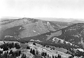
Druid Peak is a moderate domed peak on the southern flank of the Absaroka Range in Yellowstone National Park. The peak lies just north of the Lamar River and Soda Butte Creek confluence at the head of the Lamar Valley. Prior to 1885, this summit was named Soda Hill by members of the Hayden Geological Survey of 1878 and Mount Longfellow or Longfellows' Peak by then park superintendent Philetus Norris in 1880. In 1885, members of the Arnold Hague Geological Survey changed the name to Druid Peak for unknown reasons, but some historians believe it may have been the presence of Stonehenge like rock formations on its eastern face that prompted the name.

Mount Hancock el. 10,223 feet (3,116 m) is an isolated mountain peak on Big Game Ridge in Yellowstone National Park. Captain John W. Barlow named the peak in honor of General Winfield Scott Hancock during the Barlow-Heap Exploration of Yellowstone in 1871. General Hancock is noted for issuing the orders that established the military escort led by Lt. Gustavus Cheyney Doane for the Washburn–Langford–Doane Expedition of 1870.

White Peaks el. 9,472 feet (2,887 m) is a small group of mountain peaks in the southern section of the Gallatin Range in Yellowstone National Park.
Three Rivers Peak el. 9,764 feet (2,976 m) is a mountain peak in the southern section of the Gallatin Range in Yellowstone National Park.