Traverse Peak is in the northern Teton Range, Grand Teton National Park, Wyoming. The mountain rises abruptly above Moran Canyon to the south and the south fork of Snowshoe Canyon to the north. From Moran Bay on Jackson Lake, the south slopes of the mountain can be seen behind Bivouac Peak rising above Moran Canyon.

Disappointment Peak is in the Teton Range of Wyoming, in Grand Teton National Park and immediately southeast of Grand Teton. The peak is part of the Cathedral Group, a region of the Tetons noted for particularly rugged mountains. Disappointment Peak rises to the north of Garnet Canyon and to the west of Amphitheater and Surprise lakes. The peak has a variety of mountaineering routes, including the most difficult in the range.
Cloudveil Dome is located in the Teton Range, Grand Teton National Park, Wyoming, immediately southeast of Grand Teton. The peak is in the central portions of the range, immediately east of South Teton and is sometimes considered to be part of what is collectively known as the Cathedral Group. Cloudveil Dome rises to the south of Garnet Canyon. The peak has a variety of mountaineering routes but since it is near to more popular climbing zones, it is often overlooked.

Nez Perce Peak is located in the Teton Range, Grand Teton National Park, Wyoming, immediately southeast of Grand Teton. The peak is in the central portions of the range, immediately east of Cloudveil Dome and is sometimes considered to be part of what is collectively known as the Cathedral Group. Nez Perce rises to the south of Garnet Canyon and is a dramatic peak that dominates the skyline to the west of Bradley and Taggart Lakes. When viewed from the western section of Jackson Hole, Nez Perce often obscures the view of Cloudveil Dome as well as South Teton, even though both summits are higher.

Static Peak is located in the Teton Range, Grand Teton National Park, in the U.S. state of Wyoming. Located .48 miles (0.77 km) southeast of Buck Mountain, the summit is also east of the Alaska Basin Trail, from a point known as Static Peak Divide, the summit can be climbed in a scramble. Below the summit on the north face, a small remnant glacier persists, sheltered from direct sunlight by steep cliffs. Timberline Lake lies to the north of the peak.

Elk Mountain is in the northern Teton Range, Grand Teton National Park, Wyoming. The peak is part of a ridge immediately west of Owl Peak and the exact elevation is not known but is estimated to be between 10,720 and 10,800 feet. Elk Mountain is the northernmost peak in the Teton Range over 10,000 feet (3,000 m) in elevation. North of Elk Mountain, the Tetons blend into the Yellowstone Plateau.
Survey Peak is located in the northern Teton Range in the U.S. state of Wyoming. The peak is on the border of Grand Teton National Park and the Jedediah Smith Wilderness of Caribou-Targhee National Forest. Survey Peak rises to the immediate north of Berry Creek and can be accessed via the Berry Creek Trail.
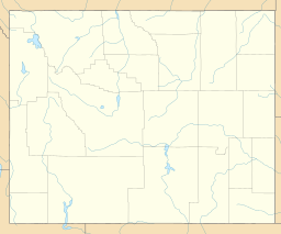
Red Mountain is located in the northern Teton Range in the U.S. state of Wyoming. The peak is on the border of Grand Teton National Park and the Jedediah Smith Wilderness of Caribou-Targhee National Forest.
Moose Mountain (10,059 feet is located in the northern Teton Range in the U.S. state of Wyoming. The peak is on the border of Grand Teton National Park and the Jedediah Smith Wilderness of Caribou-Targhee National Forest. Moose Mountain is at the western end of Webb Canyon.
Rammell Mountain (10,140 feet is located in the Teton Range in the U.S. state of Wyoming. The peak is in the Jedediah Smith Wilderness of Caribou-Targhee National Forest.
Littles Peak (10,717 feet is located in the Teton Range in the U.S. state of Wyoming. The peak is on the border of Grand Teton National Park and the Jedediah Smith Wilderness of Caribou-Targhee National Forest. Littles Peak is at the western end of Leigh Canyon.
Green Lakes Mountain (10,240 feet is located in the Teton Range in the U.S. state of Wyoming. The peak is on the border of Grand Teton National Park and the Jedediah Smith Wilderness of Caribou-Targhee National Forest. Green Lakes Mountain is at the head of Moran Canyon and 1 mile SSW of Dry Ridge Mountain.
Dry Ridge Mountain (10,326 feet is located in the Teton Range in the U.S. state of Wyoming. The peak is on the border of Grand Teton National Park and the Jedediah Smith Wilderness of Caribou-Targhee National Forest. Dry Ridge Mountain is at the head of Moran Canyon and 1 mile NNE of Green Lakes Mountain.
Maidenform Peak (11,142 feet is located in the Teton Range, Grand Teton National Park in the U.S. state of Wyoming. Maidenform Peak is at the head of Leigh Canyon and .64 miles SSW of Cleaver Peak. Cirque Lake is immediately east of the peak.
Table Mountain is located in the Teton Range in the U.S. state of Wyoming. The peak is on the border of Grand Teton National Park and the Jedediah Smith Wilderness of Caribou-Targhee National Forest. Table Mountain is west of the south fork of Cascade Canyon and a little more than 1 mile (1.6 km) north of Hurricane Pass.
The Wall is located in the Teton Range in the U.S. state of Wyoming, running for more than 4 miles (6.4 km) along the western border of Grand Teton National Park. The peak is on the border of Grand Teton National Park and the Jedediah Smith Wilderness of Caribou-Targhee National Forest. This high point, near the northern terminus of the cliff, is 1 mile (1.6 km) WSW of South Teton and overlooks Snowdrift Lake.
Veiled Peak is located in the Teton Range, within Grand Teton National Park, U.S. state of Wyoming. Veiled Peak is west of Mount Wister and rises to the south above Snowdrift Lake.

Mount Hunt (10,788 feet is located in the Teton Range, Grand Teton National Park in the U.S. state of Wyoming. The peak is situated near the head of Open Canyon and just west of Mount Hunt Divide. The peak was named after William Price Hunt, one of the leaders of the 1811-12 Astor Expedition.
Mount Glory (10,037 feet is located in the Teton Range, Caribou-Targhee National Forest, in the U.S. state of Wyoming. The peak is situated just north of Teton Pass.
Albright Peak (10,557 feet is located in the Teton Range, Grand Teton National Park, in the U.S. state of Wyoming. Albright Peak is the only mountain peak named for Horace M. Albright, the second director of the National Park Service. The peak is .8 mi SSE of Static Peak and towers to the northwest over Phelps Lake. The easiest climbing access to Albright Peak is via the Alaska Basin Trail.