Sierra Madre Range (Wyoming)

Last updated
Sierra Madre Range
Sierra Madre Mountains
Wyoming Jeep Trail.JPG
A backcountry road in the Sierra Madre Range near Bridger Peak.
Highest point
PeakBridger Peak
Elevation 3,354 m (11,004 ft)
Coordinates 41°11′21″N107°02′50″W / 41.1891667°N 107.0472222°W / 41.1891667; -107.0472222
Geography
USA Wyoming location map.svg
Red triangle with thick white border.svg
Sierra Madre Range
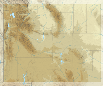
Location of the Sierra Madre Range in Wyoming
Country United States
State Wyoming and Colorado
Parent range Rocky Mountains

The Sierra Madre Range is a mountain range in the western United States, located in south-central Wyoming and north-central Colorado. Geologically, it may be considered an extension of the Park Range of Colorado. South of the Great Divide Basin, the US Continental Divide runs along the Sierre Madre high points. Its western basins drain into the Colorado River and its eastern into the North Platte River. Buck Mountain (11,396 feet (3474 m)) is the highest peak in the range and lies within Colorado. Bridger Peak (11,004 feet (3,354 m)) is its highest elevation on the Wyoming side of the range. [1]

Copper resources within the range were extracted during the late 19th and early 20th centuries by the Ferris-Haggarty mine which lies about two miles west of Bridger Peak. Its operations were centered near Encampment 15 miles to the east. [2] [3] Gold findings in the range during the 1890s sparked a short-lived gold rush that attracted thousands of prospectors. [4] The possibility of further discoveries renewed interest during the late 20th and early 21st centuries. [5]

Much of the range lies within the Medicine Bow – Routt National Forest. Protected areas include the Encampment River Wilderness, the Huston Park Wilderness, [6] and parts of the Mount Zirkel Wilderness. The range is traversed by Wyoming Highway 70, which (except in winter when the road is closed [7] ) crosses the Continental Divide at an elevation of 9,915 feet (3,022 m) at Battle Pass near the old Battle mining site. [8]

The range supports a number of popular game species, including elk, mule deer, and grouse, along with other species mentioned in the state's Comprehensive Wildlife Conservation Strategy Report. [9] In 2009 the state's Game and Fish Department, describing its wildlife as "world class", issued a report recommending that the area's natural values be analyzed and that energy development leases in the area be withdrawn. [9]

See also

Related Research Articles

<span class="mw-page-title-main">Gannett Peak</span> Mountain in Wyoming, United States

Gannett Peak is the highest mountain peak in the U.S. state of Wyoming at 13,810 feet (4,210 m). It lies in the Wind River Range within the Bridger Wilderness of the Bridger-Teton National Forest. Straddling the Continental Divide along the boundary between Fremont and Sublette counties, it has the second greatest topographic prominence in the state (7076') after Cloud Peak (7077'), and is the highest ground for 290.36 miles in any direction.

<span class="mw-page-title-main">Great Divide Basin</span> Endorheic basin adjoining the Continental Divide in southern Wyoming, USA

The Great Divide Basin or Great Divide Closed Basin is an area of land in the Red Desert of Wyoming where none of the water falling as rain to the ground drains into any ocean, directly or indirectly. It is thus an endorheic basin, one of several in the United States that adjoin the Continental Divide. To the south and west of the basin is the Green River watershed, draining to the Gulf of California/Pacific Ocean; to the north and east is the North Platte watershed, draining to the Gulf of Mexico/Atlantic Ocean. The basin is very roughly rectangular in shape; the northwest corner is at Oregon Buttes near South Pass, about 40 miles (64 km) southwest of Lander, and the southeast corner is in the Sierra Madre Range near Bridger Pass, about 20 miles (32 km) southwest of Rawlins.

<span class="mw-page-title-main">North American Cordillera</span> North American portion of the American Cordillera mountain chain

The North American Cordillera, sometimes also called the Western Cordillera of North America, the Western Cordillera or the Pacific Cordillera, is the North American portion of the American Cordillera, the mountain chain system (cordillera) along the western coast of the Americas. The North American Cordillera covers an extensive area of mountain ranges, intermontane basins and plateaus in Western/Northwestern Canada, Western United States and Mexico, including much of the territory west of the Great Plains.

<span class="mw-page-title-main">New York Mountains</span> Landform in San Bernardino County, California

The New York Mountains are a small mountain range found in northeastern San Bernardino County in California, USA. The range's northeastern area lies in southeastern Nevada. The range lies just south of the small community of Ivanpah, and north of the Lanfair Valley. The mountains are part of the mountain ranges, cones, mountains, and landforms in the Mojave National Preserve. The mountains reach an elevation of 7,533 feet (2,296 m), and run in a mostly southwest-northeasterly direction between the Providence Mountains and the McCullough Range approximately five miles into Nevada and border the northwest corner of the Piute Valley of Nevada-California.

<span class="mw-page-title-main">Whipple Mountains</span> Landform in San Bernardino County, Arizona

The Whipple Mountains are located in eastern San Bernardino County, California. They are directly west of the Colorado River, Parker Dam, and Lake Havasu; south of Needles, California; north of Parker, Arizona and Vidal, California; and northeast of Vidal Junction, California.

<span class="mw-page-title-main">Vallecito Mountains</span> Mountain range in California, United States

The Vallecito Mountains are located in the Colorado Desert, in eastern San Diego County, Southern California. They are about 28 miles (45 km) north of the U.S. border with Mexico.

<span class="mw-page-title-main">Resting Spring Range</span> Protected wilderness area in California, United States

The Resting Spring Range is found in the eastern Mojave Desert of California near the Nevada state line in the United States. The range lies in a generally north–south direction to the west of the Nopah Range and southeast of the Amargosa Range and Greenwater Range.

<span class="mw-page-title-main">Pigeon Peak</span>

Pigeon Peak, elevation 13,978 ft (4,260 m), is a summit in the Needle Mountains, a subrange of the San Juan Mountains in the southwestern part of the US State of Colorado. It rises dramatically on the east side of the Animas River, 1.5 miles (2.4 km) west of the fourteener Mount Eolus. It is located in the Weminuche Wilderness, part of the San Juan National Forest.

<span class="mw-page-title-main">Tinajas Altas Mountains</span> Landform in Yuma County, Arizona and Sonora, Mexico

The Tinajas Altas Mountains are an extremely arid northwest–southeast trending mountain range in southern Yuma County, Arizona, approximately 35 mi southeast of Yuma, Arizona. The southern end of the range extends approximately one mile into the northwestern Mexican state of Sonora on the northern perimeter of the Gran Desierto de Altar. The range is about 22 mi in length and about 4 mi wide at its widest point. The highpoint of the range is unnamed and is 2,766 feet above sea level and is located at 32°16'26"N, 114°02'48"W. Aside from the portion of the range in Mexico, the entirety of the range lies within the Barry M. Goldwater Air Force Range. They lie at the heart of the traditional homeland of the Hia C-eḍ O'odham people.

The Delamar Mountains are a mountain range in Lincoln County, Nevada, named after Captain Joseph Raphael De Lamar. The range extends for approximately 50 miles (80 km) in a NNE–SSW orientation with a width of about 11 miles (18 km). Surrounding ranges include the Burnt Springs Range and the Chief Range to the north, the Clover Mountains and Meadow Valley Mountains to the east and the Sheep Range and South Pahroc Range on the west. The Delamar Valley lies to the west, the Kane Springs Valley to the east and the Coyote Springs Valley lies to the south of the range.

The Arica Mountains are a small mountain range in northern Riverside County, California. The range lies along the south edge of Rice Valley 6.2 miles (10.0 km) southwest of the old Rice townsite on California State Route 62. They lie 6 miles (9.7 km) north of the Little Maria Mountains and 9 miles (14 km) southwest of the Turtle Mountains. The Granite Mountains lie about 8 miles to the west. They are in the Colorado Desert, in the Lower Colorado River Valley region. They are north the Palen Mountains and Big Maria Mountains; and northwest of Blythe, California.

<span class="mw-page-title-main">Coyote Mountains</span> Mountain range in California, United States

The Coyote Mountains are a small mountain range in San Diego and Imperial Counties in southern California. The Coyotes form a narrow ESE trending 2 mi (3.2 km) wide range with a length of about 12 mi (19 km). The southeast end turns and forms a 2 mi (3.2 km) north trending "hook". The highest point is Carrizo Mountain on the northeast end with an elevation of 2,408 feet (734 m). Mine Peak at the northwest end of the range has an elevation of 1,850 ft (560 m). Coyote Wash along I-8 along the southeast margin of the range is 100 to 300 feet in elevation. Plaster City lies in the Yuha Desert about 5.5 mi (8.9 km) east of the east end of the range.

The Cuyamaca Mountains, locally the Cuyamacas, are a mountain range of the Peninsular Ranges System, in San Diego County, southern California. The mountain range runs roughly northwest to southeast. The Laguna Mountains are directly adjacent to the east, with Palomar Mountain and Hot Springs Mountain more distant to the north.

The Cerro Colorado Mountains are a low mountain range in southern Pima County, Arizona, USA. The highest point of the range is Colorado Peak. The range consists of a NNW–SSE trending ridge with several shorter ridges extending off the main ridge to the ENE. The higher portions of the range cover an area of about 21 km2 (8.1 sq mi), with dimensions of 6.8 km (4.2 mi) by 4.0 km (2.5 mi).

<span class="mw-page-title-main">Patagonia Mountains</span> Landform in Santa Cruz County, Arizona, US and Sonora, Mexico

The Patagonia Mountains are a 15-mile-long (24 km) mountain range within the Coronado National Forest, and in Santa Cruz County, Arizona, United States.

The San Luis Mountains are a small, lower elevation mountain range of central-southern Pima County Arizona adjacent to the U.S.-Mexico border, northeast of Sasabe, Arizona–Sasabe, Sonora.

<span class="mw-page-title-main">Black Hills (Yavapai County)</span> Landform in Yavapai County, Arizona

The Black Hills of Yavapai County are a large mountain range of central Arizona in southeast Yavapai County. It is bordered by the Verde Valley to the east. The northwest section of the range is bisected from the southeast section by Interstate 17, which is the main route connecting Phoenix to Sedona, Oak Creek Canyon, and Flagstaff. This bisection point is the approximate center of the mostly northwest by southeast trending range. The northwest section contains a steep escarpment on the northeast with the Verde Valley, the escarpment being the location of the fault-block that created the historic mining district at Jerome. The United Verde Mine was one of the largest copper mines in the United States, producing large quantities of copper, gold, silver and zinc.

<span class="mw-page-title-main">Thunder Mountain (Tulare County, California)</span>

Thunder Mountain is located in the northern part of the Great Western Divide, a sub-range of the Sierra Nevada in California. The summit marks a point on the boundary between Sequoia and Kings Canyon national parks and is 0.6 miles (1 km) north of Table Mountain and south 2.8 miles (4.5 km) Mount Brewer. Thunder pass, on the mountains east side, has an elevation of 12,720+ feet. This pass marks the western end of the Kings-Kern Divide.

The Sierra Aguilada is a mountain range in southwest Catron County, New Mexico on the eastern perimeter of Arizona's White Mountains. The Mogollon Mountains of New Mexico lie just east, with a south-flowing section of the San Francisco River separating them. The river then turns west, forming the southern border of the Sierra Aguilada, and continues to eventually intercept the Gila River after traversing northwest of the Big Lue Mountains of Arizona.

The Las Guijas Mountains are a small northwest–southeast trending mountain range in southern Pima County, Arizona. The range is approximately 12 kilometres (7.5 mi) long by 4 km (2.5 mi). Surrounding ranges includes the Cerro Colorado Mountains to the northeast, the Tumacacori Mountains of Santa Cruz County to the east, the San Luis Mountains to the south and the Baboquivari Mountains across the Altar Valley to the west. Arivaca is immediately to the southeast and the old mining townsite of Las Guijas is in the wash just north of the range.

References

  1. Bridger Peak, Wyoming, 7.5 Minute Topographic Quadrangle, USGS, 1961 (revised 1983)
  2. Baggs, Wyoming–Colorado, 30x60 Minute Topographic Quadrangle, USGS, 1983
  3. Saratoga, Wyoming–Colorado, 30x60 Minute Topographic Quadrangle, USGS, 1982
  4. "Wyoming's Gold Fields" (PDF). New York Times . 1897-11-15. Retrieved 2010-10-21.
  5. "Sierra Madre / Encampment District". Wyoming State Geologic Survey. Retrieved 2010-10-20.
  6. "Sierra Madre" (PDF). US Forest Service . Retrieved 2010-10-21.
  7. Official State Highway Map of Wyoming (Map). Wyoming Department of Transportation. 2014.
  8. Red Mountain, Wyoming, 7.5 Minute Topographic Quadrangle, USGS, 1961
  9. 1 2 "Crucial Habitat Area Narrative - Region: Green River - Habitat Priority Area Name: Sierra Madre" (PDF). Wyoming Game and Fish Department. Retrieved 2010-10-20.