
Guadalupe Peak, also known as Signal Peak, is the highest natural point in Texas, with an elevation of 8,751 feet (2,667 m) above sea level. It is located in Guadalupe Mountains National Park, and is part of the Guadalupe Mountains range in southeastern New Mexico and West Texas. The mountain is about 90 miles (140 km) east of El Paso and about 50 miles (80 km) southwest of Carlsbad, New Mexico. The peak rises more than 3,000 feet (910 m) above the arid floor of the Chihuahuan Desert.

Humphreys Peak is the highest natural point and the second most prominent peak after Mount Graham in the U.S. state of Arizona, with an elevation of 12,633 feet (3,851 m) and is located within the Kachina Peaks Wilderness in the Coconino National Forest, about 11 miles (17.7 km) north of Flagstaff, Arizona. Humphreys Peak is the highest of a group of dormant volcanic peaks known as the San Francisco Peaks.

Cloud Peak is the highest peak within the Bighorn Mountains in the U.S. state of Wyoming.

Mount Ouray is a high and prominent mountain summit in the far southern Sawatch Range of the Rocky Mountains of North America. The 13,961-foot (4255.4 m) thirteener is located in San Isabel National Forest, 7.5 miles (12.0 km) west of Poncha Pass, Colorado, United States, on the boundary between Chaffee and Saguache counties. The mountain was named in honor of Ute Chief Ouray.

Mount Spokane [elevation 5,887 feet (1,794 m)]—previously known as Mount Baldy until 1912 due to its pronounced bald spot—is a mountain in the northwest United States, located northeast of Spokane, Washington. Its summit is the highest point in Spokane County, and it is one of the tallest peaks in the Inland Northwest. Mount Spokane is surrounded by Mount Spokane State Park, Washington's largest at 13,919 acres (56.3 km2). One of the well-known features is a bald spot on the corner of the west and south parts of the mountain.

Mount Belford is a high mountain summit of the Collegiate Peaks in the Sawatch Range of the Rocky Mountains of North America. The 14,199.6-foot (4,328 m) fourteener is located in the Collegiate Peaks Wilderness of San Isabel National Forest, 15.0 miles (24.1 km) northwest by west of the Town of Buena Vista in Chaffee County, Colorado, United States.

South Teton is the fifth-highest peak in the Teton Range, Grand Teton National Park, in the U.S. state of Wyoming. The peak is south of Middle Teton and just west of Cloudveil Dome and is part of the Cathedral Group of high Teton peaks. The 40-mile-long (64 km) Teton Range is the youngest mountain chain in the Rocky Mountains, and began their uplift 9 million years ago, during the Miocene. Several periods of glaciation have carved South Teton and the other peaks of the range into their current shapes.

Boott Spur is a minor peak located in Coos County, New Hampshire, United States. The mountain is named after Francis Boott (1792–1863), and is part of the Presidential Range of the White Mountains. Boott Spur stands on the shoulder of Mount Washington, above the south side of the headwall of Tuckerman Ravine.
Doane Peak is in the northern Teton Range, Grand Teton National Park, Wyoming. The peak is located west of and across Jackson Lake from Colter Bay Village. The scenic Waterfalls Canyon is immediately northeast of the peak, but there are no maintained trails there. Access to the summit involves off trail hiking and scrambling as the top of the mountain is more than 4,500 feet (1,400 m) above Jackson Lake. The peak is named for Lt. Gustavus Cheyney Doane.
Wyoming Peak is the tallest mountain in the Wyoming Range in the U.S. state of Wyoming. Situated in Bridger-Teton National Forest, a now collapsed fire lookout is located on the summit. Wyoming Peak is .75 miles (1.21 km) south-southeast of Coffin Peak, the second highest peak in the Wyoming Range.

Freel Peak is a mountain located in the Carson Range, a spur of the Sierra Nevada, near Lake Tahoe in California.

Clark Peak is the highest summit of the Medicine Bow Mountains range of the Rocky Mountains of North America. The prominent 12,960-foot (3,950 m) peak is located in the Rawah Wilderness of Routt National Forest, 6.3 miles (10.1 km) north-northwest of Cameron Pass, Colorado, United States, on the drainage divide between Jackson and Larimer counties. Clark Peak is the highest point of Jackson County and the entire drainage basin of the North Platte River.
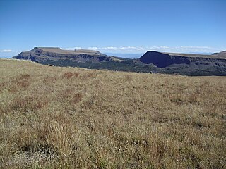
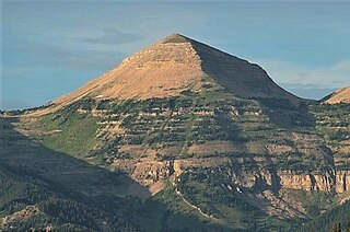
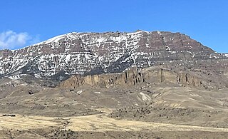
Flat Top Mountain is the highest summit of the Flat Tops in the Rocky Mountains of North America. The prominent 12,361-foot (3,768 m) peak is located in the Flat Tops Wilderness, 19.1 miles (30.7 km) south-southwest of the Town of Oak Creek, Colorado, United States, on the drainage divide between Routt National Forest and White River National Forest. The summit of Flat Top Mountain is the highest point in Garfield County, Colorado.
Crater Peak is the highest summit of Grand Mesa in the Rocky Mountains of North America. The prominent 11,333-foot (3,454 m) peak is located on the drainage divide separating Grand Mesa National Forest and Gunnison National Forest, 12.3 miles (19.8 km) north-northwest of the Town of Paonia in Delta County, Colorado, United States.
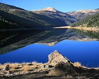
South River Peak, elevation 13,154 ft (4,009 m), is a summit in the San Juan Mountains of southwestern Colorado, United States. The mountain is in the Weminuche Wilderness of Rio Grande National Forest.

Old Baldy is a 9,156-foot (2,791-metre) double summit mountain located in Teton County of the U.S. state of Montana.
Hodges Peak is an 11,180-foot-elevation (3,408-meter) mountain summit in Sublette County, Wyoming, United States.

Hobbs Peak is an 11,663-foot-elevation (3,555-meter) mountain summit in Fremont County, Wyoming, United States.
Jim Mountain is a 10,430-foot-elevation (3,179-meter) summit in Park County, Wyoming, United States.

Sugarloaf Mountain is an 11,051-foot-elevation (3,368-meter) summit on the boundary that Salt Lake County shares with Utah County, in Utah, United States.


