Frannie, Wyoming | |
|---|---|
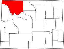
 Location of Frannie in Big Horn County, Wyoming. | |
 Frannie, Wyoming Location in the United States | |
| Coordinates: 44°58′16″N108°37′23″W / 44.97111°N 108.62306°W | |
| Country | |
| State | |
| Counties | Big Horn, Park |
| Area | |
• Total | 0.44 sq mi (1.15 km2) |
| • Land | 0.44 sq mi (1.15 km2) |
| • Water | 0 sq mi (0.00 km2) |
| Elevation | 4,223 ft (1,287 m) |
| Population | |
• Total | 145 |
• Estimate (2024) | 146 |
| • Density | 328.8/sq mi (126.96/km2) |
| Time zone | UTC-7 (Mountain (MST)) |
| • Summer (DST) | UTC-6 (MDT) |
| ZIP code | 82423 |
| Area code | 307 |
| FIPS code | 56-29825 [4] |
| GNIS feature ID | 2412654 [2] |
Frannie is a town in Big Horn and Park counties in the U.S. state of Wyoming. The population was 145 at the 2020 census.
Contents
- Geography
- Demographics
- 2010 census
- Media
- AM radio
- FM radio
- Television
- Education
- References
- External links
In 1894, Frannie's post office opened. Postmaster Morris, the town's first postmaster, had a daughter named Frannie, and the town was named after her.[ citation needed ] Until 1954, the legal status of Frannie was that of an unincorporated area taking in parts of Big Horn and Park Counties. In 1954, the town was incorporated. Under Wyoming law (WS 15-3-101), Frannie now has the status of an incorporated town having less than 4,000 people.
The town has a mayor-council government in which the governing body comprises the mayor and the council, together. The governing body has authority over the budget, other fiscal matters, and other major issues affecting the town. The current mayor is Garret Frescoln, whose current term expires in 2026. [5]
Frannie receives natural gas service from Frannie-Deaver Utilities, a privately held company in Frannie. Since 1955 the town has provided municipal (potable) water service. In 2000 the town installed a sanitary sewer system. The town contracts for its trash collection and fire-fighting services. Fire protection is provided by the Big Horn County Fire District #5 in Deaver, Wyoming. Police coverage is provided primarily by the Big Horn County Sheriff's Office.