Bozeman, Montana

Last updated

Bozeman
Bozeman MT areal.jpg
Aerial view of Bozeman
Bozeman Flag.png
Bozeman seal.png
Gallatin County Montana Incorporated and Unincorporated areas Bozeman Highlighted.svg
Location of Bozeman, Montana
USA Montana location map.svg
Red pog.svg
Bozeman
Location in the United States
Usa edcp location map.svg
Red pog.svg
Bozeman
Bozeman (the United States)
Coordinates: 45°40′40″N111°2′50″W / 45.67778°N 111.04722°W / 45.67778; -111.04722 [1]
CountryUnited States
State Montana
County Gallatin
FoundedAugust 9, 1864
Named for John Bozeman
Government
  Type City commission/City manager
  MayorTerry Cunningham [2]
Area
[3]
   City 20.91 sq mi (54.16 km2)
  Land20.86 sq mi (54.04 km2)
  Water0.05 sq mi (0.13 km2)
Elevation
[4]
4,817 ft (1,468 m)
Population
 (2020)
   City 53,293
  Estimate 
(2022) [5]
56,123
  Density2,554.43/sq mi (986.26/km2)
   Metro
[6]
118,960
   Demonym
Bozemanite
Time zone UTC−7 (MST)
  Summer (DST) UTC−6 (MDT)
ZIP codes
59715, 59717-59719, 59718, 59771-59772
Area code 406
FIPS code 30-08950
GNIS feature ID0769173 [4]
Website www.bozeman.net
[ citation needed ]

Bozeman ( /ˈbzmən/ BOHZ-mən) is a city and the county seat of Gallatin County, Montana, United States. Located in southwest Montana, the 2020 census put Bozeman's population at 53,293 making it the fourth-largest city in Montana. [7] It is the principal city of the Bozeman, Montana, Micropolitan Statistical Area, consisting of all of Gallatin County with a population of 118,960. [6] It is the fastest growing micropolitan statistical area in the United States in 2018, 2019 and 2020, [8] as well as the second-largest of all Montana's statistical areas. [9] [10]

Contents

History

Early history

For many years, indigenous people of the United States, including the Shoshone, Nez Perce, Blackfeet, Flathead, Crow Nation and Sioux traveled through the area, called the "Valley of the Flowers". [11] The Gallatin Valley in particular, in which Bozeman is located, was primarily within the territory of the Crow people.

19th century

John Bozeman JohnBozeman.JPG
John Bozeman

William Clark visited the area in July 1806 as he traveled east from Three Forks along the Gallatin River. The party camped 3 miles (4.8 km) east of what is now Bozeman, at the mouth of Kelly Canyon. The journal entries from Clark's party briefly describe the future city's location. [12]

John Bozeman

In 1863, John Bozeman, a pioneer and frontiersman from Pickens County, Georgia, along with a partner named John Jacob, opened the Bozeman Trail, a new northern trail off the Oregon Trail leading to the mining town of Virginia City through the Gallatin Valley and the future location of the city of Bozeman.

John Bozeman, with Daniel Rouse and William Beall, platted the town in August 1864, stating "standing right in the gate of the mountains ready to swallow up all tenderfeet that would reach the territory from the east, with their golden fleeces to be taken care of." [13] Red Cloud's War closed the Bozeman Trail in 1868, but the town's fertile land still attracted permanent settlers.

Nelson Story

In 1866, Nelson Story, a successful Virginia City, Montana, gold miner originally from Ohio, entered the cattle business. Story braved the hostile Bozeman Trail to successfully drive some 1,000 head of longhorn cattle into Paradise Valley just east of Bozeman. Eluding the U.S. Army, who tried to turn Story back to protect the drive from hostile Indians, Story's cattle formed one of the earliest significant herds in Montana's cattle industry. [14] Story established a sizable ranch in the Paradise Valley and holdings in the Gallatin Valley. He later donated land to the state for the establishment of Montana State University. [15]

Fort Ellis

Fort Ellis 45°39′16″N110°56′35″W / 45.65444°N 110.94306°W / 45.65444; -110.94306 (Fort Ellis) , el. 4,987 feet (1,520 m) [16] was established in 1867 by Captain R. S. LaMotte and two companies of the 2nd Cavalry, after the murder of John Bozeman near the mouth of Mission Creek on Yellowstone River 45°42′52″N110°23′20″W / 45.71444°N 110.38889°W / 45.71444; -110.38889 (Mission Creek) , [17] [18] and considerable political disturbance in the area led local settlers and miners to feel a need for added protection. The fort, named for Gettysburg casualty Colonel Augustus Van Horne Ellis, was decommissioned in 1886 and few remnants are left at the actual site, now occupied by the Fort Ellis Experimental Station of Montana State University. [19] In addition to Fort Ellis, a short-lived fort, Fort Elizabeth Meagher (also simply known as Fort Meagher), was established in 1867 by volunteer militiamen. This fort was located eight miles (13 km) east of town on Rocky Creek. 45°38′30″N110°55′05″W / 45.64167°N 110.91806°W / 45.64167; -110.91806 (Fort Elizabeth Meagher) , el. 5,249 feet (1,600 m) [20]

Other

In 1864, W.W. Alderson described Gallatin County as "one of the most beautiful and picturesque valleys the eye ever beheld, abounding in springs of clear water." Many tended to agree, and Bozeman quickly garnered the nickname of "The Egypt" of Montana. [21]

After incorporation, the first issue of the weekly Avant Courier newspaper, the precursor of today's Bozeman Chronicle , was published in Bozeman on September 13, 1871. [22]

Main Street in Bozeman, 1875 BozemanMainStreet1875.jpg
Main Street in Bozeman, 1875

Bozeman's main cemetery, Sunset Hills Cemetery, was given to the city in 1872 when the English lawyer and philanthropist William Henry Blackmore purchased the land after his wife Mary Blackmore died of pneumonia in Bozeman in July 1872. [24]

The first library in Bozeman was formed by the Young Men's Library Association in a room above a drugstore in 1872. It later moved to the mayor's office and was taken over by the city in 1890. [24] The first Grange meeting in Montana Territory was held in Bozeman in 1873. [25] The Northern Pacific Railway reached Bozeman from the east in 1883. [26] By 1900, Bozeman's population had reached 3,500.

In 1892, the United States Commission of Fish and Fisheries established a fish hatchery on Bridger Creek at the entrance to Bridger Canyon. The fourth oldest fish hatchery in the United States, the facility ceased to be primarily a hatchery in 1966 and became the U.S. Fish and Wildlife Service's Bozeman National Fish Hatchery, later a fish technology and fish health center. The Center receives approximately 5,000 visitors a year observing biologists working on diet testing, feed manufacturing technology, fish diseases, brood stock development and improvement of water quality. [27] [28]

Bozeman was home to early minor league baseball. In 1892, Bozeman fielded a team in the Class B level Montana State League. In 1909, the Bozeman Irrigators played as members of the Class D level Inter-Mountain League. Both leagues disbanded. [29]

Montana State University was established in 1893 as the state's land-grant college, then named the Agricultural College of the State of Montana. By the 1920s, the institution was known as Montana State College, and in 1965 it became Montana State University. [30]

20th century

Bozeman's first high school, the Gallatin Valley High School, was built on West Main Street in 1902. Later known as Willson School, named for notable Bozeman architect Fred Fielding Willson, son of Lester S. Willson, the building still stands today and functions as administrative offices for the Bozeman School District. [31]

In the early 20th century, over 17,000 acres (69 km2) of the Gallatin Valley were planted in edible peas harvested for both canning and seed. [32] By the 1920s, canneries in the Bozeman area were major producers of canned peas, and at one point Bozeman produced approximately 75% of all seed peas in the United States. [33] The area was once known as the "Sweet Pea capital of the nation" referencing the prolific edible pea crop. To promote the area and celebrate its prosperity, local business owners began a "Sweet Pea Carnival" that included a parade and queen contest. The annual event lasted from 1906 to 1916. Promoters used the inedible but fragrant and colorful sweet pea flower as an emblem of the celebration. In 1977 the "Sweet Pea" concept was revived as an arts festival rather than a harvest celebration, growing into a three-day event that is one of the largest festivals in Montana. [32]

The first federal building and Post Office was built in 1915. Many years later, while unused, it became a film location, along with downtown Bozeman, in A River Runs Through It (1992) by Robert Redford, starring Brad Pitt. It is now used by HRDC, a community organization.

The Bridger Bowl Ski Area 45°49′02″N110°53′48″W / 45.81722°N 110.89667°W / 45.81722; -110.89667 (Bridger Bowl Ski Area) [34] operates as a 501(c)(4) organization by the Bridger Bowl Association, and is located on the northeast face of the Bridger Mountains, utilizing state and federal land. [35] Bridger Bowl was Bozeman's first ski area and opened to the public in 1955. [36] In 1973 news anchorman Chet Huntley created the Big Sky Ski Resort off Gallatin Canyon 40 miles (64 km) south of Bozeman. The resort has grown considerably since 1973 into a residential community and major winter tourist destination. 45°16′51″N111°24′24″W / 45.28083°N 111.40667°W / 45.28083; -111.40667 (Big Sky Ski Resort) [37]

In 1986, the 60-acre (24 ha) site of the Idaho Pole Co. on Rouse Avenue was designated a Superfund site and placed on the National Priorities List. Idaho Pole treated wood products with creosote and pentachlorophenol on the site between 1945 and 1997. [38]

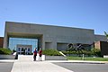
The Museum of the Rockies was created in 1957 as the gift from Butte physician Caroline McGill and is a part of Montana State University and an affiliate institution of the Smithsonian. It is Montana's premier natural and cultural history museum and houses permanent exhibits on dinosaurs, geology and Montana history, as well as a planetarium and a living history farm. Paleontologist Jack Horner was the museum's first curator of paleontology and brought national notice to the museum for his fossil discoveries in the 1980s. [39]

Bozeman receives a steady influx of new residents and visitors in part due to its plentiful recreational activities, such as fly fishing, hiking, whitewater kayaking, and mountain climbing. Additionally, Bozeman is a gateway community through which visitors pass on the way to Yellowstone National Park and its abundant wildlife and thermal features. The showcasing of spectacular scenery and the Western way of life the area received from films set nearby, such as A River Runs Through It and The Horse Whisperer , have also served to draw people to the area.

21st century

Main Street in Bozeman, 2011 BozemanMainStreetEast2011.jpg
Main Street in Bozeman, 2011

From a rank of sixth in the early [19]80s, Bozeman has grown to become the fourth largest city in Montana. [40] [41] The area attracts new residents due to quality of life, scenery, and nearby recreation. In August 2010, Bozeman was selected by Outside as the best place to live in the west for skiing. [42]

Growth in the Gallatin Valley prompted the Gallatin Airport Authority in 2009 to expand the Gallatin Field Airport with two new gates, an expanded passenger screening area, and a third baggage carousel. [43] Gallatin Field was subsequently renamed Bozeman Yellowstone International Airport. [44] Bozeman has been one of Montana's fastest growing cities from 1990 into the new millennium. With a growth rate of 3%, Bozeman could soon surpass Great Falls as Montana's third largest city by 2025.

Geography and climate

Bozeman is located at an elevation of 4,820 feet (1,470 m). [45] The Bridger Mountains are to the north-northeast, the Tobacco Root Mountains to the west-southwest, the Big Belt Mountains and Horseshoe Hills to the northwest, the Hyalite Peaks of the northern Gallatin Range to the south and the Spanish Peaks of the northern Madison Range to the south-southwest. Bozeman is east of the continental divide, and Interstate 90 passes through the city. It is 84 miles (135 km) east of Butte, 125 miles (201 km) west of Billings, and 93 miles (150 km) north of Yellowstone National Park.

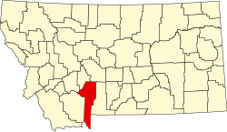
According to the United States Census Bureau, the city has a total area of 19.15 square miles (49.60 km2), of which 19.12 square miles (49.52 km2) is land and 0.03 square miles (0.08 km2) is water. [46]

Bozeman experiences a humid continental climate (Köppen: Dfb) as it is located in a more humid microclimate setting. Bozeman and the surrounding area receive significantly higher rainfall than much of the central and eastern parts of the state, up to 24 inches (610 mm) of precipitation annually vs. the 8 to 12 inches (200 to 300 mm) common throughout much of Montana east of the Continental Divide. [47] Combined with fertile soils, this means plant growth is relatively lush. This undoubtedly contributed to the Gallatin Valley's early nickname as the "Valley of the Flowers," as well as the establishment of Montana State University, the state's agricultural college, in the city. [48] Bozeman has cold, snowy winters and relatively warm summers, though due to high elevation, temperature changes from day to night can be significant. The highest temperature ever recorded in Bozeman was 105 °F (40.6 °C) on July 31, 1892. The lowest recorded temperature, −46 °F (−43.3 °C), occurred in 1957 and also 1983. [49]

Unlike most of the country, Bozeman has actually gotten cooler with the new 1991–2020 normals. Average highs dropped by 1.7 °F (0.72 °C), especially in spring and summer. It has also gotten wetter and snowier.[ citation needed ]

In 2019, Bozeman experienced unusually warm and dry temperatures during the month of December. Montana State University campus reported a daily average of 0.20 inches of precipitation for the month, some of the lowest numbers seen in over 120 years. Montana State University also recorded just over 3 inches of snowfall during December, the second lowest snowfall ever recorded. Additionally, maximum temperatures were 2 degrees warmer and lowest temperatures were 6 degrees above typical standards in previous Decembers. [50] December 2023 has also been unusually warm and dry, in line with the country as a whole.

Climate data for Bozeman, Montana (Montana State University), 1991–2020 normals, extremes 1892–present
MonthJanFebMarAprMayJunJulAugSepOctNovDecYear
Record high °F (°C)65
(18)
64
(18)
75
(24)
83
(28)
91
(33)
96
(36)
105
(41)
100
(38)
99
(37)
88
(31)
73
(23)
64
(18)
105
(41)
Mean maximum °F (°C)51.6
(10.9)
54.0
(12.2)
63.7
(17.6)
74.0
(23.3)
79.8
(26.6)
87.8
(31.0)
93.2
(34.0)
92.6
(33.7)
87.7
(30.9)
77.3
(25.2)
62.4
(16.9)
51.8
(11.0)
94.8
(34.9)
Mean daily maximum °F (°C)34.2
(1.2)
36.8
(2.7)
46.1
(7.8)
54.5
(12.5)
63.2
(17.3)
71.7
(22.1)
82.1
(27.8)
81.3
(27.4)
71.4
(21.9)
57.3
(14.1)
42.3
(5.7)
33.3
(0.7)
56.2
(13.4)
Daily mean °F (°C)24.6
(−4.1)
26.7
(−2.9)
35.0
(1.7)
42.5
(5.8)
51.0
(10.6)
58.6
(14.8)
66.9
(19.4)
65.6
(18.7)
56.9
(13.8)
44.9
(7.2)
32.3
(0.2)
23.9
(−4.5)
44.1
(6.7)
Mean daily minimum °F (°C)15.1
(−9.4)
16.6
(−8.6)
23.9
(−4.5)
30.5
(−0.8)
38.8
(3.8)
45.6
(7.6)
51.7
(10.9)
50.0
(10.0)
42.4
(5.8)
32.4
(0.2)
22.2
(−5.4)
14.5
(−9.7)
32.0
(0.0)
Mean minimum °F (°C)−10.3
(−23.5)
−5.9
(−21.1)
3.0
(−16.1)
16.1
(−8.8)
26.3
(−3.2)
33.2
(0.7)
41.6
(5.3)
38.9
(3.8)
29.5
(−1.4)
13.9
(−10.1)
−0.4
(−18.0)
−9.0
(−22.8)
−18.7
(−28.2)
Record low °F (°C)−45
(−43)
−43
(−42)
−29
(−34)
−10
(−23)
16
(−9)
26
(−3)
32
(0)
26
(−3)
12
(−11)
−10
(−23)
−26
(−32)
−46
(−43)
−46
(−43)
Average precipitation inches (mm)0.86
(22)
0.83
(21)
1.42
(36)
2.51
(64)
2.93
(74)
3.27
(83)
1.33
(34)
1.32
(34)
1.44
(37)
1.84
(47)
1.25
(32)
1.03
(26)
20.03
(510)
Average snowfall inches (cm)12.7
(32)
13.0
(33)
13.1
(33)
12.9
(33)
3.6
(9.1)
0.8
(2.0)
0.0
(0.0)
0.1
(0.25)
0.4
(1.0)
6.0
(15)
12.5
(32)
16.2
(41)
91.3
(231.35)
Average precipitation days (≥ 0.01 in.)10.79.511.813.715.415.310.110.19.011.010.211.0137.8
Average snowy days (≥ 0.1 in.)9.28.48.46.71.50.20.00.00.23.07.19.454.1
Source 1: NOAA [51]
Source 2: National Weather Service [49]

Demographics

Historical population
CensusPop.Note
1870 168
1880 894432.1%
1890 2,143139.7%
1900 3,41959.5%
1910 5,18751.7%
1920 6,18319.2%
1930 6,85510.9%
1940 8,66526.4%
1950 11,32530.7%
1960 13,36118.0%
1970 18,67039.7%
1980 21,64515.9%
1990 22,6604.7%
2000 27,50921.4%
2010 37,28035.5%
2020 53,29343.0%
2022 (est.)56,123 [5] 5.3%
source: [41] [52]
U.S. Decennial Census [53]

2020 census

As of the census of 2020, [54] there were 53,293 people and 22,041 households in the city. The population density of the city was 2,587.2 inhabitants per square mile (998.9/km2), a substantial increase since the 2010 census.

The racial makeup of the city was 88.6% White, 4.8% Hispanic or Latino, 2.4% Asian, 1.1% American Indian, and 0.6% Black. 5.6% of residents identified two or more races.

Of the 22,041 households in the city, each household has on average 2.24 people.

13.2% of Bozeman's population is under 18 years of age, and 10.7% of the population is over 65 years of age. 97.8% of the city's population, at or over the age of 25, has graduated high school or higher, and 64.2% of the population have attained at least a bachelor's degree. The gender makeup of the city is 53% male and 47% female.

The median income household income of the city was $74,113. The median per-capita income was $45,037. 14.7% of the population fell below the poverty line.

2010 census

As of the census of 2010, [55] there were 37,280 people, 15,775 households, and 6,900 families residing in the city. The population density was 1,949.8 inhabitants per square mile (752.8/km2). There were 17,464 housing units at an average density of 913.4 per square mile (352.7/km2). The racial makeup of the city was 93.6% White, 0.5% African American, 1.1% Native American, 1.9% Asian, 0.1% Pacific Islander, 0.7% from other races, and 2.1% from two or more races. Hispanic or Latino of any race were 2.9% of the population.

There were 15,775 households, of which 21.3% had children under the age of 18 living with them, 33.1% were married couples living together, 7.0% had a female householder with no husband present, 3.6% had a male householder with no wife present, and 56.3% were non-families. 33.5% of all households were made up of individuals, and 7.6% had someone living alone who was 65 years of age or older. The average household size was 2.17 and the average family size was 2.80.

The median age in the city was 27.2 years. 15.7% of residents were under the age of 18; 28.2% were between the ages of 18 and 24; 31.4% were from 25 to 44; 16.7% were from 45 to 64; and 8.1% were 65 years of age or older. The gender makeup of the city was 52.6% male and 47.4% female.

2000 census

As of the census of 2000, there were 27,509 people, 10,877 households, and 5,014 families residing in the city. The population density was 2,183.8 inhabitants per square mile (843.2/km2). There were 11,577 housing units at an average density of 919.0 per square mile (354.8/km2). The racial makeup of the city was 94.73% White, 0.33% African American, 1.24% Native American, 1.62% Asian, 0.07% Pacific Islander, 0.54% from other races, and 1.47% from two or more races. Hispanic or Latino of any race were 1.59% of the population.

There were 10,877 households, out of which 22.3% had children under the age of 18 living with them, 36.0% were married couples living together, 7.3% had a female householder with no husband present, and 53.9% were non-families. 30.4% of all households were made up of individuals, and 6.7% had someone living alone who was 65 years of age or older. The average household size was 2.26 and the average family size was 2.85.

In the city, the population was spread out, with 16.0% under the age of 18, 33.0% from 18 to 24, 28.6% from 25 to 44, 14.4% from 45 to 64, and 8.0% who were 65 years of age or older. The median age was 25 years. For every 100 females, there were 111.2 males. For every 100 females age 18 and over, there were 112.6 males.

The median income for a household in the city was $32,156, and the median income for a family was $41,723. Males had a median income of $28,794 versus $20,743 for females. The per capita income for the city was $16,104. About 9.2% of families and 20.2% of the population were below the poverty line, including 14.8% of those under age 18 and 4.4% of those age 65 or over.

Government

First City Hall (1965) BozemanCityHallOperaHouse1965.jpg
First City Hall (1965)

Bozeman became an incorporated Montana city in April 1883 and adopted a city council form of government. [56] Currently, the City of Bozeman uses a city commission/city manager form of government which the citizens adopted on January 1, 1922 [57] with an elected Municipal Judge. The City Commission is chaired by an elected Mayor. These three entities form the legislative, executive and judicial branches of government. [58]

Departments

Education

Public

Bozeman Public Schools has two components: Bozeman Elementary School District and Bozeman High School District. [63] Belgrade Public Schools has two components: Belgrade Elementary School District and Belgrade High School District. [64] Almost all of Bozeman is in Bozeman Elementary School District and Bozeman High School District. A small piece extends into Belgrade Elementary School District and Belgrade High School District. [65]

Private

Post-secondary

Media

Newspapers and Magazines
AM Radio

[71]

FM Radio

[71]

Defunct
Television

[72]

The Bozeman area has served as a filming site for a number of films, including The Wildest Dream , [73] A River Runs Through It , A Plumm Summer and Amazing Grace and Chuck . [74] Aside from being shot in Bozeman, A Plumm Summer featured two local actors, Ben Trotter and John Hosking, as well as many local extras. Films shot in the nearby Paradise Valley south of Livingston and Big Timber areas, such as The Horse Whisperer and Rancho Deluxe also headquartered out of Bozeman due to its status as the largest community in the local trade area. [75] It was also the setting for The Ninth Nugget, a children's book by Ron Roy that is a part of the A-Z Mysteries series. The 2022 Paramount+ Western drama television series 1923 features scenes of early 1920's Bozeman (filmed in Uptown Butte). [76] [77]

Bozeman also features in the film Star Trek: First Contact as the launch site of the first warp ship and location of first contact.

In popular music, the members of the noise rock group Steel Pole Bath Tub are originally from Bozeman, and wrote a song titled "Bozeman" on their third album, The Miracle of Sound in Motion. The 1980s hard rock band Vixen also featured a former Bozeman resident, Janet Gardner, as lead singer. [78]

Literary references include the Bozeman area and real-life Bozeman artists Bob and Gennie DeWeese [79] as a key setting in Robert Pirsig's novel Zen and the Art of Motorcycle Maintenance; the narrator was a professor teaching English composition while developing his philosophical ideas, reflecting the author's own history; Pirsig taught at Montana State. [80] John Steinbeck passed through Bozeman via the former U.S. Route 10 as well as venturing into Yellowstone National Park, and recounted his impressions of Montana in Travels with Charley. [81]

In season 3, episode 13 of The Big Bang Theory, The Bozeman Reaction, Sheldon attempts to move to Bozeman. After being robbed at the bus station, he changes his mind and immediately purchases a ticket back to Pasadena.

National media coverage

On March 5, 2009, the city of Bozeman made national news when an early morning explosion destroyed three buildings in the historic downtown area. Several other buildings were damaged and one person was killed. The blast occurred about 8:15 a.m. and prompted the evacuation of a two-block area. Investigators found the cause of the explosion to be a leak in a gas line that led to a business that was destroyed in the blast. The gas line was more than 70 years old. [82] Business owners and local residents later filed major lawsuits against Northwestern Energy, the company in charge of the gas line. The suits claimed negligence for the gas leak that led to the blast. As of December 2010, most of the lawsuits against the energy company were settled. [83]

In June of the same year, Bozeman was once again in the national news when it was reported that the city government was requesting job applicants provide their user names and passwords to social networking sites. A passage from the city's application form said, "Please list any and all current personal or business Web sites, web pages or memberships on any Internet-based chat rooms, social clubs or forums, to include, but not limited to: Facebook, Google, Yahoo, YouTube.com, MySpace, etc." [84]

After the initial news story aired, the Bozeman City Commissioner received e-mails and phone calls expressing indignation about the practice from across the nation. Bozeman residents were astonished and alarmed by the request. The local government believed the practice had been going on as part of a background search for about three years. [85] In response to the negative backlash from the news media and local citizens, the city rescinded the policy on June 20, 2009, just two days after the news broke. [86]

In March 2021 an episode of The Indicator, a spin-off podcast from NPR's Planet Money , covered a property boom in Bozeman due to remote working. The show states that the median home price in Bozeman is about 75% above the national median, while the median household income of about $50,000 is 25% below the national median. It concludes, "Bottom line, if you are a Bozeman local working a job in Bozeman, buying a house is becoming financially out of reach. The math doesn't work." [87]

Transportation

Bozeman straddles east-west Interstate 90 and is approximately 85 miles (137 km) east of north–south Interstate 15 in Butte, Montana. U.S. Highway 191 runs south from Bozeman to Big Sky and West Yellowstone. Montana Highway 86 runs north alongside the Bridger Range to U.S. 89. Montana Highway 84 runs west to U.S. 287 in Norris.

Freight rail service is provided by Montana Rail Link, a privately held Class II railroad that connects Spokane, Washington, with Huntley, Montana. The city was last served by passenger rail in 1979 by the North Coast Hiawatha at Bozeman Depot.

Bozeman has operated a free public bus system called Streamline since 2006. [88] Streamline operates four routes, covering the university, Bozeman-Deaconess Hospital, Gallatin Valley Mall, 7th Avenue and 19th Avenue shopping areas, and downtown. The system is funded by a variety of federal, state, and local sources. The Gallatin Big Sky Transportation District has operated the Skyline bus service between Bozeman and Big Sky since December 2006. [89]

Intercity bus service to the city is provided by Jefferson Lines. [90]

One of the three major regional airports serving southwest Montana is Bozeman Yellowstone International Airport west of Bozeman on the outskirts of Belgrade, Montana. It primarily serves travelers to Bozeman, Big Sky, West Yellowstone and Yellowstone National Park. A smaller commercial airport is located in West Yellowstone, 90 mi (140 km) south of Bozeman.

Notable people

The following individuals are either notable current or former residents of Bozeman (R), were born or raised in Bozeman in their early years (B), or otherwise have a significant connection to the history of the Bozeman area (C).

Sports personalities
Military and pioneers
Arts, culture and entertainment
Science and academia
Politics, government and business
Philanthropy
Religion
Architecture

Business and industry

Bozeman's top employers include Bozeman Health, Montana State University, Simms Fishing Products and Mystery Ranch [108] as well as at least two dozen high-tech companies engaged in research or production of lasers and other optical equipment, [109] over a dozen bio-tech companies, and several large software companies. [110] Nationally known companies based in Bozeman include ILX Lightwave (an MKS/Newport company), Quantel USA, RightNow Technologies, Snowflake Inc., Schedulicity, Workiva, onX [111] and Simms Fishing Products. Notable non-profit organizations based in Bozeman include the Greater Yellowstone Coalition, Human Resource Development Council (HRDC) and Eagle Mount.

Points of interest

Museum of the Rockies Museum of the Rockies.JPG
Museum of the Rockies
The Rialto The Rialto at Night.jpg
The Rialto

See also

Related Research Articles

<span class="mw-page-title-main">Montana</span> U.S. state

Montana is a landlocked state in the Mountain West subregion of the Western United States. It borders Idaho to the west, North Dakota to the east, South Dakota to the southeast, Wyoming to the south, and the Canadian provinces of Alberta, British Columbia, and Saskatchewan to the north. It is the fourth-largest state by area, the eighth-least populous state, and the third-least densely populated state. Its capital is Helena, while the most populous city is Billings. The western half of the state contains numerous mountain ranges, while the eastern half is characterized by western prairie terrain and badlands, with smaller mountain ranges found throughout the state.

<span class="mw-page-title-main">Yellowstone County, Montana</span> County in Montana, United States

Yellowstone County is the most populous county in the U.S. state of Montana. As of the 2020 census, the population was 164,731. Its county seat is Billings, the state's most populous city. Like the nearby park, Yellowstone County is named after the Yellowstone River which roughly bisects the county, flowing southwest to northeast. The river, in turn, was named for the yellow sandstone cliffs in what is now Yellowstone County.

<span class="mw-page-title-main">Park County, Montana</span> County in Montana, United States

Park County is a county in the U.S. state of Montana. At the 2020 census, the population was 17,191. Its county seat is Livingston. A small part of Yellowstone National Park is in the southern part of the county.

<span class="mw-page-title-main">Gallatin County, Montana</span> County in Montana, United States

Gallatin County is located in the U.S. state of Montana. With its county seat in Bozeman, it is the second-most populous county in Montana, with a population of 118,960 in the 2020 Census.

<span class="mw-page-title-main">Belgrade, Montana</span> City in Montana, United States

Belgrade is a city in Gallatin County, Montana, United States. The population was 10,460 at the 2020 census. Belgrade is part of the Bozeman, MT Micropolitan Statistical Area. It is the most populous city in Montana that is not a county seat.

<span class="mw-page-title-main">Four Corners, Montana</span> Census-designated place in Montana, United States

Four Corners is a census-designated place (CDP) in Gallatin County, Montana, United States. The population was 5,901 at the 2020 census, up from 3,146 in 2010. It is part of the Bozeman, MT Micropolitan Statistical Area.

<span class="mw-page-title-main">Billings, Montana</span> Largest city in Montana, U.S.

Billings is the most populous city in the U.S. state of Montana, with a population of 117,116 as of the 2020 census. Located in the south-central portion of the state, it is the seat of Yellowstone County and the principal city of the Billings Metropolitan Area, which had a population of 184,167 in the 2020 census. With one of the largest trade areas in the United States, Billings is the trade and distribution center for much of Montana east of the Continental Divide. Billings is also the largest retail destination for much of the same area. The Billings Chamber of Commerce claims the area of commerce covers more than 125,000 square miles (320,000 km2). In 2009, it was estimated to serve over 500,000 people.

<span class="mw-page-title-main">Big Sky, Montana</span> Census-designated place in Montana, United States

Big Sky is an unincorporated census-designated place (CDP) in Gallatin and Madison counties in southwestern Montana, United States. As of the 2010 census it had a population of 2,308. It is 45 miles (72 km) southwest of Bozeman. This unincorporated community straddles both counties, is not considered a town, and does not have a town government. The primary industry of the area is tourism.

<span class="mw-page-title-main">Yellowstone River</span> River in the western United States

The Yellowstone River is a tributary of the Missouri River, approximately 692 miles (1,114 km) long, in the Western United States. Considered the principal tributary of upper Missouri, via its own tributaries it drains an area with headwaters across the mountains and high plains of southern Montana and northern Wyoming, and stretching east from the Rocky Mountains in the vicinity of Yellowstone National Park. It flows northeast to its confluence with the Missouri River on the North Dakota side of the border, about 25 miles west of present-day Williston.

<span class="mw-page-title-main">Gallatin River</span> River in Wyoming and Montana, United States

The Gallatin River is a tributary of the Missouri River, approximately 120 mi (193 km) long, in the U.S. states of Wyoming and Montana. It is one of three rivers, along with the Jefferson and Madison, that converge near Three Forks, Montana, to form the Missouri.

<span class="mw-page-title-main">Gallatin National Forest</span> United States National Forest in Montana

The Gallatin National Forest is a United States National Forest located in South-West Montana. Most of the Custer-Gallatin goes along the state's southern border, with some of it a part of North-West Wyoming.

<span class="mw-page-title-main">Fort Ellis</span>

Fort Ellis was a United States Army fort established August 27, 1867, east of present-day Bozeman, Montana. Troops from the fort participated in many major campaigns of the Indian Wars. The fort was closed on August 2, 1886.

<span class="mw-page-title-main">Geography of Montana</span> Overview of the Geography of Montana

Montana is one of the eight Mountain States, located in the north of the region known as the Western United States. It borders North Dakota and South Dakota to the east. Wyoming is to the south, Idaho is to the west and southwest, and the Canadian provinces of British Columbia, Alberta, and Saskatchewan are to the north, making it the only state to border three Canadian provinces.

<span class="mw-page-title-main">Amsterdam, Montana</span> CDP in Montana, United States

Amsterdam is a census-designated place (CDP) in Gallatin County, Montana, United States. The population was 206 at the 2020 census. It is part of the Bozeman, MT Micropolitan Statistical Area. It was formerly part of the Amsterdam-Churchill CDP.

<span class="mw-page-title-main">U.S. Route 191 in Montana</span> U.S. Highway in Montana

U.S. Highway 191 (US 191) is a north-south United States Numbered Highway in the state of Montana. It extends approximately 442.2 miles (711.7 km) from Yellowstone National Park north to the Canadian border.

<span class="mw-page-title-main">Nelson Story</span>

Nelson Story Sr. was a pioneer Montana entrepreneur, cattle rancher, miner and vigilante, who was a notable resident of Bozeman, Montana. He was best known for his 1866 cattle drive from Texas with approximately 1000 head of Texas Longhorns to Montana along the Bozeman Trail—the first major cattle drive from Texas into Montana. His business ventures in Bozeman were so successful that he became the town's first millionaire. In 1893, he played a prominent role in the establishment of the Agricultural College of the State of Montana by donating land and facilities. He built the first Story Mansion on Main Street in Bozeman in 1880 and later built today's Story Mansion at the corner of Willson and College for his son, T. Byron Story in 1910. In his later years, he became a prominent real estate developer in Los Angeles, California.

<span class="mw-page-title-main">Regional designations of Montana</span> Overview of the Regional designations of Montana

The Regional designations of Montana vary widely within the U.S state of Montana. The state is a large geographical area that is split by the Continental Divide, resulting in watersheds draining into the Pacific Ocean, Gulf of Mexico and Hudson's Bay. The state is approximately 545 miles (877 km) east to west along the Canada–United States border and 320 miles (510 km) north to south. The fourth largest state in land area, it has been divided up in official and unofficial ways into a variety of regions. Additionally, Montana is part of a number of larger federal government administrative regions.

This is a timeline of pre-statehood Montana history comprising substantial events in the history of the area that would become the State of Montana prior to November 8, 1889. This area existed as Montana Territory from May 28, 1864, until November 8, 1889, when it was admitted to the Union as the State of Montana.

<span class="mw-page-title-main">Transportation in Montana</span>

Transportation in Montana comprises many different forms of travel. Montana shares a long border with Canada, hence international crossings are prevalent in the northern section of the state; there are 13 road crossings and one rail crossing.

<span class="mw-page-title-main">Churchill, Montana</span> CDP in Montana, United States

Churchill is a census-designated place (CDP) in Gallatin County, Montana, United States. The population was 1,030 at the 2020 census. It is part of the Bozeman, MT Micropolitan Statistical Area. It was formerly part of the Amsterdam-Churchill CDP.

References

  1. "Bozeman, Montana". Geographic Names Information System . United States Geological Survey, United States Department of the Interior.
  2. Shelly, Nora (January 10, 2024). "New year, new mayor: Cunningham, Morrison and Madgic sworn into office". Bozeman Daily Chronicle.
  3. "ArcGIS REST Services Directory". United States Census Bureau. Retrieved September 5, 2022.
  4. 1 2 U.S. Geological Survey Geographic Names Information System: Bozeman, Montana
  5. 1 2 "City and Town Population Totals: 2020-2022". United States Census Bureau. June 13, 2023. Retrieved July 19, 2023.
  6. 1 2 "Metropolitan and Micropolitan Statistical Areas". The United States Census Bureau. Retrieved November 5, 2021.
  7. "U.S. Census website". United States Census Bureau . Retrieved November 2, 2021.
  8. "Economic Strength Rankings - Micropolitan Areas". policom.com. Archived from the original on November 2, 2017. Retrieved January 24, 2021.
  9. "Archived copy". Archived from the original on April 1, 2013. Retrieved June 5, 2013.{{cite web}}: CS1 maint: archived copy as title (link)
  10. "CENSUS 2010 - STATE and COUNTY POPULATION SUMMARY" (PDF). Bloximages.chicago2.vip.townnews.com. Archived (PDF) from the original on March 28, 2014. Retrieved March 4, 2022.
  11. Smith, Phyllis (1996). Bozeman and the Gallatin Valley. A History. Helena, MT: Falcon Press Publishers. pp. 1–2. ISBN   1-56044-540-8.
  12. "Lewis and Clark, Bozeman and the Museum of the Rockies". Travel Montana. Archived from the original on December 31, 2010. Retrieved January 8, 2011.
  13. Freeman, Cortlandt L. (1988). The Growing Up Years The First 100 Years of Bozeman as an Incorporated City from 1883 to 1983. Bozeman, MT: Montana Centennial Commission Gallatin County Historical Society. pp. 62–65.
  14. Kennedy, Michael S. (1964). "Tall in the Saddle-First Trail Drive to Montana Territory". Cowboys and Cattlemen-A Roundup from Montana The Magazine of Western History. New York: Hastings House Publishing. pp. 103–111.
  15. Wellman, Paul I. (1939). "IX-Men Who Didn't Care". The Trampling Herd. Philadelphia, PA: J. B. Lippincott & Co. pp. 94–106.
  16. "Fort Ellis". Geographic Names Information System . United States Geological Survey, United States Department of the Interior.
  17. Smith, Phyllis (1996). Bozeman and the Gallatin Valley. A History. Helena, MT: Falcon Press Publishers. pp. 102–103. ISBN   1-56044-540-8.
  18. "Mission Creek". Geographic Names Information System . United States Geological Survey, United States Department of the Interior.
  19. Siebel, Dennis (1996). Fort Ellis, Montana Territory (1867–1886) – The Fort That Guarded Bozeman. Bozeman, Montana: Gallatin County Historical Association. p. 44.
  20. "Fort Elizabeth Meagher". Geographic Names Information System . United States Geological Survey, United States Department of the Interior.
  21. "Bozeman Montana History". Taunya Fagan. October 9, 2021. Retrieved February 28, 2022.
  22. Putnam, James Bruce (1988). The Evolution of a Frontier Town: Bozeman, Montana and Its Search For Economic Stability 1864–1887. Bozeman, MT: Montana Centennial Commission Gallatin County Historical Society. p. 28.
  23. Thomas B. Brook. "Thomas Brook Photographs Collection 771 – Montana State University Libraries" . Retrieved January 20, 2011.
  24. 1 2 Freeman, Cortlandt L. (1988). The Growing Up Years The First 100 Years of Bozeman as an Incorporated City from 1883 to 1983. Bozeman, MT: Montana Centennial Commission Gallatin County Historical Society. p. 67.
  25. Smith, Phyllis (1996). Bozeman and the Gallatin Valley. A History. Helena, MT: Falcon Press Publishers. p. 129. ISBN   1-56044-540-8.
  26. Mulvaney, Tom (2009). Bozeman and the Gallatin Valley. Chicago, IL: Arcadia Publishing. p. 70. ISBN   978-0-7385-7084-6.
  27. 1 2 "Fish Technology Center-Outreach". U.S. Fish and Wildlife Service. Retrieved January 18, 2011.
  28. 1 2 3 "U.S. Fish and Wildlife Service's Fish Technology Center". Montana River Action. Archived from the original on November 25, 2010. Retrieved January 11, 2011.
  29. "1909 Inter-Mountain League". Baseball-Reference.com.
  30. "Montana State University History". Montana State History. Archived from the original on June 5, 2011. Retrieved January 9, 2011.
  31. Jenks, Jim (2007). A Guide to Historic Bozeman. Helena, MT: Montana Historical Society Press. pp. 26–33. ISBN   978-0-9721522-3-5.
  32. 1 2 Hurlbut, Brian; Seabring Davis (2009). Insiders' Guide to Yellowstone and Grand Teton. Globe Pequot. pp. 179–181. ISBN   978-0-7627-5041-2.
  33. Jenks, Jim (2007). A Guide to Historic Bozeman. Helena, MT: Montana Historical Society Press. pp. 36–37. ISBN   978-0-9721522-3-5.
  34. "Bridger Bowl Ski Area". Geographic Names Information System . United States Geological Survey, United States Department of the Interior.
  35. "Bridger Bowl Association". Archived from the original on December 29, 2010. Retrieved January 23, 2011.
  36. Jenks, Jim (2007). A Guide to Historic Bozeman. Helena, MT: Montana Historical Society Press. p. 150. ISBN   978-0-9721522-3-5.
  37. "Big Sky Ski Resort". Geographic Names Information System . United States Geological Survey, United States Department of the Interior.
  38. "Superfund Program-Idaho Pole Co". Environmental Protection Agency. Archived from the original on May 14, 2010. Retrieved February 15, 2011.
  39. "Museum of the Rockies to become Smithsonian affiliate". Helena Independent Record. Retrieved January 23, 2010.
  40. "Archived copy" (PDF). Archived from the original (PDF) on April 26, 2012. Retrieved November 25, 2011.{{cite web}}: CS1 maint: archived copy as title (link)
  41. 1 2 "Bozeman (city) QuickFacts from the US Census Bureau". Quickfacts.census.gov. Archived from the original on June 18, 2012. Retrieved June 10, 2012.
  42. "Best Towns 2010". Outside Magazine. Archived from the original on January 14, 2011. Retrieved January 23, 2011.
  43. "Airport Expansion Ramping Up-October 28, 2009". Bozeman Chronicle. Retrieved January 20, 2011.
  44. Bacaj, Jason (December 9, 2011). "Gallatin Airport Authority approves airport name change". Bozeman Daily Chronicle. Retrieved January 30, 2012.
  45. "Bozeman, Montana". Geographic Names Information System . United States Geological Survey, United States Department of the Interior.
  46. "US Gazetteer files 2010". United States Census Bureau. Archived from the original on January 12, 2012. Retrieved December 18, 2012.
  47. "Bozeman Series". National Cooperative Soil Survey. Archived from the original on October 14, 2010. Retrieved January 10, 2011.
  48. "Montana State University History". Montana State University. Archived from the original on June 5, 2011. Retrieved January 10, 2011.
  49. 1 2 "NOAA Online Weather Data". National Weather Service. Retrieved August 19, 2022.
  50. Ainsworth, Greg. "Warm, dry December caps unusually cool, wet 2019". Bozeman Daily Chronicle.
  51. "U.S. Climate Normals Quick Access". National Oceanic and Atmospheric Administration. Retrieved August 19, 2022.
  52. Moffatt, Riley. Population History of Western U.S. Cities & Towns, 1850–1990. Lanham: Scarecrow, 1996, 128.
  53. United States Census Bureau. "Census of Population and Housing" . Retrieved May 31, 2014.
  54. "U.S. Census website". United States Census Bureau . Retrieved January 3, 2024.
  55. "U.S. Census website". United States Census Bureau . Retrieved December 18, 2012.
  56. Freeman, Cortlandt L. (1988). The Growing Up Years The First 100 Years of Bozeman as an Incorporated City from 1883 to 1983. Bozeman, MT: Montana Centennial Commission Gallatin County Historical Society. pp. 68–69.
  57. Freeman, Cortlandt L. (1988). The Growing Up Years The First 100 Years of Bozeman as an Incorporated City from 1883 to 1983. Bozeman, MT: Montana Centennial Commission Gallatin County Historical Society. p. 77.
  58. "Bozeman City Government". City of Bozeman. Archived from the original on November 27, 2010. Retrieved January 10, 2011.
  59. "City of Bozeman Finance Department". City of Bozeman. Archived from the original on December 14, 2010. Retrieved January 16, 2011.
  60. "Bozeman Fire Department". City of Bozeman. Archived from the original on December 18, 2010. Retrieved January 9, 2011.
  61. "City of Bozeman Parks, Recreation and Cemetery Department". Archived from the original on November 21, 2010. Retrieved January 16, 2011.
  62. "City of Bozeman Public Services Department". City of Bozeman. Archived from the original on December 27, 2010. Retrieved January 10, 2011.
  63. "Directory of Montana Schools". Montana Office of Public Instruction. March 13, 2024. pp. 100–101/319. Retrieved March 13, 2024.
  64. "Directory of Montana Schools". Montana Office of Public Instruction. March 13, 2024. pp. 98–99/319. Retrieved March 13, 2024.
  65. "2020 CENSUS - SCHOOL DISTRICT REFERENCE MAP: Gallatin County, MT" (PDF). U.S. Census Bureau. p. 1 (PDF p. 2/3). Retrieved March 13, 2024. - Text list
  66. "Bozeman School District-Our Schools". Archived from the original on July 25, 2011. Retrieved January 12, 2011.
  67. "Bozeman School District-High Schools". Archived from the original on July 25, 2011. Retrieved January 12, 2011.
  68. "About Bozeman Avant Courier". Library of Congress. Retrieved January 7, 2011.
  69. "About The Republican Courier". Library of Congress. Retrieved January 7, 2011.
  70. "About The Bozeman Courier". Library of Congress. Retrieved January 7, 2011.
  71. 1 2 "Radio Stations near the city of Bozeman MT". OnTheRadio.net. Retrieved January 7, 2011.
  72. "Butte-Bozeman TV Stations". Station Index-The Broadcasting Website. Retrieved January 7, 2011.
  73. "The Wildest Dream". MoviesPlanet. Archived from the original on March 24, 2012. Retrieved January 9, 2011.
  74. "Movies made in Montana". MontanaKids.com. Retrieved January 2, 2011.
  75. "Feature films shot in Montana". Film Montana Office. Archived from the original on December 20, 2010. Retrieved January 9, 2011.
  76. Whiting, Amanda (January 1, 2023). "1923 Recap: Everybody Gets Some". Vulture.
  77. Margolis, Joshua (November 10, 2022). "'1923' set for outdoor filming in Uptown Butte". KECI.
  78. "Big Sky Conference" . Retrieved January 10, 2011.
  79. "Henry Gurr presentation". Archived from the original on July 27, 2011. Retrieved January 10, 2011.
  80. "Robert M. Pirsig´s Zen and the Art of Motorcycle Maintenance and the term ´Chautauqua´". Archived from the original on June 28, 2011. Retrieved January 10, 2011.
  81. "Travels Without Charley – Montana: Love at first sight". Pittsburgh Post-Gazette. October 24, 2010. Retrieved January 10, 2011.
  82. Robbins, Jim (March 17, 2009). "Fatal Blast Wounds a City to Its Core". The New York Times. Retrieved February 26, 2013.
  83. Boyce, Dan (December 9, 2010). "Most lawsuits against NorthWestern Energy for downtown Bozeman explosion settled". KTVQ. Archived from the original on August 19, 2014. Retrieved February 26, 2013.
  84. Gouras, Matt (June 19, 2009). "Montana City Asks Job Applicants For Facebook passwords". HuffPost. Retrieved February 26, 2013.
  85. Heussner, Kimae (June 19, 2009). "Montana City Asks Jobb Applicants for Online Passwords". ABC News. Retrieved February 26, 2013.
  86. Weinstein, Natalie (June 20, 2009). "Bozeman to job seekers: We won't seek passwords". CNET. Retrieved February 26, 2013.
  87. "Bozeman Housing Market Gentrified by Remote Workers". NPR. Retrieved April 4, 2021.
  88. "Streamline" . Retrieved January 10, 2011.
  89. "Skyline bus service schedule between Bozeman and Big Sky announced". Montana State University News Service. Archived from the original on March 4, 2012. Retrieved January 20, 2011.
  90. "Montana Bus Stops" . Retrieved July 20, 2023.
  91. Lamothe, Dan (March 27, 2019). "Soldier's posthumous Medal of Honor highlights the Pentagon's struggles to fully recognize valor in combat". Houston Chronicle. Retrieved September 14, 2019. On Wednesday, Atkins, of Bozeman, Montana, posthumously became the fifth U.S. service member to receive the nation's highest award for combat valor, the Medal of Honor, for actions during the Iraq War.
  92. Stout, Tom (1921). History of Montana. Vol. I. New York: American Historical Society. p. 322.
  93. "Gary Cooper-Cool Montana Stories". Montanakids.com. Retrieved January 9, 2011.
  94. "Author Ben Mikaelsen". Archived from the original on February 2, 2015.
  95. "Photo Archives – Museum of the Rockies". Archived from the original on September 30, 2011.
  96. Hanna, Warren L. (1986). "Life with Apaki" . The Life and Times of James Willard Schultz (Apikuni). Norman, Oklahoma: University of Oklahoma Press. pp.  233–248. ISBN   0-8061-1985-3.
  97. "Collection 10 – James Willard Schultz Papers, 1867–1969". MSU Libraries. Retrieved January 23, 2011.
  98. 1 2 "Native Stars: The Spears Brothers Rising Stars Call Bozeman Home" The Montana Pioneer, "Native Stars - the Spears Brothers". Archived from the original on April 28, 2014. Retrieved November 3, 2014. February 2014.
  99. "Sarah Vowell". transom.org. Archived from the original on July 20, 2011. Retrieved January 9, 2011.
  100. "Sarah Vowell-Author of The Partly Cloudy Patriot talks with Robert Birnbaum". identitytheory.com. October 7, 2002. Retrieved January 9, 2011.
  101. "MSU PHYSICS FACULTY – LOREN ACTON". montana.edu.
  102. "Biographies". The Smith Alumnae Quarterly. 30–31. Smith College: 444. 1938. Retrieved March 28, 2014.
  103. "List of members of the American Phytopathological Society". Phytopathology. 3: 330. 1913.
  104. "Ex-lawmaker Dorothy Bradley named to NorthWestern boardPosted on April 22". missoulian.com. Associated Press.
  105. "Raymond Strother: Political Strategist/Author (1940)". Museum of the Gulf Coast. Archived from the original on November 3, 2013. Retrieved October 10, 2013.
  106. "Turner Enterprises, Ranches FAQ". Archived from the original on April 30, 2009.
  107. ""Ted Turner grand marshal of Livingston parade"". Greatfallstribune.com. June 26, 2009. Retrieved March 4, 2022.
  108. "Top Employers in Bozeman, Montana". Bozeman Real Estate Group. Retrieved May 12, 2022.
  109. "Montana Optics-Related Companies". optics.montana.edu.
  110. "High-tech clusters spur growth in western Montana". Federal Reserve Bank of Minneapolis. Retrieved July 11, 2010.
  111. "Tech Companies in Bozeman, Montana". Bozeman Real Estate Group. Retrieved May 12, 2022.
  112. "Gallatin Historical SocietyThe Pioneer Museum". Gallatin Historical Society. Archived from the original on April 19, 2000. Retrieved January 10, 2011.
  113. "Story Mansion History". Friends of the Story Mansion. Archived from the original on July 26, 2011. Retrieved January 23, 2011.
  114. "Bozeman Public Library" . Retrieved January 10, 2011.
  115. "Montana State University Libraries" . Retrieved January 10, 2011.
  116. "About". Bozeman Film Celebration. Retrieved September 15, 2023.
  117. "Sweet Pea-History". Archived from the original on July 28, 2011. Retrieved January 19, 2011.
  118. Smith, Phyllis (1997). Sweet Pea Days: A History. Bozeman, MT: Gallatin County Historical Society. p. 1.

Further reading

Wikivoyage-Logo-v3-icon.svg Bozeman travel guide from Wikivoyage