King Arthur Park, Montana | |
|---|---|
 King Arthur Park  King Arthur Park | |
| Coordinates: 45°39′58″N111°07′28″W / 45.66611°N 111.12444°W | |
| Country | United States |
| State | Montana |
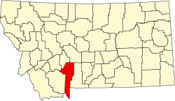
| County | Gallatin |
| Area | |
• Total | 0.47 sq mi (1.21 km2) |
| • Land | 0.46 sq mi (1.20 km2) |
| • Water | 0.01 sq mi (0.01 km2) |
| Elevation | 4,843 ft (1,476 m) |
| Population (2020) | |
• Total | 1,549 |
| • Density | 3,345.57/sq mi (1,292.74/km2) |
| Time zone | UTC-7 (Mountain (MST)) |
| • Summer (DST) | UTC-6 (MDT) |
| Area code | 406 |
| FIPS code | 30-40685 |
| GNIS feature ID | 2583820 [2] |
King Arthur Park is a census-designated place (CDP) in Gallatin County, Montana, United States. The population was 738 at the 2010 census. [3]