Hebgen Lake Estates, Montana | |
|---|---|
 Hebgen Lake Estates  Hebgen Lake Estates | |
| Coordinates: 44°46′9″N111°11′26″W / 44.76917°N 111.19056°W | |
| Country | United States |
| State | Montana |
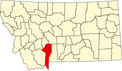
| County | Gallatin |
| Area | |
• Total | 0.18 sq mi (0.48 km2) |
| • Land | 0.18 sq mi (0.48 km2) |
| • Water | 0.00 sq mi (0.00 km2) |
| Elevation | 6,565 ft (2,001 m) |
| Population (2020) | |
• Total | 123 |
| • Density | 668.48/sq mi (257.73/km2) |
| Time zone | UTC-7 (Mountain (MST)) |
| • Summer (DST) | UTC-6 (MDT) |
| Area code | 406 |
| FIPS code | 30-35435 |
| GNIS feature ID | 2583814 [2] |
Hebgen Lake Estates is a census-designated place (CDP) in Gallatin County, Montana, United States. The population was 70 at the 2010 census. [3] It is next to Hebgen Lake.