Bridger, Gallatin County, Montana | |
|---|---|
 Bridger  Bridger | |
| Coordinates: 45°48′40″N110°53′45″W / 45.81111°N 110.89583°W | |
| Country | |
| State | |
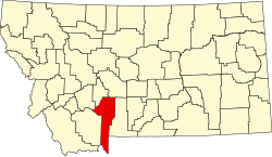
| County | Gallatin |
| Area | |
• Total | 3.60 sq mi (9.34 km2) |
| • Land | 3.60 sq mi (9.32 km2) |
| • Water | 0.01 sq mi (0.01 km2) |
| Elevation | 6,090 ft (1,860 m) |
| Population (2020) | |
• Total | 72 |
| • Density | 20.01/sq mi (7.72/km2) |
| Time zone | UTC-7 (Mountain (MST)) |
| • Summer (DST) | UTC-6 (MDT) |
| Area code | 406 |
| FIPS code | 30-09500 |
| GNIS feature ID | 2583793 [2] |
Bridger is a census-designated place (CDP) in Gallatin County, Montana, United States.