Churchill, Montana

Last updated
Churchill, Montana
CDP
Gallatin County Montana Incorporated and Unincorporated areas Amsterdam-Churchill Highlighted.svg
Location of Amsterdam-Churchill, Montana
Coordinates: 45°45′00″N111°18′37″W / 45.75000°N 111.31028°W / 45.75000; -111.31028 Coordinates: 45°45′00″N111°18′37″W / 45.75000°N 111.31028°W / 45.75000; -111.31028
Country United States
State Montana
County Gallatin
Area
[1]
  Total3.55 sq mi (9.20 km2)
  Land3.55 sq mi (9.20 km2)
  Water0.00 sq mi (0.00 km2)
Population
 (2020)
  Total1,030
  Density289.98/sq mi (111.95/km2)
Time zone UTC-7 (Mountain (MST))
  Summer (DST) UTC-6 (MDT)
Area code 406
FIPS code 30-01550

Churchill is a census-designated place (CDP) in Gallatin County, Montana, United States. The population was 902 at the 2010 census. It is part of the Bozeman, MT Micropolitan Statistical Area. It was formerly part of the Amsterdam-Churchill CDP.

Contents

Geography

Churchill is located at 45°45′00″N111°18′37″W / 45.75000°N 111.31028°W / 45.75000; -111.31028 (45.749951, -111.310256). [2]

According to the United States Census Bureau, the CDP has a total area of 3.6 square miles (9.3 km2), all land.

Demographics

Historical population
CensusPop.
2020 1,030
U.S. Decennial Census [3]

History

Church Hill, or Churchill as it was later shortened by Gallatin County Road Department, is located seven miles south of Manhattan, just to east of Amsterdam on a prominent hill. Churchill is at the center of the Montana's largest Dutch settlement that runs from Manhattan south to Little Holland which is 14 miles distant. While Amsterdam may have been the retail center of the Dutch settlement, Churchill was the cultural center with the site of the Dutch community's original church- the 1st Christian Reformed Church, today known as Manhattan Christian Reformed Church; and related parent-operated private P-12 school, Manhattan Christian School; both of which exist today along with Bethel Christian Reformed Church (a spin off of the original church) and Churchill Retirement Home. The large church on the hill is the probable origin of the name, and once was the largest wooden structure west of the Mississippi River. [4] In the late 1890s, Dutch immigrants came to the Gallatin Valley, with the aid of the Manhattan Malting Company, and created a "linear settlement" of homes, farms, and ranches that stretched roughly 14 miles south of Manhattan, with Amsterdam and Churchill roughly in the middle. Recognizing the growth of the community, the Northern Pacific designated a siding called Amsterdam to the west of "the hill" along its Anceney Spur; not to be outdone, the C.M. & St. Paul Railway (aka:the Milwaukee Road) created a siding for agricultural goods about two miles to the east of Churchill along its Gallatin Valley Railway called the "Holland Siding", subsequently the "east of the hill" became known on maps as Holland. Seven miles to the south of Churchill, near an area where many Dutch settlers homesteaded, is an area called "Little Holland" and today is marked by one of the two cemeteries established by the original Dutch settlers, while the other cemetery is located in Churchill.

Education

Manhattan Christian School is a private school in Churchill. [5] It is a Class C school.

Related Research Articles

<span class="mw-page-title-main">Gallatin County, Montana</span> County in Montana, United States

Gallatin County is located in the U.S. state of Montana. With its county seat in Bozeman, it is the second-most populous county in Montana, with a population of 118,960 in the 2020 Census.

<span class="mw-page-title-main">North Decatur, Georgia</span> CDP in Georgia, United States

North Decatur is a census-designated place (CDP) in DeKalb County, Georgia, United States. The population was 16,698 at the 2010 census.

<span class="mw-page-title-main">Fort Shaw, Montana</span> CDP in Montana, United States

Fort Shaw is a census-designated place (CDP) in Cascade County, Montana, United States. The population was 280 at the 2010 census. Named for a former United States military outpost, it is part of the Great Falls, Montana Metropolitan Statistical Area.

<span class="mw-page-title-main">Belgrade, Montana</span> City in Montana, United States

Belgrade is a city in Gallatin County, Montana, United States. The population was 10,460 at the 2020 census. It is the largest city in Montana that is not a county seat.

<span class="mw-page-title-main">Bozeman, Montana</span> City in Montana, United States

Bozeman is a city and the county seat of Gallatin County, Montana, United States. Located in southwest Montana, the 2020 census put Bozeman's population at 53,293, making it the fourth-largest city in Montana. It is the principal city of the Bozeman, MT Micropolitan Statistical Area, consisting of all of Gallatin County with a population of 118,960. Due to the fast growth rate Bozeman is expected to be upgraded to Montana's fourth metropolitan area. It is the largest micropolitan statistical area in Montana, the fastest growing micropolitan statistical area in the United States in 2018, 2019 and 2020, as well as the third-largest of all Montana's statistical areas.

<span class="mw-page-title-main">Four Corners, Montana</span> Census-designated place in Montana, United States

Four Corners is a census-designated place (CDP) in Gallatin County, Montana, United States. The population was 3,146 at the 2010 census, up from 1,828 in 2000. It is part of the Bozeman, MT Micropolitan Statistical Area.

<span class="mw-page-title-main">Manhattan, Montana</span> Town in Montana, United States

Manhattan is a town in Gallatin County, Montana, United States. The population was 2,086 at the 2020 census. It is part of the 'Bozeman Micropolitan Statistical Area'.

<span class="mw-page-title-main">Willow Creek, Montana</span> Census-designated place in Gallatin County, Montana, United States.

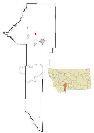
Willow Creek is a census-designated place (CDP) in Gallatin County, Montana, United States. The population was 210 at the 2010 census. It is part of the Bozeman, MT Micropolitan Statistical Area.

<span class="mw-page-title-main">Montana City, Montana</span> Census-designated place in Montana, United States

Montana City is an unincorporated community and census-designated place (CDP) in Jefferson County, Montana, United States. The population was 2,715 at the 2010 census, up from 2,094 in 2000. It is part of the Helena Micropolitan Statistical Area.

<span class="mw-page-title-main">Harrison, Montana</span> Census-designated place in Montana, United States

Harrison is a census-designated place (CDP) in Madison County, Montana, United States. The population was 137 at the 2010 census, down from 162 in 2000.

<span class="mw-page-title-main">Frenchtown, Montana</span> CDP in Montana, United States

Frenchtown is a census-designated place (CDP) in Missoula County, Montana, United States. It is part of the 'Missoula, Montana Metropolitan Statistical Area'. The population was 1,825 at the 2010 census, an increase from its population of 883 in 2000. Frenchtown is also known as an early mixed ancestry settlement in the Pacific Northwest history, sometimes referred as a French Canadian or a Métis settlement.

<span class="mw-page-title-main">Absarokee, Montana</span> CDP in Montana, United States

Absarokee is a census-designated place (CDP) in Stillwater County, Montana, United States, approximately 14 miles (23 km) south of Columbus on Highway 78. It is named after the Crow Indians who formerly inhabited the land. The population was 1,234 at the 2000 census. The Stillwater Mine, operated by the Stillwater Mining Company, is located near Absarokee.

<span class="mw-page-title-main">Wantagh, New York</span> Hamlet and census-designated place in New York, United States

Wantagh is a hamlet and census-designated place (CDP) in the Town of Hempstead in Nassau County, on Long Island, New York, United States. The population was 18,871 at the time of the 2010 census.

<span class="mw-page-title-main">Utopia, Texas</span> Census-designated place in Texas, United States

Utopia is a census-designated place (CDP) in Uvalde County, Texas, United States. The population was 227 at the 2010 census.

<span class="mw-page-title-main">Big Sky, Montana</span> Census-designated place in Montana, United States

Big Sky is an unincorporated census-designated place (CDP) in Gallatin and Madison counties in southwestern Montana, United States. As of the 2010 census it had a population of 2,308. It is 45 miles (72 km) southwest of Bozeman. This unincorporated community straddles both counties, is not considered a town, and does not have a town government. The primary industry of the area is tourism.

<span class="mw-page-title-main">Dutch Americans</span> Americans of Dutch birth or descent

Dutch Americans are Americans of Dutch descent whose ancestors came from the Netherlands in the recent or distant past. Dutch settlement in the Americas started in 1613 with New Amsterdam, which was exchanged with the English for Suriname at the Treaty of Breda (1667) and renamed New York City. The English split the Dutch colony of New Netherland into two pieces and named them New York and New Jersey. Further waves of immigration occurred in the 19th and 20th centuries.

Gallatin Gateway is a census-designated place (CDP) in Gallatin County, Montana, United States. As of the 2010 census it had a population of 856. Elevation is 4,953 ft.

Yellowstone National Park (part) was a former county-equivalent in southwestern Montana, a state in the northwestern United States.

<span class="mw-page-title-main">Amsterdam, Montana</span> CDP in Montana, United States

Amsterdam is a census-designated place (CDP) in Gallatin County, Montana, United States. The population was 180 at the 2010 census. It is part of the Bozeman, MT Micropolitan Statistical Area. It was formerly part of the Amsterdam-Churchill CDP.

Bridger is a census-designated place (CDP) in Gallatin County, Montana, United States. It comprises the Bridger Bowl Ski Area and some nearby residences on the eastern side of the Bridger Range in southwestern Montana. As of the 2010 census the Bridger CDP had a population of 30.

References

  1. "ArcGIS REST Services Directory". United States Census Bureau. Retrieved September 5, 2022.
  2. "US Gazetteer files: 2010, 2000, and 1990". United States Census Bureau. 2011-02-12. Retrieved 2011-04-23.
  3. "Census of Population and Housing". Census.gov. Retrieved June 4, 2016.
  4. Aarstad, Rich, Ellie Arguimbau, Ellen Baumler, Charlene Porsild, and Brian Shovers. Montana Place Names from Alzada to Zortman Archived October 8, 2009, at the Wayback Machine . Montana Historical Society Press.
  5. "Manhattan Christian School". Manhattan Christian School. Retrieved 17 April 2021.