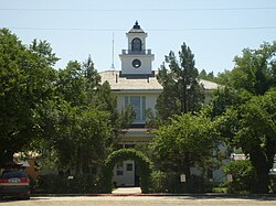
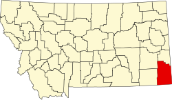
Demographics
Historical population| Census | Pop. | Note | %± |
|---|
| 1920 | 3,972 | | — |
|---|
| 1930 | 4,136 | | 4.1% |
|---|
| 1940 | 3,280 | | −20.7% |
|---|
| 1950 | 2,798 | | −14.7% |
|---|
| 1960 | 2,493 | | −10.9% |
|---|
| 1970 | 1,956 | | −21.5% |
|---|
| 1980 | 1,799 | | −8.0% |
|---|
| 1990 | 1,503 | | −16.5% |
|---|
| 2000 | 1,360 | | −9.5% |
|---|
| 2010 | 1,160 | | −14.7% |
|---|
| 2020 | 1,415 | | 22.0% |
|---|
| 2024 (est.) | 1,399 | [6] | −1.1% |
|---|
|
2020 census
As of the 2020 census, the county had a population of 1,415. Of the residents, 23.1% were under the age of 18 and 26.7% were 65 years of age or older; the median age was 43.1 years. For every 100 females there were 98.2 males, and for every 100 females age 18 and over there were 97.5 males. 0.0% of residents lived in urban areas and 100.0% lived in rural areas. [11] [12]
Females comprised 50.1% of the population, while males accounted for 49.9%. [13]
The racial makeup of the county was 95.2% White, 0.0% Black or African American, 0.5% American Indian and Alaska Native, 0.1% Asian, 0.3% from some other race, and 4.0% from two or more races. Hispanic or Latino residents of any race comprised 0.8% of the population. [14]
There were 593 households in the county, of which 24.6% had children under the age of 18 living with them and 20.2% had a female householder with no spouse or partner present. About 28.7% of all households were made up of individuals and 13.7% had someone living alone who was 65 years of age or older. [12]
There were 817 housing units, of which 27.4% were vacant. Among occupied housing units, 72.8% were owner-occupied and 27.2% were renter-occupied. The homeowner vacancy rate was 1.4% and the rental vacancy rate was 4.6%. [12]
2020 QuickFacts
The median household income was $48,000, $6,970 below the median of Montana. 61.7% of the population aged over 16 were in the civilian labor force. 14.7% of the population were classed as living in poverty. 2.4% of the population had a disability. 92.5% of the population graduated high school, with 20.2% obtaining a bachelor's degree or higher. 86.5% of households had a computer, with 77.9% having broadband access. [13]
2010 census
As of the 2010 census, there were 1,160 people, 532 households, and 354 families living in the county. The population density was 0.3 inhabitants per square mile (0.12/km2). There were 810 housing units at an average density of 0.2 per square mile (0.077/km2). The racial makeup of the county was 97.8% white, 0.9% American Indian, 0.1% black or African American, 0.1% Asian, 0.3% from other races, and 0.8% from two or more races. Those of Hispanic or Latino origin made up 0.7% of the population. In terms of ancestry, 41.5% were German, 19.6% were English, 18.8% were Norwegian, 12.3% were Irish, and 4.3% were American.
Of the 532 households, 20.5% had children under the age of 18 living with them, 59.4% were married couples living together, 4.3% had a female householder with no husband present, 33.5% were non-families, and 30.3% of all households were made up of individuals. The average household size was 2.16 and the average family size was 2.65. The median age was 50.2 years.
The median income for a household in the county was $35,703 and the median income for a family was $47,955. Males had a median income of $26,736 versus $18,274 for females. The per capita income for the county was $20,681. About 8.5% of families and 14.0% of the population were below the poverty line, including 20.4% of those under age 18 and 10.8% of those age 65 or over.
This page is based on this
Wikipedia article Text is available under the
CC BY-SA 4.0 license; additional terms may apply.
Images, videos and audio are available under their respective licenses.