Index of Montana-related articles

Last updated

The location of the state of Montana in the United States of America Map of USA MT.svg
The location of the state of Montana in the United States of America

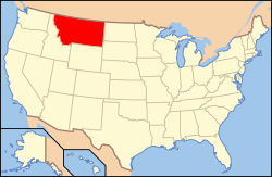
The following is an alphabetical list of articles related to the U.S. state of Montana .

Contents

0–9

An enlargeable map of the state of Montana Map of Montana NA.png
An enlargeable map of the state of Montana

A

B

Billings, Montana Billings Skyline.jpg
Billings, Montana

C

Montana State Capitol in Helena Helena capitol.jpg
Montana State Capitol in Helena
William Clark William Clark-Charles Willson Peale.jpg
William Clark
An enlargeable map of the 56 counties of the state of Montana Montana counties map.png
An enlargeable map of the 56 counties of the state of Montana
George Armstrong Custer Custer9.jpg
George Armstrong Custer

D

E

Electric Peak Electric-peak-trees.jpg
Electric Peak

F

The flag of the State of Montana Flag of Montana.svg
The flag of the State of Montana

G

A mountain goat below Granite Peak Granite Peak Montana.jpg
A mountain goat below Granite Peak
The Great Seal of the State of Montana Montana-StateSeal.svg
The Great Seal of the State of Montana
Grizzly bear with cub A mother and a cub bears.JPG
Grizzly bear with cub

H

I

J

Chief Joseph ChiefJoseph.jpeg
Chief Joseph

K

L

Meriwether Lewis Meriwether Lewis-Charles Willson Peale.jpg
Meriwether Lewis
The route of the Lewis and Clark Expedition Carte Lewis and Clark Expedition.png
The route of the Lewis and Clark Expedition
Native American Memorial at Little Bighorn Battlefield National Monument Little-bighorn-memorial-sculpture-2.jpg
Native American Memorial at Little Bighorn Battlefield National Monument
Map of the Louisiana Purchase National-atlas-1970-1810-loupurchase-1.png
Map of the Louisiana Purchase

M

Missoula, Montana Missoula from mt sentinel.jpg
Missoula, Montana
Mount Cleveland in Glacier National Park Mount Cleveland.jpg
Mount Cleveland in Glacier National Park
Mourning cloak butterfly Nymphalis antiopa (Suruvaippa).jpg
Mourning cloak butterfly

N

Bison Range NationalBisonRangeBison.jpg
Bison Range

O

P

R

Red Cloud Red Cloud3.jpg
Red Cloud

S

Sitting Bull Sitting Bull by D F Barry ca 1883 Dakota Territory.jpg
Sitting Bull

T

Trapper Peak TrapperPeakMTfromRt93.jpg
Trapper Peak

U

V

W

Western meadowlark Western Meadowlark.jpg
Western meadowlark

X

Y

Z

See also

Related Research Articles

<span class="mw-page-title-main">Ravalli County, Montana</span> County in Montana, United States

Ravalli County is a county in the southwestern part of the U.S. state of Montana. As of the 2020 census, the population was 44,174. Its county seat is Hamilton.

<span class="mw-page-title-main">Flathead County, Montana</span> County in Montana, United States

Flathead County is in the U.S. state of Montana. At the 2020 census, its population was 104,357, making it the state's fourth most populous county. Its county seat is Kalispell. Its numerical designation is 7. Its northern border is on the state's north border, making it contiguous with the Canada–US border, facing British Columbia.

<span class="mw-page-title-main">Protected areas of the United States</span> Legally protected land, eg national parks

The protected areas of the United States are managed by an array of different federal, state, tribal and local level authorities and receive widely varying levels of protection. Some areas are managed as wilderness, while others are operated with acceptable commercial exploitation. As of 2022, the 42,826 protected areas covered 1,235,486 km2 (477,024 sq mi), or 13 percent of the land area of the United States. This is also one-tenth of the protected land area of the world. The U.S. also had a total of 871 National Marine Protected Areas, covering an additional 1,240,000 sq mi (3,200,000 km2), or 26 percent of the total marine area of the United States.

<span class="mw-page-title-main">Flathead National Forest</span> National forest in Montana, United States

The Flathead National Forest is a national forest in the western part of the U.S. state of Montana. The forest lies primarily in Flathead County, south of Glacier National Park. The forest covers 2,404,935 acres of which about 1 million acres (4,000 km2) is designated wilderness. It is named after the Flathead Native Americans who live in the area.

<span class="mw-page-title-main">Beaverhead–Deerlodge National Forest</span> National Forests in Montana, United States

The Beaverhead–Deerlodge National Forest is the largest of the National Forests in Montana, United States. Covering 3.36 million acres (13,600 km2), the forest is broken into nine separate sections and stretches across eight counties in the southwestern area of the state. President Theodore Roosevelt named the two forests in 1908 and they were merged in 1996. Forest headquarters are located in Dillon, Montana. In Roosevelt's original legislation, the Deerlodge National Forest was called the Big Hole Forest Reserve. He created this reserve because the Anaconda Copper Mining Company, based in Butte, Montana, had begun to clearcut the upper Big Hole River watershed. The subsequent erosion, exacerbated by smoke pollution from the Anaconda smelter, was devastating the region. Ranchers and conservationists alike complained to Roosevelt, who made several trips to the area. (Munday 2001)

<span class="mw-page-title-main">Bitterroot National Forest</span> U.S. Forest across Montana and Idaho

Bitterroot National Forest comprises 1.587 million acres (6,423 km2) in west-central Montana and eastern Idaho of the United States. It is located primarily in Ravalli County, Montana, but also has acreage in Idaho County, Idaho (29.24%), and Missoula County, Montana (0.49%).

Lewis and Clark National Forest is located in west central Montana, United States. Spanning 2,912 square miles (7,500 km2), the forest is managed as two separate zones. The eastern sections, under the Jefferson Division, is a mixture of grass and shrublands dotted with "island" pockets of forested areas. Here, cattle leases to local ranchers as well as timber harvesting are the norm. The western Rocky Mountain Division, which straddles the Continental divide, is managed chiefly for environmental preservation, as much of the land has been designated as wilderness. Forest headquarters are located in Great Falls, Montana. Local ranger district offices have been established in Choteau, Harlowton, Neihart, Stanford, and White Sulphur Springs.

<span class="mw-page-title-main">Index of Nebraska-related articles</span>

The following is an alphabetical list of articles related to the U.S. State of Nebraska.

<span class="mw-page-title-main">Index of Arizona-related articles</span>

The following is an alphabetical list of articles related to the U.S. state of Arizona.

<span class="mw-page-title-main">Geography of Idaho</span> Overview of the Geograpny of Idaho

The U.S. state of Idaho borders six other U.S. states and one Canadian province. The states of Washington and Oregon are to the west, Nevada and Utah are to the south, and Montana and Wyoming are to the east. Idaho also shares a short border with the Canadian province of British Columbia to the north.

<span class="mw-page-title-main">Geography of Montana</span> Overview of the Geography of Montana

Montana is one of the eight Mountain States, located in the north of the region known as the Western United States. It borders North Dakota and South Dakota to the east. Wyoming is to the south, Idaho is to the west and southwest, and the Canadian provinces of British Columbia, Alberta, and Saskatchewan are to the north, making it the only state to border three Canadian provinces.

<span class="mw-page-title-main">Index of Colorado-related articles</span>

This is an alphabetical list of articles related to the U.S. State of Colorado.

<span class="mw-page-title-main">Index of Wyoming-related articles</span>

The following is an alphabetical list of articles related to the U.S. state of Wyoming.

<span class="mw-page-title-main">Index of Utah-related articles</span>

The following is an alphabetical list of articles related to the U.S. state of Utah.

<span class="mw-page-title-main">Index of New Mexico–related articles</span>

The following is an alphabetical list of articles related to the U.S. state of New Mexico.

<span class="mw-page-title-main">North Central Rockies forests</span> Temperate coniferous forest ecoregion in Canada and the United States

The North Central Rockies forests is a temperate coniferous forest ecoregion of Canada and the United States. This region overlaps in large part with the North American inland temperate rainforest and gets more rain on average than the South Central Rockies forests and is notable for containing the only inland populations of many species from the Pacific coast.

<span class="mw-page-title-main">Regional designations of Montana</span> Overview of the Regional designations of Montana

The Regional designations of Montana vary widely within the U.S state of Montana. The state is a large geographical area that is split by the Continental Divide, resulting in watersheds draining into the Pacific Ocean, Gulf of Mexico and Hudson's Bay. The state is approximately 545 miles (877 km) east to west along the Canada–United States border and 320 miles (510 km) north to south. The fourth largest state in land area, it has been divided up in official and unofficial ways into a variety of regions. Additionally, Montana is part of a number of larger federal government administrative regions.

<span class="mw-page-title-main">Idaho Batholith ecoregion</span>

The Idaho Batholith ecoregion is a Level III ecoregion designated by the United States Environmental Protection Agency (EPA) in the U.S. states of Idaho and Montana. It is contained within the following biomes designated by the World Wild Fund for Nature (WWF): temperate coniferous forests; temperate grasslands, savannas, and shrublands; and deserts and xeric shrublands.

<span class="mw-page-title-main">Protected areas of North Carolina</span> North Carolina protected areas

The protected areas of North Carolina cover roughly 3.8 million acres, making up 11% of the total land in the state. 86.5% of this protected land is publicly owned and is managed by different federal and state level authorities and receive varying levels of protection. Some areas are managed as wilderness while others are operated with acceptable commercial exploitation. The remainder of the land is privately owned, but willingly entered into conservation easement management agreements, or are owned by various nonprofit conservation groups such as the National Audubon Society and The Nature Conservancy. North Carolina contains 1 National Park, and various other federally owned protected land including 2 National Seashores, 5 National Forests, 12 Wildlife Refuges, and the southern half of the Blue Ridge Parkway. North Carolina has an extensive state park system of 42 open units, 35 of which are state parks, 4 that are recreation areas, and 3 staffed state natural areas, along with other designated units managed by the North Carolina Department of Natural and Cultural Resources.