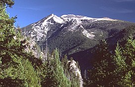
Granite Peak, at an elevation of 12,807 feet (3,904 m) above sea level, is the highest natural point in the U.S. state of Montana, and the tenth-highest state high point in the nation. It lies within the Absaroka-Beartooth Wilderness in Park County, very near the borders of Stillwater County and Carbon County. Granite Peak is 10 miles (16 km) north of the Wyoming border and 45 miles (72 km) southwest of Columbus, Montana.

Cloud Peak is the highest peak within the Bighorn Mountains in the U.S. state of Wyoming.
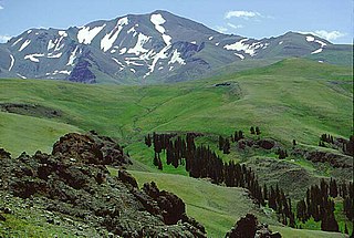
Francs Peak, elevation 13,158 feet (4,011 m), is the highest point in the Absaroka Range which extends from north-central Wyoming into south-central Montana, in the United States. It is in the Washakie Wilderness of Shoshone National Forest, and the peak is also the highest point in Park County, Wyoming, which includes much of Yellowstone National Park. It was named after Otto Franc, a cattle baron and homesteader in the Big Horn Basin.
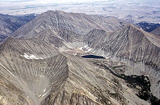
Crazy Peak, elevation 11,214 ft (3,418 m), is the highest peak in the Crazy Mountains, an isolated range of the Montana Rockies, in the United States. Crazy Peak dominates the surroundings, rising over 7,000 feet (2,100 m) above the Yellowstone River Valley, and is the highest peak in Montana north of the Beartooth Mountains, which are 50 miles (80 km) to the south. Crazy Peak is also the most topographically prominent peak in Montana. A small glacier exists on the northeast slope of the mountain. The mountain is located on private land within the Gallatin National Forest.

The Anaconda Range, informally known as the "Pintlers", is a group of high mountains located in southwestern Montana, in the northwestern United States. The mountain range takes its name from the nearby town of Anaconda, founded by Marcus Daly in 1883. It runs northeast approximately 50 miles (80 km) from Lost Trail Pass to a point near the community of Anaconda, covering parts of Ravalli, Deer Lodge, Granite and Beaverhead Counties. To the northwest are the Sapphire Mountains, to the south is the Big Hole Valley. Due north, the range blends into the Flint Creek Range, and to the southeast lies the Big Hole River and Pioneer Mountains. The crest of the range is part of the Continental Divide, rising to 10,793 feet (3,290 m) at West Goat Peak. Other major summits include Mt. Evans, Mt. Haggin, Warren Peak, and East Goat Peak. West Pintler Peak, located in a more commonly visited area, rises to 9,894 feet (3,016 m). Much of the range is protected in the Anaconda-Pintler Wilderness Area.

Electric Peak is the tallest mountain in the Gallatin Range of southern Montana, close to the Wyoming border and rises to an altitude of 10,969 feet (3,343 m). The peak has some of the greatest physical relief in Yellowstone National Park, rising 3,389 ft (1,033 m) above its base.
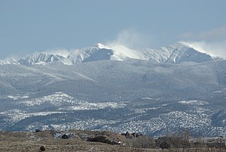
Truchas Peak is the second highest peak in the U.S. State of New Mexico behind Wheeler Peak. It is in the Sangre de Cristo Mountains 26 miles (42 km) northeast of Santa Fe. It lies within the Pecos Wilderness, part of the Santa Fe National Forest. The name of the peak is Spanish for "trout" (plural). It is the highest point in both Rio Arriba and Mora counties. It is also the most southerly peak and land area in the continental United States to rise above 13,000 feet (3,962 m).
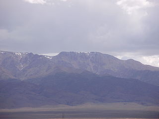
Mount Jefferson is the highest mountain in both the Toquima Range and Nye County in Nevada, United States. It is the sixth highest mountain in the state. As the high point of a range which is well separated from other ranges by low basins, Mount Jefferson has a high topographic prominence of 5,861 feet (1,786 m). This makes it the most prominent peak in Nye County and the third most prominent peak in Nevada. For similar reasons, it is also the highest mountain for over 90 miles in all directions. It is located about 50 miles (80 km) northeast of the county seat of Tonopah within the Alta Toquima Wilderness of the Humboldt-Toiyabe National Forest, near the smaller towns of Carvers and Round Mountain. Three distinct summits are located on a broad area of subalpine tundra: North Summit rises to 11,820 feet (3,603 m), Middle Summit to 11,692 feet (3,564 m), and South Summit to 11,949 feet (3,642 m). During the Pleistocene, alpine glaciers eroded several cirques east of the summit plateau.

Lolo Peak is a mountain in the western United States, in the northern Rocky Mountains. It is located in the Bitterroot Range of western Montana in Missoula County, southwest of Missoula.
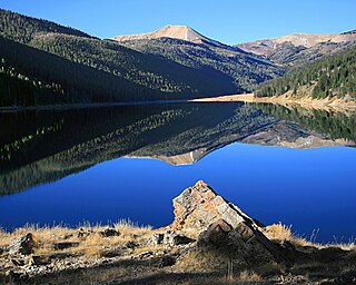
Wyoming Peak is the tallest mountain in the Wyoming Range in the U.S. state of Wyoming. Situated in Bridger-Teton National Forest, a now collapsed fire lookout is located on the summit. Wyoming Peak is .75 miles (1.21 km) south-southeast of Coffin Peak, the second highest peak in the Wyoming Range.

The Swan Range is a mountain range in western Montana in the United States. Its peaks typically rise to around 8,000 to 9,000 feet. The range is bounded by the South Fork Flathead River to the east, the Flathead River to the north and northwest, the Swan River to the west, and lie to the southwest of Glacier National Park, just south of the Canada–US border. It runs about 99 miles (159 km) from north-northwest to south-southeast. Major cities near the Swan Range include Kalispell and Bigfork to the northwest, and Seeley Lake on the south.
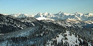
The Whitefish Range is a mountain range stretching north-south from British Columbia, Canada to Montana, United States. It is about 76 miles (122 km) long and 58 miles (93 km) wide. Water flowing from its east side drains down the North Fork Flathead River and its west side drains into the Whitefish River, both part of the Columbia River drainage basin.

The Beaverhead Mountains, highest point Scott Peak, el. 11,393 feet (3,473 m), are a mountain range straddling the Continental Divide in the U.S. states of Montana and Idaho. They are a sub-range of the Bitterroot Range, and divide Beaverhead County, Montana from Lemhi County, Idaho and Clark County, Idaho.

McDonald Peak, elevation 9,820 feet (2,993 m), is located in the U.S. state of Montana and is the highest peak in the Mission Mountains. McDonald Peak is situated within the Flathead Indian Reservation. The peak has the second greatest topographic prominence of all summits within Montana and is almost 80 miles (130 km) away from the next highest mountain in the state. McDonald Glacier is on the north slope of the peak.

Bighorn Peak is located in the Bighorn Mountains in the U.S. state of Wyoming. The peak is the seventh highest in the range and it is in the Cloud Peak Wilderness of Bighorn National Forest. Bighorn Peak is 1.5 miles (2.4 km) south of Darton Peak.
Mather Peaks is located in the Bighorn Mountains in the U.S. state of Wyoming. The peak is the sixth highest in the range and it is in the Cloud Peak Wilderness of Bighorn National Forest. Mather Peaks is 4.5 miles (7.2 km) northwest of Darton Peak and 3.2 mi (5.1 km) south of Bomber Mountain.

Sundance Mountain is in the Beartooth Mountains in the U.S. state of Montana. The peak is one of the tallest in the Beartooth Mountains and is in the Absaroka-Beartooth Wildernessin Custer National Forest.
Echo Peak is the one of the taller mountains in the Madison Range in the U.S. state of Montana. The summit is located in Lee Metcalf Wilderness within Gallatin and Beaverhead-Deerlodge National Forests. Echo Peak is less than 2 mi (3.2 km) north of Hilgard Peak.
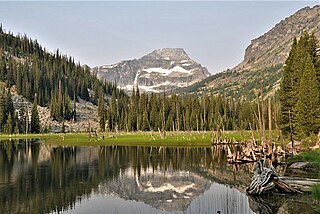
El Capitan is a mountain summit in the Bitterroot Range of Montana. The peak is located in the Selway-Bitterroot Wilderness on land managed by the Bitterroot National Forest. The summit lies 12 miles west of the town of Darby, Montana, and three miles east of the Idaho–Montana border. The highest point of the Central Bitterroot Range is line parent Trapper Peak, 9.3 miles south-southeast.
Tumble Mountain is in the Absaroka Range in the U.S. state of Montana. The peak is located in Custer National Forest. The tiny glacieret Tumble Glacier lies to the northeast.
