WikiMili
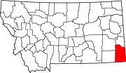
List of mountains in Carter County, Montana
Last updated
March 21, 2022
Map all coordinates using:
OpenStreetMap
Download coordinates as:
KML
This list is
incomplete
; you can help by
adding missing items
.
(
February 2011
)
There are at least
40 named
mountains
in
Carter County, Montana
.
Belcher Mountain
,
45°07′51″N
104°57′32″W
/
45.13083°N 104.95889°W
/
45.13083; -104.95889
(
Belcher Mountain
)
, el.
4,009 feet (1,222
m)
[1]
Belltower Butte
,
45°36′00″N
104°17′26″W
/
45.60000°N 104.29056°W
/
45.60000; -104.29056
(
Belltower Butte
)
, el.
3,921 feet (1,195
m)
[2]
Big Hill
,
45°49′47″N
104°43′21″W
/
45.82972°N 104.72250°W
/
45.82972; -104.72250
(
Big Hill
)
, el.
3,947 feet (1,203
m)
[3]
Black Point
,
45°10′00″N
104°37′54″W
/
45.16667°N 104.63167°W
/
45.16667; -104.63167
(
Black Point
)
, el.
3,750 feet (1,140
m)
[4]
Blue Mud Hills
,
45°37′36″N
104°41′58″W
/
45.62667°N 104.69944°W
/
45.62667; -104.69944
(
Blue Mud Hills
)
, el.
3,501 feet (1,067
m)
[5]
Capitol Rock
,
45°35′43″N
104°07′12″W
/
45.59528°N 104.12000°W
/
45.59528; -104.12000
(
Capitol Rock
)
, el.
4,042 feet (1,232
m)
[6]
Chimney Rock
,
45°58′19″N
104°24′47″W
/
45.97194°N 104.41306°W
/
45.97194; -104.41306
(
Chimney Rock
)
, el.
3,547 feet (1,081
m)
[7]
Coal Creek Hill
,
45°52′33″N
104°13′01″W
/
45.87583°N 104.21694°W
/
45.87583; -104.21694
(
Coal Creek Hill
)
, el.
3,209 feet (978
m)
[8]
Coal Creek Hill
,
45°52′23″N
104°12′56″W
/
45.87306°N 104.21556°W
/
45.87306; -104.21556
(
Coal Creek Hill
)
, el.
3,222 feet (982
m)
[9]
Dead Horse Point
,
45°16′11″N
104°37′44″W
/
45.26972°N 104.62889°W
/
45.26972; -104.62889
(
Dead Horse Point
)
, el.
3,881 feet (1,183
m)
[10]
Dutchmans Hill
,
45°56′17″N
104°20′07″W
/
45.93806°N 104.33528°W
/
45.93806; -104.33528
(
Dutchmans Hill
)
, el.
3,540 feet (1,080
m)
[11]
Finger Buttes
,
45°19′36″N
104°23′33″W
/
45.32667°N 104.39250°W
/
45.32667; -104.39250
(
Finger Buttes
)
, el.
4,196 feet (1,279
m)
[12]
Flasted Hill
,
45°57′49″N
104°14′40″W
/
45.96361°N 104.24444°W
/
45.96361; -104.24444
(
Flasted Hill
)
, el.
3,442 feet (1,049
m)
[13]
Grassy Butte
,
45°43′15″N
104°08′07″W
/
45.72083°N 104.13528°W
/
45.72083; -104.13528
(
Grassy Butte
)
, el.
3,494 feet (1,065
m)
[14]
Greasy Hill
,
45°13′47″N
104°48′11″W
/
45.22972°N 104.80306°W
/
45.22972; -104.80306
(
Greasy Hill
)
, el.
4,068 feet (1,240
m)
[15]
Hackett Butte
,
45°34′14″N
104°58′31″W
/
45.57056°N 104.97528°W
/
45.57056; -104.97528
(
Hackett Butte
)
, el.
3,360 feet (1,020
m)
[16]
Haystack Butte
,
45°29′59″N
104°57′27″W
/
45.49972°N 104.95750°W
/
45.49972; -104.95750
(
Haystack Butte
)
, el.
3,297 feet (1,005
m)
[17]
Indian Butte
,
45°25′39″N
104°05′20″W
/
45.42750°N 104.08889°W
/
45.42750; -104.08889
(
Indian Butte
)
, el.
3,333 feet (1,016
m)
[18]
Mud Butte
,
45°28′04″N
104°04′28″W
/
45.46778°N 104.07444°W
/
45.46778; -104.07444
(
Mud Butte
)
, el.
3,297 feet (1,005
m)
[19]
Newberry Knob
,
45°47′29″N
104°40′33″W
/
45.79139°N 104.67583°W
/
45.79139; -104.67583
(
Newberry Knob
)
, el.
3,750 feet (1,140
m)
[20]
Pine Hill
,
45°40′44″N
104°58′15″W
/
45.67889°N 104.97083°W
/
45.67889; -104.97083
(
Pine Hill
)
, el.
3,392 feet (1,034
m)
[21]
Piney Butte
,
46°01′31″N
104°30′54″W
/
46.02528°N 104.51500°W
/
46.02528; -104.51500
(
Piney Butte
)
, el.
3,432 feet (1,046
m)
[22]
Pocochichee Butte
,
45°30′55″N
104°56′57″W
/
45.51528°N 104.94917°W
/
45.51528; -104.94917
(
Pocochichee Butte
)
, el.
3,297 feet (1,005
m)
[23]
Potato Buttes
,
45°18′58″N
104°30′35″W
/
45.31611°N 104.50972°W
/
45.31611; -104.50972
(
Potato Buttes
)
, el.
3,773 feet (1,150
m)
[24]
Potato Buttes
,
45°20′51″N
104°31′15″W
/
45.34750°N 104.52083°W
/
45.34750; -104.52083
(
Potato Buttes
)
, el.
3,599 feet (1,097
m)
[25]
Red Hill
,
45°54′34″N
104°27′10″W
/
45.90944°N 104.45278°W
/
45.90944; -104.45278
(
Red Hill
)
, el.
3,599 feet (1,097
m)
[26]
Roosevelt Rock
,
46°02′40″N
104°28′17″W
/
46.04444°N 104.47139°W
/
46.04444; -104.47139
(
Roosevelt Rock
)
, el.
3,428 feet (1,045
m)
[27]
Saddle Butte
,
45°30′19″N
104°58′00″W
/
45.50528°N 104.96667°W
/
45.50528; -104.96667
(
Saddle Butte
)
, el.
3,281 feet (1,000
m)
[28]
Saddle Butte
,
45°37′54″N
104°48′16″W
/
45.63167°N 104.80444°W
/
45.63167; -104.80444
(
Saddle Butte
)
, el.
3,720 feet (1,130
m)
[29]
Sheep Mountain
,
45°28′56″N
104°11′38″W
/
45.48222°N 104.19389°W
/
45.48222; -104.19389
(
Sheep Mountain
)
, el.
3,927 feet (1,197
m)
[30]
Stone Lady Rock
,
46°01′07″N
104°29′14″W
/
46.01861°N 104.48722°W
/
46.01861; -104.48722
(
Stone Lady Rock
)
, el.
3,425 feet (1,044
m)
[31]
Stormy Butte
,
45°37′47″N
104°08′31″W
/
45.62972°N 104.14194°W
/
45.62972; -104.14194
(
Stormy Butte
)
, el.
3,911 feet (1,192
m)
[32]
Three Peaks
,
45°24′44″N
104°05′28″W
/
45.41222°N 104.09111°W
/
45.41222; -104.09111
(
Three Peaks
)
, el.
3,346 feet (1,020
m)
[33]
Timber Hill
,
45°33′25″N
104°10′37″W
/
45.55694°N 104.17694°W
/
45.55694; -104.17694
(
Timber Hill
)
, el.
3,543 feet (1,080
m)
[34]
Tip Top Butte
,
45°17′52″N
104°42′06″W
/
45.29778°N 104.70167°W
/
45.29778; -104.70167
(
Tip Top Butte
)
, el.
3,894 feet (1,187
m)
[35]
Twin Buttes,
45°19′30″N
104°40′17″W
/
45.32500°N 104.67139°W
/
45.32500; -104.67139
(
Twin Buttes
)
, el.
3,776 feet (1,151
m)
[36]
W L Butte
,
45°36′09″N
104°49′24″W
/
45.60250°N 104.82333°W
/
45.60250; -104.82333
(
W L Butte
)
, el.
3,399 feet (1,036
m)
[37]
West Butte
,
45°05′27″N
105°01′17″W
/
45.09083°N 105.02139°W
/
45.09083; -105.02139
(
West Butte
)
, el.
4,413 feet (1,345
m)
[38]
Wilder Butte
,
45°57′56″N
104°34′42″W
/
45.96556°N 104.57833°W
/
45.96556; -104.57833
(
Wilder Butte
)
, el.
3,566 feet (1,087
m)
[39]
Wolf Point
,
45°15′31″N
104°42′52″W
/
45.25861°N 104.71444°W
/
45.25861; -104.71444
(
Wolf Point
)
, el.
3,934 feet (1,199
m)
[40]
See also
List of mountains in Montana
List of mountain ranges in Montana
Notes
↑
"Belcher Mountain"
.
Geographic Names Information System
.
United States Geological Survey
.
↑
"Belltower Butte"
.
Geographic Names Information System
.
United States Geological Survey
.
↑
"Big Hill"
.
Geographic Names Information System
.
United States Geological Survey
.
↑
"Black Point"
.
Geographic Names Information System
.
United States Geological Survey
.
↑
"Blue Mud Hills"
.
Geographic Names Information System
.
United States Geological Survey
.
↑
"Capitol Rock"
.
Geographic Names Information System
.
United States Geological Survey
.
↑
"Chimney Rock"
.
Geographic Names Information System
.
United States Geological Survey
.
↑
"Coal Creek Hill"
.
Geographic Names Information System
.
United States Geological Survey
.
↑
"Coal Creek Hill"
.
Geographic Names Information System
.
United States Geological Survey
.
↑
"Dead Horse Point"
.
Geographic Names Information System
.
United States Geological Survey
.
↑
"Dutchmans Hill"
.
Geographic Names Information System
.
United States Geological Survey
.
↑
"Finger Buttes"
.
Geographic Names Information System
.
United States Geological Survey
.
↑
"Flasted Hill"
.
Geographic Names Information System
.
United States Geological Survey
.
↑
"Grassy Butte"
.
Geographic Names Information System
.
United States Geological Survey
.
↑
"Greasy Hill"
.
Geographic Names Information System
.
United States Geological Survey
.
↑
"Hackett Butte"
.
Geographic Names Information System
.
United States Geological Survey
.
↑
"Haystack Butte"
.
Geographic Names Information System
.
United States Geological Survey
.
↑
"Indian Butte"
.
Geographic Names Information System
.
United States Geological Survey
.
↑
"Mud Butte"
.
Geographic Names Information System
.
United States Geological Survey
.
↑
"Newberry Knob"
.
Geographic Names Information System
.
United States Geological Survey
.
↑
"Pine Hill"
.
Geographic Names Information System
.
United States Geological Survey
.
↑
"Piney Butte"
.
Geographic Names Information System
.
United States Geological Survey
.
↑
"Pocochichee Butte"
.
Geographic Names Information System
.
United States Geological Survey
.
↑
"Potato Buttes"
.
Geographic Names Information System
.
United States Geological Survey
.
↑
"Potato Buttes"
.
Geographic Names Information System
.
United States Geological Survey
.
↑
"Red Hill"
.
Geographic Names Information System
.
United States Geological Survey
.
↑
"Roosevelt Rock"
.
Geographic Names Information System
.
United States Geological Survey
.
↑
"Saddle Butte"
.
Geographic Names Information System
.
United States Geological Survey
.
↑
"Saddle Butte"
.
Geographic Names Information System
.
United States Geological Survey
.
↑
"Sheep Mountain"
.
Geographic Names Information System
.
United States Geological Survey
.
↑
"Stone Lady Rock"
.
Geographic Names Information System
.
United States Geological Survey
.
↑
"Stormy Butte"
.
Geographic Names Information System
.
United States Geological Survey
.
↑
"Three Peaks"
.
Geographic Names Information System
.
United States Geological Survey
.
↑
"Timber Hill"
.
Geographic Names Information System
.
United States Geological Survey
.
↑
"Tip Top Butte"
.
Geographic Names Information System
.
United States Geological Survey
.
↑
"Twin Buttes"
.
Geographic Names Information System
.
United States Geological Survey
.
↑
"W L Butte"
.
Geographic Names Information System
.
United States Geological Survey
.
↑
"West Butte"
.
Geographic Names Information System
.
United States Geological Survey
.
↑
"Wilder Butte"
.
Geographic Names Information System
.
United States Geological Survey
.
↑
"Wolf Point"
.
Geographic Names Information System
.
United States Geological Survey
.
v
t
e
Municipalities and communities of
Carter County, Montana
,
United States
County seat
:
Ekalaka
Town
Ekalaka
Carter County map
CDP
Alzada
Other
communities
Boyes
Capitol
Hammond
Mill Iron
Ridge
Indian reservation
Turtle Mountain Indian Reservation
‡
Footnotes
‡This populated place also has portions in an adjacent county or counties
Montana portal
United States portal
This page is based on this
Wikipedia article
Text is available under the
CC BY-SA 4.0
license; additional terms may apply.
Images, videos and audio are available under their respective licenses.