Bigfork, Montana

Last updated
Bigfork, Montana
Bigfork, Montana.jpg
Bigfork during Independence Day parade
Flathead County Montana Incorporated and Unincorporated areas Bigfork Highlighted.svg
Location of Bigfork, Montana
Coordinates: 48°3′55″N114°4′54″W / 48.06528°N 114.08167°W / 48.06528; -114.08167
Country United States
State Montana
County Flathead
Area
[1]
  Total37.31 sq mi (96.63 km2)
  Land31.25 sq mi (80.95 km2)
  Water6.05 sq mi (15.68 km2)
Elevation
[2]
2,989 ft (911 m)
Population
 (2020)
  Total5,118
  Density163.76/sq mi (63.23/km2)
Time zone UTC-7 (Mountain (MST))
  Summer (DST) UTC-6 (MDT)
ZIP code
59911
Area code 406
FIPS code 30-05875
GNIS feature ID0806295 [2]
Website http://www.bigfork.org

Bigfork is a census-designated place (CDP) in Flathead County, Montana, United States. It is within Montana's Rocky Mountains. The population was 5,118 at the 2020 census, [3] up from 4,270 in 2010.

Contents

History

The Flathead River emptying into the north end of Flathead Lake at Bigfork, Montana, with the Salish Mountains in the distance Flathead River, Flathead Lake.jpg
The Flathead River emptying into the north end of Flathead Lake at Bigfork, Montana, with the Salish Mountains in the distance

Some say the name "Bigfork" is derived from the Salish name for the area. However, Bigfork is a fork where two rivers, the Flathead River and the Swan River, flow in to the Flathead Lake. There are reports of a homestead and orchard immediately north of Bigfork as early as 1885. Everit L. Sliter set out 500 apple, cherry, plum, and pear trees in 1892 on Flathead Lake's east shore. He became the first postmaster in 1901. [4] In 1902, he platted the Bigfork townsite at the mouth of the Swan River. The east shore has since become a major cherry-growing area. Wayfarers State Park lies just south of the community. [5]

Geography

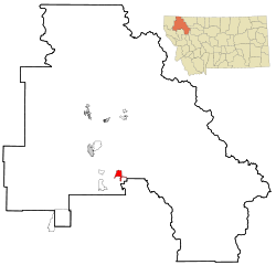
Bigfork is located in south-central Flathead County at 48°3′55″N114°4′54″W / 48.06528°N 114.08167°W / 48.06528; -114.08167 (48.065214, -114.081700), [6] at the north end of Flathead Lake. The western edge of the CDP is the Flathead River, the primary inflow of the lake. The Swan River flows into Flathead Lake from the east, entering the lake at the center of town. The CDP extends south to the Lake County line; east to Mud Lake, Mud Creek, and the north–south part of the Swan River; and northwards to the roads north of Echo Lake.

Kalispell is 18 miles (29 km) to the northwest, via Montana Highway 35, Montana Highway 82, and U.S. Route 93. Highway 35 runs through the center of Bigfork and proceeds south along the eastern shore of Flathead Lake, rejoining US 93 at Polson.

According to the United States Census Bureau, the Bigfork CDP has a total area of 37.3 square miles (96.6 km2), of which 31.2 square miles (80.9 km2) is land and 6.1 square miles (15.7 km2), or 16.25%, is water. [7]

Demographics

Historical population
CensusPop.Note
2000 1,421
2010 4,270200.5%
2020 5,11819.9%
U.S. Decennial Census [8]

As of the census [9] of 2010, there were 4,270 people, 652 households, and 410 families residing in the CDP. The population density was 247.1 people per square mile (95.4 people/km2). There were 962 housing units at an average density of 167.3 per square mile (64.6/km2). The racial makeup of the CDP was 97.33% White, 0.35% African American, 1.06% Native American, 0.35% Asian, 0.14% Pacific Islander, 0.07% from other races, and 0.70% from two or more races. Hispanic or Latino of any race were 1.48% of the population.

There were 652 households, out of which 18.9% had children under the age of 18 living with them, 55.4% were married couples living together, 4.9% had a female householder with no husband present, and 37.0% were non-families. 33.3% of all households were made up of individuals, and 14.4% had someone living alone who was 65 years of age or older. The average household size was 2.08 and the average family size was 2.59.

In the CDP, the population was spread out, with 16.8% under the age of 18, 5.7% from 18 to 24, 18.2% from 25 to 44, 30.9% from 45 to 64, and 28.4% who were 65 years of age or older. The median age was 50 years. For every 100 females there were 91.8 males. For every 100 females age 18 and over, there were 85.8 males.

The median income for a household in the CDP was $36,116, and the median income for a family was $50,288. Males had a median income of $36,313 versus $23,542 for females. The per capita income for the CDP was $20,314. About 7.6% of families and 9.1% of the population were below the poverty line, including 10.0% of those under age 18 and 13.1% of those age 65 or over.

Education

Bigfork School District [10] educates students from kindergarten to 12th grade. Bigfork High School is home to the Vikings and Valkyries. [11]

Bigfork has a public library, a branch of the Flathead County Library. [12]

Arts and culture

Located on a bay of Flathead Lake, Bigfork boasts an array of tourist activities for every season. The town is home to a 27-hole golf course, art galleries, and live theatre. Visitors can rent boats or take a chartered tour of the lake. Nearby Jewel Basin offers hiking. Glacier National Park and the Bob Marshall Wilderness are only a short drive away. Bigfork Summer Playhouse offers Broadway-caliber productions every summer. Bigfork is also home to the Bigfork Independent Film Festival (BIFF) which is held in the fall. BIFF is where Montana-made films are shown and Montana filmmakers are recognized and awarded.

Media

The Bigfork Eagle is a newspaper available either by print or online. It is published weekly. [13]

The radio station KIBG is licensed in Bigfork. [14] The town is also served by the wider Kalispell area.

Notable people

See also

Related Research Articles

<span class="mw-page-title-main">Lake County, Montana</span> County in Montana, United States

Lake County is a county located in the northwest part of the U.S. state of Montana. As of the 2020 census, the population was 31,134. Its county seat is Polson.

<span class="mw-page-title-main">Flathead County, Montana</span> County in Montana, United States

Flathead County is in the U.S. state of Montana. At the 2020 census, its population was 104,357, making it the state's fourth most populous county. Its county seat is Kalispell. Its numerical designation is 7. Its northern border is on the state's north border, making it contiguous with the Canada–US border, facing British Columbia.

<span class="mw-page-title-main">Columbia Falls, Montana</span> City in Montana, United States

Columbia Falls is a city along the Flathead River in Flathead County, Montana, United States. The population was 5,308 at the 2020 census. Columbia Falls has been ranked as one of the best and safest places to live in Montana.

<span class="mw-page-title-main">Coram, Montana</span> Unincorporated community in Montana, United States

Coram is an unincorporated community and census-designated place (CDP) in Flathead County, Montana, United States. The population was 539 in 2010, up from 337 at the 2000 census. Coram lies 7 miles (11 km) southwest of the western entrance of Glacier National Park.

<span class="mw-page-title-main">Evergreen, Montana</span> Unincorporated community in Montana, United States

Evergreen is a census-designated place (CDP) in Flathead County, Montana, United States. Its population was 8,149 at the 2020 census, up from 7,616 at the 2010 census, and 6,215 in 2000.

<span class="mw-page-title-main">Hungry Horse, Montana</span> Unincorporated community in Montana, United States

Hungry Horse is an unincorporated community and census-designated place (CDP) in Flathead County, Montana, United States. The population was 828 at the 2020 census. The ZIP code for Hungry Horse is 59919.

<span class="mw-page-title-main">Kalispell, Montana</span> City in Montana, United States

Kalispell is a city in Montana and the county seat of Flathead County, Montana, United States. The 2020 census put Kalispell's population at 24,558. In Montana's northwest region, it is the largest city and the commercial center of the Kalispell Micropolitan Statistical Area. The name Kalispell is a Salish word meaning "flat land above the lake".

<span class="mw-page-title-main">Lakeside, Montana</span> Unincorporated community in Montana, United States

Lakeside is an unincorporated area and census-designated place (CDP) in Flathead County, Montana, United States. The population was 2,705 at the 2020 census, up from 2,669 in 2010.

<span class="mw-page-title-main">Martin City, Montana</span> Unincorporated community in Montana, United States

Martin City is an unincorporated community and census-designated place (CDP) in Flathead County, Montana, United States. As of the 2010 census, it had a population of 500, up from 331 in 2000.

<span class="mw-page-title-main">Somers, Montana</span> Unincorporated community in Montana, United States

Somers is an unincorporated community and census-designated place (CDP) in Flathead County, Montana, United States. The population was 1,109 at the 2010 census, up from 556 in 2000.

<span class="mw-page-title-main">Big Arm, Montana</span> Census-designated place in Montana, United States

Big Arm is a census-designated place (CDP) in Lake County, Montana, United States. The population was 177 at the 2010 census, up from 131 in 2000.

<span class="mw-page-title-main">Elmo, Montana</span> Census-designated place in Montana, United States

Elmo is a census-designated place (CDP) in Lake County, Montana, United States. The population was 180 at the 2010 census, up from 143 in 2000.

<span class="mw-page-title-main">Finley Point, Montana</span> Census-designated place in Montana, United States

Finley Point is a census-designated place (CDP) in Lake County, Montana, United States. As of the 2010 census the population was 480.

<span class="mw-page-title-main">Rollins, Montana</span> Census-designated place in Montana, United States

Rollins is an unincorporated community and census-designated place (CDP) in Lake County, Montana, United States. The population was 209 at the 2010 census, up from 183 in 2000.

<span class="mw-page-title-main">Turtle Lake, Montana</span> Census-designated place in Montana, United States

Turtle Lake is a census-designated place (CDP) in Lake County, Montana, United States. The population was 209 at the 2010 census.

<span class="mw-page-title-main">Woods Bay, Montana</span> Census-designated place in Montana, United States

Woods Bay is a census-designated place (CDP) in Lake County, Montana, United States. The population was 661 at the 2010 census, down from 748 at the 2000 census.

<span class="mw-page-title-main">Paradise, Montana</span> CDP in Montana, United States

Paradise is a census-designated place (CDP) in Sanders County, Montana, United States. The population was 166 at the 2020 census.

<span class="mw-page-title-main">Dayton, Montana</span> Census-designated place in Montana, United States

Dayton is an unincorporated community and census-designated place (CDP) in Lake County, Montana, United States. The population was 84 at the 2010 census.

<span class="mw-page-title-main">Pablo, Montana</span> Census-designated place in Montana, United States

Pablo is a census-designated place (CDP) in Lake County, Montana, United States. The population was 2,254 at the 2010 census, up from 1,814 in 2000. It is the home of Salish Kootenai College and the seat of government of the Flathead Indian Reservation.

Swan Lake is a census-designated place and unincorporated community in Lake County, Montana, United States. Its population was 113 as of the 2010 census.

References

  1. "ArcGIS REST Services Directory". United States Census Bureau. Retrieved September 5, 2022.
  2. 1 2 U.S. Geological Survey Geographic Names Information System: Bigfork, Montana
  3. "Explore Census Data". data.census.gov. Retrieved 2023-10-06.
  4. Carkeek Cheney, Roberta (1983). Names on the Face of Montana. Missoula, Montana: Mountain Press Publishing Company. p. 5. ISBN   0-87842-150-5.
  5. Aarstad, Rich, Ellie Arguimbau, Ellen Baumler, Charlene Porsild, and Brian Shovers. Montana Place Names from Alzada to Zortman Archived October 8, 2009, at the Wayback Machine . Montana Historical Society Press.
  6. "US Gazetteer files: 2010, 2000, and 1990". United States Census Bureau. 2011-02-12. Retrieved 2011-04-23.
  7. "Geographic Identifiers: 2010 Census Summary File 1 (G001), Bigfork CDP, Montana". American FactFinder. U.S. Census Bureau. Archived from the original on February 13, 2020. Retrieved June 5, 2016.
  8. "Census of Population and Housing". Census.gov. Retrieved June 4, 2016.
  9. "U.S. Census website". United States Census Bureau . Retrieved 2008-01-31.
  10. "Bigfork School District". Bigfork School District. Retrieved 17 April 2021.
  11. "Member Schools". Montana High School Association. Retrieved 19 April 2021.
  12. "Montana Public Libraries". PublicLibraries.com. Retrieved 14 June 2019.
  13. "home page". Bigfork Eagle. Retrieved 23 August 2023.
  14. "KIBG". FCC. Retrieved 23 August 2023.
  15. "Jack Hanna's Cozy Log Cabin in Montana". hookedonhouses.net. Retrieved 2015-03-31.
  16. Bill Lindsay
  17. "J.K. Simmons". Late Night with Seth Meyers . S6:E72. March 1, 2018.