Libby, Montana

Last updated

Libby, Montana
Libby, Montana - date unknown (14604413572).jpg
Looking west-southwest
Lincoln County Montana Incorporated and Unincorporated areas Libby Highlighted.svg
Location of Libby, Montana
USA Montana location map.svg
Red pog.svg
Libby
Usa edcp location map.svg
Red pog.svg
Libby
Coordinates: 48°23′17″N115°33′13″W / 48.38806°N 115.55361°W / 48.38806; -115.55361
Country United States
State Montana
County Lincoln
Government
  MayorPeggy Williams
Area
[1]
  Total1.88 sq mi (4.86 km2)
  Land1.84 sq mi (4.77 km2)
  Water0.04 sq mi (0.09 km2)
Elevation
[2]
2,096 ft (639 m)
Population
 (2020)
  Total2,775
  Density1,506.51/sq mi (581.64/km2)
Time zone UTC-7 (Mountain (MST))
  Summer (DST) UTC-6 (MDT)
ZIP code
59923
Area code 406
FIPS code 30-43450
GNIS feature ID0786083 [2]
Website cityoflibby.com

Libby is a city in northwestern Montana, United States and the county seat of Lincoln County. [3] The population was 2,775 at the 2020 census. [4]

Contents

Libby suffered from the area's contamination from nearby vermiculite mines contaminated with particularly fragile asbestos, leading to the town's inclusion in the United States Environmental Protection Agency's National Priorities List status in 2002 and Public Health Emergency event in 2009. Most risk was reduced by 2015.

Local natural features, such as the Kootenai Falls, have attracted tourism to the area and have been featured in movies, such as The River Wild (1994) and The Revenant (2015). There is a public school district and a public library, and the town is in-district for Flathead Valley Community College, which operates the Lincoln County Campus there.

History

Continental and alpine glaciers shaped the area's valleys and lakes. The first indigenous peoples arrived at least 8,000 years ago and hunted and gathered for food. [5] The earliest known American settler, David Thompson, arrived in the 1800s, and early American economic activity included "fur trading, railroad construction, mining, and logging." [5] Miners flocked to Libby Creek in 1867. It was deserted by the 1870s. In 1892, with the arrival of the Great Northern Railway, the town moved downstream and the name was shortened from Libbysville to Libby. [6]

Geography

Libby is on U.S. Route 2 at its junction with Montana Highway 37. It is at the confluence of Libby Creek and the Kootenai River.

According to the United States Census Bureau, the city has an area of 1.95 square miles (5.05 km2), of which 1.91 square miles (4.95 km2) is land and 0.04 square miles (0.10 km2) is water. [7] Libby is in the Kootenai National Forest, between the Cabinet Mountains to the south and the Purcell Mountains to the north, the town lies in the heart of the Kootenai Valley along the Kootenai River, and downstream from the Libby Dam. Libby is at an elevation of 2,096 feet (640 m) above sea level.

Libby experiences a continental climate (Köppen Dfb).

Climate data for Libby, Montana, 1991–2020 normals, extremes 1895–2022
MonthJanFebMarAprMayJunJulAugSepOctNovDecYear
Record high °F (°C)56
(13)
65
(18)
75
(24)
90
(32)
102
(39)
107
(42)
110
(43)
109
(43)
105
(41)
89
(32)
73
(23)
65
(18)
110
(43)
Mean maximum °F (°C)45.3
(7.4)
51.6
(10.9)
65.7
(18.7)
78.4
(25.8)
88.2
(31.2)
94.1
(34.5)
99.9
(37.7)
99.3
(37.4)
91.1
(32.8)
75.7
(24.3)
54.6
(12.6)
43.1
(6.2)
101.5
(38.6)
Mean daily maximum °F (°C)34.4
(1.3)
40.9
(4.9)
51.8
(11.0)
61.5
(16.4)
72.6
(22.6)
79.6
(26.4)
89.3
(31.8)
89.6
(32.0)
77.6
(25.3)
58.5
(14.7)
41.1
(5.1)
32.8
(0.4)
60.8
(16.0)
Daily mean °F (°C)27.9
(−2.3)
31.5
(−0.3)
39.3
(4.1)
46.6
(8.1)
55.6
(13.1)
62.5
(16.9)
69.2
(20.7)
68.5
(20.3)
59.2
(15.1)
46.2
(7.9)
34.7
(1.5)
27.3
(−2.6)
47.4
(8.5)
Mean daily minimum °F (°C)21.5
(−5.8)
22.2
(−5.4)
26.8
(−2.9)
31.7
(−0.2)
38.7
(3.7)
45.4
(7.4)
49.2
(9.6)
47.4
(8.6)
40.9
(4.9)
33.8
(1.0)
28.3
(−2.1)
21.8
(−5.7)
34.0
(1.1)
Mean minimum °F (°C)−0.5
(−18.1)
2.4
(−16.4)
12.8
(−10.7)
21.6
(−5.8)
25.9
(−3.4)
33.3
(0.7)
38.6
(3.7)
36.7
(2.6)
28.6
(−1.9)
20.3
(−6.5)
12.0
(−11.1)
2.9
(−16.2)
−9.7
(−23.2)
Record low °F (°C)−46
(−43)
−37
(−38)
−20
(−29)
−5
(−21)
12
(−11)
24
(−4)
30
(−1)
26
(−3)
13
(−11)
−7
(−22)
−19
(−28)
−39
(−39)
−46
(−43)
Average precipitation inches (mm)1.92
(49)
1.29
(33)
1.73
(44)
1.14
(29)
1.66
(42)
2.04
(52)
0.91
(23)
0.74
(19)
1.09
(28)
1.82
(46)
2.29
(58)
2.52
(64)
19.15
(487)
Average snowfall inches (cm)11.8
(30)
5.4
(14)
3.8
(9.7)
0.2
(0.51)
0.0
(0.0)
0.0
(0.0)
0.0
(0.0)
0.0
(0.0)
0.0
(0.0)
0.3
(0.76)
6.3
(16)
20.4
(52)
48.2
(122.97)
Average extreme snow depth inches (cm)12.3
(31)
10.3
(26)
6.2
(16)
0.4
(1.0)
0.0
(0.0)
0.0
(0.0)
0.0
(0.0)
0.0
(0.0)
0.0
(0.0)
0.6
(1.5)
3.5
(8.9)
11.2
(28)
14.6
(37)
Average precipitation days (≥ 0.01 in)14.310.011.99.810.411.66.85.37.210.113.414.0124.8
Average snowy days (≥ 0.1 in)7.24.62.20.10.00.00.00.00.00.12.37.724.2
Source 1: NOAA [8]
Source 2: National Weather Service (mean maxima/minima, snow depth 19812010) [9]

Demographics

Historical population
CensusPop.Note
1890 260
1900 29613.8%
1910 630112.8%
1920 1,522141.6%
1930 1,75215.1%
1940 1,8374.9%
1950 2,40130.7%
1960 2,82817.8%
1970 3,28616.2%
1980 2,748−16.4%
1990 2,532−7.9%
2000 2,6263.7%
2010 2,6280.1%
2020 2,7755.6%
source: [10]
U.S. Decennial Census [11] [4]

2020 census

The 2020 United States census counted 2,775 people, 1,297 households, and 644 families in Libby. [12] [13] The population density was 1,506.5 per square mile (581.7/km2). There were 1,428 housing units at an average density of 775.2 per square mile (299.3/km2). [13] [14] The racial makeup was 90.52% (2,512) white or European American (89.62% non-Hispanic white), 0.07% (2) black or African-American, 1.23% (34) Native American or Alaska Native, 1.08% (30) Asian, 0.18% (5) Pacific Islander or Native Hawaiian, 0.86% (24) from other races, and 6.05% (168) from two or more races. [15] Hispanic or Latino of any race was 2.74% (76) of the population. [16]

Of the 1,297 households, 21.7% had children under the age of 18; 35.0% were married couples living together; 33.5% had a female householder with no spouse or partner present. 43.6% of households consisted of individuals and 21.7% had someone living alone who was 65 years of age or older. [13] The average household size was 2.1 and the average family size was 3.0. [17] The percent of those with a bachelor’s degree or higher was estimated to be 11.5% of the population. [18]

20.1% of the population was under the age of 18, 5.7% from 18 to 24, 21.3% from 25 to 44, 26.4% from 45 to 64, and 26.5% who were 65 years of age or older. The median age was 48.7 years. For every 100 females, there were 103.0 males. [13] For every 100 females ages 18 and older, there were 105.0 males. [13]

The 2016-2020 5-year American Community Survey estimates show that the median household income was $37,434 (with a margin of error of +/- $5,721) and the median family income was $46,905 (+/- $14,298). [19] Males had a median income of $28,533 (+/- $6,664) versus $25,685 (+/- $4,127) for females. The median income for those above 16 years old was $27,188 (+/- $2,184). [20] Approximately, 9.7% of families and 16.3% of the population were below the poverty line, including 18.4% of those under the age of 18 and 5.7% of those ages 65 or over. [21] [22]

2010 census

As of the census [23] of 2010, there were 2,628 people, 1,252 households, and 647 families residing in the city. The population density was 1,375.9 inhabitants per square mile (531.2/km2). There were 1,416 housing units at an average density of 741.4 per square mile (286.3/km2). The racial makeup of the city was 95.9% White, 0.1% African American, 1.1% Native American, 0.4% Asian, 0.3% from other races, and 2.1% from two or more races. Hispanic or Latino of any race were 2.5% of the population.

There were 1,252 households, of which 23.2% had children under the age of 18 living with them, 36.7% were married couples living together, 11.1% had a female householder with no husband present, 3.9% had a male householder with no wife present, and 48.3% were non-families. 41.9% of all households were made up of individuals, and 19.1% had someone living alone who was 65 years of age or older. The average household size was 2.02 and the average family size was 2.71.

The median age in the city was 45.8 years. 19.1% of residents were under the age of 18; 8.4% were between the ages of 18 and 24; 21.4% were from 25 to 44; 28.6% were from 45 to 64; and 22.5% were 65 years of age or older. The gender makeup of the city was 48.6% male and 51.4% female.

Economy and environment
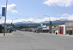
Downtown Libby Libby, Montana.jpg
Downtown Libby

Libby's economy had been largely supported in the past by the use of natural resources, such as logging and mining. Mining and timber mills have since closed down. Tourism is playing an increasing role in the local economy. The Libby Dam is 17 miles (27 km) upstream from Libby, one of the Columbia River Treaty Dams, finished in 1975. Libby is known as the "City of Eagles". Several eagle sculptures can be found around town, including a 60-foot (18 m) eagle at both ends of town.

In 1961, area volunteers opened the Turner Ski Area about 20 miles north of Libby. Owned by a nonprofit foundation, the Ski Area served around 4,600 visits per year in 2017/2018 and relies on volunteer hours and donations for most of its services. [24] In the mid-1980s, a major ski resort was proposed for Great Northern Mountain, twenty miles (30 km) south of Libby. [25] Discussions on land usage and wildlife reached the United States Senate Committee on Energy and Natural Resources in the Subcommittee on Public Lands and Reserved Water, and ultimately the ski resort was not built. [26]

Libby's energy usage includes or potentially includes multiple renewable resources: biomass, hydroelectric, and solar. In 2008, a report found that wood pellet waste from nearby lumber mills could be used to produce several megawatts of electricity. [27] The Flathead Electric Co-op began purchasing up to 2.5 megawatts of power from the F.H. Stoltze Land & Lumber Company in 2013 with a twenty year contract, leading to the construction of "a biomass-fueled electric generation facility at their plant near Columbia Falls." [28] The Co-op "receives Renewable Energy Credits." [28] The city also generates and sells hydroelectric energy. [29] In 2020, a statewide appraisal of Montana public schools' solar power potential, the Montana Community Solar Project, assessed Libby's schools and found the buildings had good potential, but installing solar panels would be financially inefficient as the schools' "electric demand charges [were] in the 92nd percentile when compared against the cohort of 25 schools." [30]

Vermiculite mine

In 1919, vermiculite was discovered in the mountains near town. In 1963 W. R. Grace and Company bought the local mine, by which time it was producing 80% of the vermiculite in the world. [31] Because the local vermiculite contains asbestos, and the mine's byproducts were used in local buildings and landscaping, the town suffered from an extremely high rate of asbestosis. [32] Nearly 10% of the population died from asbestos contamination, and the federal government later charged company officials for complicity. [31] On May 8, 2009, W.R. Grace & Co. was acquitted of charges that it knowingly harmed the people of Libby. It was also acquitted of subsequently participating in any cover-up. Fred Festa, chairman, president and CEO said in a statement, "the company worked hard to keep the operations in compliance with the laws and standards of the day." [33] In 2004, Libby, Montana , a documentary on the situation, was released.

On June 17, 2009, the EPA declared its first public health emergency, which covered Libby and nearby Troy. It had provided an additional $130 million in cleanup and medical assistance. [34] The 2010 Patient Protection and Affordable Care Act includes a provision which provided Medicare coverage to individuals of such public health emergencies. [35] [36]

By 2015, the U.S. Environmental Protection Agency (EPA) was concluding the removal of asbestos-contaminated soils and other suspect materials in and near Libby [34] and had spent $425 million in Superfund money on cleanup. [37] [38] [39] That year, an EPA review of toxicity and risks found that the cleanups had managed asbestos exposure risk effectively. By the end of 2018, the EPA had removed "more than one million cubic yards of contaminated soil," and area cleanup was completed that year, except for the location of the former mine, which is the disposal site of the contaminated soil. Contaminated construction materials were disposed of "in a specially designed landfill cell." [40] The remaining contamination is limited to the forests and property in or near the former mine, with cleanup plans pending and with controls for higher exposures during wildfire fighting. [40]

In 2020, the EPA transferred control of the site to the Montana Department of Environmental Quality. [41] [42] The same year, the local Center for Asbestos began offering testing for autoimmune markers for pleural disease, which would act as an early screen for at-risk patients. [43] [44]

Ground water contamination

A second EPA Superfund site is the Libby Ground Water Contamination site at a former lumber and plywood mill which ceased operations in 1969. The mill's disposal practices and spills contaminated the soil, surface water, and groundwater with chemicals including pentachlorophenol, which the EPA discovered in nearby well water in 1979. Site reviews are held every five years, and as of 2020, several controls are in place to prevent contact with and consumption of contaminated materials. [45]

Government

Local government

As of 2022 the mayor and city council members are:

Media

Radio
Newspaper

Education

Public education in Libby is administered by the Libby School District. [52] The district operates Libby Elementary School and Libby Middle-High School. [53] [54]

Libby Adventist Christian School and Kootenai Valley Christian School are private institutions. [55] [56]

Libby has a public library, a branch of the Lincoln County Public Libraries. [57] Established in 1920 after residents petitioned the Board of County Commissioners, the county free library first operated out of the former Libby Woman’s Club building. The Woman's Club had formerly sponsored a small library of two thousand books for Libby citizens, and members of the Woman’s Club voted to donate the collection to kickstart the new library's circulating collection. The library moved buildings for the next few decades until its current building, the Inez R. Herrig building, was built in 1964. Branches were established in other county towns, and from 1956 to 1974, a bookmobile served smaller areas. [58] The library now provides programming for children and adults and online services such as mobile data hotspots for borrowing. [59]

Flathead Valley Community College offers courses through its Lincoln County Campus in Libby. [60] This campus operates the Glacier Bank Adult Basic Education Learning Center "where students can take free classes in preparation for their GED exams." [61]

Transportation

Libby Amtrak station Libby station - May 2017.jpg
Libby Amtrak station

Amtrak serves Libby through a local station.

U.S. Route 2 and Highway 37 meet at a traffic light in the center of town.

Libby Airport is a public use airport 7 miles south of town.

Notable people

The nearby Kootenai Falls and the Swinging Bridge were featured in the 1994 movie The River Wild . [64] The original bridge was constructed by the Civilian Conservation Corps during the Great Depression, and the falls are a sacred site to the Kutenai tribes who originally lived in the area. [65]

The Kootenai Falls were featured in the 2015 movie The Revenant. [66]

Related Research Articles

<span class="mw-page-title-main">Lincoln County, Montana</span> County in Montana, United States

Lincoln County is a county located in the U.S. state of Montana. As of the 2020 census, the population was 19,677. Its county seat is Libby. The county was founded in 1909 and named for President Abraham Lincoln. The county lies on Montana's north border and thus shares the US-Canadian border with the Canadian province of British Columbia.

<span class="mw-page-title-main">Flathead County, Montana</span> County in Montana, United States

Flathead County is in the U.S. state of Montana. At the 2020 census, its population was 104,357, making it the state's fourth most populous county. Its county seat is Kalispell. Its numerical designation is 7. Its northern border is on the state's north border, making it contiguous with the Canada–US border, facing British Columbia.

<span class="mw-page-title-main">Bigfork, Montana</span> Unincorporated community in Montana, United States

Bigfork is a census-designated place (CDP) in Flathead County, Montana, United States. It is within Montana's Rocky Mountains. The population was 5,118 at the 2020 census, up from 4,270 in 2010.

<span class="mw-page-title-main">Columbia Falls, Montana</span> City in Montana, United States

Columbia Falls is a city along the Flathead River in Flathead County, Montana, United States. The population was 5,308 at the 2020 census. Columbia Falls has been ranked as one of the best and safest places to live in Montana.

<span class="mw-page-title-main">Kalispell, Montana</span> City in Montana, United States

Kalispell is a city in Montana and the county seat of Flathead County, Montana, United States. The 2020 census put Kalispell's population at 24,558. In Montana's northwest region, it is the largest city and the commercial center of the Kalispell Micropolitan Statistical Area. The name Kalispell is a Salish word meaning "flat land above the lake".

<span class="mw-page-title-main">Lakeside, Montana</span> Unincorporated community in Montana, United States

Lakeside is an unincorporated area and census-designated place (CDP) in Flathead County, Montana, United States. The population was 2,705 at the 2020 census, up from 2,669 in 2010.

<span class="mw-page-title-main">Whitefish, Montana</span> City in Montana, United States

Whitefish is a city in Flathead County, Montana, United States. According to the 2020 United States Census, there were 7,751 people in the city.

<span class="mw-page-title-main">Big Arm, Montana</span> Census-designated place in Montana, United States

Big Arm is a census-designated place (CDP) in Lake County, Montana, United States. The population was 177 at the 2010 census, up from 131 in 2000.

<span class="mw-page-title-main">Finley Point, Montana</span> Census-designated place in Montana, United States

Finley Point is a census-designated place (CDP) in Lake County, Montana, United States. As of the 2010 census the population was 480.

<span class="mw-page-title-main">Troy, Montana</span> City in Montana, United States

Troy is a city in Lincoln County, Montana, United States. The population was 797 at the 2020 census. It lies at the lowest elevation of any settlement in Montana. The town is on U.S. Route 2, near Montana Highway 56, in the Kootenai River gorge by the Kootenai National Forest.

<span class="mw-page-title-main">Stevensville, Montana</span> Town in Montana, United States

Stevensville is a town in Ravalli County, Montana, United States. The population was 2,002 at the 2020 census.

<span class="mw-page-title-main">Pablo, Montana</span> Census-designated place in Montana, United States

Pablo is a census-designated place (CDP) in Lake County, Montana, United States. The population was 2,138 at the 2020 census. It is the home of Salish Kootenai College and the seat of government of the Flathead Indian Reservation.

<span class="mw-page-title-main">Polson, Montana</span> Town in Montana, United States

Polson is a city in , United States, on the southern shore of Flathead Lake and within the Flathead Indian Reservation. The population was 5,148 at the 2020 census. It is the county seat of Lake County. In 1898 the city was named after pioneer rancher David Polson. It was incorporated in 1910.

<span class="mw-page-title-main">Ronan, Montana</span> City in Montana, United States

Ronan is a city in Lake County, Montana, United States. It is on the Flathead Indian Reservation. The population was 1,955 at the 2020 census.

<span class="mw-page-title-main">Skykomish, Washington</span> Town in Washington, United States

Skykomish is a town in King County, Washington, United States. The population was 161 as of the 2020 census, down from an estimated peak of "several thousand" in the 1920s.

<span class="mw-page-title-main">Vermiculite</span> Hydrous phyllosilicate mineral which expands significantly when heated

Vermiculite is a hydrous phyllosilicate mineral which undergoes significant expansion when heated. Exfoliation occurs when the mineral is heated sufficiently; commercial furnaces can routinely produce this effect. Vermiculite forms by the weathering or hydrothermal alteration of biotite or phlogopite. Large commercial vermiculite mines exist in the United States, Russia, South Africa, China, and Brazil.

<span class="mw-page-title-main">Montana Highway 37</span> State highway in Montana, United States

Montana State Highway 37 is a 67.048-mile-long (107.903 km) state highway in the US state of Montana. It begins in downtown Libby, Montana at US 2 and takes a meandering course northeastwards upstream along the Kootenai River and the eastern shore of Lake Koocanusa before terminating at U.S. Route 93 at the northern end of Eureka, Montana. Previously, MT 37 also followed US 93 from Eureka into Whitefish and turned down what is now MT 40 towards US 2 and Glacier National Park until at least 1942.

<span class="mw-page-title-main">Stryker, Montana</span> Census-designated place in Montana, United States

Stryker is an unincorporated community and census-designated place (CDP) in Lincoln County, Montana, United States. As of the 2010 census it had a population of 26. Stryker has the 59933 ZIP code.

Pioneer Junction is a census-designated place (CDP) in Lincoln County, Montana, United States. The population was 959 at the 2010 census.

White Haven is an unincorporated community and census-designated place (CDP) in Lincoln County, Montana, United States. The population was 577 at the 2010 census.

References

  1. "ArcGIS REST Services Directory". United States Census Bureau. Retrieved September 5, 2022.
  2. 1 2 U.S. Geological Survey Geographic Names Information System: Libby, Montana
  3. "Find a County". National Association of Counties. Archived from the original on May 31, 2011. Retrieved June 7, 2011.
  4. 1 2 "U.S. Census website". United States Census Bureau . Retrieved November 2, 2021.
  5. 1 2 "Kootenai National Forest – History & Culture". US Forest Service . Retrieved March 9, 2021.
  6. "Libby". Montana Place Names Companion. Montana Historical Society. Retrieved April 5, 2021.
  7. "US Gazetteer files 2010". United States Census Bureau. Archived from the original on January 12, 2012. Retrieved December 18, 2012.
  8. "U.S. Climate Normals Quick Access – Station: Libby 1 NE RS, MT". National Oceanic and Atmospheric Administration. Retrieved February 21, 2023.
  9. "NOAA Online Weather Data – NWS Missoula". National Weather Service. Retrieved February 21, 2023.
  10. Moffatt, Riley. Population History of Western U.S. Cities & Towns, 1850-1990. Lanham: Scarecrow, 1996, 132.
  11. "Census of Population and Housing". Census.gov. Retrieved July 19, 2016.
  12. "US Census Bureau, Table P16: HOUSEHOLD TYPE". data.census.gov. Retrieved January 7, 2024.
  13. 1 2 3 4 5 "US Census Bureau, Table DP1: PROFILE OF GENERAL POPULATION AND HOUSING CHARACTERISTICS". data.census.gov. Retrieved January 7, 2024.
  14. "Gazetteer Files". Census.gov. Retrieved December 30, 2023.
  15. "US Census Bureau, Table P1: RACE". data.census.gov. Retrieved January 7, 2024.
  16. "US Census Bureau, Table P2: HISPANIC OR LATINO, AND NOT HISPANIC OR LATINO BY RACE". data.census.gov. Retrieved January 7, 2024.
  17. "US Census Bureau, Table S1101: HOUSEHOLDS AND FAMILIES". data.census.gov. Retrieved January 7, 2024.
  18. "US Census Bureau, Table S1501: EDUCATIONAL ATTAINMENT". data.census.gov. Retrieved January 7, 2024.
  19. "US Census Bureau, Table S1903: MEDIAN INCOME IN THE PAST 12 MONTHS (IN 2020 INFLATION-ADJUSTED DOLLARS)". data.census.gov. Retrieved January 7, 2024.
  20. "US Census Bureau, Table S2001: EARNINGS IN THE PAST 12 MONTHS (IN 2020 INFLATION-ADJUSTED DOLLARS)". data.census.gov. Retrieved January 7, 2024.
  21. "US Census Bureau, Table S1701: POVERTY STATUS IN THE PAST 12 MONTHS". data.census.gov. Retrieved January 7, 2024.
  22. "US Census Bureau, Table S1702: POVERTY STATUS IN THE PAST 12 MONTHS OF FAMILIES". data.census.gov. Retrieved January 7, 2024.
  23. "U.S. Census website". United States Census Bureau. Retrieved December 18, 2012.
  24. Menzel, Claire (January 6, 2019). "Why are Northwest Montana's Ski Areas Still Independent?". Flathead Beacon. Retrieved March 9, 2021.
  25. Sher, Jeff (March 4, 1984). "Super resort envisioned". Spokesman-Review. (Spokane, Washington). p. B1.
  26. United States Congress Senate Committee on Energy and Natural Resources Subcommittee on Public Lands and Reserved Water (1984). Montana Wilderness: Hearings Before the Subcommittee on Public Lands and Reserved Water of the Committee on Energy and Natural Resources, United States Senate, Ninety-eighth Congress, First Session, to Review the Montana Wilderness Recommendations, Missoula, Mont., July 5, 1983; Anaconda, Mont., July 7, 1983, Great Falls, Mont., July 9, 1983. U.S. Government Printing Office. p. 195.
  27. "From Wood Waste to Renewable Energy: A Summary Report of Wood Utilization Efforts in Heating Systems in the Western United States and Territories" (PDF). Western Forestry Leadership Coalition. June 2008. Archived (PDF) from the original on May 12, 2021.
  28. 1 2 "Stoltze Biomass Facility". Flathead Electric Cooperative. May 18, 2018. Retrieved March 9, 2021.
  29. "Libby Hydro". Flathead Electric Cooperative. 2016. Retrieved December 13, 2020.
  30. "Resources and Information". Montana Community Solar Project. Retrieved December 12, 2020.
  31. 1 2 Joanna Walters (March 7, 2009). "Welcome to Libby, Montana, the town that was poisoned". The Guardian.
  32. Brown, Matthew; Hanson, Amy Beth (April 19, 2024). "BNSF Railway says it didn't know about asbestos that's killed hundreds in Montana town". AP News. Retrieved April 20, 2024.
  33. Matthew Davis (September 27, 2016). "A Nation Infected by the Mine of One Small Montana Town in Libby, Montana". mesowatch.com.
  34. 1 2 "Asbestos cleanup 'emergency' declared in Montana town". CNN. June 17, 2009. Retrieved December 22, 2009.
  35. Pear, Robert (December 20, 2009). "Deep in Health Bill, Very Specific Beneficiaries". The New York Times. Retrieved December 22, 2009.
  36. Werner, Erica (December 21, 2009). "Libby is big winner in Senate's mammoth health care bill". The Missoulian. Associated Press. Retrieved December 22, 2009.
  37. "Libby, Montana: Health Risk Remains In Asbestos-Plagued Town". Huffington Post. May 3, 2011. Retrieved July 5, 2011.
  38. "Libby Asbestos". Huffington Post. May 4, 2011. Retrieved July 5, 2011.
  39. "Petition For Writ of Certiorari, W.R. Grace & Co., Kootenai Development Company, and W.R. Grace & Co.- Conn, petitioners" (PDF). April 27, 2006. Retrieved August 4, 2010.
  40. 1 2 "Libby Asbestos Site; Cleanup activities". cumulis.epa.gov. Retrieved January 22, 2021.
  41. Bolton, Aaron (October 31, 2019). "EPA Moves To Transfer Oversight Of Libby, Troy Superfund Sites To Montana". Montana Public Radio. Retrieved December 13, 2020.
  42. Brown, Matthew. "US transfers care for towns polluted with asbestos to state". Washington Post. ISSN   0190-8286 . Retrieved December 13, 2020.
  43. Disease, Center for Asbestos Related. "Autoantibodies Established as Useful Tool for Screening Patients with Libby, MT Asbestos Exposure". PR Newswire (Press release). Retrieved December 21, 2020.
  44. "(ANA) Antinuclear Antibodies". CARD in Libby, MT. Retrieved December 21, 2020.
  45. "LIBBY GROUND WATER CONTAMINATION Site Profile". United States Environmental Protection Agency. Retrieved December 21, 2020.
  46. "Peggy Williams appointed mayor of Libby". thewesternnews.com. October 5, 2016. Retrieved August 27, 2021.
  47. "City Council". cityoflibby.com. Retrieved March 15, 2022.
  48. "KHRU-LP". FCC. Retrieved October 9, 2023.
  49. "KLCB". FCC. Retrieved October 9, 2023.
  50. "KTNY". FCC. Retrieved October 9, 2023.
  51. "KUFL". FCC. Retrieved October 9, 2023.
  52. Libby School District Archived 2009-03-24 at the Wayback Machine
  53. Libby High School Archived 2011-04-27 at the Wayback Machine
  54. Libby Middle School Archived 2010-02-09 at the Wayback Machine
  55. Kootenai Valley Christian School
  56. Libby Adventist Christian School
  57. "Montana Public Libraries". PublicLibraries.com. Retrieved June 14, 2019.
  58. "Library History". Lincoln County Library. Retrieved December 13, 2020.
  59. "Hot Spots". Lincoln County Library. Retrieved December 13, 2020.
  60. "Lincoln County Campus". Flathead Valley Community College. Retrieved May 11, 2020.
  61. "Lincoln County Campus".
  62. "Steve Gunderson's Biography". Vote Smart . Retrieved August 13, 2020.
  63. "Ralph Heinert Jr.'s Biography". Vote Smart . Retrieved August 18, 2020.
  64. "Recreational Opportunities in and around the City of Troy, Montana". www.cityoftroymontana.com. Retrieved December 12, 2020.
  65. "Kootenai Falls, Libby, Montana". www.libbymt.com. Retrieved December 12, 2020.
  66. "Oscar Force 'The Revenant' Shot Near Libby". Flathead Beacon. December 20, 2015. Retrieved December 12, 2020.