Ryegate, Montana

Last updated
Ryegate, Montana
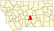
Golden Valley County Montana Incorporated and Unincorporated areas Ryegate Highlighted.svg
Location of Ryegate, Montana
Coordinates: 46°17′56″N109°15′20″W / 46.29889°N 109.25556°W / 46.29889; -109.25556 Coordinates: 46°17′56″N109°15′20″W / 46.29889°N 109.25556°W / 46.29889; -109.25556
Country United States
State Montana
County Golden Valley
Area
[1]
  Total0.75 sq mi (1.95 km2)
  Land0.75 sq mi (1.95 km2)
  Water0.00 sq mi (0.00 km2)
Elevation
3,652 ft (1,113 m)
Population
 (2020)
  Total223
  Density295.76/sq mi (114.23/km2)
Time zone UTC-7 (Mountain (MST))
  Summer (DST) UTC-6 (MDT)
ZIP code
59074
Area code 406
FIPS code 30-64975
GNIS feature ID0776044

Ryegate is a town in, and the county seat of, Golden Valley County, Montana, United States. [2] The population was 223 at the 2020 census. [3] Ryegate is situated on the north bank of the Musselshell River.

Contents

The Milwaukee Road established Ryegate in 1908 as a depot and station stop. [4]

Geography

Ryegate is located at 46°17′56″N109°15′20″W / 46.29889°N 109.25556°W / 46.29889; -109.25556 (46.298780, -109.255569). [5] U.S. Route 12 passes through town.

According to the United States Census Bureau, the town has a total area of 0.69 square miles (1.79 km2), all land. [6]

Climate

According to the Köppen Climate Classification system, Ryegate has a semi-arid climate, abbreviated "BSk" on climate maps. [7]

Climate data for Ryegate, Montana, 19912020 normals, extremes 1962present
MonthJanFebMarAprMayJunJulAugSepOctNovDecYear
Record high °F (°C)67
(19)
73
(23)
77
(25)
86
(30)
93
(34)
100
(38)
102
(39)
100
(38)
99
(37)
95
(35)
79
(26)
66
(19)
102
(39)
Mean maximum °F (°C)56.2
(13.4)
58.7
(14.8)
68.6
(20.3)
77.6
(25.3)
82.5
(28.1)
87.7
(30.9)
94.2
(34.6)
94.3
(34.6)
90.6
(32.6)
81.6
(27.6)
67.9
(19.9)
56.5
(13.6)
96.0
(35.6)
Average high °F (°C)35.8
(2.1)
38.3
(3.5)
47.1
(8.4)
55.0
(12.8)
63.6
(17.6)
71.8
(22.1)
81.9
(27.7)
81.7
(27.6)
71.7
(22.1)
58.2
(14.6)
45.1
(7.3)
35.9
(2.2)
57.2
(14.0)
Daily mean °F (°C)23.8
(−4.6)
25.4
(−3.7)
33.5
(0.8)
41.3
(5.2)
50.3
(10.2)
58.6
(14.8)
66.8
(19.3)
65.9
(18.8)
56.2
(13.4)
43.6
(6.4)
32.2
(0.1)
24.2
(−4.3)
43.5
(6.4)
Average low °F (°C)11.8
(−11.2)
12.4
(−10.9)
19.8
(−6.8)
27.5
(−2.5)
37.1
(2.8)
45.5
(7.5)
51.7
(10.9)
50.1
(10.1)
40.7
(4.8)
29.1
(−1.6)
19.3
(−7.1)
12.4
(−10.9)
29.8
(−1.2)
Mean minimum °F (°C)−15.7
(−26.5)
−10.8
(−23.8)
−2.4
(−19.1)
12.7
(−10.7)
23.9
(−4.5)
33.3
(0.7)
40.4
(4.7)
37.5
(3.1)
26.4
(−3.1)
9.9
(−12.3)
−4.6
(−20.3)
−11.8
(−24.3)
−25.0
(−31.7)
Record low °F (°C)−36
(−38)
−41
(−41)
−32
(−36)
−10
(−23)
13
(−11)
21
(−6)
32
(0)
28
(−2)
10
(−12)
−15
(−26)
−26
(−32)
−42
(−41)
−42
(−41)
Average precipitation inches (mm)0.45
(11)
0.38
(9.7)
0.69
(18)
1.45
(37)
2.27
(58)
2.99
(76)
1.61
(41)
1.19
(30)
1.07
(27)
1.03
(26)
0.62
(16)
0.53
(13)
14.28
(362.7)
Average snowfall inches (cm)8.3
(21)
8.3
(21)
10.1
(26)
6.0
(15)
0.7
(1.8)
0.0
(0.0)
0.0
(0.0)
0.0
(0.0)
0.3
(0.76)
3.6
(9.1)
7.2
(18)
8.4
(21)
52.9
(133.66)
Average precipitation days (≥ 0.01 in)4.44.85.87.69.410.67.35.45.15.44.14.674.5
Average snowy days (≥ 0.1 in)4.44.64.53.10.50.00.00.00.21.63.44.526.8
Source 1: NOAA [8]
Source 2: National Weather Service [9]

Demographics

Historical population
CensusPop.Note
1920 405
1930 292−27.9%
1940 34819.2%
1950 339−2.6%
1960 314−7.4%
1970 261−16.9%
1980 2734.6%
1990 260−4.8%
2000 2683.1%
2010 245−8.6%
2020 223−9.0%
U.S. Decennial Census [10] [3]

2010 census

As of the census [11] of 2010, there were 245 people, 122 households, and 73 families residing in the town. The population density was 355.1 inhabitants per square mile (137.1/km2). There were 145 housing units at an average density of 210.1 per square mile (81.1/km2). The racial makeup of the town was 97.1% White, 0.4% Native American, 0.8% from other races, and 1.6% from two or more races. Hispanic or Latino of any race were 4.1% of the population.

There were 122 households, of which 13.9% had children under the age of 18 living with them, 47.5% were married couples living together, 5.7% had a female householder with no husband present, 6.6% had a male householder with no wife present, and 40.2% were non-families. 31.1% of all households were made up of individuals, and 13.9% had someone living alone who was 65 years of age or older. The average household size was 2.01 and the average family size was 2.48.

The median age in the town was 53.5 years. 11.4% of residents were under the age of 18; 6.6% were between the ages of 18 and 24; 13.4% were from 25 to 44; 39.6% were from 45 to 64; and 29% were 65 years of age or older. The gender makeup of the town was 53.9% male and 46.1% female.

2000 census

As of the census [12] of 2000, there were 268 people, 113 households, and 81 families residing in the town. The population density was 391.6 inhabitants per square mile (151.2/km2). There were 131 housing units at an average density of 191.4 per square mile (73.9/km2). The racial makeup of the town was 98.51% White and 1.49% Native American. Hispanic or Latino of any race were 1.49% of the population.

There were 113 households, out of which 26.5% had children under the age of 18 living with them, 66.4% were married couples living together, 4.4% had a female householder with no husband present, and 28.3% were non-families. 25.7% of all households were made up of individuals, and 15.9% had someone living alone who was 65 years of age or older. The average household size was 2.37 and the average family size was 2.84.

In the town, the population was spread out, with 22.0% under the age of 18, 4.5% from 18 to 24, 21.6% from 25 to 44, 24.6% from 45 to 64, and 27.2% who were 65 years of age or older. The median age was 46 years. For every 100 females there were 109.4 males. For every 100 females age 18 and over, there were 99.0 males.

The median income for a household in the town was $26,250, and the median income for a family was $34,167. Males had a median income of $19,688 versus $18,750 for females. The per capita income for the town was $12,016. About 20.0% of families and 20.2% of the population were below the poverty line, including 15.9% of those under the age of eighteen and 32.5% of those 65 or over.

Education

Ryegate Public School educates students from kindergarten through 12th grade. They are known as the Blue Demons. [13] Ryegate High School is a Class C school [14] (less than 108 students) which helps determine athletic competitions.

Related Research Articles

<span class="mw-page-title-main">Golden Valley County, Montana</span> County in Montana, United States

Golden Valley County is a county located in the U.S. state of Montana. As of the 2020 census, the population was 823, making it the third-least populous county in Montana. Its county seat is Ryegate.

<span class="mw-page-title-main">Ekalaka, Montana</span> Town in Montana, United States

Ekalaka is a town in and the county seat of Carter County, Montana, United States. The population was 399 at the 2020 census.

<span class="mw-page-title-main">Cascade, Montana</span> Town in Cascade County, Montana, United States

Cascade is a town in Cascade County, Montana, United States. The population was 600 at the 2020 census. It is part of the Great Falls, Montana Metropolitan Statistical Area, which in 2020 had a population of 84,414. Cascade was incorporated in 1911.

<span class="mw-page-title-main">Moore, Montana</span> Town in Montana, United States

Moore is a town in Fergus County, Montana, United States. The population was 194 at the 2020 census.

<span class="mw-page-title-main">Winifred, Montana</span> Town in Montana, United States

Winifred is a small town in rural north-central Fergus County, Montana, United States, founded in 1913 and providing services for its region's populace. The town population was 172 at the 2020 census.

<span class="mw-page-title-main">West Yellowstone, Montana</span> Town in Montana, United States

West Yellowstone is a town in Gallatin County, Montana, United States, adjacent to Yellowstone National Park. The population was 1,272 at the 2020 census. West Yellowstone is served by Yellowstone Airport. It is part of the Bozeman, MT Micropolitan Statistical Area.

<span class="mw-page-title-main">Browning, Montana</span> Town in Montana, United States

Browning is a town in Glacier County, Montana, United States. It is the headquarters for the Blackfeet Indian Reservation and the only incorporated town on the Reservation. The population was 1,018 at the 2020 census.

<span class="mw-page-title-main">Circle, Montana</span> Town in Montana, United States

Circle is a town in and the county seat of McCone County, Montana, United States. The population was 591 at the 2020 census.

<span class="mw-page-title-main">White Sulphur Springs, Montana</span> City in Montana, United States

White Sulphur Springs is a city in and the county seat of Meagher County, Montana, United States. The population was 955 at the 2020 census.

<span class="mw-page-title-main">Melstone, Montana</span> Town in Montana, United States

Melstone is a rural small town in far eastern Musselshell County, Montana, United States, along U.S. Route 12. The population was 126 at the 2020 census. The town was established in 1908 as a base for operating crews on the Chicago, Milwaukee, St. Paul and Pacific Railroad, then under construction in Montana. Although the railroad was abandoned in 1980, Melstone survives as a community center for farmers and ranchers in the lower Musselshell River valley. It has a K-12 school with a staff of 16, which in the Fall of 2017 successfully began a 4-day school week.

<span class="mw-page-title-main">Saco, Montana</span> Town in Montana, United States

Saco is a town in Phillips County, Montana, United States. The population was 159 at the 2020 census.

<span class="mw-page-title-main">Valier, Montana</span> Town in Montana, United States

Valier is a town in Pondera County, Montana, United States. The population was 530 at the 2020 census.

<span class="mw-page-title-main">Hamilton, Montana</span> City in Montana, United States

Hamilton is a city that serves as the county seat of Ravalli County, Montana, United States. The population was 4,659 at the 2020 census.

<span class="mw-page-title-main">Columbus, Montana</span> Town in Montana, United States

Columbus is a town in and the county seat of Stillwater County, Montana, United States. The population was 1,857 at the 2020 census.

<span class="mw-page-title-main">Big Timber, Montana</span> City in Montana, United States

Big Timber is a city in, and the county seat of Sweet Grass County, Montana, United States. The population was 1,650 at the 2020 census.

<span class="mw-page-title-main">Greycliff, Montana</span> CDP in Montana, United States

Greycliff is a census-designated place (CDP) in Sweet Grass County, Montana, United States. The population was 56 at the 2000 census.

<span class="mw-page-title-main">Opheim, Montana</span> Town in Montana, United States

Opheim is a town in Valley County, Montana, United States. The population was 75 at the 2020 census.

<span class="mw-page-title-main">Judith Gap, Montana</span> City in Wheatland County, Montana, United States

Judith Gap is a city in Wheatland County, Montana, United States. The population was 110 at the 2020 census.

<span class="mw-page-title-main">Prescott, Washington</span> City in Washington, United States

Prescott is a city in central Walla Walla County, Washington. The population was 318 at the 2010 census.

<span class="mw-page-title-main">Hobson, Montana</span> City in Montana, United States

Hobson is a city in Judith Basin County, Montana, United States. The population was 179 at the 2020 census.

References

  1. "ArcGIS REST Services Directory". United States Census Bureau. Retrieved September 5, 2022.
  2. "Find a County". National Association of Counties. Retrieved 2011-06-07.
  3. 1 2 "U.S. Census website". United States Census Bureau . Retrieved November 2, 2021.
  4. "Ryegate". Montana Place Names Companion. Montana Historical Society. Retrieved 9 April 2021.
  5. "US Gazetteer files: 2010, 2000, and 1990". United States Census Bureau. 2011-02-12. Retrieved 2011-04-23.
  6. "US Gazetteer files 2010". United States Census Bureau. Archived from the original on 2012-01-25. Retrieved 2012-12-18.
  7. Climate Summary for Ryegate, Montana
  8. "U.S. Climate Normals Quick Access". National Oceanic and Atmospheric Administration. Retrieved August 7, 2022.
  9. "NOAA Online Weather Data". National Weather Service. Retrieved August 7, 2022.
  10. "Census of Population and Housing". Census.gov. Retrieved June 4, 2015.
  11. "U.S. Census website". United States Census Bureau . Retrieved 2012-12-18.
  12. "U.S. Census website". United States Census Bureau . Retrieved 2008-01-31.
  13. "Ryegate Public School". Ryegate Public School. Retrieved 17 April 2021.
  14. "Member Schools". Montana High School Association. Retrieved 19 April 2021.