Farson, Wyoming | |
---|---|
Coordinates: 42°10′19″N109°25′12″W / 42.17194°N 109.42000°W | |
Country | United States |
State | Wyoming |
County | Sweetwater |
Area | |
• Total | 77.8 sq mi (201.4 km2) |
• Land | 75.4 sq mi (195.4 km2) |
• Water | 2.4 sq mi (6.1 km2) |
Elevation | 6,595 ft (2,010 m) |
Population (2010) | |
• Total | 313 |
• Density | 4.2/sq mi (1.6/km2) |
Time zone | UTC−7 (Mountain (MST)) |
• Summer (DST) | UTC−6 (MDT) |
ZIP code | 82932 |
Area code | 307 |
FIPS code | 56-26055 [2] |
GNIS feature ID | 1588389 [1] |
Farson is a census-designated place (CDP) in Sweetwater County, Wyoming, United States. The population was 313 at the 2010 census.
Farson is located at 42°10′19″N109°25′12″W / 42.17194°N 109.42000°W (42.171927, -109.420096). [3]
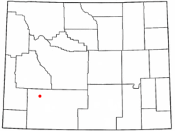
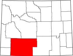
According to the United States Census Bureau, the CDP has a total area of 77.8 square miles (201.4 km2), of which 75.4 square miles (195.4 km2) of land and 2.3 square miles (6.1 km2) (3.02%) is water.
Farson lies at the intersection of U.S. 191 and Wyoming Highway 28 (the South Pass Highway). It is 40 miles north of Rock Springs and approximately 45 miles southwest of South Pass.
According to the Köppen Climate Classification system, Farson has a cold semi-arid climate, abbreviated "BSk" on climate maps. The hottest temperature recorded in Farson was 102 °F (39 °C) on July 9, 2018, while the coldest temperature recorded was −52 °F (−47 °C) on December 31, 1978. [4]
Climate data for Farson, Wyoming, 1991-2020 normals, extremes 1915-present | |||||||||||||
---|---|---|---|---|---|---|---|---|---|---|---|---|---|
Month | Jan | Feb | Mar | Apr | May | Jun | Jul | Aug | Sep | Oct | Nov | Dec | Year |
Record high °F (°C) | 55 (13) | 58 (14) | 70 (21) | 81 (27) | 89 (32) | 97 (36) | 102 (39) | 109 (43) | 93 (34) | 81 (27) | 71 (22) | 70 (21) | 109 (43) |
Mean maximum °F (°C) | 39.7 (4.3) | 43.3 (6.3) | 58.1 (14.5) | 70.7 (21.5) | 79.0 (26.1) | 85.3 (29.6) | 90.0 (32.2) | 88.0 (31.1) | 82.1 (27.8) | 72.3 (22.4) | 56.3 (13.5) | 42.7 (5.9) | 88.2 (31.2) |
Mean daily maximum °F (°C) | 27.5 (−2.5) | 30.1 (−1.1) | 42.5 (5.8) | 53.8 (12.1) | 64.1 (17.8) | 74.1 (23.4) | 82.9 (28.3) | 80.6 (27.0) | 71.0 (21.7) | 57.2 (14.0) | 41.2 (5.1) | 29.8 (−1.2) | 54.6 (12.5) |
Daily mean °F (°C) | 11.5 (−11.4) | 14.3 (−9.8) | 28.1 (−2.2) | 38.0 (3.3) | 47.8 (8.8) | 57.0 (13.9) | 64.0 (17.8) | 62.1 (16.7) | 52.1 (11.2) | 39.6 (4.2) | 25.6 (−3.6) | 13.7 (−10.2) | 37.8 (3.2) |
Mean daily minimum °F (°C) | −4.4 (−20.2) | −1.6 (−18.7) | 13.6 (−10.2) | 22.2 (−5.4) | 31.6 (−0.2) | 39.8 (4.3) | 45.1 (7.3) | 43.7 (6.5) | 33.2 (0.7) | 22.0 (−5.6) | 9.9 (−12.3) | −2.4 (−19.1) | 21.1 (−6.1) |
Mean minimum °F (°C) | −24.5 (−31.4) | −21.8 (−29.9) | −4.9 (−20.5) | 11.6 (−11.3) | 18.7 (−7.4) | 29.0 (−1.7) | 37.1 (2.8) | 34.3 (1.3) | 22.6 (−5.2) | 9.4 (−12.6) | −9.2 (−22.9) | −20.2 (−29.0) | −28.5 (−33.6) |
Record low °F (°C) | −49 (−45) | −47 (−44) | −31 (−35) | −24 (−31) | 5 (−15) | 19 (−7) | 25 (−4) | 21 (−6) | 7 (−14) | −15 (−26) | −34 (−37) | −52 (−47) | −52 (−47) |
Average precipitation inches (mm) | 0.34 (8.6) | 0.29 (7.4) | 0.47 (12) | 0.79 (20) | 1.47 (37) | 1.05 (27) | 0.54 (14) | 0.73 (19) | 0.85 (22) | 0.61 (15) | 0.32 (8.1) | 0.37 (9.4) | 7.83 (199.5) |
Average snowfall inches (cm) | 4.8 (12) | 5.1 (13) | 4.9 (12) | 4.1 (10) | 0.4 (1.0) | 0.0 (0.0) | 0.0 (0.0) | 0.0 (0.0) | 0.1 (0.25) | 1.1 (2.8) | 3.3 (8.4) | 4.6 (12) | 28.4 (71.45) |
Average precipitation days (≥ 0.01 in) | 3.1 | 3.3 | 3.5 | 4.7 | 6.0 | 4.1 | 3.1 | 3.7 | 4.1 | 3.2 | 2.5 | 3.2 | 44.5 |
Average snowy days (≥ 0.1 in) | 3.2 | 3.0 | 2.6 | 2.1 | 0.3 | 0.0 | 0.0 | 0.0 | 0.0 | 0.9 | 1.9 | 2.9 | 16.9 |
Source 1: NOAA [5] | |||||||||||||
Source 2: National Weather Service [4] |
As of the census [2] of 2000, there were 242 people, 96 households, and 69 families residing in the CDP. The population density was 3.2 people per square mile (1.2/km2). There were 118 housing units at an average density of 1.6/sq mi (0.6/km2). The racial makeup of the CDP was 96.28% White, 0.83% African American, 1.65% from other races, and 1.24% from two or more races. Hispanic or Latino of any race were 5.37% of the population.
There were 96 households, out of which 30.2% had children under the age of 18 living with them, 64.6% were married couples living together, 5.2% had a female householder with no husband present, and 28.1% were non-families. 26.0% of all households were made up of individuals, and 9.4% had someone living alone who was 65 years of age or older. The average household size was 2.52 and the average family size was 3.01.
In the CDP, the population was spread out, with 23.6% under the age of 18, 8.7% from 18 to 24, 25.2% from 25 to 44, 31.8% from 45 to 64, and 10.7% who were 65 years of age or older. The median age was 40 years. For every 100 females, there were 103.4 males. For every 100 females age 18 and over, there were 110.2 males.
The median income for a household in the CDP was $44,545, and the median income for a family was $56,806. Males had a median income of $41,364 versus $21,250 for females. The per capita income for the CDP was $16,140. None of the population or families were below the poverty line.
Public education in the community of Farson is provided by Sweetwater County School District #1. [6] Farson-Eden School, a K-12 campus, serves the community. The majority of the students enrolled reside in either Farson or Eden; however, there is a bus that transports students from nearby Rock Springs.
Farson has a public library, a branch of the Sweetwater County Library System. [7]
Sweetwater County is a county in southwestern Wyoming, United States. As of the 2020 United States Census, the population was 42,272, making it the fourth-most populous county in Wyoming. Its county seat is Green River. By area, it is the largest county in Wyoming. Its southern boundary line abuts the north lines of the states of Colorado and Utah.
Alcova is a census-designated place (CDP) in Natrona County, Wyoming, United States. It is part of the Casper, Wyoming Metropolitan Statistical Area. The population was 34 at the 2020 census. Wyoming's center of population is located in the small Town of Alcova. Alcova and the nearby reservoir, Alcova Lake, are popular vacation spots with many seasonal residents.
Bessemer Bend is a census-designated place (CDP) in Natrona County, Wyoming, United States. It is part of the Casper, Wyoming Metropolitan Statistical Area. The population was 199 at the 2010 census.
Boulder is a census-designated place (CDP) in Sublette County, Wyoming, United States. The population was 170 at the 2010 census.
Cora is a census-designated place (CDP) in Sublette County, Wyoming. The population was 114 at the 2020 census.
Arrowhead Springs is a census-designated place (CDP) in Sweetwater County, Wyoming, United States. The population was 63 at the 2010 census.
Bairoil is a town in Sweetwater County, Wyoming, United States. The population was 68 at the 2020 census.
Clearview Acres is a census-designated place (CDP) in Sweetwater County, Wyoming, United States. The population was 795 at the 2010 census.
Eden is a census-designated place (CDP) in Sweetwater County, Wyoming, United States. The population was 281 at the 2010 census.
Granger is a town along Blacks Fork near the western edge of Sweetwater County, Wyoming, United States. The population was 139 at the 2010 census. It is located near the confluence of the Blacks Fork and the Hams Fork rivers. The geography of the area is flat with semi-arid scrub.
Green River is a city in and the county seat of Sweetwater County, Wyoming, United States, in the southwestern part of the state. The population was 11,825 at the 2020 census. It is the 7th most populous city in Wyoming.
James Town is a census-designated place (CDP) in Sweetwater County, Wyoming, United States. The population was 536 at the 2010 census.
Little America is a census-designated place (CDP) in Sweetwater County, Wyoming, United States. The population was 68 at the 2010 census. The community got its name from the Little America motel, which was purposefully located in a remote location as a haven, not unlike the Little America base camp the polar explorer Richard E. Byrd set up in the Antarctic in 1928. However, being situated on a coast-to-coast highway and offering travel services, it thrived, launching a chain of travel facilities by the same name. Its developer, Robert Earl Holding, died on April 19, 2013, with a personal net worth of over $3 billion.
McKinnon is a census-designated place (CDP) in Sweetwater County, Wyoming, United States. The population was 60 at the 2010 census.
North Rock Springs is a census-designated place (CDP) in Sweetwater County, Wyoming, United States. The population was 2,439 at the 2020 census.
Purple Sage is a census-designated place (CDP) in Sweetwater County, Wyoming, United States. The population was 535 at the 2010 census.
Reliance is a census-designated place (CDP) in Sweetwater County, Wyoming, United States. The population was 714 at the 2010 census.
Sweeney Ranch is an unincorporated community in Sweetwater County, Wyoming, United States. The population was 17 at the 2000 census, when it was a census-designated place (CDP).
Wamsutter is a town in Sweetwater County, Wyoming, United States. The population was 203 at the 2020 census.
Washam is a census-designated place (CDP) in Sweetwater County, Wyoming, United States. The population was 51 at the 2010 census.