Wamsutter, Wyoming

Last updated

Wamsutter, Wyoming
WamsutterWyoming.jpg
Panorama of Wamsutter, looking south from I-80
Sweetwater County Wyoming Incorporated and Unincorporated areas Wamsutter Highlighted 5681300.svg
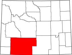
Location of Wamsutter in Sweetwater County, Wyoming.
Usa edcp location map.svg
Red pog.svg
Wamsutter, Wyoming
Location in the United States
Coordinates: 41°40′15″N107°58′39″W / 41.67083°N 107.97750°W / 41.67083; -107.97750
Country United States
State Wyoming
County Sweetwater
Area
[1]
  Total1.63 sq mi (4.21 km2)
  Land1.63 sq mi (4.21 km2)
  Water0.00 sq mi (0.00 km2)
Elevation
[2]
6,746 ft (2,056 m)
Population
 (2020) [3]
  Total203
  Estimate 
(2023) [4]
200
  Density287.03/sq mi (110.82/km2)
Time zone UTC-7 (Mountain (MST))
  Summer (DST) UTC-6 (MDT)
ZIP code
82336
Area code 307
FIPS code 56-81300 [5]
GNIS feature ID1609172 [2]

Wamsutter is a town in Sweetwater County, Wyoming, United States. The population was 203 at the 2020 census.

Contents

The original inhabitants of the area were the Shoshone and Ute tribes. Westerners only began to settle in the county with the coming of the railroad in the 1860s. [6] Originally, the town was known as Washakie. Confusion with nearby Fort Washakie prompted an 1884 name change to Wamsutter, after a Union Pacific bridge engineer. [7]

The town, which bills itself as "The Gateway to the Red Desert" is located along Interstate 80 between Rawlins and Rock Springs, on the easternmost border of Sweetwater County. The natural gas industry has exerted great influence on Wamsutter in recent years, through employment opportunities in the area, and by contributing to the community directly. [8]

Wamsutter is the largest settlement, and the only incorporated town in the Great Divide Basin.

Geography

Wamsutter is located at 41°40′15″N107°58′39″W / 41.67083°N 107.97750°W / 41.67083; -107.97750 (41.670839, –107.977457). [9]

According to the United States Census Bureau, the town has a total area of 1.45 square miles (3.76 km2), all land. [10]

Climate

According to the Köppen Climate Classification system, Wamsutter has a cold semi-arid climate, abbreviated "BSk" on climate maps. The hottest temperature recorded in Wamsutter was 105 °F (41 °C) on July 28, 1897, while the coldest temperature recorded was −40 °F (−40 °C) on January 1, 1979, and February 2, 2011. [11]

Climate data for Wamsutter, Wyoming, 1991–2020 normals, extremes 1897–present
MonthJanFebMarAprMayJunJulAugSepOctNovDecYear
Record high °F (°C)52
(11)
59
(15)
71
(22)
78
(26)
90
(32)
104
(40)
105
(41)
100
(38)
90
(32)
87
(31)
71
(22)
79
(26)
105
(41)
Mean maximum °F (°C)41.0
(5.0)
46.7
(8.2)
60.8
(16.0)
71.5
(21.9)
79.4
(26.3)
88.0
(31.1)
92.5
(33.6)
90.3
(32.4)
85.3
(29.6)
74.5
(23.6)
58.3
(14.6)
44.4
(6.9)
91.0
(32.8)
Mean daily maximum °F (°C)29.6
(−1.3)
33.4
(0.8)
45.3
(7.4)
54.6
(12.6)
65.1
(18.4)
76.9
(24.9)
85.1
(29.5)
82.7
(28.2)
72.6
(22.6)
58.1
(14.5)
42.2
(5.7)
29.9
(−1.2)
56.3
(13.5)
Daily mean °F (°C)19.0
(−7.2)
22.3
(−5.4)
33.1
(0.6)
40.6
(4.8)
49.9
(9.9)
59.9
(15.5)
67.6
(19.8)
65.3
(18.5)
56.0
(13.3)
43.6
(6.4)
30.3
(−0.9)
19.5
(−6.9)
42.3
(5.7)
Mean daily minimum °F (°C)8.5
(−13.1)
11.3
(−11.5)
20.8
(−6.2)
26.6
(−3.0)
34.8
(1.6)
42.9
(6.1)
50.1
(10.1)
48.0
(8.9)
39.3
(4.1)
29.2
(−1.6)
18.4
(−7.6)
9.1
(−12.7)
28.3
(−2.1)
Mean minimum °F (°C)−14.8
(−26.0)
−10.9
(−23.8)
1.4
(−17.0)
11.6
(−11.3)
21.4
(−5.9)
31.5
(−0.3)
39.0
(3.9)
36.0
(2.2)
24.5
(−4.2)
9.7
(−12.4)
−3.2
(−19.6)
−13.5
(−25.3)
−19.9
(−28.8)
Record low °F (°C)−40
(−40)
−40
(−40)
−26
(−32)
−8
(−22)
10
(−12)
19
(−7)
24
(−4)
23
(−5)
5
(−15)
−21
(−29)
−27
(−33)
−33
(−36)
−40
(−40)
Average precipitation inches (mm)0.43
(11)
0.40
(10)
0.48
(12)
0.76
(19)
1.35
(34)
0.81
(21)
0.67
(17)
0.72
(18)
0.90
(23)
0.76
(19)
0.64
(16)
0.53
(13)
8.45
(213)
Average snowfall inches (cm)7.8
(20)
7.6
(19)
7.2
(18)
6.1
(15)
2.5
(6.4)
0.1
(0.25)
0.0
(0.0)
0.0
(0.0)
0.7
(1.8)
3.0
(7.6)
7.0
(18)
8.8
(22)
50.8
(128.05)
Average precipitation days (≥ 0.01 in)4.54.74.96.67.34.54.34.95.24.34.65.060.8
Average snowy days (≥ 0.1 in)4.03.63.33.10.90.00.00.00.31.23.04.323.7
Source 1: NOAA [12]
Source 2: National Weather Service [11]

Demographics

Historical population
CensusPop.Note
1940 169
1950 103−39.1%
1960 1106.8%
1970 13926.4%
1980 681389.9%
1990 240−64.8%
2000 2618.8%
2010 45172.8%
2020 203−55.0%
U.S. Decennial Census [13]

2010 census

As of the census [3] of 2010, there were 451 people, 189 households, and 112 families residing in the town. The population density was 311.0 inhabitants per square mile (120.1/km2). There were 286 housing units at an average density of 197.2 per square mile (76.1/km2). The racial makeup of the town was 82.7% White, 0.7% African American, 2.9% Native American, 11.1% from other races, and 2.7% from two or more races. Hispanic or Latino of any race were 19.7% of the population.

There were 189 households, of which 32.3% had children under the age of 18 living with them, 45.5% were married couples living together, 8.5% had a female householder with no husband present, 5.3% had a male householder with no wife present, and 40.7% were non-families. 29.6% of all households were made up of individuals, and 3.2% had someone living alone who was 65 years of age or older. The average household size was 2.39 and the average family size was 2.96.

The median age in the town was 38.3 years. 25.7% of residents were under the age of 18; 6.7% were between the ages of 18 and 24; 27.9% were from 25 to 44; 33.6% were from 45 to 64; and 6% were 65 years of age or older. The gender makeup of the town was 58.1% male and 41.9% female.

2000 census

As of the census [5] of 2000, there were 261 people, 100 households, and 65 families residing in the town. The population density was 198.7 people per square mile (76.9/km2). There were 148 housing units at an average density of 112.6 per square mile (43.6/km2). The racial makeup of the town was 93.87% White, 0.77% Native American, 3.07% from other races, and 2.30% from two or more races. Hispanic or Latino of any race were 13.03% of the population.

There were 100 households, out of which 38.0% had children under the age of 18 living with them, 54.0% were married couples living together, 8.0% had a female householder with no husband present, and 35.0% were non-families. 29.0% of all households were made up of individuals, and 5.0% had someone living alone who was 65 years of age or older. The average household size was 2.54 and the average family size was 3.25.

In the town, the population was spread out, with 31.4% under the age of 18, 6.9% from 18 to 24, 34.9% from 25 to 44, 23.8% from 45 to 64, and 3.1% who were 65 years of age or older. The median age was 33 years. For every 100 females, there were 119.3 males. For every 100 females age 18 and over, there were 126.6 males.

The median income for a household in the town was $35,625, and the median income for a family was $46,250. Males had a median income of $34,643 versus $20,000 for females. The per capita income for the town was $18,943. About 11.4% of families and 10.6% of the population were below the poverty line, including 20.6% of those under the age of eighteen and none of those 65 or over.

Education

Public education in the town of Wamsutter is provided by Sweetwater County School District #1. Students in grades K–8 attend Desert School in Wamsutter, which is divided into elementary (grades K–6) and middle school (grades 7–8) campuses. Upon the completion of 8th grade, students attend Rawlins High School (grades 9–12; part of Carbon County School District #1) by agreement of the respective boards of trustees.

Wamsutter has a public library, a branch of the Sweetwater County Library System. [14]

Related Research Articles

<span class="mw-page-title-main">Johnson County, Wyoming</span> County in Wyoming, United States

Johnson County is a county in the north central part of the U.S. state of Wyoming. At the 2020 United States Census, the population was 8,447. The county seat is Buffalo. Kaycee is the only other incorporated town in the county.

<span class="mw-page-title-main">Washakie County, Wyoming</span> County in Wyoming, United States

Washakie County is a county in the U.S. state of Wyoming. As of the 2020 United States Census, the population was 7,685. Its county seat is Worland.

<span class="mw-page-title-main">Sweetwater County, Wyoming</span> County in Wyoming, United States

Sweetwater County is a county in southwestern Wyoming, United States. As of the 2020 United States Census, the population was 42,272, making it the fourth-most populous county in Wyoming. Its county seat is Green River. By area, it is the largest county in Wyoming. Its southern boundary line abuts the north lines of the states of Colorado and Utah.

<span class="mw-page-title-main">Fremont County, Wyoming</span> County in Wyoming, United States

Fremont County is a county in the U.S. state of Wyoming. As of the 2020 United States census, the population was 39,234, making it the fifth-most populous county in Wyoming. Its county seat is Lander. The county was founded in 1884 and is named for John C. Frémont, a general, explorer, and politician. It is roughly the size of the state of Vermont.

<span class="mw-page-title-main">Carbon County, Wyoming</span> County in Wyoming, United States

Carbon County is a county in the U.S. state of Wyoming. As of the 2020 United States Census, the population was 14,537. Its county seat is Rawlins. Its south border abuts the north line of Colorado.

<span class="mw-page-title-main">Rock River, Wyoming</span> Town in Wyoming, United States

Rock River is a town in Albany County, Wyoming, United States. As of the 2010 census, the town population was 245.

<span class="mw-page-title-main">Fort Washakie, Wyoming</span> CDP in Wyoming, United States

Fort Washakie is a census-designated place (CDP) in Fremont County, Wyoming, United States, within the Wind River Indian Reservation and along U.S. Route 287. The population was 1,759 at the 2010 census. The headquarters for the Eastern Shoshone Tribe is located in Fort Washakie, as well as the Bureau of Indian Affairs agency for the Wind River Indian Reservation.

<span class="mw-page-title-main">Bairoil, Wyoming</span> Town in Wyoming, United States

Bairoil is a town in Sweetwater County, Wyoming, United States. The population was 106 at the 2010 census.

Clearview Acres is a census-designated place (CDP) in Sweetwater County, Wyoming, United States. The population was 795 at the 2010 census.

<span class="mw-page-title-main">Granger, Wyoming</span> Town in Sweetwater County, Wyoming, United States

Granger is a town along Blacks Fork near the western edge of Sweetwater County, Wyoming, United States. The population was 139 at the 2010 census. It is located near the confluence of the Blacks Fork and the Hams Fork rivers. The geography of the area is flat with semi-arid scrub.

<span class="mw-page-title-main">James Town, Wyoming</span> CDP in Wyoming, United States

James Town is a census-designated place (CDP) in Sweetwater County, Wyoming, United States. The population was 536 at the 2010 census.

<span class="mw-page-title-main">Reliance, Wyoming</span> CDP in Wyoming, United States

Reliance is a census-designated place (CDP) in Sweetwater County, Wyoming, United States. The population was 714 at the 2010 census.

<span class="mw-page-title-main">Superior, Wyoming</span> Town in Wyoming, United States

Superior is a town in Sweetwater County, Wyoming, United States. The population was 336 at the 2010 census.

Sweeney Ranch is an unincorporated community in Sweetwater County, Wyoming, United States. The population was 17 at the 2000 census, when it was a census-designated place (CDP).

<span class="mw-page-title-main">Table Rock, Wyoming</span> Town in Wyoming, United States

Table Rock is a ghost town in Sweetwater County, Wyoming, United States. It was also part of a census-designated place at the 2000 census, with a population of 82, but the 2010 census reported a population of 0.

<span class="mw-page-title-main">Lyman, Wyoming</span> Town in Wyoming, United States

Lyman is a town in Uinta County, Wyoming, United States. The population was 2,115 at the 2010 census.

<span class="mw-page-title-main">Mountain View, Wyoming</span> Town in Wyoming, United States

Mountain View is a town in Uinta County, Wyoming, United States. The population was 1,286 at the 2010 census.

<span class="mw-page-title-main">Ten Sleep, Wyoming</span> Town in Wyoming, United States

Ten Sleep is a town in Washakie County, Wyoming, United States. It is located in the Bighorn Basin in the western foothills of the Bighorn Mountains, approximately 26 miles (42 km) east of Worland and 59 miles (95 km) west of Buffalo.

Washakie is an unincorporated community in Washakie County, Wyoming, United States. The population was 604 at the 2000 census, when it was a census-designated place (CDP).

<span class="mw-page-title-main">Worland, Wyoming</span> City in Wyoming, United States

Worland is a city in Washakie County, Wyoming, United States. The population was 5,487 at the 2010 census. It is the county seat of Washakie County. It is located within the Big Horn Basin and along the Big Horn River in northwestern Wyoming.

References

  1. "2019 U.S. Gazetteer Files". United States Census Bureau. Retrieved August 7, 2020.
  2. 1 2 U.S. Geological Survey Geographic Names Information System: Wamsutter, Wyoming
  3. 1 2 "U.S. Census website". United States Census Bureau . Retrieved December 14, 2012.
  4. "Population and Housing Unit Estimates". United States Census Bureau. May 24, 2020. Retrieved May 27, 2020.
  5. 1 2 "U.S. Census website". United States Census Bureau . Retrieved January 31, 2008.
  6. "Sweetwater County Historical Museum - Sweetwater County Historical Museum". www.sweetwatermuseum.org. Retrieved November 4, 2021.
  7. "Wamsutter, Wyoming".
  8. http://casperstartribune.net/articles/2008/09/17/news/wyoming/567cba04cbcc32f9872574c70006245c.prt [ dead link ]
  9. "US Gazetteer files: 2010, 2000, and 1990". United States Census Bureau. February 12, 2011. Retrieved April 23, 2011.
  10. "US Gazetteer files 2010". United States Census Bureau . Retrieved December 14, 2012.
  11. 1 2 "NOAA Online Weather Data". National Weather Service. Retrieved August 20, 2022.
  12. "U.S. Climate Normals Quick Access". National Oceanic and Atmospheric Administration. Retrieved August 20, 2022.
  13. "Census of Population and Housing". Census.gov. Retrieved June 4, 2015.
  14. "Wyoming Public Libraries". PublicLibraries.com. Retrieved June 14, 2019.