These are the six National Natural Landmarks in Maryland .
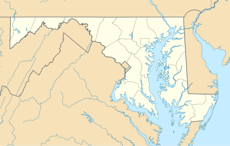
Maryland National Natural Landmarks (clickable map)
| Name | Image | Date | Location | County | Ownership | Description |
|---|---|---|---|---|---|---|
| Battle Creek Cypress Swamp | 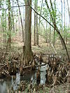 | April 1965 | Prince Frederick 38°29′25″N76°35′27″W / 38.490275°N 76.590773°W | Calvert | private (The Nature Conservancy) | One of the northernmost sites of naturally occurring bald cypress ( Taxodium distichum ) trees in North America, and the only large stand of the trees on the western shore of Maryland. The site also contains a wide range of plant and animal life. |
| Belt Woods | 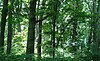 | 1974 | Woodmore 38°54′18″N76°45′47″W / 38.90505°N 76.76304°W | Prince George's | state (Department of Natural Resources) | One of the few remaining old-growth upland forests in the Atlantic Coastal Plain biophysiographic province. It is an example of upland hardwood forest dominated by tulip poplar and white oak. The Woods support a diverse bird population, including neotropical migrants. |
| Cranesville Swamp Nature Sanctuary |  | 1964 | 39°31′53″N79°28′55″W / 39.531389°N 79.481944°W | Garrett | private (The Nature Conservancy) | A natural bowl where cool, moist conditions yield plant and animal communities more common in northern latitudes. Extends into Preston County, West Virginia. |
| Gilpin's Falls | 1980 | Cecil | private | Outcrop of undeformed early Paleozoic metavolcanic pillow basalts. | ||
| Long Green Creek and Sweathouse Branch | 1977 | Baltimore | state (Department of Natural Resources) | A maturing beech-tulip poplar-white oak forest. | ||
| Sugarloaf Mountain |  | June 1969 | Frederick 39°16′09″N77°23′43″W / 39.269208°N 77.395248°W | Frederick, Montgomery | private | An outlier to the east of the main mass of the Catoctin Mountain, or a root remnant of the ancient Appalachia land mass. |