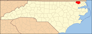
There are 13 National Natural Landmarks in North Carolina.
| Name | Image | Date | Location | County | Ownership | Description |
|---|---|---|---|---|---|---|
| Bear Island |  | 1980 | 34°37′55″N77°08′44″W / 34.631944°N 77.145556°W | Onslow | state | Dune movement has created a dynamic landscape of outstanding scenic beauty. Bear Island is the principal attraction of Hammocks Beach State Park. |
| Goose Creek State Park Natural Area |  | 1980 | 35°28′25″N76°54′50″W / 35.473611°N 76.913889°W | Beaufort | state | An excellent example of a gently sloping mainland undergoing rapid ocean transgression. |
| Green Swamp | 1974 | 34°05′36″N78°17′57″W / 34.09321°N 78.29925°W | Brunswick | private | The largest and most unusual mosaic of wetland communities in the Carolinas. The Nature Conservancy manages the site as the Green Swamp Preserve. | |
| Long Hope Creek Spruce Bog | 1974 | 36°22′52″N81°38′44″W / 36.381101°N 81.645663°W | Ashe, Watauga | private | One of the rarest plant communities in North Carolina. The still forming Elk Knob State Park is adjacent to the privately owned NNL, and the state has a long-term goal to acquire the site. | |
| Mount Jefferson State Park |  | 1974 | 36°24′03″N81°27′46″W / 36.400833°N 81.462778°W | Ashe | state | One of the best remaining examples of oak-chestnut forest in the Southeast. The State Park was redesignated a State Natural Area. |
| Mount Mitchell State Park |  | 1974 | 35°46′13″N82°15′48″W / 35.770278°N 82.263333°W | Yancey | state | Mount Mitchell is the highest mountain in the eastern half of the United States at 6,684 feet (2,037 m). |
| Nags Head Woods and Jockey Ridge |  | 1974 | 35°57′43″N75°38′03″W / 35.961944°N 75.634167°W | Dare | state | Illustrates the entire series of dune development and plant succession. Jockey's Ridge State Park encompasses the southern portion of the NNL, and The Nature Conservancy's Nags Head Woods Ecological Preserve encompasses the northern portion. |
| Orbicular Diorite | 1980 | Davie | private | Site contains an unusual plutonic igneous rock consisting of hornblende, pyroxene, and feldspars. | ||
| Piedmont Beech Natural Area | 1974 | 35°51′14″N78°44′34″W / 35.853889°N 78.742778°W | Wake | state | One of the best examples of mixed mesophytic forest in the eastern Piedmont of North Carolina. The natural area is located within William B. Umstead State Park. | |
| Pilot Mountain |  | 1974 | 36°20′24″N80°28′27″W / 36.340138°N 80.474224°W | Surry | state | A classic monadnock that harbors disjunct vegetation from the Blue Ridge region. It is a core component of the greater Pilot Mountain State Park. |
| Salyer's Ridge Natural Area | 1983 | Hyde | federal | A rare example of mature loblolly pine forest in process of succession towards a deciduous forest. The natural area is located within the Mattamuskeet National Wildlife Refuge. | ||
| Smith Island | 1967 | Brunswick, New Hanover | state | A barrier island complex representing one of the least disturbed areas remaining on the Atlantic Coast. The island complex is protected as part of Fort Fisher State Recreation Area and Baldhead Island State Natural Area. | ||
| Stone Mountain |  | 1974 | 36°23′37″N81°02′36″W / 36.393611°N 81.043333°W | Alleghany, Wilkes | state | The best example of a monadnock in North Carolina. It is the principal attraction of Stone Mountain State Park. |


