List of National Natural Landmarks in Kentucky

Last updated

Map all coordinates using: OpenStreetMap  
Download coordinates as: KML

From List of National Natural Landmarks, these are the National Natural Landmarks in Kentucky. There are 7 in total, 1 is shared with Indiana.

NameImageDateLocationCountyOwnershipDescription
1 Creelsboro Natural Bridge Creelsboro Natural Arch.jpg 1987 36°53′06″N85°14′11″W / 36.884992°N 85.236425°W / 36.884992; -85.236425 (Creelsboro Natural Bridge) Russell privateAn outstanding illustration of subterranean stream diversion.
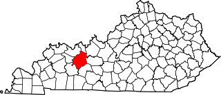
2 Henderson Sloughs 1974 37°51′38″N87°46′48″W / 37.860445°N 87.780100°W / 37.860445; -87.780100 (Henderson Sloughs) Henderson, Union state (Dept. of Fish & Wildlife)One of the largest wetlands remaining in Kentucky
3 Lilley Cornett Woods 1971 37°05′16″N82°59′33″W / 37.087865°N 82.992453°W / 37.087865; -82.992453 (Lilley Cornett Woods) Letcher state (Eastern Kentucky University)Virgin tract of mixed mesophytic forest.
4 Red River Gorge Redrivergorge2.jpg 1975 37°50′02″N83°36′28″W / 37.833889°N 83.607778°W / 37.833889; -83.607778 (Red River Gorge) Menifee, Powell, Wolfe federal (Daniel Boone National Forest)Contains examples of many geological formations, including 41 natural bridges.
5 Rock Creek Research Natural Area 1975 37°17′17″N83°52′31″W / 37.288056°N 83.875278°W / 37.288056; -83.875278 (Daniel Boone National Forest) Laurel federal (Daniel Boone National Forest)One of the few virgin hemlock hardwood forests remaining in Kentucky.
6 Big Bone Lick BIG BONE LICK STATE PARK.jpg 2009 38°53′13″N84°44′52″W / 38.886944°N 84.747778°W / 38.886944; -84.747778 (Big Bone Lick State Park) Boone state (Big Bone Lick State Park)Combination of salt springs and associated Late Pleistocene bone beds. Also on the mighty Ohio River.
7 Ohio Coral Reef Fossil beds on the Ohio River.JPG 1966 38°16′36″N85°45′56″W / 38.27665°N 85.76544°W / 38.27665; -85.76544 (Falls of the Ohio National Wildlife Conservation Area) Jefferson federal (Falls of the Ohio National Wildlife Conservation Area)A classic example of a Silurian and Devonian coral community. Extends into Indiana.

Related Research Articles

National Historic Landmark Building, area, or object officially recognized by the US govt. for historical significance

A National Historic Landmark (NHL) is a building, district, object, site, or structure that is officially recognized by the United States government for its outstanding historical significance. Only some 2,500 (~3%) of over 90,000 places listed on the country's National Register of Historic Places are recognized as National Historic Landmarks.

National Natural Landmark Natural areas program in the U.S.

The National Natural Landmarks (NNL) Program recognizes and encourages the conservation of outstanding examples of the natural history of the United States. It is the only national natural areas program that identifies and recognizes the best examples of biological and geological features in both public and private ownership. The program was established on May 18, 1962, by United States Secretary of the Interior Stewart Udall.

Keeley Creek Natural Area is a Research Natural Area and a National Natural Landmark that is protected by the United States Department of Agriculture, specifically through the branch of the Forest Service. It is located in Stony River Township, in Lake County, Minnesota, and is part of the Superior National Forest.

Dendron Swamp Natural Area Preserve

Dendron Swamp Natural Area Preserve is a 636-acre (257 ha) Natural Area Preserve in Sussex County, Virginia, USA. Located along the Blackwater River, the preserve supports a bald cypress and tupelo swamp. Canopy trees over 98 feet (30 m) tall line the river for two miles (3.2 km) and the swamp shows only occasional signs of logging. Some of the larger cypresses are believed to be over 600 years old. Within the preserve is a nesting site for the great blue heron.

Bear Swamp Preserve

Bear Swamp Preserve is a Nature Conservancy preserve and National Natural Landmark in Westerlo, New York. It consists of a pond and surrounding 310 acres (1.3 km2) of swamp and woodland. It is recognized for its great laurel tree population. It has two nature trails totaling about two miles (3.2 km) in length.

Deer Lick Nature Sanctuary is a protected forest and gorge in Cattaraugus County, New York. The preserve is within Zoar Valley near Gowanda, and is managed by The Nature Conservancy.

Ironsides Island is an uninhabited rocky island in the Saint Lawrence River, and part of the Thousand Islands region near Alexandria Bay, New York. It is in both Jefferson and St. Lawrence counties. Most of the island lies in the Town of Alexandria, in Jefferson County, while its northeasternmost corner lies in the Town of Hammond, in St. Lawrence County. The island is located near Kring Point State Park.

Moss Lake Bog is an 84-acre (34 ha) site containing a 15-acre (6.1 ha) glacial kettle lake located in the town of Caneadea, New York, outside Houghton. Over time, sphagnum moss has grown over the open water, turning it into an acidic bog. It is managed by The Nature Conservancy as part of Moss Lake Preserve, and was declared a National Natural Landmark in 1973.

Thompson Pond Lake in New York, United States

Thompson Pond in Pine Plains, New York is a 75-acre (30 ha) 15,000-year-old glacial kettle pond at the foot of 1,403-foot (428 m) Stissing Mountain. It is the source of Wappinger Creek, a tributary of the Hudson River that drains much of Dutchess County.

Zurich Bog

Zurich Bog is a 490-acre (2.0 km2) sphagnum bog in Arcadia, New York. Lyman Stuart and the Newark School District donated the land on December 10, 1957 to the Bergen Swamp Preservation Society which had been created in 1935 to preserve the similar Bergen-Byron Swamp. The bog has been the focus of scientific interest since the 19th century, and was declared a National Natural Landmark in May 1973.

Sand Creek (Wyoming)

Sand Creek is a stream noted for the "most spectacular examples of cross-bedded sandstone and topple blocks in North America". Sand Creek flows from the Laramie Mountains in Larimer County, Colorado into Albany County, Wyoming where it joins the Laramie River.

Landmark Recognizable feature used for navigation

A landmark is a recognizable natural or artificial feature used for navigation, a feature that stands out from its near environment and is often visible from long distances.

The Bergen-Byron Swamp is a protected 2,000-acre (810 ha) swamp and nature preserve located in the towns of Byron and Bergen, New York. It is over 10,000 years old. The Bergen Swamp Preservation Society was formed in 1935 to protect and preserve this delicate ecological environment.

Lacawac United States historic place

Lacawac is a historic estate located in Paupack Township and Salem Township, Wayne County, Pennsylvania. It was built in 1903, as a summer estate of Congressman William Connell (1827-1909). Six of the eight buildings remain. They are the main house, barn, spring house, pump house, Coachman's Cabin, and ice house. The buildings are in an Adirondack Great Camp style. The main house is a 2+12-story frame dwelling with a cross gable roof. It features two-story porches and the interior is paneled in southern yellow pine.