List of National Natural Landmarks in Georgia

Last updated

Map all coordinates using: OpenStreetMap

As of 2023, there are eleven National Natural Landmarks in the U.S. state of Georgia .

USA Georgia location map.svg
Purple pog.svg
Big Hammock Natural Area
Purple pog.svg
Lewis Island Tract
Purple pog.svg
Cason J. Calloway Memorial Forest
Purple pog.svg
Ebenezer Creek Swamp
Purple pog.svg
Wade Tract Preserve
Georgia National Natural Landmarks (clickable map)
NameImageDateLocationCountyOwnershipDescription
1 Big Hammock Natural Area 1976 31°51′55″N82°05′11″W / 31.86522°N 82.0864°W / 31.86522; -82.0864 (Big Hammock Natural Area) Tattnall state (Dept. of Natural Resources)Relatively undisturbed broadleaf evergreen hammock forest.
2 Camp E.F. Boyd Natural Area 1974 Emanuel privateOne of the best representatives of the upland sand ridge ecosystem of the Coastal Plain
3 Cason J. Calloway Memorial Forest 1972 32°44′59″N84°56′05″W / 32.7498°N 84.9346°W / 32.7498; -84.9346 (Cason J. Calloway Memorial Forest) Harris privateAn outstanding example of transitional conditions between eastern deciduous and southern coniferous forest types.
4 Ebenezer Creek Swamp 1976 32°21′50″N81°13′53″W / 32.3640°N 81.2313°W / 32.3640; -81.2313 (Ebenezer Creek Swamp) Effingham privateThe best remaining cypress-gum swamp forest in the Savannah River basin.
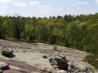
5 Heggie's Rock Heggies Rock in the Rain small.jpg 1980 33°32′29.8″N82°15′13.1″W / 33.541611°N 82.253639°W / 33.541611; -82.253639 (Heggie's Rock) Columbia county, private (The Nature Conservancy)The best example in eastern North America of the remarkable endemic flora restricted to granite outcrops.
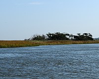
6 Lewis Island Tract 1974 31°24′N81°30′W / 31.4°N 81.5°W / 31.4; -81.5 (Lewis Island Tract) McIntosh state (Department of Natural Resources)One of the most extensive bottomland hardwood swamps in Georgia. website
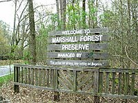
7 Marshall Forest Marshall forest1.jpg 1966 34°15′03″N85°11′43″W / 34.250898°N 85.195375°W / 34.250898; -85.195375 (Marshall Forest) Floyd privateA loblolly pine-shortleaf pine forest believed to have originated following an intense fire at about the time the Cherokee Indians were forcibly removed to Oklahoma.
8 Okefenokee Swamp OkefenokeeCanalDiggersTrail.wmg.jpg 1974 30°37′00″N82°19′00″W / 30.616667°N 82.316667°W / 30.616667; -82.316667 (Okefenokee Swamp) Charlton, Clinch, Ware federal (Okefenokee National Wildlife Refuge)One of the largest and most primitive swamps in the country.
9 Panola Mountain Panola.JPG 1980 33°38′07″N84°10′13″W / 33.635278°N 84.170278°W / 33.635278; -84.170278 (Panola Mountain) Rockdale state (Department of Natural Resources)The most natural and undisturbed monadnock of exposed granitic rock in the Piedmont biophysiographic province.
10 Wassaw Island DSC 9425 (8091112286).jpg 1967 31°54′01″N80°58′56″W / 31.9003°N 80.9822°W / 31.9003; -80.9822 (Wassaw Island) Chatham federal (Wassaw National Wildlife Refuge)Only barrier island in Georgia with an undisturbed forest cover.
11 Wade Tract Preserve 2014 30°45′N84°00′W / 30.75°N 84°W / 30.75; -84 (Wade Tract Preserve) Thomas privateOld growth longleaf pine savanna.

Related Research Articles

<span class="mw-page-title-main">Swamp</span> A forested wetland

A swamp is a forested wetland. Swamps are considered to be transition zones because both land and water play a role in creating this environment. Swamps vary in size and are located all around the world. The water of a swamp may be fresh water, brackish water, or seawater. Freshwater swamps form along large rivers or lakes where they are critically dependent upon rainwater and seasonal flooding to maintain natural water level fluctuations. Saltwater swamps are found along tropical and subtropical coastlines. Some swamps have hammocks, or dry-land protrusions, covered by aquatic vegetation, or vegetation that tolerates periodic inundation or soil saturation. The two main types of swamp are "true" or swamp forests and "transitional" or shrub swamps. In the boreal regions of Canada, the word swamp is colloquially used for what is more formally termed a bog, fen, or muskeg. Some of the world's largest swamps are found along major rivers such as the Amazon, the Mississippi, and the Congo.

<span class="mw-page-title-main">Big Lake National Wildlife Refuge</span>

Big Lake National Wildlife Refuge is an 11,047-acre (45 km²) National Wildlife Refuge located in Mississippi County, Arkansas, managed by the United States Fish and Wildlife Service. It is situated 2 miles (3.2 km) east of Manila, Arkansas, and consists mostly of a shallow lake, swamp, and bottomland hardwood forests. The preservation of habitat for waterfowl in an intensely agricultural region is the primary purpose of the refuge. 6,400 acres (20 km²) of Big Lake is classified as a National Natural Landmark and 2,144 acres (8 km²) are classified as wilderness.

<span class="mw-page-title-main">Congaree National Park</span> National park in South Carolina, United States

Congaree National Park is a 26,692.6-acre American national park in central South Carolina, 18 miles southeast of the state capital, Columbia. The park preserves the largest tract of old growth bottomland hardwood forest left in the United States. The lush trees growing in its floodplain forest are some of the tallest in the eastern United States, forming one of the highest temperate deciduous forest canopies remaining in the world. The Congaree River flows through the park. About 15,000 acres are designated as a wilderness area.

<span class="mw-page-title-main">Sundarbans</span> Mangrove forest in the Bay of Bengal

Sundarbans is a mangrove area in the delta formed by the confluence of the Ganges, Brahmaputra and Meghna Rivers in the Bay of Bengal. Sundarban Reserve Forest (SRF) of Bangladesh is the largest mangrove forest in the world. It spans the area from the Baleswar River in Bangladesh's division of Khulna to the Hooghly River in India's state of West Bengal. It comprises closed and open mangrove forests, land used for agricultural purpose, mudflats and barren land, and is intersected by multiple tidal streams and channels. Sundarbans is home to the world's largest area of mangrove forests. Four protected areas in the Sundarbans are enlisted as UNESCO World Heritage Sites, viz. Sundarbans West (Bangladesh), Sundarbans South (Bangladesh), Sundarbans East (Bangladesh) and Sundarbans National Park (India).

<span class="mw-page-title-main">Picayune Strand State Forest</span> Protected natural area in the U.S. state of Florida

Picayune Strand State Forest is one of 37 state forests in Florida managed by the Florida Forest Service. The 78,000-acre forest consists primarily of cypress swamps, wet pine flatwoods and wet prairies. It also features a grid of closed roads over part of it, left over from previous land development schemes.

<span class="mw-page-title-main">Forbes State Forest</span> State forest in Pennsylvania, United States

Forbes State Forest is a Pennsylvania state forest in Pennsylvania Bureau of Forestry District #4. The main offices are located in Laughlintown in Westmoreland County, Pennsylvania in the United States. Mount Davis, the highest peak in Pennsylvania, is located in the forest.

<span class="mw-page-title-main">Tiadaghton State Forest</span> State forest in Pennsylvania, United States

Tiadaghton State Forest is a Pennsylvania State Forest in the Pennsylvania Department of Conservation and Natural Resources, Bureau of Forestry. The forest is primarily in western and southern Lycoming County, with small portions in Clinton, Potter, Tioga, and Union Counties. The district's topography consists of narrow, flat to sloping plateaus cut by deep, steep-sloped valleys carved by fast moving mountain streams, including Pine Creek, Slate Run, and their tributaries. The Tiadaghton district extends south across the lowland along the west branch of the Susquehanna River to the narrow crests of Bald Eagle Mountain and North and South White Deer Ridge. The majority of forest cover is dominated by mixed oak forests, with some areas of northern hardwoods. The Tiadaghton State Forest is one of eight forest districts in the Pennsylvania Wilds region.

<span class="mw-page-title-main">Florida Trail</span> A US National Scenic trail

The Florida Trail is one of eleven National Scenic Trails in the United States. It currently runs 1,500 miles (2,400 km), from Big Cypress National Preserve to Fort Pickens at Gulf Islands National Seashore, Pensacola Beach. Also known as the Florida National Scenic Trail, the Florida Trail provides permanent non-motorized recreation opportunity for hiking and other compatible activities and is within an hour of most Floridians. The Florida National Scenic Trail is designated as a National Scenic Trail by the National Trails System Act of 1968.

<span class="mw-page-title-main">Powwow River</span> River in Massachusetts, United States

The Powwow River is a 22.8-mile-long (36.7 km) river located in New Hampshire and Massachusetts in the United States. It is a tributary of the Merrimack River, part of the Gulf of Maine watershed.

<span class="mw-page-title-main">Tiger Bay State Forest</span>

The Tiger Bay State Forest is in the U.S. state of Florida. The 27,330-acre (11,060 ha) forest is located in Volusia County, Florida, between Daytona Beach and DeLand.

<span class="mw-page-title-main">Au Sable State Forest</span> State forest on the Lower Peninsula of Michigan, US

The Au Sable State Forest is a state forest in the north-central Lower Peninsula of Michigan. It is operated by the Michigan Department of Natural Resources.

<span class="mw-page-title-main">Minesing Wetlands</span>

Minesing Wetlands, previously known as Minesing Swamp, is a Ramsar boreal wetland in central Ontario, Canada stretching from the western periphery of Barrie to Georgian Bay. It was identified and classified through the International Biological Program. It is "the largest and best example of fen bog in southern Ontario", one of the "most diverse undisturbed wetland tracts in Canada" and is a provincially significant Area of Natural and Scientific Interest. The term minesing is of Ojibwe origin and means "island", referring to an island located within Lake Edenvale, which encompassed the present-day wetlands and surrounding areas.

Maryland Wildlands are a group of public properties that are protected from logging or other activities in the state of Maryland.

<span class="mw-page-title-main">Deforestation in Borneo</span>

Deforestation in Borneo has taken place on an industrial scale since the 1960s. Borneo, the third largest island in the world, divided between Indonesia, Malaysia and Brunei, was once covered by dense tropical and subtropical rainforests.

The Dukes Research Natural Area is a 233-acre (0.94 km2) tract of northern hardwood forest located within the 5,000-acre (20 km2) Upper Peninsula Experimental Forest, a unit of the Hiawatha National Forest in the Upper Peninsula of the U.S. state of Michigan. The Dukes Research Natural Area was listed in 1974 as a National Natural Landmark by the U.S. Department of the Interior.

Coffee Swamp is a freshwater swamp located on the northern edge of Washington Island, in Door County Wisconsin and is a designated state natural area since 1994. At the center of the swamp is a small, shallow pond.

The Gardner Swamp Wildlife Area is a 1,180 acres (480 ha) tract of protected land located in Door County, Wisconsin, managed by the Wisconsin Department of Natural Resources. Land to be used for the Wildlife Area was first acquired in 1958, and the master plan for the Wildlife Area was completed in 1980.

The Amberg Wildlife Area (AWA) is a 1,190-acre (480 ha) tract of protected land located in Marinette County, Wisconsin, managed by the Wisconsin Department of Natural Resources (WDNR). The wildlife area is surrounded by other protected areas, operated by either the county or other WDNR lands. The property was established in 1948, primarily to protect rare swamp conifer land, made up of 90-100 year old white cedar. The wildlife area is split up into two land management areas, the 909-acre (368 ha) native community management area of the Amberg Swamp Conifers and the eponymous 299-acre (121 ha) habitat management area.