List of National Natural Landmarks in Oklahoma

Last updated

Map all coordinates using: OpenStreetMap  
Download coordinates as: KML

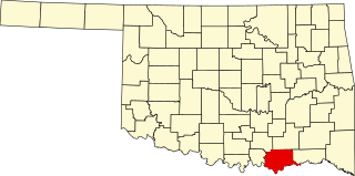
From List of National Natural Landmarks, these are the National Natural Landmarks in Oklahoma. There are 3 in total. [1]

NameImageDateLocationCountyOwnershipDescription
1 Devil's Canyon December 1974 35°21′48″N98°20′30″W / 35.363333°N 98.341667°W / 35.363333; -98.341667 (Devil's Canyon) Canadian privateKnown for several different mesic plants in a diverse environment of oak woodland/tall prairie grass and eastern deciduous forest
2 McCurtain County Wilderness Area December 1974 Broken Bow 34°16′55″N94°41′48″W / 34.281971°N 94.696655°W / 34.281971; -94.696655 (McCurtain County Wilderness Area) McCurtain stateA 14,087 acres (57.01 km2) wilderness nature preserve since 1918. It is an excellent example of a xeric upland oak-pine forest
3 Salt Plains National Wildlife Refuge June 1983 Jet 36°45′01″N98°13′27″W / 36.750314°N 98.224259°W / 36.750314; -98.224259 (Salt Plains National Wildlife Refuge) Alfalfa federalA 32,000-acre (130 km2) National Wildlife Refuge, it is a critical habitat for 75% of the endangered whooping crane population.

Related Research Articles

Oklahoma U.S. state

Oklahoma is a state in the South Central region of the United States, bordered by Texas on the south and west, Kansas on the north, Missouri on the northeast, Arkansas on the east, New Mexico on the west, and Colorado on the northwest. Partially in the western extreme of the Upland South, it is the 20th-most extensive and the 28th-most populous of the 50 United States. Its residents are known as Oklahomans, and its capital and largest city is Oklahoma City.

Alfalfa County, Oklahoma County in Oklahoma, United States

Alfalfa County is a county located in the U.S. state of Oklahoma. As of the 2010 census, the population was 5,642. The county seat is Cherokee.

McLaurin v. Oklahoma State Regents, 339 U.S. 637 (1950), was a United States Supreme Court case that prohibited racial segregation in state supported graduate or professional education. The unanimous decision was delivered on the same day as another case involving similar issues, Sweatt v. Painter.

Mount Shishaldin A Symmetrical volcano in Alaska

Mount Shishaldin is a moderately active volcano on Unimak Island in the Aleutian Islands chain of Alaska. It is the highest mountain peak of the Aleutian Islands. The most symmetrical cone-shaped glacier-clad large mountain on Earth, the volcano's topographic contour lines are nearly perfect circles above 6,500 feet (1,981 m). The lower north and south slopes are somewhat steeper than the lower eastern and western slopes. The volcano is the westernmost of three large stratovolcanoes along an east–west line in the eastern half of Unimak Island.

National Natural Landmark Natural areas program in the U.S.

The National Natural Landmarks (NNL) Program recognizes and encourages the conservation of outstanding examples of the natural history of the United States. It is the only national natural areas program that identifies and recognizes the best examples of biological and geological features in both public and private ownership. The program was established on May 18, 1962, by United States Secretary of the Interior Stewart Udall.

Chickasaw National Recreation Area

Chickasaw National Recreation Area is a national recreation area in the foothills of the Arbuckle Mountains in south-central Oklahoma near Sulphur in Murray County. It includes the former Platt National Park and Arbuckle Recreation Area.

Gold Dome United States historic place

The Gold Dome, a geodesic dome in Oklahoma City, Oklahoma, is a landmark on Route 66. It was built in 1958 and is located at the intersection of NW 23rd Street and North Classen Boulevard. It was declared eligible to be listed in the National Register of Historic Places in 2002.

National Register of Historic Places listings in Oklahoma

This is a list of properties and historic districts in Oklahoma that are designated on the National Register of Historic Places. Listings are distributed across all of Oklahoma's 77 counties.

The Recreational Demonstration Area program was a National Park Service program during the 1930s and early 1940s that built forty-six public parks in twenty-four states on 397,000 acres (1,606.6 km2), chiefly near urban areas in the United States. The NPS used labor from a variety of Great Depression federal relief programs, chiefly the Civilian Conservation Corps and Works Progress Administration, to build recreational demonstration areas. By the end of World War II, the recreational demonstration areas had all either become National Park Service units or been given to their states for use as state parks.

Folsom Site Archaeological type site

Folsom Site or Wild Horse Arroyo, designated by the Smithsonian trinomial 29CX1, is a major archaeological site about 8 miles (13 km) west of Folsom, New Mexico. It is the type site for the Folsom tradition, a Paleo-Indian cultural sequence dating to between 9000 BC and 8000 BC. The Folsom Site was excavated in 1926 and found to have been a marsh-side kill site or camp where 32 bison had been killed using distinctive tools, known as Folsom points. This site is significant because it was the first time that artifacts indisputably made by humans were found directly associated with faunal remains from an extinct form of bison from the Late Pleistocene. The information culled from this site was the first of a set of discoveries that would allow archaeologists to revise their estimations for the time of arrival of Native Americans on the North American continent.

Bizzell Memorial Library United States historic place

The Bizzell Memorial Library, known also as Bizzell Library, is a five-story brick structure located at the University of Oklahoma in Norman, Oklahoma. It is an elaborate Collegiate Gothic or Cherokee Gothic building, designed by the architecture firm Layton Hicks & Forsyth and erected in 1928 during the administration of OU's fifth president, William Bennett Bizzell.

Cherokee National Capitol United States historic place

The Cherokee National Capitol, now the Cherokee Nation Courthouse, is a historic tribal government building in Tahlequah, Oklahoma. Completed in 1869, it served as the capitol building of the Cherokee Nation from 1869 to 1907, when Oklahoma became a state. It now serves as the site of the tribal supreme court and judicial branch. It was designated a National Historic Landmark in 1961 for its role in the Nation's history.

Sequoyahs Cabin Historic house in Oklahoma, United States

Sequoyah's Cabin is a log cabin and historic site off Oklahoma State Highway 101 near Akins, Oklahoma. It was the home between 1829 and 1844 of the Cherokee Indian Sequoyah, who in 1821 created a written language for the Cherokee Nation. The cabin and surrounding park, now owned by the Cherokee Nation, was declared a National Historic Landmark in 1965.

Index of Oklahoma-related articles Wikipedia index

The following is an alphabetical list of articles related to the U.S. state of Oklahoma.

The McCurtain County Wilderness Area is a 14,087 acres (5,701 ha) wilderness nature preserve 25 miles (40 km) north of Broken Bow, Oklahoma. It has been owned by the Oklahoma Department of Wildlife Conservation. It was designated a National Natural Landmark in December 1974 for its excellent example of a xeric upland oak-pine forest.

Osage Village State Historic Site

The Osage Village State Historic Site is a publicly owned property in Vernon County, Missouri, maintained by the Missouri Department of Natural Resources. The historic site preserves the archaeological site of a major Osage village, that once had some 200 lodges housing 2,000 to 3,000 people. The site, designated by the Smithsonian trinomial 23VE01, was also known for many years as the Carrington Osage Village Site, under which name it was designated a National Historic Landmark in 1964.

Outline of Oklahoma Overview of and topical guide to Oklahoma

The following outline is provided as an overview of and topical guide to the U.S. state of Oklahoma:

United States Post Office, Courthouse, and Federal Office Building (Oklahoma City) United States historic place

The United States Post Office and Courthouse, Oklahoma City, Oklahoma is a historic post office, courthouse, and Federal office building built in 1912 and located at Oklahoma City in Oklahoma County, Oklahoma. It previously served as a courthouse of the United States District Court for the Western District of Oklahoma, and of the United States Court of Appeals, briefly housing the Eighth Circuit and, then the Tenth Circuit for several decades. It was listed on the National Register of Historic Places in 1974. It continues to house the Bankruptcy court for the Western District of Oklahoma. The building includes Moderne and Beaux Arts.

Atoka County, Choctaw Nation Former political subdivision of the Choctaw Nation

Atoka County was a political subdivision of the Choctaw Nation of Indian Territory, prior to Oklahoma being admitted as a state. The county formed part of the Nation's Pushmataha District, or Third District, one of three administrative super-regions.

References

  1. "National Natural Landmarks - National Natural Landmarks (U.S. National Park Service)". www.nps.gov. Retrieved 2019-03-26. There are three National Natural Landmark sites located within the state of Oklahoma.