List of National Natural Landmarks in South Dakota

Last updated

Map all coordinates using: OpenStreetMap  
Download coordinates as: KML

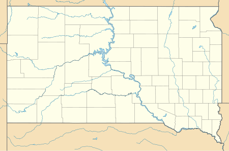
From List of National Natural Landmarks, these are the National Natural Landmarks in South Dakota.

NameImageDateLocationCountyOwnershipDescription
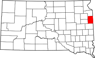
1 Ancient River Warren Channel 1965 Grant mixed- state, privateA channel cut by the Ancient River Warren during the Ice Age.
2 Bear Butte BEAR BUTTE.jpg 1965 44°28′33″N103°25′37″W / 44.475833°N 103.426944°W / 44.475833; -103.426944 (Bear Butte) Meade mixed- state, tribal, privateA cone-shaped mass of igneous rock standing alone 1,300 feet (400 m) above the surrounding plains.
3 Bijou Hills 1976 43°31′04″N99°08′50″W / 43.517778°N 99.147222°W / 43.517778; -99.147222 (Bijou Hills) Charles Mix privateAn excellent example of an erosional remnant of soft clays and shales capped by a channel sandstone and quartzite.
4 Buffalo Slough 1980 43°52′28″N96°56′20″W / 43.874308°N 96.939013°W / 43.874308; -96.939013 (Buffalo Slough) Lake stateExcellent examples of a prairie pothole with native emergent vegetation, and a native bluestem prairie.
5 The Castles 1976 45°31′39″N103°10′15″W / 45.527583°N 103.170965°W / 45.527583; -103.170965 (The Castles) Harding federal (Custer National Forest)Steep-walled, flat-topped buttes standing 200 to 400 feet (61 to 122 m) above the surrounding prairie.
6 Cathedral Spires and Limber Pine Natural Area The Needles in Custer State Park, South Dakota.jpg 1976 43°50′28″N103°32′40″W / 43.841111°N 103.544444°W / 43.841111; -103.544444 (Cathedral Spires and Limber Pine Natural Area) Custer state (Custer State Park)An excellent, rare example of joint-controlled weathering of granite.
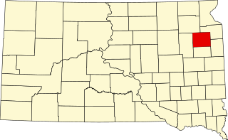
7 Cottonwood Slough- Dry Run 1975 44°57′25″N97°11′37″W / 44.957077°N 97.193497°W / 44.957077; -97.193497 (Cottonwood Slough- Dry Run) Roberts mixed- state, privateA completely undisturbed wetland complex including potholes, streams, shallow open water, lakes, and marsh.
8 Fort Randall Eagle Roost 1967 Gregory federal (Missouri National Recreational River)A prime winter roosting area for bald and golden eagles.
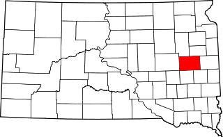
9 Lake Thompson 1975 44°17′06″N97°27′43″W / 44.285°N 97.461944°W / 44.285; -97.461944 (Lake Thompson) Kingsbury stateContains a large undisturbed and unmanipulated marsh, an outstanding waterfowl breeding and resting area.
10 The Mammoth Site Mammoth Site Hot Springs.jpg 1980 43°25′29″N103°28′59″W / 43.42471°N 103.48313°W / 43.42471; -103.48313 (The Mammoth Site) Fall River privateOne of the largest concentrations of mammoth remains in the United States.
11 Red Lake 1975 43°43′35″N99°13′31″W / 43.726352°N 99.22518°W / 43.726352; -99.22518 (Red Lake) Brule stateOne of the largest remaining natural and unmanipulated prairie pothole lakes.
12 Sica Hollow 1967 45°44′31″N97°14′33″W / 45.741944°N 97.2425°W / 45.741944; -97.2425 (Sica Hollow) Marshall stateDisplays many facets of natural history.
13 Snake Butte 1967 Jackson tribal (Oglala Sioux)Illustrates one of two types of sand calcite deposits in the world.

Related Research Articles

Bad River (Wisconsin)

The Bad River is a river flowing to Lake Superior in northern Wisconsin in the United States. It flows for 119.6 kilometres (74.3 mi) in Ashland County, draining an area of 1,061 square miles (2,750 km2) in portions of Ashland, Bayfield and Iron counties. The Bad River sloughs were designated a Ramsar Wetland of International Importance on February 2, 2012.

National Natural Landmark Natural areas program in the U.S.

The National Natural Landmarks (NNL) Program recognizes and encourages the conservation of outstanding examples of the natural history of the United States. It is the only national natural areas program that identifies and recognizes the best examples of biological and geological features in both public and private ownership. The program was established on May 18, 1962, by United States Secretary of the Interior Stewart Udall.

The Fish Slough Area of Critical Environmental Concern is a protected slough in Inyo County, eastern California. It is located on the western side of the Chalfant Valley, 5 miles (8.0 km) north of Bishop in the northern Owens Valley area.

Forest Preserve District of Cook County

The Forest Preserve District of Cook County is a governmental commission in Cook County, Illinois, that owns and manages a network of open spaces, containing forest, prairie, wetland, streams, and lakes, that are mostly set aside as natural areas. Cook County contains Chicago, and is the center of the most densely populated urban metropolitan area in the Midwest. The Forest Preserve lands encompass approximately 70,000 acres (280 km2), about 11% of the county, providing open space within its urban surroundings. It contains facilities for recreation, as well as a zoo and a botanic garden.

The South Florida Water Management District (SFWMD) is a regional governmental district that oversees water resources from Orlando to the Florida Keys. The mission of the SFWMD is to manage and protect water resources by balancing and improving water quality, flood control, natural systems and water supply, covering 16 counties in Central and Southern Florida. It is the largest water management district in the state, managing water needs for 7.7 million residents. A key initiative is the restoration of America's Everglades – the largest environmental restoration project in the nation's history. The District is also working to improve the Kissimmee River and its floodplain, Lake Okeechobee and South Florida's coastal estuaries.

Columbia Slough Narrow waterway in the floodplain of the Columbia River in the U.S. state of Oregon

The Columbia Slough is a narrow waterway, about 19 miles (31 km) long, in the floodplain of the Columbia River in the U.S. state of Oregon. From its source in the Portland suburb of Fairview, the Columbia Slough meanders west through Gresham and Portland to the Willamette River, about 1 mile (1.6 km) from the Willamette's confluence with the Columbia. It is a remnant of the historic wetlands between the mouths of the Sandy River to the east and the Willamette River to the west. Levees surround much of the main slough as well as many side sloughs, detached sloughs, and nearby lakes. Drainage district employees control water flows with pumps and floodgates. Tidal fluctuations cause reverse flow on the lower slough.

Smith and Bybee Wetlands Natural Area Public park and nature reserve in Portland, Oregon, U.S.

Smith and Bybee Wetlands Natural Area is a public park and nature reserve between the Columbia Slough and the Columbia River in Portland, Oregon. At about 2,000 acres (810 ha), it is one of the largest urban freshwater wetlands in the United States. Metro, the regional government for the Oregon part of the Portland metropolitan area, manages the park. A covered shelter, restrooms, a paved walkway, and a canoe launch lie on the north side of the natural area.

Moss Lake Bog is an 84-acre (34 ha) site containing a 15-acre (6.1 ha) glacial kettle lake located in the town of Caneadea, New York, outside Houghton. Over time, sphagnum moss has grown over the open water, turning it into an acidic bog. It is managed by The Nature Conservancy as part of Moss Lake Preserve, and was declared a National Natural Landmark in 1973.

Heron Pond – Little Black Slough Nature Preserve

Heron Pond – Little Black Slough Nature Preserve is a parcel of protected wetland property located approximately 5 miles (8 km) southwest of Vienna in Johnson County, Illinois. It was designated a National Natural Landmark in 1972. As part of the Cache River basin, it is classified as a wetland of international importance under the Ramsar Convention.

Slough (hydrology) Type of wetland

A slough is a wetland, usually a swamp or shallow lake, often a backwater to a larger body of water. Water tends to be stagnant or may flow slowly on a seasonal basis.

Buena Vista Lake Former fresh-water lake in Kern County, California

Buena Vista Lake was a fresh-water lake in Kern County, California, in the Tulare Lake Basin in the southern San Joaquin Valley, California.

Kakagon Sloughs

The Kakagon Sloughs are a number of tributaries that flow into Chequamegon Bay and Lake Superior in Ashland County, Wisconsin. Species of fish found in the sloughs include the northern pike, walleye, panfish, and smallmouth bass. This wetland includes a variety of species of seasonal waterfowl including the Wood Duck, Mallard, Blue-winged Teal, Bufflehead, Coot, as well as year-long Midwestern aves. It is maintained by the Bad River Band of the Lake Superior Tribe of Chippewa Indians. The tradition of harvesting Wild Rice also known as, Manomin (Ojibwe), occurs in the late summer after the dormant rice beds arise during the summer months and are ripe for harvest come mid-August. Protecting this sacred region of the Great Lakes is pivotal in maintaining traditions for our youth to learn and continue, providing opportunities to harvest food year-round, as well as providing a stable ecosystem that affects the entirety of Lake Superior which correlates directly into the Great Lakes as a whole. The wetland was designated a National Natural Landmark in 1973. On February 2, 2012 it was designated a Ramsar Wetland of International Importance.

Laguna Creek watershed

The Laguna Creek watershed consists of 25.1 square miles (100 km2) of land within northern California's Alameda County. The watershed drains the foothills of the Diablo Range south of Niles Canyon. To the southeast, the area of Mission Peak Regional Preserve around Mission Peak is included. Agua Caliente, Canada del Aliso, Mission, Morrison, Sabercat, Vargas, and Washington creeks drain the area of the watershed. They drain into Laguna Creek and eventually Mud Slough.

The Amsterdam Sloughs Wildlife Area is a 5,052-acre (2,044 ha) tract of protected land located in Burnett County, Wisconsin, managed by the Wisconsin Department of Natural Resources (WDNR). The Amsterdam Sloughs Wildlife Area is one of three such wildlife areas within the bounds of the Glacial Lake Grantsburg project, the others being Crex Meadows and Fish Lake.