There are 18 National Natural Landmarks in the U.S. state of Washington, out of nearly 600 National Natural Landmarks in the United States.

Washington National Natural Landmarks (clickable map)
| Name | Image | Date | Location | County | Ownership | Description |
|---|---|---|---|---|---|---|
| Boulder Park and McNeil Canyon Haystack Rocks | | 1986 | 47°52′43″N119°48′06″W / 47.878611°N 119.801667°W | Douglas | Federal, state | The most illustrative examples of glacial erratics in the United States. |
| Davis Canyon | 1986 | 48°14′38″N119°45′06″W / 48.243775°N 119.751774°W | Okanogan | State, private | One of the largest and least disturbed examples of antelope bitterbrush-Idaho fescue shrub steppe remaining in the Columbia Plateau. | |
| Drumheller Channels |  | 1986 | 46°58′30″N119°11′47″W / 46.975°N 119.196389°W | Adams, Grant | Federal, state, private | Illustrates the dramatic modification of the Columbia Plateau volcanic terrain by late Pleistocene catastrophic glacial outburst floods. Includes Columbia National Wildlife Refuge. |
| Ginkgo Petrified Forest |  | 1965 | 46°56′56″N120°00′10″W / 46.948889°N 120.002778°W | Kittitas | State | Thousands of logs petrified in lava flows. Part of Ginkgo/Wanapum State Park. |
| Grand Coulee | 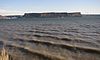 | 1965 | 47°46′00″N119°13′00″W / 47.766667°N 119.216667°W | Grant | Federal, state, private | An illustration of a series of geological events. |
| Grande Ronde Feeder Dikes | 1980 | Asotin | Private | The best example of basalt dikes, the congealed feeder sources of the Columbia River basalt plateau. | ||
| Grande Ronde Goosenecks | 1980 | Asotin | Federal | A 1,500-foot (460 m) deep canyon that follows a tortuous path along meanders. | ||
| The Great Gravel Bar of Moses Coulee | 1986 | 47°27′30″N119°48′00″W / 47.458333°N 119.8°W | Douglas | State, private | Largest and best example of a pendent river bar formed by catastrophic glacial outburst floods that swept across the Columbia Plateau. | |
| Kahlotus Ridgetop | 2011 | Franklin | State | The best remaining example of the Central Palouse Prairie grassland subtheme. | ||
| Mima Mounds |  | 1966 | 46°53′N123°03′W / 46.89°N 123.05°W | Thurston | State | A prairie containing unusual soil pimples of black silt-gravel. |
| Nisqually Delta |  | 1971 | 47°06′31″N122°42′11″W / 47.108611°N 122.703056°W | Pierce, Thurston | Federal, state, tribal, private | An unusually fine example of an estuarine ecosystem. Includes Nisqually National Wildlife Refuge. |
| Point of Arches |  | 1980 | 48°14′47″N124°42′01″W / 48.2464503°N 124.7002419°W | Clallam | Federal | An outstanding exhibit of sea action in sculpturing a rocky shoreline. A unit of Olympic National Park. |
| Rose Creek Preserve | 1984 | Whitman | Private | The best remaining example of the aspen phase of the hawthorne-cow parsnip habitat type in the Columbia Plateau. Managed by The Nature Conservancy. | ||
| Sims Corner Eskers and Kames |  | 1986 | 47°49′30″N119°22′00″W / 47.825°N 119.366667°W | Douglas | Federal, state, private | The best examples in the Columbia Plateau of landforms resulting from stagnation and rapid retreat of the ice sheet during the last glaciation. |
| Steptoe and Kamiak Buttes |  | 1965 | 47°01′57″N117°17′55″W / 47.0325°N 117.298611°W | Whitman | State, county, private | Isolated mountain peaks of older rock surrounded by basalt, rising above the surrounding lava plateau. |
| Umtanum Ridge Water Gap |  | 1980 | 46°51′00″N120°32′40″W / 46.85°N 120.544444°W | Kittitas | Federal, state, private | Geologic formation that illustrates the processes of tectonic folding and antecedent stream cutting. [1] |
| Wallula Gap |  | 1980 | 46°02′40″N118°56′48″W / 46.044444°N 118.946667°W | Benton, Walla Walla | Federal, state, county, municipal | The largest and most spectacular of several large water gaps through basalt anticlines in the Columbia River basin. |
| Withrow Moraine and Jameson Lake Drumlin Field | | 1980 | 47°41′15″N119°37′29″W / 47.6875°N 119.624722°W | Douglas | Federal, private | The best examples of drumlins and the most illustrative segment of the only Pleistocene terminal moraine in the Columbia Plateau |
