List of National Natural Landmarks in Maine

Last updated

Map all coordinates using: OpenStreetMap

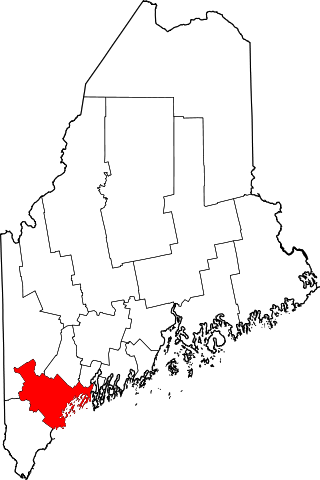
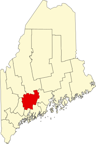
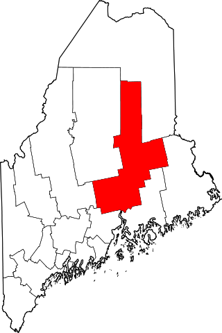
These are 14 National Natural Landmarks in Maine .

NameImageDateLocationCountyOwnershipDescription
1 Appleton Bog Atlantic White Cedar Stand 1984 Knox privateA large peatland with continuous forest cover and well-developed hummock-and- hollow topography.
2 Carrying Place Cove Bog 1980 Washington stateA tombolo that has been eroded by the sea.
3 Colby-Marston Preserve 1973 Kennebec privateNorthern sphagnum bog located in a deep kettle hole, the sphagnum mat exceeds a depth of 40 feet (12 m).
4 Crystal Bog 1973 46°02′04″N68°19′49″W / 46.034472°N 68.330394°W / 46.034472; -68.330394 (Crystal Bog) Aroostook privateAn undisturbed, sphagnum bog considered one of the largest and finest in Maine.
5 Gulf Hagas Lookingatwedge.jpg 1968 45°29′03″N69°19′23″W / 45.4841°N 69.323°W / 45.4841; -69.323 (Gulf Hagas) Piscataquis federal (Appalachian Trail)Waterfalls, cliffs, and growth of spruce-fir forest on the gorge walls give the site unusual scenic beauty.
6 The Hermitage Gulf Hagas Maine - The Hermitage (15587136919).jpg 1977 Piscataquis federal (Appalachian Trail)One of the few undisturbed, old-growth white pine stands remaining in New England.
7 Monhegan Island Monhegan Harbor, Monhegan, ME.jpg 1966 43°45′44″N69°19′13″W / 43.762222°N 69.320278°W / 43.762222; -69.320278 (Monhegan Island) Lincoln privateDense, almost pure stands of red spruce and over 400 species of wildflower.
8 Mount Bigelow (Maine) Avery+West peaks-Bigelow.JPG 1975 45°08′50″N70°17′21″W / 45.147277°N 70.289234°W / 45.147277; -70.289234 (Mount Bigelow (Maine)) Franklin, Somerset stateExceptionally scenic and wild, with some of the best summit views in the eastern United States.
9 Mount Katahdin Katahdin.jpg 1967 45°54′16″N68°55′17″W / 45.904354°N 68.921274°W / 45.904354; -68.921274 (Mount Katahdin) Piscataquis state (Baxter State Park)Kames, eskers, drumlins, kettleholes, moraines, and erratics provide a complete illustration of glacial geology.
10 New Gloucester Black Gum Stand 1975 Cumberland privateA small, remnant, forested swamp dominated mostly by virgin black gum.
11 No. 5 Bog and Jack Pine Stand 1984 Somerset state, privateThe only large, intermontane peatland and one of the few expansive, virgin landscapes in the northeastern United States.
12 Orono Bog Orono Bog 1.jpg 1973 44°52′09″N68°43′32″W / 44.86907°N 68.725668°W / 44.86907; -68.725668 (Orono Bog) Penobscot municipal, privateA classic northern sphagnum bog.
13 Passadumkeag Marsh and Bogland 1973 Penobscot privateOne of the largest, unspoiled wetlands in the state of Maine.
14 Penny Pond-Joe Pond Complex 1973 Kennebec privateKettle hole bogs and ponds.

Related Research Articles

Bar Harbor is a resort town on Mount Desert Island in Hancock County, Maine, United States. As of the 2020 census, its population is 5,089. The town is home to the College of the Atlantic, Jackson Laboratory, and MDI Biological Laboratory. During the summer and fall seasons, it is a popular tourist destination.

<span class="mw-page-title-main">Bog iron</span> Form of iron ore deposited in bogs

Bog iron is a form of impure iron deposit that develops in bogs or swamps by the chemical or biochemical oxidation of iron carried in solution. In general, bog ores consist primarily of iron oxyhydroxides, commonly goethite.

Mount Crescent is a mountain located in the Crescent Range of the White Mountains in Randolph, New Hampshire. It is 3,251 ft (991 m) high, and its summit is the second highest mountain summit in Randolph, after Black Crescent Mountain. Both mountains are in Randolph's Ice Gulch Town Forest. On the 1896 topographic map, Mount Crescent is shown as "Randolph Mtn." with an elevation of 3,280 ft, and Black Crescent is shown as "Mt. Crescent" with an elevation of 3,322 ft.

<span class="mw-page-title-main">Great Cranberry Island</span>

Great Cranberry Island is an island located in Maine, United States. It is the largest of the five islands of the Town of Cranberry Isles. It is roughly two miles long and one mile wide.

The West Branch of the Magalloway River is a 9.3-mile-long (15.0 km) river in northernmost New Hampshire and northwestern Maine in the United States. It is a tributary of the Magalloway River, located in the Androscoggin River watershed of Maine and New Hampshire.

<span class="mw-page-title-main">Ragged Mountain (New Hampshire)</span>

Ragged Mountain is a low mountain with numerous knobby summits in the towns of Danbury and Andover in central New Hampshire. It is home to the Ragged Mountain ski resort.

<span class="mw-page-title-main">Volo Bog State Natural Area</span> State park in Illinois, USA

Volo Bog State Natural Area is a nature reserve in Illinois, United States, preserving Volo Bog. The bog was designated a National Natural Landmark in 1973 as the only remaining open-water quaking bog in Illinois. The site also contains woodlands, savanna, marshes, prairie restoration areas, shrubland and old fields. Maintained by the Illinois Department of Natural Resources, the site is located about a mile west of U.S. Route 12 between the towns of Volo and Fox Lake, Illinois.

<span class="mw-page-title-main">Mount Redington</span> Mountain in United States of America

Mount Redington is a mountain located in Franklin County, Maine. Redington is flanked to the northeast by South Crocker Mountain and to the west by Black Nubble. Redington stands just northeast of the U.S. Navy Survival Escape and Evasion Training Facility (USSEAETF).

<span class="mw-page-title-main">New England–Acadian forests</span> Temperate broadleaf and mixed forest ecoregion of Canada and the United States

The New England-Acadian forests are a temperate broadleaf and mixed forest ecoregion in North America that includes a variety of habitats on the hills, mountains and plateaus of New England and New York State in the Northeastern United States, and Quebec and the Maritime Provinces of Eastern Canada.

Black Nubble is a mountain located in Franklin County, Maine. Black Nubble is flanked to the southeast by Mount Redington. The U.S. Navy Survival Escape and Evasion Training Facility (USSEAETF) is located just south of Redington.

The Bog River is a river in Hancock County, Maine. From its source on Sugar Hill in Maine Township 16 M D, the river runs 9.4 miles (15.1 km) northwest to its confluence with the East Branch of the Union River in Osborn.

The Little Bog River is a short stream in Hancock County, Maine. From its source in Osborn, the river runs 5.4 miles (8.7 km) south to its confluence with Mill Brook in Eastbrook. Mill Brook flows west to Webb Pond. Via Mill Brook, Webb Pond, and Webb Brook, the Little Bog River is part of the Union River watershed.

The North Branch Penobscot River is a river in Somerset County, Maine. From its source at the outlet of Little Bog about 10 miles (16 km) east of the Canada–United States border in Maine Township 6, Range 17, WELS, the river runs 27.8 miles (44.7 km) southwest and southeast to its drowned confluence with the South Branch of the Penobscot River in Seboomook Lake in Pittston Academy Grant.

<span class="mw-page-title-main">Sunkhaze Meadows National Wildlife Refuge</span>

Sunkhaze Meadows National Wildlife Refuge is located in the Town of Milford, Penobscot County, Maine, approximately fourteen miles north of Bangor. The refuge was established in 1988 to ensure the ecological integrity of the Sunkhaze Meadows peat bog and the continued availability of its wetland, stream, forest and wildlife resources to the citizens of the United States. The purpose of acquisition, under the authority of the Fish and Wildlife Act of 1956 was "... for the development, advancement, management, conservation, and protection of fish and wildlife resources ..." and "... for the benefit of the United States Fish and Wildlife Service, in performing its activities and services. Such acceptance may be subject to the terms of any restrictive or affirmative covenant, or condition of servitude ..." The Land and Water Conservation Fund was the source of funding for the purchase

<span class="mw-page-title-main">Harris Station Dam</span>

Harris Station Dam is a hydroelectric dam in Northeast Somerset, Somerset County, Maine. Also known as the Indian Pond Project, the dam was built from 1952 to 1954 as the largest hydroelectric dam in the state of Maine. It impounds the Kennebec River at the southern end of the natural Indian Pond, about 12 miles (19 km) downstream from Moosehead Lake.

Wohoa Bay is a bay on the coast of Washington County, Maine. It is located between the towns of Addison and Jonesport. It features a coastal plateau bog ecosystem not found anywhere else in North America. Three rare species have been found in Wohoa Bay, including the crowberry, blue butterfly and bald eagle. Both West River and Indian River drain into Wohoa Bay.

Schoodic Lake is a deep Maine lake with a small drainage basin. The lake covers much of the western half of Lake View Plantation. Tributaries drain Orson Bog, Norton Pond, and Jaquith Pond in eastern Brownville. The south end of the lake overflows through Schoodic Stream 5 miles (8.0 km) to the Piscataquis River 13 miles (21 km) upstream of the Piscataquis confluence with the Penobscot River at Howland. The lake provides good habitat for togue, squaretail, and land-locked Atlantic salmon. Fishermen also find smallmouth bass, white sucker and round whitefish.

The Belgrade Lakes are a chain of lakes around Belgrade, Maine. The flow sequence is from East Pond to North Pond to Great Pond to Long Pond to Messalonskee Lake and thence via Messalonskee Stream to the Kennebec River at Waterville. The lakes have long been an important resort area for fishing, boating, and swimming; and shoreline development includes residences for individuals employed in the cities of Waterville and Augusta.

Millinocket Lake is the source of Millinocket Stream in the North Maine Woods north of Baxter State Park. Millinocket Stream flows 5.5 miles (8.9 km) to Maine township 8, range 8, where it joins Munsungan Stream to form the Aroostook River. The lake extending along the border of Maine range 9 townships 7 and 8 is impounded behind a wooden dam. The dam enlarged the lake to include Little Millinocket Lake and Moose Pond by flooding adjoining bogs to store water for hydropower. The large areas of shallow flooded bog are a good habitat for fallfish, yellow perch and white suckers; but with summer water temperatures ranging from 70° near the surface to 55° in the deeper areas, dissolved oxygen concentrations become unfavorable for trout. Tributaries to the lake drain a number of small ponds to the west of the lake including Atkins Pond, Blackmore Pond, Buckley Pond, Big Caribou Pond, Little Caribou Pond, Chandler Pond, Elsie Pond, Ervin Pond, Jack Pond, Kyle Pond, Line Pond, Mathews Pond, May Pond, Little Moose Pond, Upper Moose Pond, Pretty Pond, Snowshoe Pond, and Spring Pond.