Kennebec County, Maine

Last updated

Kennebec County
Kennebec County Courthouse.jpg
Kennebec County Courthouse
Kennebec.jpg
Map of Maine highlighting Kennebec County.svg
Location within the U.S. state of Maine
Maine in United States.svg
Maine's location within the U.S.
Coordinates: 44°24′00″N69°47′04″W / 44.39996°N 69.784554°W / 44.39996; -69.784554
CountryFlag of the United States.svg United States
StateFlag of Maine.svg  Maine
Founded1799
Named for Kennebec River
Seat Augusta
Largest cityAugusta
Area
  Total951 sq mi (2,460 km2)
  Land868 sq mi (2,250 km2)
  Water84 sq mi (220 km2)  8.8%
Population
 (2020)
  Total123,642
  Density130/sq mi (50/km2)
Time zone UTC−5 (Eastern)
  Summer (DST) UTC−4 (EDT)
Congressional districts 1st, 2nd
Website www.kennebeccounty.org

Kennebec County is a county located in the South-central portion of the U.S. state of Maine. At the 2020 census, the population was 123,642. [1] Its county seat is Augusta, [2] the state capital. The county was established on February 20, 1799, from portions of Cumberland and Lincoln Counties. The name Kennebec comes from the Eastern Abenaki /kínipekʷ/, meaning "large body of still water, large bay." [3]

Contents

Kennebec County comprises the Augusta–Waterville, ME Micropolitan Statistical Area .

In 2010, the center of population of Maine was in Kennebec County, in the city of Augusta. [4]

Geography

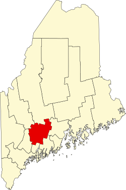
According to the U.S. Census Bureau, the county has a total area of 951 square miles (2,460 km2), of which 868 square miles (2,250 km2) is land and 84 square miles (220 km2) (8.8%) is water. [5]

Adjacent counties

Demographics

Historical population
CensusPop.Note
1800 24,571
1810 32,56432.5%
1820 42,62330.9%
1830 52,48523.1%
1840 55,8236.4%
1850 62,52112.0%
1860 55,655−11.0%
1870 53,203−4.4%
1880 53,058−0.3%
1890 57,0127.5%
1900 59,1173.7%
1910 62,8636.3%
1920 63,8441.6%
1930 70,69110.7%
1940 77,2319.3%
1950 83,8818.6%
1960 89,1506.3%
1970 95,2476.8%
1980 109,88915.4%
1990 115,9045.5%
2000 117,1141.0%
2010 122,1514.3%
2020 123,6421.2%
2023 (est.)127,259 [6] 2.9%
U.S. Decennial Census [7]
1790–1960 [8] 1900–1990 [9]
1990–2000 [10] 2010–2019 [11]

2000 census

As of the census [12] of 2000, there were 117,114 people, 47,683 households, and 31,327 families living in the county. The population density was 135 people per square mile (52 people/km2). There were 56,364 housing units at an average density of 65 per square mile (25/km2). The racial makeup of the county was 97.45% White, 0.34% Black or African American, 0.40% Native American, 0.59% Asian, 0.02% Pacific Islander, 0.18% from other races, and 1.02% from two or more races. 0.73% of the population were Hispanic or Latino of any race. 20.6% were of English, 17.4% French, 13.4% French Canadian, 10.9% United States or American and 9.9% Irish ancestry. 92.5% spoke only English at home, while 5.48% spoke French. [13]

There were 47,683 households, out of which 31.20% had children under the age of 18 living with them, 51.60% were married couples living together, 10.00% had a female householder with no husband present, and 34.30% were non-families. 27.60% of all households were made up of individuals, and 10.60% had someone living alone who was 65 years of age or older. The average household size was 2.38 and the average family size was 2.89. [14]

In the county, the population was spread out, with 23.80% under the age of 18, 8.50% from 18 to 24, 28.60% from 25 to 44, 24.90% from 45 to 64, and 14.20% who were 65 years of age or older. The median age was 39 years. For every 100 females there were 94.00 males. For every 100 females age 18 and over, there were 90.80 males.

The median income for a household in the county was $36,498, and the median income for a family was $43,814. Males had a median income of $32,279 versus $24,032 for females. The per capita income for the county was $18,520. About 8.50% of families and 11.10% of the population were below the poverty line, including 13.20% of those under age 18 and 10.20% of those age 65 or over.

2010 census

As of the 2010 United States Census, there were 122,151 people, 51,128 households, and 32,368 families living in the county. [14] The population density was 140.8 inhabitants per square mile (54.4/km2). There were 60,972 housing units at an average density of 70.3 units per square mile (27.1 units/km2). [15] The racial makeup of the county was % from other races, and % from two or more races. Those of Hispanic or Latino origin made up % of the population. [14] In terms of ancestry, 24.2% were English, 17.0% were Irish, 8.3% were German, 7.7% were French Canadian, 5.7% were American, and 5.4% were Scottish. [16]

The median income for a household in the county was $45,973 and the median income for a family was $56,853. Males had a median income of $42,176 versus $32,471 for females. The per capita income for the county was $24,656. About 7.8% of families and 12.5% of the population were below the poverty line, including 16.9% of those under age 18 and 9.6% of those age 65 or over. [17]

Micropolitan statistical area

The United States Office of Management and Budget has designated Kennebec County as the Augusta–Waterville, ME Micropolitan Statistical Area (µSA). As of the 2010 U.S. Census [18] the micropolitan area ranked the most populous in the State of Maine and also the only micropolitan area within the state. The area also ranks 14th most populous in the United States with a population of 125,540 as of July 2022.

Economy

Kennebec County's economy has traditionally been industrial. A large amount of paper and textiles were produced, and mills sprung up along the Kennebec river. The median household income is $36,498. The unemployment rate is 4.2%.

Education

There are three colleges: Colby College and Thomas College (both in Waterville), and the University of Maine at Augusta. There are 19 school districts (however, 4 are consolidated ones). In China Maine, there is no public high school, but a private school (Erskine Academy) exists, and the town pays for students tuition if they choose to attend. Students from Vassalboro can pick from one of four school districts (Cony in Augusta, Erskine, Winslow, or Waterville). However, many towns have local public high schools.

K-12 school districts include: [19]

Politics

Kennebec County has consistently voted for Democrats in recent elections, until 2016 when it voted for Donald Trump, the first time since 1988. While the more rural areas support the Republican Party, the urban areas are strongly Democratic. Kennebec County is the only county in Maine that is split between Maine's two congressional districts. The larger, southern portion of the county is in the 1st Congressional District of Maine, while the northern, smaller portion is in the 2nd Congressional District of Maine.

Voter registration

Voter registration and party enrollment as of March 2024 [20]
Republican 27,635
Democratic 27,487
Unenrolled24,455
Green Independent 3,698
Libertarian 403
No Labels 271
Total83,949
United States presidential election results for Kennebec County, Maine [21] [22]
Year Republican Democratic Third party
No.%No.%No.%
2020 34,72148.32%34,90248.57%2,2353.11%
2016 31,67547.84%29,30244.26%5,2317.90%
2012 26,51941.76%35,06855.23%1,9103.01%
2008 27,48241.65%37,23856.43%1,2661.92%
2004 29,76144.57%35,61653.34%1,3952.09%
2000 23,96740.69%31,19852.96%3,7426.35%
1996 15,40327.68%30,25754.37%9,99417.96%
1992 17,13526.81%25,12539.31%21,66133.89%
1988 27,73453.60%23,57845.57%4330.84%
1984 31,75359.70%21,18339.82%2550.48%
1980 21,51743.84%20,94342.67%6,61713.48%
1976 22,53447.53%23,47349.51%1,4002.95%
1972 24,61759.99%16,37939.91%390.10%
1968 16,00941.81%21,75256.81%5311.39%
1964 11,30731.28%24,81368.65%230.06%
1960 21,69954.31%18,25245.69%00.00%
1956 23,02866.73%11,48333.27%00.00%
1952 21,20763.59%12,11336.32%310.09%
1948 13,92355.12%11,16344.19%1740.69%
1944 14,33550.42%14,07049.49%250.09%
1940 14,87748.36%15,86151.56%270.09%
1936 14,98755.34%11,26841.61%8263.05%
1932 14,45153.93%12,11045.19%2360.88%
1928 15,54165.14%8,22634.48%920.39%
1924 13,12272.26%4,18423.04%8534.70%
1920 12,33368.62%5,46630.41%1740.97%
1916 6,73153.71%5,52744.11%2732.18%
1912 1,78215.20%4,39737.50%5,54747.31%
1908 6,13365.99%2,87130.89%2903.12%
1904 5,76568.68%2,33327.79%2963.53%
1900 6,22862.60%3,41034.27%3113.13%
1896 7,88971.70%2,81725.60%2972.70%
1892 6,16557.27%4,09438.03%5064.70%
1888 7,45362.46%4,13934.69%3402.85%
1884 7,57261.30%3,90631.62%8747.08%
1880 7,77159.00%5,00137.97%4003.04%
1876 6,75162.26%4,09337.74%00.00%
1872 6,23273.67%2,22726.33%00.00%
1868 7,28370.40%3,06229.60%00.00%
1864 6,80367.02%3,34732.98%00.00%
1860 6,59970.90%2,35325.28%3563.82%
1856 7,32072.14%2,48724.51%3403.35%
1852 4,48955.11%2,70333.18%95411.71%
1848 5,05654.10%2,63428.18%1,65617.72%
1844 5,39356.83%3,53537.25%5615.91%
1840 6,90565.96%3,52133.63%430.41%
1836 1,86751.04%1,79148.96%00.00%

Communities

Cities

Towns

Unorganized territory

Census-designated places

Other unincorporated villages

See also

Footnotes

  1. "Census - Geography Profile: Kennebec County, Maine". United States Census Bureau . Retrieved November 21, 2021.
  2. "Find a County". National Association of Counties. Archived from the original on May 31, 2011. Retrieved June 7, 2011.
  3. Bright, William (2004). Native American placenames of the United States. University of Oklahoma Press. p. 212. ISBN   978-0-8061-3598-4 . Retrieved April 14, 2011.
  4. "Centers of Population by State: 2010". United States Census Bureau. Archived from the original on January 3, 2014. Retrieved September 7, 2014.
  5. "2010 Census Gazetteer Files". United States Census Bureau. August 22, 2012. Archived from the original on September 9, 2014. Retrieved September 7, 2014.
  6. "Annual Estimates of the Resident Population for Counties: April 1, 2020 to July 1, 2023". United States Census Bureau. Retrieved April 3, 2024.
  7. "U.S. Decennial Census". United States Census Bureau. Retrieved September 7, 2014.
  8. "Historical Census Browser". University of Virginia Library. Retrieved September 7, 2014.
  9. "Population of Counties by Decennial Census: 1900 to 1990". United States Census Bureau. Retrieved September 7, 2014.
  10. "Census 2000 PHC-T-4. Ranking Tables for Counties: 1990 and 2000" (PDF). United States Census Bureau. Archived (PDF) from the original on March 27, 2010. Retrieved September 7, 2014.
  11. "State & County QuickFacts". United States Census Bureau. Archived from the original on June 6, 2011. Retrieved August 19, 2013.
  12. "U.S. Census website". United States Census Bureau . Retrieved January 31, 2008.
  13. "Language Map Data Center".
  14. 1 2 3 "DP-1 Profile of General Population and Housing Characteristics: 2010 Demographic Profile Data". United States Census Bureau. Archived from the original on February 13, 2020. Retrieved January 21, 2016.
  15. "Population, Housing Units, Area, and Density: 2010 - County". United States Census Bureau. Archived from the original on February 13, 2020. Retrieved January 21, 2016.
  16. "DP02 SELECTED SOCIAL CHARACTERISTICS IN THE UNITED STATES – 2006-2010 American Community Survey 5-Year Estimates". United States Census Bureau. Archived from the original on February 13, 2020. Retrieved January 21, 2016.
  17. "DP03 SELECTED ECONOMIC CHARACTERISTICS – 2006-2010 American Community Survey 5-Year Estimates". United States Census Bureau. Archived from the original on February 13, 2020. Retrieved January 21, 2016.
  18. "2010 U.S. Census website". United States Census Bureau . Retrieved July 10, 2016.
  19. "2020 census - school district reference map: Kennebec County, ME" (PDF). U.S. Census Bureau. Archived (PDF) from the original on July 26, 2022. Retrieved July 25, 2022. - Text list
  20. Bureau of Corporations, Elections & Commissions. "Registered & Enrolled Voters Statewide" (PDF). Maine SOS. Retrieved April 9, 2024.
  21. Leip, David. "Dave Leip's Atlas of U.S. Presidential Elections". uselectionatlas.org. Retrieved August 25, 2018.
  22. Burnham, Walter Dean. "Presidential ballots, 1836-1892". archive.org. Retrieved January 16, 2021.

Further reading

44°25′N69°46′W / 44.41°N 69.77°W / 44.41; -69.77

Related Research Articles

<span class="mw-page-title-main">Augusta, Maine</span> Capital city of the U.S. state of Maine.

Augusta is the capital of the U.S. state of Maine and the county seat of and most populous city in Kennebec County. Augusta is included in the Lewiston-Auburn, Maine metropolitan New England city and town area. The city's population was 18,899 at the 2020 census, making it the 12th most populous city in Maine, and 3rd least populous state capital in the United States after Montpelier, Vermont, and Pierre, South Dakota.

<span class="mw-page-title-main">Chelsea, Maine</span> Town in the state of Maine, United States

Chelsea is a town in Kennebec County, Maine, United States. The population was 2,778 at the 2020 census. It is home to the Togus Veterans Administration facilities.

<span class="mw-page-title-main">China, Maine</span> Town in Maine, United States

China is a town in Kennebec County, Maine, United States. The population was 4,408 at the 2020 census. China is included in the Augusta, Maine micropolitan NECTA.

<span class="mw-page-title-main">Fayette, Maine</span> Town in the state of Maine, United States

Fayette is a town in Kennebec County, Maine, United States. The population was 1,160 as of the 2020 census. A popular recreation spot in central Maine, Fayette is part of the Winthrop Lakes Region.

<span class="mw-page-title-main">Litchfield, Maine</span> Town in the state of Maine, United States

Litchfield is a town in Kennebec County, Maine, United States. The population was 3,586 at the 2020 census. Litchfield is included in the Augusta, Maine micropolitan and included in the Lewiston-Auburn, Maine metropolitan New England city and town area. Litchfield is included Wales, Maine micropolitan

<span class="mw-page-title-main">Manchester, Maine</span> Town in Maine, United States

Manchester is a town in Kennebec County, Maine, United States, located at 44.33°N 69.87°W. The population was 2,456 at the 2020 census. The southern part of the town bordering Cobbosseecontee Lake is a popular recreation spot in central Maine, and part of the Winthrop Lakes Region. Manchester is included in the Augusta, Maine micropolitan and included in the Lewiston-Auburn, Maine metropolitan New England City and Town Area.

<span class="mw-page-title-main">Mount Vernon, Maine</span> Town in the state of Maine, United States

Mount Vernon is a town in Kennebec County, Maine, United States. The population was 1,721 at the 2020 census. Mount Vernon is included in the Augusta, Maine micropolitan New England City and Town Area. A popular recreation spot in central Maine, the northern area of Mount Vernon is part of the Belgrade Lakes Region, while the southern area is part of the Winthrop Lakes Region.

<span class="mw-page-title-main">Readfield, Maine</span> Town in the state of Maine, United States

Readfield is a town in Kennebec County, Maine, United States. The population was 2,597 at the 2020 census. Readfield is home to the Kents Hill School, a preparatory school, Maranacook Community Schools, public schools for the district, a few summer camps, and the annual Readfield Heritage Days. A popular recreation spot in central Maine, the town contains nine lakes and ponds, including Maranacook Lake, and is part of the Winthrop Lakes Region. The town of Readfield was previously named Pond Town. Readfield is included in the Augusta, Maine micropolitan and included in the Lewiston-Auburn, Maine metropolitan New England City and Town Area.

<span class="mw-page-title-main">Vassalboro, Maine</span> Town in Maine, United States

Vassalboro is a town in Kennebec County, Maine, United States. The population was 4,520 at the 2020 census. Vassalboro includes the villages of Riverside, Getchell's Corner, North Vassalboro, and East Vassalboro, home to the town library and sports field. Vassalboro is included in the Augusta, Maine, micropolitan New England City and Town Area.

<span class="mw-page-title-main">Waterville, Maine</span> City in Maine, United States

Waterville is a city in Kennebec County, Maine, United States, on the west bank of the Kennebec River. The city is home to Colby College, Thomas College, and the headquarters of HealthReach Community Health Centers. As of the 2020 census the population was 15,828. Along with Augusta, Waterville is one of the principal cities of the Augusta-Waterville, ME Micropolitan Statistical Area.

<span class="mw-page-title-main">Wayne, Maine</span> Town in the state of Maine, United States

Wayne is a town in Kennebec County, Maine, United States. Wayne is included in the Lewiston-Auburn, Maine metropolitan New England city and town area. The population was 1,129 at the 2020 census. The town was named after Revolutionary War General Anthony Wayne. During the summer, Wayne is home to Camp Androscoggin. A popular recreation spot in central Maine, Wayne is part of the Winthrop Lakes Region. The town is included in the Augusta, Maine micropolitan New England City and Town Area. and included in the Lewiston-Auburn, Maine metropolitan New England city and town area.

<span class="mw-page-title-main">Windsor, Maine</span> Town in the state of Maine, United States

Windsor is a town in Kennebec County, Maine, United States. The population was 2,632 at the 2020 census. Windsor is included in the Augusta, Maine micropolitan New England City and Town Area.

<span class="mw-page-title-main">Randolph, Maine</span> Town in the state of Maine, United States

Randolph is a town and a census-designated place (CDP) in Kennebec County, Maine, United States. The population was 1,743 at the 2020 census. The town was named for Randolph, Massachusetts. Randolph is included in the Augusta, Maine micropolitan New England City and Town Area.

<span class="mw-page-title-main">Winslow, Maine</span> Town in the state of Maine, United States

Winslow is a town and census-designated place in Kennebec County, Maine, United States, along the Kennebec River across from Waterville. The population was 7,948 at the 2020 census.

<span class="mw-page-title-main">Oakland, Maine</span> Town in the state of Maine, United States

Oakland is a town in Kennebec County in the U.S. state of Maine. The population was 6,230 at the 2020 census. Oakland is 4 miles (6 km) west of Waterville and approximately 18 miles (29 km) north of Augusta, the state capital. Waterville and Augusta are service centers for Oakland, and many Oakland residents commute to jobs in those areas.

<span class="mw-page-title-main">Clinton (CDP), Maine</span> Census-designated place in Maine, United States

Clinton is a census-designated place (CDP) and the primary village in the town of Clinton in Kennebec County, Maine, United States. The population was 1,419 at the 2010 census, out of 3,486 in the entire town of Clinton.

<span class="mw-page-title-main">Farmingdale, Maine</span> Town in the state of Maine, United States

Farmingdale is a town in Kennebec County, Maine, United States. The population was 2,995 at the 2020 census. Farmingdale is included in the Augusta, Maine micropolitan New England City and Town Area.

<span class="mw-page-title-main">Oakland (CDP), Maine</span> Census-designated place in Maine, United States

Oakland is a census-designated place (CDP) comprising the main population center in the town of Oakland in Kennebec County, Maine, United States. The population was 2,602 at the 2010 census, out of 6,240 in the entire town of Oakland.

<span class="mw-page-title-main">Winthrop (CDP), Maine</span> Census-designated place in Maine, United States

Winthrop is a census-designated place (CDP) comprising the primary settlement in the town of Winthrop in Kennebec County, Maine, United States. The population was 2,650 at the 2010 census, out of 6,092 in the town of Winthrop as a whole.

<span class="mw-page-title-main">Winthrop, Maine</span> Town in Maine, United States

Winthrop is a town in Kennebec County, Maine, United States. Winthrop is included in the Lewiston-Auburn, Maine metropolitan New England city and town area. The population was 6,121 at the 2020 census. Winthrop's population, however, approximately doubles during the summer months as part-year residents return to seasonal camps located on the shores of Winthrop's Lakes and Ponds. A recreational area located among lakes, the town includes the villages of Winthrop and East Winthrop, and is the center of the Winthrop Lakes Region. Winthrop is included in the Augusta, Maine Micropolitan New England City and Town Area.