Farmingdale, Maine

Last updated

Farmingdale, Maine
FarmingdaleME CaptNathanielStoneHouse.jpg
Kennebec County Maine incorporated and unincorporated areas Farmingdale highlighted.svg
Location in Kennebec County and the state of Maine
Coordinates: 44°15′29″N69°48′30″W / 44.25806°N 69.80833°W / 44.25806; -69.80833
CountryUnited States
State Maine
County Kennebec
Incorporated1852
Village Farmingdale
Area
[1]
  Total11.55 sq mi (29.91 km2)
  Land11.24 sq mi (29.11 km2)
  Water0.31 sq mi (0.80 km2)
Elevation
230 ft (70 m)
Population
 (2020)
  Total2,995
  Density267/sq mi (102.9/km2)
Time zone UTC-5 (Eastern (EST))
  Summer (DST) UTC-4 (EDT)
ZIP code
04344
Area code 207
FIPS code 23-24635
GNIS feature ID0566053
Website farmingdalemaine.org

Farmingdale is a town in Kennebec County, Maine, United States. The population was 2,995 at the 2020 census. [2] Farmingdale is included in the Augusta, Maine micropolitan New England City and Town Area.

Contents

History

In 1852, Farmingdale was incorporated as a town, combining parts of South Hallowell, North Gardiner and East/West Gardiner. [3] Many businesses operated in Farmingdale, most of them along the Kennebec River. A major business was harvesting and selling ice for a worldwide market. The Knickerbocker Ice Company (the largest ice company in the country), and the Marshall Ice Company had ice-houses at Bowman's Point. [4] The Knickerbocker Ice Company burned in 1894 or 1895 leaving only the chimney that stood until it was demolished in 1911 to make room for the Central Maine Power Plant. [5] Other businesses on the river in Farmingdale included shipyards, brickyards, pottery, and a glue factory. Commercial growth in ensuing years centered in Gardiner, Hallowell and Augusta, while Farmingdale never developed a town center to compare with those cities. Time, fires, floods and economic forces eventually removed the larger businesses. In the 21st century, Farmingdale is a residential community for those who work in Augusta or other cities. The distinction between the densely developed riverbanks and the open rural back-land remains. Structures that are on the National Register of Historic Places include the Peter Grant House, [6] and the Captain Nathaniel Stone House. [7]

Geography

The town is in southern Kennebec County and is bordered to the north by the city of Hallowell, to the east by the towns of Chelsea and Randolph, to the south by the city of Gardiner and the town of West Gardiner, and to the west by the town of Manchester. The Kennebec River forms the eastern border of the town. Interstate 95, part of the Maine Turnpike, crosses the center of the town but has no direct access. U.S. Route 201 and Maine State Route 27 pass through the eastern side of the town following the Kennebec River.

According to the United States Census Bureau, the town has a total area of 11.55 square miles (29.91 km2), of which 11.24 square miles (29.11 km2) is land and 0.31 square miles (0.80 km2) is water. [1] The Farmingdale census-designated place, where two-thirds of the town population live, occupies the eastern part of the town.

Demographics

Historical population
CensusPop.Note
1860 896
1870 859−4.1%
1880 789−8.1%
1890 8214.1%
1900 8483.3%
1910 823−2.9%
1920 819−0.5%
1930 1,04427.5%
1940 1,19714.7%
1950 1,44921.1%
1960 1,94134.0%
1970 2,42324.8%
1980 2,5354.6%
1990 2,91815.1%
2000 2,804−3.9%
2010 2,9565.4%
2020 2,9951.3%
U.S. Decennial Census [8]

As of 2000 the median income for a household in the town was $51,344, and the median income for a family was $56,415. Males had a median income of $49,643 versus $29,391 for females. The per capita income for the town was $24,015. About 18.8% of families and 14.1% of the population were below the poverty line, including 6.5% of those under age 18 and 0% of those age 65 or over.

2010 census

As of the census [9] of 2010, there were 2,956 people, 1,259 households, and 807 families residing in the town. The population density was 263.9 inhabitants per square mile (101.9/km2). There were 1,374 housing units at an average density of 122.7 per square mile (47.4/km2). The racial makeup of the town was 96.3% White, 0.5% Black or African American, 0.3% Native American, 1.1% Asian, 0.4% from other races, and 1.4% from two or more races. Hispanic or Latino of any race were 1.3% of the population.

There were 1,374 households, of which 31.0% had children under the age of 18 living with them, 46.4% were married couples living together, 13.7% had a female householder with no husband present, and 35.9% were non-families. 28.5% of all households were made up of individuals 65 years of age or older, and 11.2% had someone living alone who was 65 years of age or older. The average household size was 2.3 and the average family size was 2.81.

In the town, the population was spread out, with 24.9% under the age of 20, 10.7% from 20 to 29, 18.6% from 30 to 44, 27.6% from 45 to 64, and 18.1% who were 65 years of age or older. The median age was 41.6 years. The female population was 52.3% and male population 47.7%.

Economy

Farmingdale is largely a commuter town, though close to 300 small businesses exist.

Education

Farmingdale, along with neighboring Hallowell, is served by the Hall-Dale School System, which is part of the Kennebec Intra-District Schools (KIDS) Regional School Unit 2, which joins the towns of Dresden, Farmingdale, Hallowell, Monmouth, and Richmond.

Hallowell and Farmingdale operate three schools: [10]

Further reading

"History of the Town of Farmingdale, Maine, 1852-1952"

Related Research Articles

<span class="mw-page-title-main">Augusta, Maine</span> Capital city of the U.S. state of Maine.

Augusta is the capital city of the U.S. state of Maine and the seat of Kennebec County.

<span class="mw-page-title-main">Kennebec County, Maine</span> County in Maine, United States

Kennebec County is a county located in the South-central portion of the U.S. state of Maine. At the 2020 census, the population was 123,642. Its county seat is Augusta, the state capital. The county was established on February 20, 1799, from portions of Cumberland and Lincoln Counties. The name Kennebec comes from the Eastern Abenaki /kínipekʷ/, meaning "large body of still water, large bay."

<span class="mw-page-title-main">Chelsea, Maine</span> Town in the state of Maine, United States

Chelsea is a town in Kennebec County, Maine, United States. The population was 2,778 at the 2020 census. It is home to the Togus Veterans Administration facilities.

<span class="mw-page-title-main">Gardiner, Maine</span> City in Maine, United States

Gardiner is a city in Kennebec County, Maine, United States. The population was 5,961 at the 2020 census. Popular with tourists, Gardiner is noted for its culture and old architecture. Gardiner is a nationally accredited Main Street America community. It is included in the Augusta, Maine micropolitan New England City and Town Area.
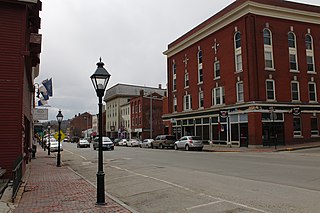
<span class="mw-page-title-main">Hallowell, Maine</span> City in Maine, United States

Hallowell is a city in Kennebec County, Maine, United States. The population was 2,570 at the 2020 census. Popular with tourists, Hallowell is noted for its culture and old architecture. Hallowell is included in the Augusta, Maine, micropolitan New England City and Town Area.

<span class="mw-page-title-main">Litchfield, Maine</span> Town in the state of Maine, United States

Litchfield is a town in Kennebec County, Maine, United States. The population was 3,586 at the 2020 census. Litchfield is included in the Augusta, Maine micropolitan New England City and Town Area.

<span class="mw-page-title-main">Manchester, Maine</span> Town in Maine, United States

Manchester is a town in Kennebec County, Maine, United States, located at 44.33°N 69.87°W. The population was 2,456 at the 2020 census. The southern part of the town bordering Cobbosseecontee Lake is a popular recreation spot in central Maine, and part of the Winthrop Lakes Region. Manchester is included in the Augusta, Maine micropolitan New England City and Town Area.

<span class="mw-page-title-main">Mount Vernon, Maine</span> Town in the state of Maine, United States

Mount Vernon is a town in Kennebec County, Maine, United States. The population was 1,721 at the 2020 census. Mount Vernon is included in the Augusta, Maine micropolitan New England City and Town Area. A popular recreation spot in central Maine, the northern area of Mount Vernon is part of the Belgrade Lakes Region, while the southern area is part of the Winthrop Lakes Region.
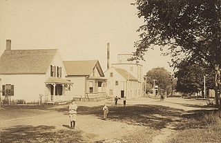
<span class="mw-page-title-main">Readfield, Maine</span> Town in the state of Maine, United States

Readfield is a town in Kennebec County, Maine, United States. The population was 2,597 at the 2020 census. Readfield is home to the Kents Hill School, a preparatory school, Maranacook Community Schools, public schools for the district, a few summer camps, and the annual Readfield Heritage Days. A popular recreation spot in central Maine, the town contains nine lakes and ponds, including Maranacook Lake, and is part of the Winthrop Lakes Region. The town of Readfield was previously named Pond Town. Readfield is included in the Augusta, Maine micropolitan New England City and Town Area.

<span class="mw-page-title-main">Sidney, Maine</span> Town in the state of Maine, United States

Sidney is a town in Kennebec County, Maine, United States. The population was 4,645 at the 2020 census. Sidney was incorporated as a town on January 30, 1792. The town was named for Sir Philip Sidney, an English author. Sidney is included in the Augusta, Maine micropolitan New England City and Town Area. Since 1937, the town has been the home of the New England Music Camp.

<span class="mw-page-title-main">Vassalboro, Maine</span> Town in Maine, United States

Vassalboro is a town in Kennebec County, Maine, United States. The population was 4,520 at the 2020 census. Vassalboro includes the villages of Riverside, Getchell's Corner, North Vassalboro, and East Vassalboro, home to the town library and sports field. Vassalboro is included in the Augusta, Maine, micropolitan New England City and Town Area.

<span class="mw-page-title-main">Wayne, Maine</span> Town in the state of Maine, United States

Wayne is a town in Kennebec County, Maine, United States. The population was 1,129 at the 2020 census. The town was named after Revolutionary War General Anthony Wayne. During the summer, Wayne is home to Camp Androscoggin. A popular recreation spot in central Maine, Wayne is part of the Winthrop Lakes Region. The town is included in the Augusta, Maine micropolitan New England City and Town Area.

<span class="mw-page-title-main">West Gardiner, Maine</span> Town in the state of Maine, United States

West Gardiner is a town in Kennebec County, Maine, United States. The population was 3,671 at the 2020 census. West Gardiner is included in the Augusta, Maine micropolitan New England City and Town Area.

<span class="mw-page-title-main">Windsor, Maine</span> Town in the state of Maine, United States

Windsor is a town in Kennebec County, Maine, United States. The population was 2,632 at the 2020 census. Windsor is included in the Augusta, Maine micropolitan New England City and Town Area.

<span class="mw-page-title-main">Randolph, Maine</span> Town in the state of Maine, United States

Randolph is a town and a census-designated place (CDP) in Kennebec County, Maine, United States. The population was 1,743 at the 2020 census. The town was named for Randolph, Massachusetts. Randolph is included in the Augusta, Maine micropolitan New England City and Town Area.
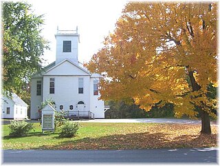
<span class="mw-page-title-main">Winslow, Maine</span> Town in the state of Maine, United States

Winslow is a town and census-designated place in Kennebec County, Maine, United States, along the Kennebec River across from Waterville. The population was 7,948 at the 2020 census.

<span class="mw-page-title-main">Oakland, Maine</span> Town in the state of Maine, United States

Oakland is a town in Kennebec County in the U.S. state of Maine. The population was 6,230 at the 2020 census. Oakland is 4 miles (6 km) west of Waterville and approximately 18 miles (29 km) north of Augusta, the state capital. Waterville and Augusta are service centers for Oakland, and many Oakland residents commute to jobs in those areas.

<span class="mw-page-title-main">Farmingdale (CDP), Maine</span> Census-designated place in Maine, United States

Farmingdale is a census-designated place (CDP) in the town of Farmingdale in Kennebec County, Maine, United States. The population was 1,970 at the 2010 census, out of 2,956 in the entire town.

<span class="mw-page-title-main">Winthrop (CDP), Maine</span> Census-designated place in Maine, United States

Winthrop is a census-designated place (CDP) comprising the primary settlement in the town of Winthrop in Kennebec County, Maine, United States. The population was 2,650 at the 2010 census, out of 6,092 in the town of Winthrop as a whole.

<span class="mw-page-title-main">Winthrop, Maine</span> Town in Maine, United States

Winthrop is a town in Kennebec County, Maine, United States. The population was 6,121 at the 2020 census. Winthrop's population, however, approximately doubles during the summer months as part-year residents return to seasonal camps located on the shores of Winthrop's Lakes and Ponds. A recreational area located among lakes, the town includes the villages of Winthrop and East Winthrop, and is the center of the Winthrop Lakes Region. Winthrop is included in the Augusta, Maine Micropolitan New England City and Town Area.

References

  1. 1 2 "US Gazetteer files 2010". United States Census Bureau . Retrieved December 16, 2012.
  2. "Census - Geography Profile: Farmingdale town, Kennebec County, Maine" . Retrieved January 16, 2022.
  3. "Farmingdale, Kennebec County | Maine Genealogy".
  4. Illustrated history of Kennebec County, Maine; 1625-1799-1892, Part 1
  5. "Historic Hallowell - Ice Cutting and Ice Houses on the Bombahook".
  6. "Grant, Peter, House".
  7. http://www.antiquing.com/oldhomes.htm
  8. "Census of Population and Housing". Census.gov. Retrieved June 4, 2015.
  9. "U.S. Census website". United States Census Bureau . Retrieved 2008-01-31.
  10. "The school system's website". Archived from the original on June 15, 2012. Retrieved June 6, 2012.