The Baker Branch Saint John River is a 48.0-mile-long (77.2 km) river. This river is a tributary of the Saint John River, flowing in the Maine North Woods, in Maine, in the Northeastern United States.
The East Branch Mattawamkeag River is a tributary of the Mattawamkeag River in Aroostook County, Maine. From its source in Dudley, the river runs 36 miles (58 km) south and southeast to its confluence with the West Branch Mattawamkeag River in Haynesville, about 10 miles (16 km) west of the Canada–United States border.

The Fish River is a 69.9-mile-long (112.5 km) river in northern Maine in the United States. It is a tributary of the Saint John River, which flows to the Bay of Fundy in New Brunswick, Canada.

The Moose River is an 83-mile-long (134 km) river in Maine. Its source is in Beattie, on the Canada–United States border, which runs along the height of land between the watersheds of the Kennebec River in Maine and the Chaudière River in Quebec. From there, the river runs east through Attean Pond and Wood Pond, past the town of Moose River, then through Long Pond and Brassua Lake. The Moose River empties into Moosehead Lake, the source of the Kennebec River, in Rockwood Strip. The International Railway of Maine was built along Moose River in 1889.
The Roach River is a river in Piscataquis County, Maine. From the outlet of Third Roach Pond in Shawtown, the river runs 19.1 miles (30.7 km) west, through a chain of ponds. The Flow sequence through the ponds is from the Fourth Roach Pond through the Third Roach Pond, Second Roach Pond, and First Roach Pond to empty into Moosehead Lake, the source of the Kennebec River, in Spencer Bay. The Seventh Roach Pond drains through the Sixth Roach Pond in a separate tributary to the Third Roach Pond. No fifth Roach Pond is shown on modern maps.

The Sebec River is a tributary of the Piscataquis River in Piscataquis County, Maine. From the outflow of Sebec Lake in Sebec, the river runs 10.0 miles (16.1 km) east and southeast to its confluence with the Piscataquis in Milo.

Harris Station Dam is a hydroelectric dam in Northeast Somerset, Somerset County, Maine. Also known as the Indian Pond Project, the dam was built from 1952 to 1954 as the largest hydroelectric dam in the state of Maine. It impounds the Kennebec River at the southern end of the natural Indian Pond, about 12 miles (19 km) downstream from Moosehead Lake.
Seboeis Lake extends from Lake View Plantation, Maine, north into Maine township 4, range 9. The lake is enclosed by rocky headlands and sandy beaches and contains several pine-covered islands. The inlet at the north end receives several tributaries from Long A township including Dean Brook, Jordan Brook, and West Seboeis Stream. Bear Brook flows into the northwest corner of the lake, and Northwest Pond overflows into the west side of the Lake. West Branch Sebois Stream overflows the east side of the lake through Dudley Rips into Endless Lake; and Endless Lake overflow reaches the Piscataquis River 15 miles (24 km) downstream, just 3 miles (4.8 km) upstream of the Piscataquis and Penobscot River confluence at Howland.
Caucomgomoc Lake is in the North Maine Woods at the corner of townships 6 and 7 in ranges 14 and 15. Loon Stream flows into the southern end of the lake from Loon Lake, Bear Pond, Big Hurd Pond, Little Hurd Pond, Bear Brook Pond, McDougal Pond, and tributaries from the southwest. Overflow from Little Shallow Lake through Shallow Lake, Daggett Pond, and Round Pond enters the east side of Caucomgomoc Lake through Ciss Stream. Smaller tributaries Avery Brook, Middle Brook, and Ramsell Brook flow into the north end of the lake. There is a dam at the lake outlet on the eastern shore a short distance south of Ciss Stream. Discharge through the dam flows down Caucomgomoc Stream through Black Pond and Chesuncook Lake to the West Branch Penobscot River at Ripogenus Gorge. White perch and yellow perch have largely replaced historic trout populations in the lake.
Upper Richardson Lake and Lower Richardson Lake are impounded as a single reservoir by Middle Dam at the outlet to Rapid River on the western shore of the lower lake. Rapid River flows 5 miles (8.0 km) to Umbagog Lake headwaters of the Androscoggin River. Upper Richardson Lake is in the western portion of Richardsontown township, and the lower lake is on the border of Magalloway Plantation and Maine township C. Primary inflow is discharge over Upper Dam on Mooselookmeguntic Lake on the eastern shore of the upper lake. Smaller tributaries entering the north end of the upper lake include Mill Brook draining the Richardson Ponds, Fish Brook draining Fish Pond, and Beaver Brook draining Beaver Pond, Little Beaver Pond, and Aziscohos Pond. Other small tributaries include Rand Brook on the western shore, and Mosquito Brook, Metallak Brook, and Bailey Brook on the eastern shore. The lake offers excellent habitat for adult trout, but with dams on the outlet and major inlet, fish populations are limited by the insufficient spawning and nursery areas of these small tributaries. The public boat launch area at the north end of the upper lake is 1 mile (1.6 km) off Maine State Route 16; and the boat launch area at the south end of the lower lake is accessed by driving 12 miles (19 km) north of Andover on South Arm Road.
The Fish River chain of lakes is a series of five lakes in the North Maine Woods region of northern Maine, in a tributary stream to the Fish River. The lakes are an important northern Maine recreation area providing habitat for wildlife including rainbow smelt, brook trout, lake trout, and land-locked Atlantic salmon.
The Belgrade Lakes are a chain of lakes around Belgrade, Maine. The flow sequence is from East Pond to North Pond to Great Pond to Long Pond to Messalonskee Lake and thence via Messalonskee Stream to the Kennebec River at Waterville. The lakes have long been an important resort area for fishing, boating, and swimming; and shoreline development includes residences for individuals employed in the cities of Waterville and Augusta.
Millinocket Lake is the source of Millinocket Stream in the North Maine Woods north of Baxter State Park. Millinocket Stream flows 5.5 miles (8.9 km) to Maine township 8, range 8, where it joins Munsungan Stream to form the Aroostook River. The lake extending along the border of Maine range 9 townships 7 and 8 is impounded behind a wooden dam. The dam enlarged the lake to include Little Millinocket Lake and Moose Pond by flooding adjoining bogs to store water for hydropower. The large areas of shallow flooded bog are a good habitat for fallfish, yellow perch and white suckers; but with summer water temperatures ranging from 70° near the surface to 55° in the deeper areas, dissolved oxygen concentrations become unfavorable for trout. Tributaries to the lake drain a number of small ponds to the west of the lake including Atkins Pond, Blackmore Pond, Buckley Pond, Big Caribou Pond, Little Caribou Pond, Chandler Pond, Elsie Pond, Ervin Pond, Jack Pond, Kyle Pond, Line Pond, Mathews Pond, May Pond, Little Moose Pond, Upper Moose Pond, Pretty Pond, Snowshoe Pond, and Spring Pond.
Rainbow Lake is the source of Rainbow Stream in Rainbow township in the North Maine Woods. Rainbow Stream discharges over a dam at the west end of the lake and flows 4 miles (6.4 km) south to Nahmakanta Lake. Nahmakanta Lake overflows through Nahmakanta Stream and Pemadumcook Chain of Lakes to the Penobscot River. The Appalachian Trail follows Rainbow Stream and the south shore of the lake; but the old logging road to the dam has deteriorated with boggy areas no longer passable by four-wheel drive vehicles. The lake has a small catchment basin and is surrounded by large granite boulders. The low nutrient input in this setting produces unusually clear water. The lake has a native population of brook trout.
A chain of three Jo-Mary Lakes along the border of Penobscot County and Piscataquis County drain into the Pemadumcook Chain of Lakes in the North Maine Woods. The flow sequence is from Upper Jo-Mary Lake into Middle Jo-Mary Lake and then through Lower Jo-Mary Lake into Pemadumcook Lake.
Toddy Pond is a narrow lake, eight-miles long, in Hancock County, Maine. South Toddy leads from Surry and Blue Hill townships via a narrow channel to Middle Toddy that is edged by Surry and Penobscot townships. All of North Toddy, which is connected to Middle Toddy by another narrow channel, lies in Orland township. U.S. Route One crosses the northern end of the lake, paralleling the dam through which the waters of Toddy Pond flow down to Alamoosook Lake and thence eventually to the Penobscot River. A public boat landing is located off Route One. The cold water of North Toddy is home to a self-sustaining population of lake trout; it is also stocked with splake, brown trout, and land-locked Atlantic salmon. Smallmouth bass and white perch thrive in the warmer water of Middle and South Toddy. In spring the lake is a spawning venue for alewife. The Toddy Pond Association was established in 1999 by concerned property owners in order to protect the lake and its watershed and educate members about relevant environmental issues.
Nahmakanta Lake is the source of Nahmakanta Stream in the North Maine Woods. Nahmakanta Stream flows 4 miles (6.4 km) from the southeast end of the lake in Maine township 1, range 11, to the Pemadumcook Chain of Lakes in township 1, range 10. The Appalachian Trail follows Nahmakanta Stream and the southwest shore of Nahmakanta Lake. The northwest end of the lake in township 2, range 11, receives drainage from Rainbow Lake via Rainbow Stream, from Gould Pond via Gould Brook, from the Bean Ponds via Bean Brook, and from Female Pond, Wadleigh Pond, the Musquash Ponds, and Pollywog Pond via Pollywog Brook. These streams provide spawning habitat for brook trout and land-locked Atlantic salmon, while lake trout spawn in the shoals of the lake.
Hancock Brook is an east-bank tributary to the Saco River at Hiram, Maine. The brook originates in eastern Denmark and flows through a chain of ponds along the border between Hiram and Sebago. The narrow-gauge Bridgton and Saco River Railroad was built along the brook in 1882, and operated until 1941.
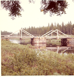
The Saint John Ponds are a chain of shallow lakes at the headwaters of the Baker Branch Saint John River in the North Maine Woods. The flow sequence is from the Upper First Saint John Pond, through the Lower First Saint John Pond, Second Saint John Pond, Third Saint John Pond, and Fourth Saint John Pond to the Fifth Saint John Pond. Flow from one pond to the next is sometimes called Baker Stream rather than the Baker Branch Saint John River. Great Northern Paper Company dug a canal from Fifth Saint John Pond 2 miles (3.2 km) eastward to the North Branch Penobscot River in 1939, and built a dam at the north end of Fifth Saint John Pond so pulpwood logs harvested in the upper Saint John River watershed could be floated down the Penobscot River to Millinocket, Maine. The canal and dam have fallen into disrepair so most drainage from the ponds again flows down the Saint John River. All upstream ponds with the exception of the first had dams to regulate discharge flow for log driving, but those dams have similarly fallen into disrepair. Moose use the ponds as summer refuge from heat and biting insects.
Musquacook Stream is a tributary to the Allagash River in the North Maine Woods. The stream originates in a chain of lakes in Maine range 11 townships 10, 11 and 12. The flow sequence is from Clear Lake through Fifth Musquacook Lake into Fourth Musquacook Lake in Piscataquis County; and from Fourth Musquacook Lake through Third Musquacook Lake, Second Musquacook Lake, and First Musquacook Lake into the Allagash River Musquacook Deadwater in Aroostook County.

