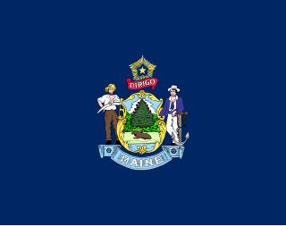
Pleasant River is a 4.7-mile-long (7.6 km) river in Oxford County, Maine in the United States. It is a tributary of the Androscoggin River, which flows east and south to join the Kennebec River in Merrymeeting Bay near the Atlantic Ocean.

Mount Abraham is a mountain located in Franklin County, Maine. Mount Abraham is flanked to the north by Spaulding Mountain.

Spaulding Mountain is a mountain located in Franklin County, Maine. Spaulding Mountain is flanked to the northeast by Sugarloaf Mountain, and to the southeast by Mount Abraham.
The East Branch Nezinscot River is a 19.4-mile-long (31.2 km) river in Maine. It flows from its source on Black Mountain in Peru to its confluence with the West Branch in Buckfield. The resulting river, the Nezinscot, continues east to the Androscoggin River, which flows to the Kennebec River near its mouth at the Atlantic Ocean.
The East Branch Pleasant River is a 6.2-mile-long (10.0 km) tributary of the Pleasant River in the U.S. state of Maine. The Pleasant River is a tributary of the Androscoggin River, which flows southeast to the tidal Kennebec River and the Atlantic Ocean.
The East Branch Swift River is a 10.2-mile-long (16.4 km) tributary of the Swift River in western Maine. Via the Swift River, it is part of the Androscoggin River watershed, which flows to the Kennebec River and ultimately the Atlantic Ocean.
The Nezinscot River is a 15-mile-long (24 km) river in Maine. It runs east from the confluence of its East Branch and West Branch in Buckfield to its mouth on the Androscoggin River in Turner.
The Passadumkeag River is a river in Maine. From the confluence of its East Branch and West Branch in Maine Township 3, Range 1, NBPP, the river runs 48.2 miles (77.6 km) south and west to its mouth on the Penobscot River in Passadumkeag.
The South Branch Dead River is a 26.3-mile-long (42.3 km) tributary of the Dead River in Franklin County, Maine.
The South Branch Sandy River is a short tributary of the Sandy River in Franklin County, Maine. From its source on Blueberry Mountain in Berlin, the river runs 7.4 miles (11.9 km) northeast to its confluence with the Sandy River in Phillips.
The South Branch Sunday River is a 2.5-mile-long (4.0 km) mountain stream in western Maine. It is a tributary of the Sunday River, which flows to the Androscoggin River and ultimately to the Kennebec River and the Atlantic Ocean.
The Southwest Branch Indian River is a short stream in Addison, Maine. From its source, the river runs about 3 miles (5 km) east to its confluence with the Indian River.
The Spring River is a short stream in Township 16, MD, Hancock County, Maine, USA. From the outflow of Narraguagus Lake, the river runs 4.0 miles (6.4 km) northeast to its confluence with the West Branch Narraguagus River.
The West Branch Ellis River is a 13.5-mile-long (21.7 km) river in western Maine. It is a tributary of the Ellis River, which flows to the Androscoggin River and ultimately to the Kennebec River near its mouth at the Atlantic Ocean.
The West Branch Narraguagus River is a short stream in Township 34, MD, Hancock County, Maine. From its source, the river runs 7.6 miles (12.2 km) east and southeast to its confluence with the Narraguagus River.
The West Branch Nezinscot River is an 18.7-mile-long (30.1 km) river in Maine. It flows from Shagg Pond in Woodstock to its confluence with the East Branch in Buckfield. The resulting river, the Nezinscot, flows east to the Androscoggin River, which in turn flows southeast to the Kennebec River near its mouth at the Atlantic Ocean.
The West Branch Oyster River is a 3.3-mile-long (5.3 km) tributary of the Oyster River in Warren, Maine. From its source, the stream runs about 2 miles south and 1 mile east to its confluence with the main stem of the Oyster River.
The West Branch Pleasant River is a 7.5-mile-long (12.1 km) tributary of the Pleasant River in the U.S. state of Maine. It is part of the Androscoggin River watershed, which flows to the tidal Kennebec River near its mouth at the Atlantic Ocean.
The West Branch Swift River is a 6.4-mile-long (10.3 km) tributary of the Swift River in western Maine. Via the Swift River, it is part of the Androscoggin River watershed, flowing to the Kennebec River and ultimately the Atlantic Ocean.

The Geographic Names Information System (GNIS) is a database that contains name and locative information about more than two million physical and cultural features located throughout the United States of America and its territories. It is a type of gazetteer. GNIS was developed by the United States Geological Survey in cooperation with the United States Board on Geographic Names (BGN) to promote the standardization of feature names.

The United States Geological Survey is a scientific agency of the United States government. The scientists of the USGS study the landscape of the United States, its natural resources, and the natural hazards that threaten it. The organization has four major science disciplines, concerning biology, geography, geology, and hydrology. The USGS is a fact-finding research organization with no regulatory responsibility.


