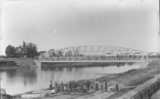
Saint-Pamphile is a town in the Canadian province of Quebec situated in the L'Islet Regional County Municipality in the Chaudière-Appalaches administrative district. While the official municipal territory ends at the Canada–United States border located at the eastern end of town, there is a tiny hamlet located immediately east of the border, known as St-Pamphile, Maine. The hamlet is historically part of the larger entity located in Quebec and is considered an integral part of the town by locals. The economy of St-Pamphile, Maine is entirely dependent upon the economy of St-Pamphile, Quebec, from which Maine residents obtain goods and services, and sometimes even employment. Saint-Pamphile, Quebec is the central town of seven neighboring parishes and provides a CLSC, elementary school, and high school for the area.

The Ouelle River is a tributary of the south shore of the St. Lawrence River, in the province of Quebec, in Canada. This river flows successively in the MRC of:

The Big Black River is a river crossing the administrative region of Chaudière-Appalaches in Quebec and in Maine. From its source, in L'Islet RCM, Quebec, the river runs northeast and east across the Canada–United States border in Maine Township 14, Range 16, WELS, to the Saint John River in Northwest Aroostook T 15, R 13.
The Daaquam River is a river primarily flowing in the administrative region of Chaudière-Appalaches, at South of Quebec in Canada and northern Maine, in United States. The river runs from its source, south of Sainte-Justine, northeast across the Canada–United States border to the Northwest Branch of the Saint John River in Maine.
The Shields Branch is a tributary of the Big Black River, flowing in:

Sainte-Félicité is a municipality in L'Islet Regional County Municipality in the Chaudière-Appalaches region of Quebec. Its population in the 2021 Canadian census was 350.
The Otter River is a tributary of the Northwest Branch Saint John River, flowing in Quebec (Canada) and in Maine. This river crosses the following administrative territories:
The Brown River is a tributary of the Depot River, flowing in Quebec, Canada, in the municipality of Saint-Adalbert, in L'Islet Regional County Municipality, in the administrative region of Chaudière-Appalaches, and in Aroostook County, Maine, United States, in Township T13 R16 Wels, in the North Maine Woods. Its course runs entirely through forested region in a plain in Quebec and in a valley south of the Canada-US border.

The Filkars River is a tributary of the Beaurivage River which is a tributary of the west bank of the Chaudière River. It flows in the municipalities of Saint-Sylvestre, Sainte-Agathe-de-Lotbinière and Saint-Patrice-de-Beaurivage, in the Lotbinière Regional County Municipality, in the administrative region of Chaudière-Appalaches, in Québec, in Canada.
The Vallée River is a tributary of the west bank of the Chaudière River which flows northward to empty onto the south bank of the St. Lawrence River. It flows in the municipalities of Saint-Elzéar and Siante-Marie-de-Beauce, in the La Nouvelle-Beauce Regional County Municipality, in the administrative region of Chaudière-Appalaches, in Quebec, in Canada.
The Prévost-Gilbert river is a tributary of the west bank of the Bras Saint-Victor which flows into the Chaudière River; the latter flows northward to empty on the south shore of the St. Lawrence River. It flows in the administrative region of Chaudière-Appalaches, in Quebec, in Canada, in MRC of:
The Bras d'Apic is a river which flows in the municipalities of Saint-Marcel and Saint-Cyrille-de-Lessard, in the L'Islet Regional County Municipality, in the administrative region of Chaudière-Appalaches, in Quebec, in Canada.
The Bras de Riche flows in the municipalities of Saint-Cyrille-de-Lessard, Saint-Aubert and L'Islet, in the L'Islet Regional County Municipality, in the administrative region of Chaudière-Appalaches, in Quebec, in Canada.
The Bras du Nord-Est flows entirely in the municipality of Saint-Cyrille-de-Lessard, in the L'Islet Regional County Municipality, in the administrative region of Chaudière-Appalaches, in Québec, in Canada.
The Damnée River flows entirely in the municipality of Saint-Damase-de-L'Islet, in the L'Islet Regional County Municipality, in the administrative region of Chaudière-Appalaches, in the province of Quebec, in Canada.
The Grande Rivière is a tributary of the Ouelle River which flows on the south shore of the St. Lawrence River, in the province of Quebec, in Canada.
The rivière du Rat Musqué flows successively in the municipality of Sainte-Perpétue and in the municipalities of Tourville, in the L'Islet Regional County Municipality, in the administrative region of Chaudière-Appalaches, in Québec, in Canada.
The Port Joli River is a tributary of the south shore of the St. Lawrence River where it flows southwest of the village of Saint-Jean-Port-Joli and north-east of the village of L'Islet-sur-Mer.

The Trois Saumons River is a tributary of the south shore of the St. Lawrence River where it flows to the southwest of the village of Saint-Jean-Port-Joli and to the north-east of the village of L'Islet-sur-Mer. The Trois-Saumons river water mill in Saint-Jean-Port-Joli is located upstream of route 132.
The Trois Saumons East River(in French: Trois Saumons Est) river is a tributary of the east bank of the Trois Saumons River which flows to the south bank of the St. Lawrence River where it flows south-west of the village of Saint-Jean-Port-Joli and north-east of the village of L'Islet-sur-Mer.


