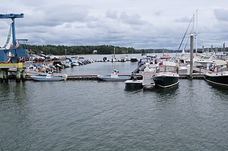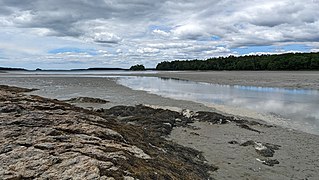
The Fore River is a short horn-shaped estuary, approximately 5.7 miles (9.2 km) long, separating Portland and South Portland in Maine in the United States. Many of the port facilities of the Portland harbor are along the estuary, which is formed just southwest of Portland by the confluence of several creeks. The estuary was initially known as Levett's River, so named by the first English settler of the Casco Bay region, Capt. Christopher Levett. But shortly afterwards, the estuary came to have the name by which it is known today.

Chebeague Island is located in Casco Bay, an inlet of the Gulf of Maine. It was originally used as a fishing ground by Abenaki Native Americans. Also known as Great Chebeague Island, today it is a town in Cumberland County, Maine, United States. It is located 10 miles (16 km) northeast of Portland, Maine. Chebeague Island is the largest island in Casco Bay that is not connected to the mainland by a bridge. The largest island is Sebascodegan, or "Great Island," which is part of the Town of Harpswell and connected to the mainland by a bridge.

The Presumpscot River is a 25.8-mile-long (41.5 km) river located in Cumberland County, Maine. It is the main outlet of Sebago Lake. The river provided an early transportation corridor with reliable water power for industrial development of the city of Westbrook and the village of South Windham.

The Royal River is a small river, 39 miles (63 km) long, in southern Maine. The river originates in Sabbathday Lake in New Gloucester and flows northeasterly into Auburn and then southerly through New Gloucester, Gray and North Yarmouth into Casco Bay at Yarmouth.
The Bear River is a 2.7-mile-long (4.3 km) tributary of Long Lake in the U.S. state of Maine. It originates at the outlet of Bear Pond in the town of Waterford in Oxford County, then flows southeast into the town of Bridgton in Cumberland County and finally the town of Harrison, where it reaches Long Lake. Via Long Lake, the Songo River, and Sebago Lake, the Bear River is part of the Presumpscot River watershed, flowing to Casco Bay on the Atlantic Ocean.
The Cousins River is a 4.7-mile-long (7.6 km), primarily tidal river in southern Maine. Rising in the town of Freeport at the junction of Harvey Brook and Merrill Brook, it flows south and forms, for most of its course, the boundary between Freeport and Yarmouth. It ends at the Royal River just west of that river's mouth in Casco Bay.
The Crooked River is a 58.0-mile-long (93.3 km) tributary of the Songo River in Maine. It is the longest of the tributaries of Sebago Lake, the outlet of which is the Presumpscot River, flowing to Casco Bay on the Atlantic Ocean.
The East Branch Piscataqua River is a 10.2-mile-long (16.4 km) river in Maine. It is a tributary of the Piscataqua River, which flows to the Presumpscot River and ultimately to Casco Bay.

The Harraseeket River is a 3.2-mile-long (5.1 km) tidal river in the town of Freeport within the U.S. state of Maine. It forms a northern arm of Casco Bay.
The Little Androscoggin River is a 51.4-mile-long (82.7 km) river in Maine. It flows from Bryant Pond in Woodstock to its confluence with the Androscoggin River in Auburn. The Androscoggin flows into Merrymeeting Bay in the Kennebec River estuary.
The Little Saco River is a 4.5-mile-long (7.2 km) tributary of the Saco River in western Maine in the United States. It begins at the junction of Haley Brook and Paine Brook in the northern part of the town of Brownfield and flows northeast, entering the town of Fryeburg just before its mouth at the Saco.
The New Meadows River is a 12-mile-long (19 km) tidal river in Maine, flowing into the northern end of Casco Bay. It serves as the boundary between Cumberland and Sagadahoc counties for its entire length.
The North Branch Little River is a 9.8-mile-long (15.8 km) tributary of the Little River in southern Maine. It is part of the Presumpscot River watershed, which flows to Casco Bay in the Atlantic Ocean.
The Piscataqua River is an 11.9-mile-long (19.2 km) tributary of the Presumpscot River in the U.S. state of Maine. Via the Presumpscot River, it is part of the watershed of Casco Bay, an arm of the Atlantic Ocean.

The Spurwink River is a 4.6-mile-long (7.4 km) primarily tidal river in Cumberland County, Maine, in the United States. It rises in the town of Cape Elizabeth and flows west, then southwest, through salt marshes to its mouth at the Atlantic Ocean. It is bridged by Maine State Route 77 at the river's approximate halfway point. From a point shortly above the bridge to the river's mouth, it forms the boundary between Cape Elizabeth to the east and the town of Scarborough to the west. The river's mouth is at the Scarborough village of Higgins Beach.
The Tenny River is a 1.0-mile-long (1.6 km) navigable stream connecting Crescent Lake with Panther Pond in the town of Raymond in the U.S. state of Maine. The river drops just one foot in elevation over its course, from 278 feet (85 m) above sea level at Crescent Lake to 277 feet (84 m) at Panther Pond, the outlet of which then drops another 10 feet (3.0 m) to Sebago Lake. The Tenny River is part of the Presumpscot River watershed, flowing to Casco Bay, an arm of the Atlantic Ocean.

Wolfe's Neck Woods State Park is a public recreation area located on Casco Bay on the southeastern side of Freeport, Maine. The state park occupies 244 acres (99 ha) on a narrow peninsula, Wolfe's Neck, that runs between Casco Bay and the Harraseeket River. It includes white pine and hemlock forests, salt marsh estuary, and rocky shore. The park is managed by the Maine Department of Agriculture, Conservation and Forestry.

The Captain Greenfield Pote House is an historic house located on Wolfe's Neck Road in Freeport, Maine, United States. Built c. 1750 and supposedly moved to this location in 1765, it is Freeport's oldest surviving building. It was listed on the National Register of Historic Places in 1970, and is part of the Harraseeket Historic District. The property is owned by the Wolfe's Neck Center for Agriculture and the Environment.

Freeport is a town in Cumberland County, Maine, United States. The population was 8,737 at the 2020 census. Once home to a prominent shipbuilding industry, timber operations, and farming, it is now known for its numerous outlet stores; Freeport is home to L.L. Bean, Wolfe's Neck Woods State Park, and the Desert of Maine.

Wolfe's Neck Center for Agriculture & the Environment is a sustainable coastal farm in Freeport, Maine, United States. Located at 184 Burnett Road, the farm was established in 1959 by Philadelphia natives Eleanor Houston Smith (1910–1987) and Lawrence Smith (1902–1975).


