| Saint Francis River | |
|---|---|
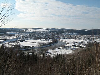
 Saint Francis River from Petit-Témis | |
   | |
| Etymology | Saint Francis Xavier |
| Native name | Rivière Saint-François (French) |
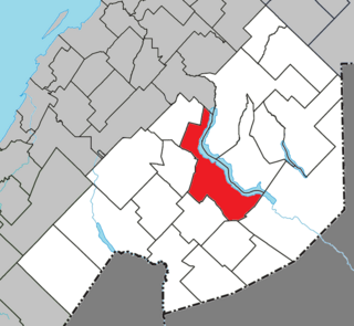
| Location | |
| Country | Canada, United States |
| State (US) | Maine (United States) |
| Providence (Canada) | Quebec (Canada) New Brunswick (Canada) |
| County (US) | Northwest Aroostook (Maine) St. Francis (Maine) |
| Region (Canada) | Bas-Saint-Laurent (Quebec) Rivière-Bleue (Quebec) Saint-François Parish (New Brunswick) |
| Physical characteristics | |
| Source | Saint-Hubert-de-Rivière-du-Loup, Quebec (Québec) |
| • coordinates | 47°40′36″N69°21′19″W / 47.67667°N 69.35528°W |
| • elevation | 359 metres (1,178 ft) |
| Mouth | St. Francis (Maine) Saint-François Parish (New Brunswick); flowing in Saint John River |
• coordinates | 47°10′49″N68°54′14″W / 47.18028°N 68.90389°W |
• elevation | 163 metres (535 ft) |
| Length | 102.4 kilometres (63.6 mi) |
| Basin features | |
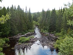
| Landmarks | Kelly Rapids |
| Tributaries | |
| • left | (from the mouth) Canadian Tuladi Brook, Bogasse Brook, Petite coulée Creuse, Coulée Creuse Brook, Jim Brook, Pelletier brook, Botsford Brook, Bleue River, Providence Brook, Beaupré Brook (discharge of Volcan Lake), Des Saules Brook, discharge of Morrison Lake and Yards Lake, Turner Brook, Cascades Brook, Armstrong Brook, Castonguay Brook. |
| • right | (from the mouth) Falls Brook, Yankeetuladi Brook, Jones Brook, Dead Brook, Wildcat Brook, Rousseau Brook, Chouinard Brook, Bouchard Brook, Boucanée River, Cèdres Brook, Black Brook. |
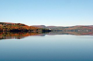
| Waterbodies | Beau Lake, Glazier Lake |
The St. Francis River (French : Rivière Saint-François) is a river roughly 75 miles (120 km) long, which forms part of the Canada–United States border. The river rises ( 47°44′07″N69°17′15″W / 47.7352°N 69.2874°W ) in a lake of the same name located 12 miles (20 km) east of the Rivière du Loup in Quebec. The portion that forms the boundary starts at the bottom of Lake Pohenegamook at the very northernmost point of New England between Estcourt Station, Maine, and Estcourt, Quebec. The river along the international boundary flows south and then south-east through two deep, narrow lakes to its mouth on the Saint John River at St. Francis, Maine/Saint-François-de-Madawaska, New Brunswick. [1]
Contents
USS Bancroft (DD-256) became a Canadian ship as part of the Destroyers for Bases Agreement and was renamed after the St. Francis River to follow the Canadian tradition of naming destroyers after Canadian rivers while recognizing the shared national history of the ship. [2]