Nerepis River

Last updated

The Nerepis River is a river approximately 25 miles long, located in New Brunswick, Canada. A popular river for canoeists and anglers, it is a tributary of the Saint John River. The river has been subjected to significant environmental stress over many years.

New Brunswick province in Canada

New Brunswick is one of four Atlantic provinces on the east coast of Canada. According to the Constitution of Canada, New Brunswick is the only bilingual province. About two thirds of the population declare themselves anglophones and a third francophones. One third of the population describes themselves as bilingual. Atypically for Canada, only about half of the population lives in urban areas, mostly in Greater Moncton, Greater Saint John and the capital Fredericton.

Contents

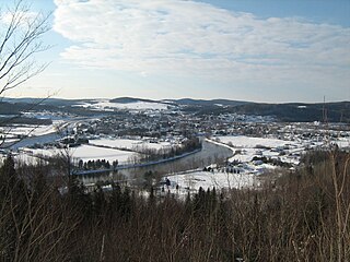
The river meets the Saint John River at Westfield, part of the Town of Grand Bay-Westfield, where it feeds a fresh water marsh. Towards the headwaters, it passes through the communities of Nerepis, Blagdon, Bayard, Welsford (where a tributary, Douglas Creek, tumbles into the river over a 15-metre waterfall), [1] Fowlers Corners, Petersville, and New Jerusalem. The river also passes the 13th hole of the Welsford Golf Course. [2] Most of the land it passes through is undeveloped although there has been extensive clear cutting in the upper reaches. The Nerepis River Watershed also drains part of CFB Gagetown.

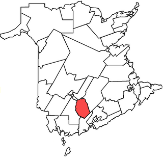
Nerepis is a Canadian rural community in Westfield Parish, Kings County, New Brunswick.

Welsford, New Brunswick human settlement in New Brunswick, Canada

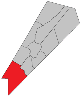
Welsford is a Canadian rural community in Queens County, New Brunswick.

CFB Gagetown Canadian Forces base

5th Canadian Division Support Base Gagetown, formerly known as and commonly referred to as CFB Gagetown, is a large Canadian Forces Base covering an area over 1,100 km2 (420 sq mi), located in southwestern New Brunswick.

Settlement

This house was owned by General John Coffin. Coffin was granted a tract on the Nerepis as a reward for services rendered the British during the American Revolution. The painting dates from 1839. New Brunswick Museum Coffin house at Westfield 1839.JPG
This house was owned by General John Coffin. Coffin was granted a tract on the Nerepis as a reward for services rendered the British during the American Revolution. The painting dates from 1839. New Brunswick Museum

There was an Indian settlement and fort at the confluence of the Nerepis and the St John Rivers (Woodman's Point), known to the French as early as 1696. [3] The French, under the command of Boishébert, rebuilt the fort in 1749 and renamed it Fort Boishebert. The fort was used as a base to lead a harassment campaign against the English. The fort was abandoned after Fort LaTour was rebuilt at the mouth of the St John. [4]

Charles Deschamps de Boishébert et de Raffetot French army officer

Charles Deschamps de Boishébert was a member of the Compagnies Franches de la Marine and was a significant leader of the Acadian militia's resistance to the Expulsion of the Acadians. He settled and tried to protect Acadians refugees along the rivers of New Brunswick. At Beaubears National Park on Beaubears Island, New Brunswick he settled refugee Acadians during the Expulsion of the Acadians.

Fort Boishebert

Fort Boishébert is a National Historic Site of Canada located at modern-day Woodmans Point in the town of Grand Bay–Westfield, Kings County, New Brunswick, Canada. Located at the confluence of the Saint John River and Nerepis rivers, the fort may have had its origins as a fortified aboriginal village. Joseph Robineau de Villebon noted this in a letter dated October 22, 1696, "Sr. de Neuvillette reported that he was continuing on his way down river and would, as he passed the fort of the Nerepis Indians..." Earlier in October 1696, French soldiers upon being rescued by Nerepis, retreated to Fort Nerepis after being attacked by a small English fleet that had entered Saint John Harbour.

The land came to be settled by Loyalists following the American Revolution. Lands were granted to those who had pleased the British. Among the recipients was Maj. John Coffin, a half-pay officer of the New York Volunteers and later a member of the Assembly in New Brunswick.

American Revolution Colonial revolt in which the Thirteen Colonies won independence from Great Britain

The American Revolution was a colonial revolt that took place between 1765 and 1783. The American Patriots in the Thirteen Colonies won independence from Great Britain, becoming the United States of America. They defeated the British in the American Revolutionary War (1775–1783) in alliance with France and others.

The New York Volunteers, also known as the New York Companies and 1st Dutchess County Company, was a British Loyalist Provincial regiment, which served with the British Army, during American Revolutionary War. Eventually, the New York Volunteers became the 3rd American Regiment, after being place on American establishment.

Transportation

Bridge across Nerepis River at Westfield, 1875 Bridge across Nerepis River Westfield 1875.jpg
Bridge across Nerepis River at Westfield, 1875

Early in the European period of New Brunswick settlement, Route 7 ran along the west side of the river providing the main link between the capital city of Fredericton and the port city of Saint John. Part of the route was superseded in 1965 and is now designated Route 177 (Nerepis Road). There are more than half a dozen bridges or culverts over the river. A long crib bridge structure in the nineteenth century was short-lived. It served the modern Route 102.

Route 7 is 97 kilometres (60 mi) long and runs from Fredericton, near an interchange with Route 8, to an interchange with Route 1 in Saint John. Most of the highway is either a divided expressway or has limited access.

Fredericton Provincial capital city in New Brunswick, Canada

Fredericton is the capital of the Canadian province of New Brunswick. The city is situated in the west-central portion of the province along the Saint John River, which flows west to east as it bisects the city. The river is the dominant natural feature of the area. One of the main urban centres in New Brunswick, the city had a population of 56,224 in the 2011 census. It is the third-largest city in the province after Moncton and Saint John.

Saint John, New Brunswick City in New Brunswick, Canada

Saint John is the coastal port city of the Bay of Fundy in the Canadian province of New Brunswick. The port is Canada’s third largest port by tonnage with a cargo base that includes dry and liquid bulk, break bulk, containers, and cruise. In 2016, after more than 40 years of population decline, the city became the second most populous city in the province for the first time, with a population of 67,575 over an area of 315.82 square kilometres (121.94 sq mi). Greater Saint John covers a land area of 3,362.95 square kilometres (1,298.44 sq mi) across the Caledonia Highlands, with a population of 126,202. After the partitioning of the colony of Nova Scotia in 1784, the new colony of New Brunswick was thought to be named 'New Ireland' with the capital to be in Saint John before being vetoed by Britain's King George III. Saint John is the oldest incorporated city in Canada. During the reign of George III, the municipality was created by royal charter in 1785.

Water quality concerns

Over many years, military practice manoeuvres at CFB Gagetown have degraded the water quality and affected fish habitat in the river and its tributaries. [5] Since 1996, the base has been actively working to remedy the situation by hardening fords and stream approach routes. Perhaps more insidiously, the river was also exposed to dioxins from the use of Agent Orange and Agent Purple during secret tests in 1966 and 1967. Herbicides have also been sprayed on the base since 1952. However, a 2006 report found that “exposures to dioxin in soil, sediment and surface water in the Nerepis River area do not represent a potential concern for illness for the angler.” [6]

Ford (crossing) crossing in a river

A ford is a shallow place with good footing where a river or stream may be crossed by wading, or inside a vehicle getting its wheels wet. A ford may occur naturally or be constructed. Fords may be impassable during high water. A low water crossing is a low bridge that allows crossing over a river or stream when water is low but may be covered by deep water when the river is high.

Dioxin may refer to:

Agent Orange military herbicide

Agent Orange is a herbicide and defoliant chemical, one of the "tactical use" Rainbow Herbicides. It is widely known for its use by the U.S. military as part of its herbicidal warfare program, Operation Ranch Hand, during the Vietnam War from 1961 to 1971. It is a mixture of equal parts of two herbicides, 2,4,5-T and 2,4-D. In addition to its damaging environmental effects, traces of dioxin found in the mixture have caused major health problems for many individuals who were exposed.

The Nerepis Marsh, a fresh-water body of approximately one square mile in size, lies near the confluence of the Nerepis and the Saint John rivers.

See also

Related Research Articles

Queens County, New Brunswick County in New Brunswick, Canada

Queens County is located in central New Brunswick, Canada. The county shire town is the village of Gagetown.

Saint John River (Bay of Fundy) river in New Brunswick and Quebec, Canada and Maine, USA

The Saint John River is a 673 kilometres (418 mi) long river that flows from Northern Maine into Canada, and runs south along the western side of New Brunswick, emptying into the Atlantic Ocean in the Bay of Fundy. Eastern Canada's longest river, its drainage basin is one of the largest on the east coast at about 55,000 square kilometres (21,000 sq mi).

Madawaska River (Saint John River tributary) river in Quebec and New Brunswick, Canada

The Madawaska River flows from Lake Témiscouata in Quebec, through Degelis Quebec, to join the Saint John River at Edmundston, New Brunswick.

Oromocto (electoral district)

Oromocto was a provincial electoral district for the Legislative Assembly of New Brunswick, Canada.

Grand Bay–Westfield Town in New Brunswick, Canada

Grand Bay–Westfield is a Canadian suburb outside Saint John in the western part of Kings County, New Brunswick.

Route 177 is a provincial highway in the southwestern portion of the Canadian province of New Brunswick. Its main purpose is to serve the town of Grand Bay-Westfield. Route 177 is a former alignment of Route 7 and is 19.6 kilometres long.

The Jemseg River is a short river in the Canadian province of New Brunswick which drains Grand Lake into the Saint John River.

St. John River Campaign

The St. John River Campaign occurred during the French and Indian War when Colonel Robert Monckton led a force of 1150 British soldiers to destroy the Acadian settlements along the banks of the Saint John River until they reached the largest village of Sainte-Anne des Pays-Bas in February 1759. Monckton was accompanied by Captain George Scott as well as New England Rangers led by Joseph Goreham, Captain Benoni Danks, as well as William Stark and Moses Hazen, both of Rogers' Rangers.

Fort Menagoueche

Fort Menagoueche was a French fort at the mouth of the St. John River, New Brunswick, Canada. French Officer Charles Deschamps de Boishébert et de Raffetot and Ignace-Philippe Aubert de Gaspé built the fort during Father Le Loutre's War and eventually burned it themselves as the French retreated after losing the Battle of Beausejour. It was reconstructed as Fort Frederick by the British.

Siege of Fort Nashwaak

The Siege of Fort Nashwaak occurred during King William's War when New England forces from Boston attacked the capital of Acadia, Fort Nashwaak, at present-day Fredericton, New Brunswick. The siege was in retaliation for the French and Indian Siege of Pemaquid (1696) at present day Bristol, Maine. In the English Province of Massachusetts Bay. Colonel John Hathorne and Major Benjamin Church were the leaders of the New England force of 400 men. The siege lasted two days, between October 18–20, 1696, and formed part of a larger expedition by Church against a number of other Acadian communities.

Oromocto Town in New Brunswick, Canada

Oromocto is a Canadian town in Sunbury County, New Brunswick.

Petersville Parish, New Brunswick Parish in New Brunswick, Canada

Petersville is a Canadian parish in Queens County, New Brunswick.

Gagetown Parish, New Brunswick Parish in New Brunswick, Canada

Gagetown is a Canadian parish in Queens County, New Brunswick.

References

  1. Waterfalls New Brunswick: Description of Welsford Falls
  2. Welsford Golf Club Hole descriptions
  3. John Clarence Webster, 1934 (1979 reprint), “Acadia at the End of the 17th Century”, Saint John Museum, p. 90
  4. John Clarence Webster, 1928, “An Historical Guide to New Brunswick”, New Brunswick Tourist Association, p. 85
  5. National Defence, “Fish Habitat Enhancement at CTC Gagetown”
  6. National Defence, “Fact Finding Task 3A-2: Human health risk assessment for current exposures to dioxins at CFB Gagetown”

Coordinates: 45°22′N66°15′W / 45.367°N 66.250°W / 45.367; -66.250