Perth-Andover

Last updated

Perth-Andover
Castleinn.jpg
The Castle Inn
PA Logo PNG.png
Motto: 
Connect to a Greener Life
Canada New Brunswick location map 2.svg
Red pog.svg
Perth-Andover
Coordinates: 46°44′21″N67°41′54″W / 46.73927°N 67.69840°W / 46.73927; -67.69840
CountryCanada
Province New Brunswick
County Victoria
Municipality Southern Victoria
Established1966
Government
  MP Richard Bragdon (Con.)
  MLAMargaret Johnson (Conservative)
Area
[1]
  Land8.97 km2 (3.46 sq mi)
Highest elevation
183 m (734 ft)
Lowest elevation
130 m (246 ft)
Population
 (2021) [1]
  Total1,574
  Density175.6/km2 (455/sq mi)
  Change (2016–21)
Decrease2.svg 1.0%
Time zone UTC-4 (Atlantic (AST))
  Summer (DST) UTC-3 (ADT)
Canadian Postal code
E7H
Area code 506
Telephone Exchange273, 819
NTS Map 21J13 Aroostook
GNBC CodeDANFW
Website perth-andover.com

Perth-Andover is a former village in Victoria County, New Brunswick, Canada. It held village status prior to 2023. It is now part of the village of Southern Victoria.

Contents

History

Andover was originally called Little Tobique, the community was given the name Andover, from the town in Hampshire, England. Much of Andover's original land grants were to English soldiers and Loyalist from the American Revolution.

Much of Perth (originally called Larlee) was originally part of the territory of the Tobique First Nation, whose reserve was established in 1801, at the band's request. Due to squatters, the First Nation were forced to surrender a total of 2,539 acres, much in Perth-Andover. [2]

In 1878 the New Brunswick Railway opened its line through the community connecting Fredericton and Edmundston, crossing the river from the east bank at Perth to the west bank at Andover. In 1890 the NBR was leased by the Canadian Pacific Railway (CPR). In 1894 the Tobique Valley Railway constructed a line from a junction with the CPR at Perth to Plaster Rock; it was leased by CPR in 1897.

Until the end of county government in New Brunswick in 1966, Andover was the shire town of Victoria County.

In March 1987 the spring freshet caused several severe ice jams on the Saint John River upstream of the railway bridge in Perth-Andover. On the night of April 1, 1987 an extremely high water level forced residents to evacuate, including a seniors home and the hospital. The morning of April 2, 1987 the Canadian Pacific Railway bridge was demolished by the large ice jam, and many buildings and homes along the river in Perth-Andover were flooded. The destruction of the railway bridge cut off CP Rail's network north of Perth from the railway lines in the southern part of western New Brunswick. This contributed to CP Rail's abandonment of these rural branchlines, which were considered unprofitable by the railway. CP Rail tried to blame NB Power for failing to control water discharges from its hydro-electric dams on the river. By the early 1990s, the railroad had ended railway from the northern end of the Saint John River valley.

In 2009 the Canadian government accepted the Tobique Specific Land Claim of 10,533 acres for negotiation; this relates to the 1892 surrender which the First Nation claims is invalid due to the failure of the government to get approval by Order in Council. [2] Settlement of the claim will result in compensation; existing landowners will not be affected. [3] The governments and the Tobique First Nation have three years to negotiate a settlement.

On March 23, 2012, a high spring freshet coupled with an ice jam caused a rise in water levels surpassing those in the 1987 flood. A mandatory evacuation order was issued. [4] About 500 people were affected. [5]

On 1 January 2023, Perth-Andover amalgamated with the village of Aroostook and parts of two local service districts to form the new village of Southern Victoria. [6] [7] The community's name remains in official use. [8]

Geography

The village is divided by the Saint John River with Perth on the east bank and Andover on the west bank; each was a separate community until municipal amalgamation in 1966. Perth-Andover's population meets the requirements for "town" status under the provincial Municipalities Act; however, it has not applied to change from village designation. It was decided by the council at the time to keep the 'Village ' designation.

Demographics

In the 2021 Census of Population conducted by Statistics Canada, Perth-Andover had a population of 1,574 living in 744 of its 785 total private dwellings, a change of

Attractions

Perth-Andover is host to the annual Gathering of the Scots Festival [9] at Veteran's Field on the last weekend in May and the Larlee Creek Hullabaloo [10] in August, held at Baird's Campground. Other major events in the Village are the Tuff Muck Challenge on the last Saturday in July and the Dam Run marathon on the first Saturday in October. Neat Perth Andover, the Tomlinson Lake Hike to Freedom Trail explores New Brunswick's role in the Underground Railroad for African Americans escaping enslavement who crossed the border from the Maple Grove Friends Church near Fort Fairfield, Maine. [11]

Infrastructure

Perth-Andover Electric Light Commission (PAELC) is one of three municipal power utilities left in New Brunswick, and the only one completely independent of NB Power. The residents of the municipality pay the lowest power rates in the province.

Notable people

See also

Related Research Articles

<span class="mw-page-title-main">Florenceville-Bristol</span> Place in New Brunswick, Canada

Florenceville-Bristol is a former town in the northwestern part of Carleton County, New Brunswick, Canada along the Saint John River. It held town status prior to 2023 and is now part of the town of Carleton North.

<span class="mw-page-title-main">Woodstock, New Brunswick</span> Town on the Saint John River, western New Brunswick, Canada

Woodstock is a town in Carleton County, New Brunswick, Canada on the Saint John River, 103 km upriver from Fredericton at the mouth of the Meduxnekeag River. It is near the Canada–United States border and Houlton, Maine and the intersection of Interstate 95 and the Trans-Canada Highway making it a transportation hub. It is also a service centre for the potato industry and for more than 26,000 people in the nearby communities of Hartland, Florenceville-Bristol, Centreville, Bath and Lakeland Ridges for shopping, employment and entertainment.

<span class="mw-page-title-main">Saint John River (Bay of Fundy)</span> River defining parts of the border of Maine and New Brunswick

The Saint John River is a 673-kilometre-long (418 mi) river flowing within the Dawnland region from headwaters in the Notre Dame Mountains near the Maine-Quebec border through western New Brunswick to the northwest shore of the Bay of Fundy. Eastern Canada's longest river, its drainage basin is one of the largest on the east coast at about 55,000 square kilometres (21,000 sq mi). This “River of the Good Wave” and its tributary drainage basin formed the territorial countries of the Wolastoqiyik and Passamaquoddy First Nations prior to European colonization, and it remains a cultural centre of the Wabanaki Confederacy to this day.

The New Brunswick Railway Company Limited (NBR) is currently a Canadian non-operating railway and land holding company headquartered in Saint John, New Brunswick that is part of Irving Transportation Services, a division within the J.D. Irving Limited (JDI) industrial conglomerate. It is not to be confused with another JDI company, New Brunswick Southern Railway (NBSR), established in 1995, which is an operational railway and considered a sister company of the NBR.

<span class="mw-page-title-main">Mactaquac Dam</span> Dam in York County, New Brunswick

The Mactaquac Dam is an embankment dam used to generate hydroelectricity in Mactaquac, New Brunswick. It dams the waters of the Saint John River and is operated by NB Power with a capacity to generate 670 megawatts of electricity from 6 turbines; this represents 20 percent of New Brunswick's power demand.

Victoria-Tobique was a provincial electoral district for the Legislative Assembly of New Brunswick, Canada. This riding was created in the 1973 redistribution when New Brunswick moved to single member districts. It had previously been part of the Victoria district which returned two members.

<span class="mw-page-title-main">Hampton, New Brunswick</span> Town in New Brunswick, Canada

Hampton is a town in Kings County, New Brunswick, Canada.

<span class="mw-page-title-main">Aroostook, New Brunswick</span> Place in New Brunswick, Canada

Aroostook is a former village in Victoria County, New Brunswick, Canada. It held village status prior to 2023. It is now part of the village of Southern Victoria.

<span class="mw-page-title-main">Bath, New Brunswick</span> Place in New Brunswick, Canada

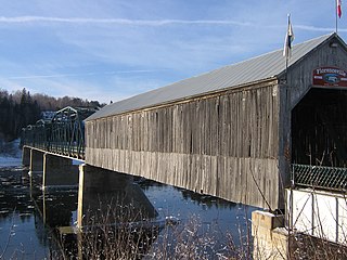
Bath is a former village on the Saint John River in Carleton County, New Brunswick, Canada. It held village status prior to 2023 and is now part of the town of Carleton North.

<span class="mw-page-title-main">Plaster Rock, New Brunswick</span> Place in New Brunswick, Canada

Plaster Rock is a former village in Victoria County, New Brunswick. It is now part of the village of Tobique Valley.

Larry Ronald Kennedy is a politician in the province of New Brunswick, Canada.

<span class="mw-page-title-main">New Denmark, New Brunswick</span> Community in New Brunswick, Canada

New Denmark is a rural community in Victoria County, New Brunswick, Canada. The community is situated in rolling hills east of the Saint John River valley several kilometres south of Drummond. Its main industry is potato farming and related industries. Once the site of several schools, they have all closed and students in New Denmark can choose to continue school in nearby Grand Falls or Tobique Valley.

The Tobique River is a river in northwestern New Brunswick, Canada. The river rises from Nictau Lake in Mount Carleton Provincial Park and flows for 148 kilometres to its confluence with the Saint John River near Perth-Andover.

The Tobique Narrows Dam is a hydroelectric dam built on the Tobique River in the Canadian province of New Brunswick and operated by NB Power corporation. Its powerhouse has a capacity of 20 megawatts.

Arthurette is a Canadian farming community in Victoria County, New Brunswick. It is located on the Tobique River halfway between the villages of Tobique Valley and Perth-Andover. The community is located where the Route 109 and Route 390 change banks of the Tobique River.

Tobique First Nation is one of six Wolastoqiyik or Maliseet Nation reserves in New Brunswick, Canada.

<span class="mw-page-title-main">Gordon Parish, New Brunswick</span> Parish in New Brunswick, Canada

Gordon is a geographic parish in Victoria County, New Brunswick, Canada.

<span class="mw-page-title-main">Perth Parish, New Brunswick</span> Parish in New Brunswick, Canada

Perth is a geographic parish in Victoria County, New Brunswick, Canada.

<span class="mw-page-title-main">Andover Parish, New Brunswick</span> Parish in New Brunswick, Canada

Andover is a geographic parish in Victoria County, New Brunswick, Canada.

<span class="mw-page-title-main">Southern Victoria</span> Village in New Brunswick, Canada

Southern Victoria is a village in the Canadian province of New Brunswick. It was formed through the 2023 New Brunswick local governance reforms.

References

  1. 1 2 3 "Census Profile of Perth-Andover". Statistics Canada. 6 December 2022. Retrieved 21 January 2023.
  2. 1 2 "Background and History of the Claim" Archived 2012-04-26 at the Wayback Machine , Tobique Land Rights: No Consent and No Surrender, Official Website, accessed 25 November 2011
  3. "Compensation talks for Tobique First Nation to begin in October", CBC, 17 June 2008, accessed 25 November 2011
  4. Huras, Adam (24 March 2012). "New Brunswick village Perth-Andover flooded". Vancouver Sun. Perth-Andover, NB. Archived from the original on 26 March 2012. Retrieved 24 March 2012.
  5. "Dozens ordered out of N.B. flood area". The Chronicle Herald. Perth-Andover, NB. 24 March 2012. Retrieved 24 March 2012.
  6. "Local Governments Establishment Regulation – Local Governance Act". Government of New Brunswick. 12 October 2022. Retrieved 21 January 2023.
  7. "RSC 12 - Western Valley Regional Service Commission". Government of New Brunswick. Retrieved 21 January 2023.
  8. "Proposed entity names reflect strong ties to nature and history" (Press release). Irishtown, New Brunswick: Government of New Brunswick. 25 May 2022. Retrieved 21 January 2023.
  9. Gathering of the Scots Festival
  10. Larlee Creek Hullabaloo
  11. Jim Dumville, "The Tomlinson Lake Hike to Freedom special event on July 3", The Toronto Star, June 23, 2021
  12. "Matt Andersen". Archived from the original on 2009-03-31. Retrieved 2007-01-30.