The Canadian province of New Brunswick is divided into 89 local entities, consisting of 77 local governments and 12 rural districts.
A local government can be a city, town, village, regional municipality or rural community, mainly according to population. [1] Cities generally provide more services than smaller entities. [2] Services include certain transportation, environmental, security, and recreational and culture services. [3]
Ninety-five per cent of the population lives in a city, town, village, regional municipality, or rural community and can vote to elect responsible local government. Parts of the province not covered by these local governments are divided into rural districts. These are sparsely populated unincorporated areas.[ citation needed ] Each district elects councillors to form an advisory committee to advise the minister on local matters.
Twelve regional service commissions provide services over larger areas. [4]
In 1784 New Brunswick was created via the partitioning of the Colony of Nova Scotia and divided into the counties of NB, which were in turn divided into parishes. By the 1960s the province was a patchwork of incorporated cities, towns, villages, local improvement districts, [5] and local administrative commissions. [6] Under this system, many public services including healthcare, social services, and education were provided by county government. [7] Underfunded poor counties were stuck in a "perpetual cycle of poverty". [7]
In response, Liberal premier Louis Robichaud introduced the Equal Opportunity Program. [8] This reformed municipal taxation, and via the 1966 Municipalities Act [8] eliminated county governments and led to the subsequent centralization of many of their powers. In 1967 counties ceased to exist as government units and nonmunicipal incorporated bodies [lower-alpha 1] were converted to villages. A new governance unit, the local service district (LSD), was created to administer local services like fire departments in some rural areas. [lower-alpha 2] The new villages were given the same municipal powers as towns and cities. [1] Existing cities and towns were not changed, [9] while existing villages [lower-alpha 3] were converted to the new village model.
Regional service commissions were added in 2012.
The 2023 New Brunswick local governance reform was an overhaul of the system as follows: [10]
Name | Status | Regional service commission | Entity number |
---|---|---|---|
Acadian Peninsula | rural district | Acadian Peninsula | 4 |
Alnwick | rural community | Greater Miramichi | 20 |
Arcadia | village | Capital Region | 66 |
Bathurst | city | Chaleur | 12 |
Belledune | village | Chaleur | 10 |
Beaurivage | town | Kent | 26 |
Beausoleil | rural community | Kent | 31 |
Bois-Joli | village | Restigouche | 8 |
Butternut Valley | rural community | Kings | 79 |
Campbellton | city | Restigouche | 7 |
Campobello Island | rural community | Southwest | 55 |
Cap-Acadie | town | Southeast | 38 |
Capital Region | rural district | Capital Region | 11 |
Caraquet | town | Acadian Peninsula | 14 |
Carleton North | town | Western Valley | 76 |
Central York | rural community | Capital Region | 70 |
Chaleur | rural district | Chaleur | 3 |
Champdoré | town | Kent | 30 |
Dieppe | city | Southeast | 36 |
Doaktown | village | Greater Miramichi | 23 |
Eastern Charlotte | rural community | Southwest | 53 |
Edmundston | city | Northwest | 2 |
Five Rivers | village | Kent | 28 |
Fredericton | city | Capital Region | 69 |
Fredericton Junction | village | Capital Region | 60 |
Fundy | rural district | Fundy | 9 |
Fundy Albert | village | Southeast | 42 |
Fundy Shores | rural community | Southwest | 52 |
Fundy-St. Martins | village | Fundy | 46 |
Grand Bay-Westfield | town | Fundy | 51 |
Grand-Bouctouche | town | Kent | 29 |
Grand Falls | town | Northwest | 4 |
Grand Lake | village | Capital Region | 67 |
Grand Manan | village | Southwest | 54 |
Greater Miramichi | rural district | Greater Miramichi | 5 |
Hampton | town | Fundy | 47 |
Hanwell | rural community | Capital Region | 62 |
Hartland | town | Western Valley | 74 |
Harvey | rural community | Capital Region | 59 |
Haut-Madawaska | town | Northwest | 1 |
Hautes-Terres | town | Acadian Peninsula | 17 |
Heron Bay | town | Restigouche | 9 |
Île-de-Lamèque | town | Acadian Peninsula | 15 |
Kedgwick | rural community | Northwest | 6 |
Kent | rural district | Kent | 6 |
Kings | rural district | Kings | 8 |
Lakeland Ridges | village | Western Valley | 72 |
Maple Hills | rural community | Southeast | 32 |
Memramcook | village | Southeast | 41 |
Miramichi | city | Greater Miramichi | 21 |
Miramichi River Valley | rural community | Greater Miramichi | 22 |
McAdam | village | Southwest | 58 |
Moncton | city | Southeast | 34 |
Nackawic-Millville | rural community | Capital Region | 71 |
Nashwaak | rural community | Capital Region | 68 |
Neguac | village | Acadian Peninsula | 19 |
New Maryland | village | Capital Region | 64 |
Northwest | rural district | Northwest | 1 |
Nouvelle-Arcadie | village | Kent | 25 |
Oromocto | town | Capital Region | 65 |
Quispamsis | town | Fundy | 48 |
Restigouche | rural district | Restigouche | 2 |
Rivière-du-Nord | town | Acadian Peninsula | 13 |
Rothesay | town | Fundy | 49 |
Saint Andrews | town | Southwest | 56 |
Saint John | city | Fundy | 50 |
Saint-Quentin | town | Northwest | 5 |
Salisbury | town | Southeast | 33 |
Shediac | town | Southeast | 37 |
Shippagan | town | Acadian Peninsula | 16 |
Southeast | rural district | Southeast | 7 |
Southern Victoria | village | Western Valley | 77 |
Southwest | rural district | Southwest | 10 |
St. Stephen | town | Southwest | 57 |
Strait Shores | rural community | Southeast | 39 |
Sunbury-York South | rural community | Capital Region | 63 |
Sussex | town | Kings | 44 |
Tantramar | town | Southeast | 40 |
Three Rivers | village | Southeast | 43 |
Tobique Valley | village | Western Valley | 78 |
Tracadie | regional municipality | Acadian Peninsula | 18 |
Tracy | village | Capital Region | 61 |
Upper Miramichi | rural community | Greater Miramichi | 24 |
Vallée-des-Rivières | town | Northwest | 3 |
Valley Waters | village | Kings | 45 |
Western Valley | rural district | Western Valley | 12 |
Woodstock | town | Western Valley | 73 |
Census Canada divides the province into census divisions and subdivisions, population centres, and economic regions (Fredericton-Moncton-Saint John, Madawaska-Charlotte, Restigouche-Albert).
The New Brunswick Department of Health funds two regional health authorities: Horizon Health Network and Vitalité Health Network. The province is divided into seven health regions, with Region 1 being managed under both networks; regions 2, 3, and 7 under the Horizon network; and regions 4, 5, and 6 under the Vitalité network. [11]
There are 15 First Nations in New Brunswick.
There is one Canadian Forces Base, CFB Gagetown.
fr:Gouvernance locale au Nouveau-Brunswick (local government in NB)
Beresford is a geographic parish in Gloucester County, New Brunswick, Canada.
Dundas is a geographic parish in Kent County, New Brunswick, Canada.
A local service district (LSD) was a provincial administrative unit for the provision of local services in the Canadian province of New Brunswick. LSDs originally covered areas of the province that maintained some services but were not made municipalities when the province's former county municipalities were dissolved at the start of 1967; eventually all of rural New Brunswick was covered by the LSD system. They were defined in law by the Local Service Districts Regulation of the Municipalities Act. In 2017, the Municipalities Act was replaced by the Local Governance Act, which continued the Local Service Districts Regulation.
Addington is a geographic parish in Restigouche County, New Brunswick, Canada.
Dalhousie is a geographic parish in Restigouche County, New Brunswick, Canada.
Balmoral is a geographic parish in Restigouche County, New Brunswick, Canada.
Colborne is a geographic parish in Restigouche County, New Brunswick, Canada.
Eldon is a geographic parish in Restigouche County, New Brunswick, Canada.
Grimmer is a geographic parish in Restigouche County, New Brunswick, Canada.
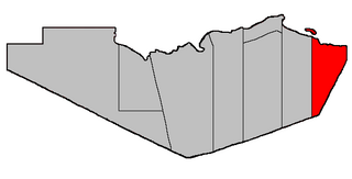
Durham is a geographic parish in Restigouche County, New Brunswick, Canada.
Saint-Quentin is a geographic parish in Restigouche County, New Brunswick, Canada.
Paquetville is a geographic parish in Gloucester County, New Brunswick, Canada.
Shippegan is a geographic parish in Gloucester County, New Brunswick, Canada. Located in the northeastern corner of the province at the end of the Acadian Peninsula, the parish consists of the three main islands of Taylor, Lamèque, and Miscou, along with several smaller islands and tidal wetlands; Taylor Island is now joined to the mainland by an isthmus, which is crossed by a causeway.
Allardville is a geographic parish in Gloucester County, New Brunswick, Canada,
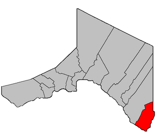
Saint-André is a geographic parish in Madawaska County, New Brunswick, Canada.
Drummond is a geographic parish in Victoria County, New Brunswick, Canada.
Hillsborough is a geographic parish in eastern Albert County, New Brunswick, Canada.
Alma is a geographic parish on the Bay of Fundy in the southwestern corner of Albert County, New Brunswick, Canada.
A regional service commission (RSC) is an administrative entity in the province of New Brunswick, Canada. As the name implies, an RSC administers services on a regional level.