Saint-Quentin, New Brunswick

Last updated

Saint-Quentin
Eglise et Presbytere de Saint-Quentin.jpg
Saint-Quentin NB logo.gif
Nickname: 
The maple syrup capital of Atlantic Canada
Canada New Brunswick location map 2.svg
Red pog.svg
Saint-Quentin
Location in New Brunswick.
Coordinates: 47°30′42″N67°23′25″W / 47.51175°N 67.39014°W / 47.51175; -67.39014
CountryCanada
Province New Brunswick
County Restigouche
Parish Saint-Quentin
Founded1910
Local improvement district1947
Village1966
Town1996
Electoral Districts   
Federal

Madawaska—Restigouche
Provincial Restigouche West
Government
[1]
  TypeSaint-Quentin Town Council
  MayorNicole Somers
  Deputy MayorJocelyne Querry Bossé
  Councillors
List of Members
  • Marie-Josée Thériault
  • Martine Côté
  • Josée Caron
  • Bertrand LeClerc
Area
[2]
  Total4.24 km2 (1.64 sq mi)
Elevation
283 m (928 ft)
Population
 (2021) [2]
  Total2,141
  Density504.7/km2 (1,307/sq mi)
  Change (2016–21)
Decrease2.svg 2.4%
  Dwellings
1,015
Time zone UTC-4 (AST)
  Summer (DST) UTC-3 (ADT)
Postal code(s)
E8A
Area code 506
HighwaysNB 17.svg Route 17
NB 180.svg Route 180
NTS Map021O11
GNBC CodeDAEGG
Website saintquentin.nb.ca

Saint-Quentin is a town in northern New Brunswick, Canada. [1]

Contents

Saint-Quentin is in the Restigouche region of the Appalachian Mountains, 50 kilometres west of Mount Carleton, the province's highest elevation.

The great majority of individuals in the area speak French.

On 1 January 2023, Saint-Quentin annexed the local service district (LSD) of St. Martin de Restigouche and part of the LSD of the parish of Saint-Quentin [3] [4] Revised census figures have not been released.

History

Church in Saint-Quentin, New Brunswick. Eglise Saint Quentin.JPG
Church in Saint-Quentin, New Brunswick.

In 1897, the Restigouche and Western Railway Company embarked on a project to build a railway linking Campbellton and St-Léonard, two towns in northwestern New Brunswick. The progress of its construction sent workers deep into the forest. In 1909, Simon Gallant, an Acadian working as a blacksmith, decided to settle his family by a stream near Five Fingers where he found a stray cow.

At the same time, authorities began to worry about the emigration of Québec families to the United States and to Western Canada, resulting in a population decline. Msgr. Joseph Arthur Melanson, the largest settler and missionary in Saint-Quentin Parish, originally named Anderson Siding, launched a large program of colonization. Valuing farming and agriculture, he encouraged Acadien and Québécois families to settle in the Restigouche region of New Brunswick on the fertile lands along the length of the newly built train line.

The village of Anderson Siding was founded in 1910; its first mass was held in Simon Gallant's round log cabin in the forest. The first chapel was built in 1911, its first post office in 1912, its first school in 1913, and its first church in 1918. The name Anderson Siding was changed to the present name of Saint-Quentin in 1919 in commemoration of the Canadian victory in the French town of the same name during the Battle of the Somme in the First World War. Its first hospital, Hôtel-Dieu Saint-Joseph, was built in 1947 and is still in operation today.

Saint-Quentin was incorporated as a district in 1947, as a village in 1966, and as a town in 1992.

Demographics

In the 2021 Census of Population conducted by Statistics Canada, Saint-Quentin had a population of 2,141 living in 976 of its 1,015 total private dwellings, a change of

Industry

Logging of the area's forests is Saint-Quentin's largest industry. The two sawmills, Groupe Savoie and North American Forest Products, are Saint-Quentin's largest employers, employing 400 and 225 employees respectively. Agriculture is another major industry in the Saint-Quentin region. Livestock is raised for dairy, beef and pork production, and potatoes, grain and hay are grown on the area's many farms. The production of maple syrup and other maple sugar products is the third major industry in the region; there are over 35 commercial maple plantations as well as 25 traditional sugar shacks in the area.[ citation needed ]

Tourism

Festival Western

Since 1984, Saint-Quentin has hosted the Festival Western (Western Festival) in mid-July of each year, the largest Western-themed festival of its kind in New Brunswick. Run by Le Festival Western de Saint-Quentin, Inc., it now includes rodeo, a parade, fireworks, children's activities and much more. The largest event is the "Pow-Pow", a flea market and gathering of local musicians and performers which takes place on Rue Canada, the main street of the town, which is closed to traffic for the occasion.

Old railway station

In 2005, the former railway station, which was reconstructed in its original location, reopened as a tourist centre as well as the offices of the Chamber of Commerce and the Festival Western. The route of the train tracks, which have been removed, has been transformed into a trail for walking, bicycling, and riding all-terrain vehicles and snowmobiles.

Other events and activities

Related Research Articles

<span class="mw-page-title-main">Campbellton, New Brunswick</span> City in New Brunswick, Canada

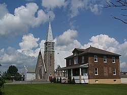
Campbellton is a city in Restigouche County, New Brunswick, Canada.

<span class="mw-page-title-main">Thetford Mines</span> City in Quebec, Canada

Thetford Mines is a city in south-central Quebec, Canada. It is the seat of Les Appalaches Regional County Municipality. The city is located in the Appalachian Mountains, 187 km northeast of Montreal and 79 km south of Quebec City. It is known mostly as the asbestos capital of Canada.

<span class="mw-page-title-main">Kortright Centre for Conservation</span>

The Kortright Centre for Conservation is a suburban conservation area and educational facility in Vaughan, Ontario, Canada in the northern part of the Greater Toronto Area. It is operated by the Toronto and Region Conservation Authority. The area in which it is located is predominantly forested in its western and northern extent. The Humber River is situated in the west and the Cold Creek and Harris Creek are to the north.

<span class="mw-page-title-main">Beresford Parish, New Brunswick</span> Parish in New Brunswick, Canada

Beresford is a geographic parish in Gloucester County, New Brunswick, Canada.

<span class="mw-page-title-main">Dundas Parish, New Brunswick</span> Parish in Canada

Dundas is a geographic parish in Kent County, New Brunswick, Canada.

Dalhousie is a former town located in Northern New Brunswick. On January 1, 2023, Dalhousie merged with the village of Charlo and all or part of five local service districts (LSDs) to form the new town of Heron Bay, named Baie-des-Hérons in French. Heron Bay is New Brunswick's northernmost point of land.

Kedgwick is a Canadian incorporated rural community in northern New Brunswick, Canada. On 1 January 2023, Kedgwick annexed a large area including the local service districts of St. Jean Baptiste – Menneval and White's Brook, with parts of two others; revised census figures have not been released.

<span class="mw-page-title-main">Sugar bush</span> Forest stand which is utilized for maple syrup

Sugar bush refers to a forest stand of maple trees which is utilized for maple syrup. This was originally an Indigenous camp set up for several weeks each spring, beginning when the ice began to melt and ending when the tree buds began to open. At a traditional sugarbush, all the trees were hand tapped and the sap was boiled over wood fires. The Anishinaabe (Ojibwe) peoples have been doing sugarbush for generations and consider the process both a part of food and of medicine.

<span class="mw-page-title-main">Sugar shack</span> Cabin where sap from maple trees is boiled into maple syrup

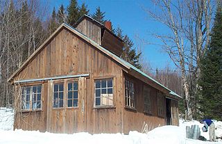
A sugar shack, also known as sap house, sugar house, sugar shanty or sugar cabin is an establishment, primarily found in Eastern Canada and northern New England. Sugar shacks are small cabins or groups of cabins where sap collected from maple trees is boiled into maple syrup. They are often found on the same territory as the sugar bush, which is intended for cultivation and production of maple syrup by way of craftsmanship.

<span class="mw-page-title-main">Elmvale</span> Unincorporated Community in Ontario, Canada

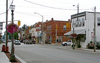
Elmvale is a rural town in Springwater Township, Ontario, Canada. It is located at the intersection of County Road 27 and County Road 92, 20 minutes north of Barrie. Elmvale is home to 2,314 people, as of 2016.

<span class="mw-page-title-main">Addington Parish, New Brunswick</span> Parish in New Brunswick, Canada

Addington is a geographic parish in Restigouche County, New Brunswick, Canada.

<span class="mw-page-title-main">Dalhousie Parish, New Brunswick</span> Parish in New Brunswick, Canada

Dalhousie is a geographic parish in Restigouche County, New Brunswick, Canada.

<span class="mw-page-title-main">Balmoral Parish, New Brunswick</span> Parish in New Brunswick, Canada

Balmoral is a geographic parish in Restigouche County, New Brunswick, Canada.

<span class="mw-page-title-main">Eldon Parish, New Brunswick</span> Parish in New Brunswick, Canada

Eldon is a geographic parish in Restigouche County, New Brunswick, Canada.

<span class="mw-page-title-main">Grimmer Parish, New Brunswick</span> Former Parish in New Brunswick, Canada

Grimmer is a geographic parish in Restigouche County, New Brunswick, Canada.

<span class="mw-page-title-main">Saint-Quentin Parish, New Brunswick</span> Parish in New Brunswick, Canada

Saint-Quentin is a geographic parish in Restigouche County, New Brunswick, Canada.

<span class="mw-page-title-main">Allardville Parish, New Brunswick</span> Parish in New Brunswick, Canada

Allardville is a geographic parish in Gloucester County, New Brunswick, Canada,

A regional service commission (RSC) is an administrative entity in the province of New Brunswick, Canada. As the name implies, an RSC administers services on a regional level.

<span class="mw-page-title-main">Administrative divisions of New Brunswick</span> Local governance in New Brunswick

The Canadian province of New Brunswick is divided into 89 local entities, consisting of 77 local governments and 12 rural districts.

References

  1. 1 2 "Community Profile - Saint-Quentin". Government of New Brunswick. Retrieved August 13, 2019.
  2. 1 2 3 "Census Profile of Saint-Quentin, Town (TV)". Statistics Canada. 6 December 2022. Retrieved 21 January 2023.
  3. "Local Governments Establishment Regulation – Local Governance Act". Government of New Brunswick. 12 October 2022. Retrieved 21 January 2023.
  4. "RSC 1 Northwest Regional Service Commission". Government of New Brunswick. Retrieved 21 January 2023.
  5. Statistics Canada: 1996, 2001, 2006 census
  6. 1 2 2011 Statistics Canada Census Profile: Saint-Quentin, New Brunswick
  7. "Census Profile, 2016 Census: Saint-Quentin, Town". Statistics Canada. Retrieved August 13, 2019.

Further reading


47°30′48.77″N67°23′31.59″W / 47.5135472°N 67.3921083°W / 47.5135472; -67.3921083 (Saint-Quentin)